Embarking from Ajo, AZ, your journey to Mesa, AZ covers 130.1 miles and is estimated to take about 2 hours and 38 minutes. This drive, entirely within the Desert Southwest region of Arizona, is best suited as a single-day trip, requiring no overnight stays. You'll navigate primarily using the Blue Star Memorial Highway, Gila Bend-Lukeville Highway, and South John Wayne Parkway. With an estimated fuel cost of $26, this route offers a straightforward drive. Be prepared for a somewhat turn-heavy local driving experience as you make your way towards Mesa.
Trip Pace
Same-day drive is realistic
A same-day return is realistic if you keep stops short.
Break Rhythm
1 planned break
A short stop every 2 to 3 hours is enough for this drive.
Midpoint
65 miles from Ajo, AZ
A natural place for your longest stop of the day
, about 1h 16m into the drive
.
Main Roads
Road
Distance
Duration
Blue Star Memorial Highway
35.5 mi
35m
Gila Bend-Lukeville Highway
31.5 mi
36m
South John Wayne Parkway
14.8 mi
18m
Maricopa Road
11.8 mi
13m
North Ajo Gila Bend Highway
8.1 mi
10m
Gila Bend–Casa Grande Highway
5.7 mi
6m
Price Freeway
5.4 mi
6m
West Queen Creek Road
5.3 mi
7m
Longest stretch:
Blue Star Memorial Highway
— 35.5 mi, about 35m
Turn-by-Turn Driving Directions
Step-by-step road directions between Ajo, AZ and Mesa, AZ.
1
Start on AZ 85
0.1 mi·27 sec·East Taladro Avenue
2
Continue on AZ 85
0.2 mi·28 sec·North Pizal Lane
3
Continue on AZ 85
0.5 mi·1 min·West Solana Avenue
4
Continue on AZ 85
1.0 mi·2 min·North 2nd Avenue
5
Continue on AZ 85
8.1 mi·10 min·North Ajo Gila Bend Highway
6
Continue on AZ 85
31 mi·36 min·Gila Bend-Lukeville Highway
7
Take the ramp
0.3 mi·36 sec
Toward I 8 East: Tucson
8
Merge onto I 8
35 mi·35 min·Blue Star Memorial Highway
9
Take the exit
0.2 mi·35 sec
Toward AZ 84 East: Maricopa
10
Turn left onto AZ 84
5.7 mi·6 min·Gila Bend–Casa Grande Highway
11
Turn left onto AZ 347
15 mi·18 min·South John Wayne Parkway
Use the left lane.
12
Continue on AZ 347
12 mi·13 min·Maricopa Road
13
Continue on AZ 347
5.3 mi·7 min·West Queen Creek Road
14
Turn left onto South Price Road
2.4 mi·4 min·South Price Road
Use the left lane.
15
Take the ramp
0.5 mi·32 sec
Toward AZ 101 Loop North
16
Merge onto AZ 101 Loop
5.4 mi·6 min·Price Freeway
Use the straight / slight right lanes.
17
Take the exit
0.2 mi·21 sec
Exit 55A; 55BToward US 60 West, US 60 East: Phoenix, GlobeUse the slight right lane.
18
Keep slight right at fork
0.7 mi·1 min
Exit 55BToward US 60 East: GlobeUse the straight / slight right lanes.
19
Merge onto US 60
2.9 mi·3 min·Superstition Freeway
20
Take the exit
0.4 mi·55 sec
Exit 180Toward Mesa DriveUse the slight right lane.
21
Turn left onto South Mesa Drive
2.0 mi·4 min·South Mesa Drive
Use the left lane.
22
Continue on North Mesa Drive
0.5 mi·1 min·North Mesa Drive
23
Turn right onto East University Drive
73 ft·1 sec·East University Drive
24
Arrive at destination
East University Drive
Trip Plan
For this 130.1-mile drive, leaving in the morning is advisable to take advantage of daylight and the estimated 2 hours and 38 minutes of travel time. Since it's a single-day trip, you have flexibility with stops, but plan for at least one stop to break up the drive. Keep an eye on your fuel gauge, especially before heading out, as the estimated fuel cost is $26. A specific tip for this route: pay close attention to signage on the Gila Bend-Lukeville Highway and South John Wayne Parkway, as these local roads may have frequent turns and varying speed limits.
Morning Departure
Leave by 9 AM and you'll arrive before lunch.
Evening Departure
Even a 4 PM departure gets you there before dark in summer.
You can normally do this drive in one day.
Plan roughly 1 meaningful break for fuel, food, and rest.
The halfway point lands around 65 miles from Ajo, AZ, or about 1h 16m into the drive.
The longest continuous stretch on this route runs about 35.5 miles.
This is a comfortable same-day trip.
Departure
Before you leave
Start with fuel, water, and navigation already sorted so the first hour feels easy.
First stop
Around 29 miles or 38m in
Use this first pause for coffee, a restroom break, and a quick traffic check ahead.
Halfway reset
Around 65 miles or 1h 16m in
This is the best place for your longest stop, a real meal, and a full fuel check.
Final approach
Final hour starts around 2h 4m
Traffic, exits, and arrival timing usually matter more near Mesa, AZ than in the middle of the route.
Before You Leave
+
Open the route before leaving Ajo, AZ so your first major turns are already loaded.
+
Leave with enough water and a charging cable within reach, not packed away.
+
Check your fuel range against the first long segment, especially if you are starting outside city service areas.
Day 1
Settle into the route from Ajo, AZ
This is one driving day of about 130.1 miles and 2h 38m.
Your first comfortable stop window is around 29 miles from Ajo, AZ.
This route can stay practical as a one-day drive if traffic stays reasonable.
Plan about 1 real break rather than only quick fuel stops.
The longest stretch is on Blue Star Memorial Highway for about 35.5 miles.
Where to Stop
Rest stops, refuel points, and overnight suggestions along this route.
Place data sourced from public business listings. Hours and availability may vary.
Heads-up: tricky spots
5 of 14
5 decision points cluster between mile 83.1 and 127.1 — GPS handles the exact turns, but know they're coming. Your lane choice matters more than the turn itself.
5
83.1 mi into trip|~1h 35m in|AZ 347 / South John Wayne Parkway
Turn left onto AZ 347 / South John Wayne Parkway
Lane positioning matters here
Use the left lane.
5
117.9 mi into trip|~2h 21m in|AZ 101 Loop / Price Freeway
Merge onto AZ 101 Loop / Price Freeway
Merge point - match speed before joining. Lane positioning matters here
Use the straight / slight right lanes.
8
123.3 mi into trip|~2h 27m in
Take the exit toward US 60 West, US 60 East: Phoenix, Globe
Exit ramp - move to the correct lane early. Lane positioning matters here. Multiple destination signs - pick the right one
Use the slight right lane.
Exit 55A; 55B
Toward US 60 West, US 60 East: Phoenix, Globe
8
123.5 mi into trip|~2h 27m in
Keep slight right at fork toward US 60 East: Globe
Highway fork - watch signs carefully. Lane positioning matters here
Use the straight / slight right lanes.
Exit 55B
Toward US 60 East: Globe
7
127.1 mi into trip|~2h 32m in
Take the exit toward Mesa Drive
Exit ramp - move to the correct lane early. Lane positioning matters here
Use the slight right lane.
Exit 180
Toward Mesa Drive
Fuel & Cost
Regular Gas
$25.92 one way
$51.84 round trip
$5.06/gal25.4 MPG avg46 kg CO2
Fuel Type
$/gal
One Way
Round Trip
midgrade
$5.36
$27.43
$54.86
premium
$5.59
$28.64
$57.27
diesel
$5.61
$28.72
$57.45
No toll roads detected on this route.
Estimated Trip Cost (one way, 1 person)
Fuel
$26
Meals
$25–$50
Total
$51–$76
Rough estimate based on US averages. Hotel $80–$140/night, meals $25–$50/day.
Estimated CO2 emission: 45.5 kg one way.
Prices: EIA weekly data, 2026-04-13.
Driving Electric?
About $14 in charging
· 0 stops
· 67% less CO2
Vehicle Type
kWh
Stops
DC Fast
Home Charge
Average EV
39
0
$13.66
$6.24
Efficient EV
32.5
0
$11.38
$5.20
EV Truck/SUV
52
0
$18.21
$8.33
Gas CO2
46 kg
EV CO2
15 kg (67% less)
This trip is well within single-charge range for most EVs. No charging stops needed if you start fully charged.
DC fast charging avg $0.35/kWh. Home charging avg $0.16/kWh. US grid CO2: 0.39 kg/kWh.
Travel Intel
Current conditions at both ends of the drive.
Forecast as of Apr 18, 2026
Origin
Ajo, AZ
Night
in Ajo on Saturday
Local time
10:59 PM
MST
Current temp
85°F
Unavailable
Live forecast
Destination
Mesa, AZ
Night
in Mesa on Saturday
Local time
10:59 PM
MST
Current temp
92°F
Sunny
E 0 to 5 mph0% chanceLive forecast
Seasonal Notes
Summer travel usually means heavier construction, hotter rest stops, and busier weekend traffic around major cities.
Winter travel shortens daylight, so a route that looks manageable on paper can feel much longer after dark.
Holiday weekends tend to make both departure and arrival windows slower than the raw route time suggests.
Time zone
Same local time
Origin and destination are on the same clock, so arrival timing is easier to judge at a glance.
Temperature spread
7 degrees warmer at arrival
A meaningful temperature swing is a good cue to rethink layers, water, and how soon you want to arrive.
Road read
2h 38m on the road
The weather snapshot is not static. If you are leaving later, give both cities one more quick forecast check before departure.
Weather data from the National Weather Service. Conditions may change; check closer to your travel date.
National Parks Near This Route
Worth a detour if your schedule allows.
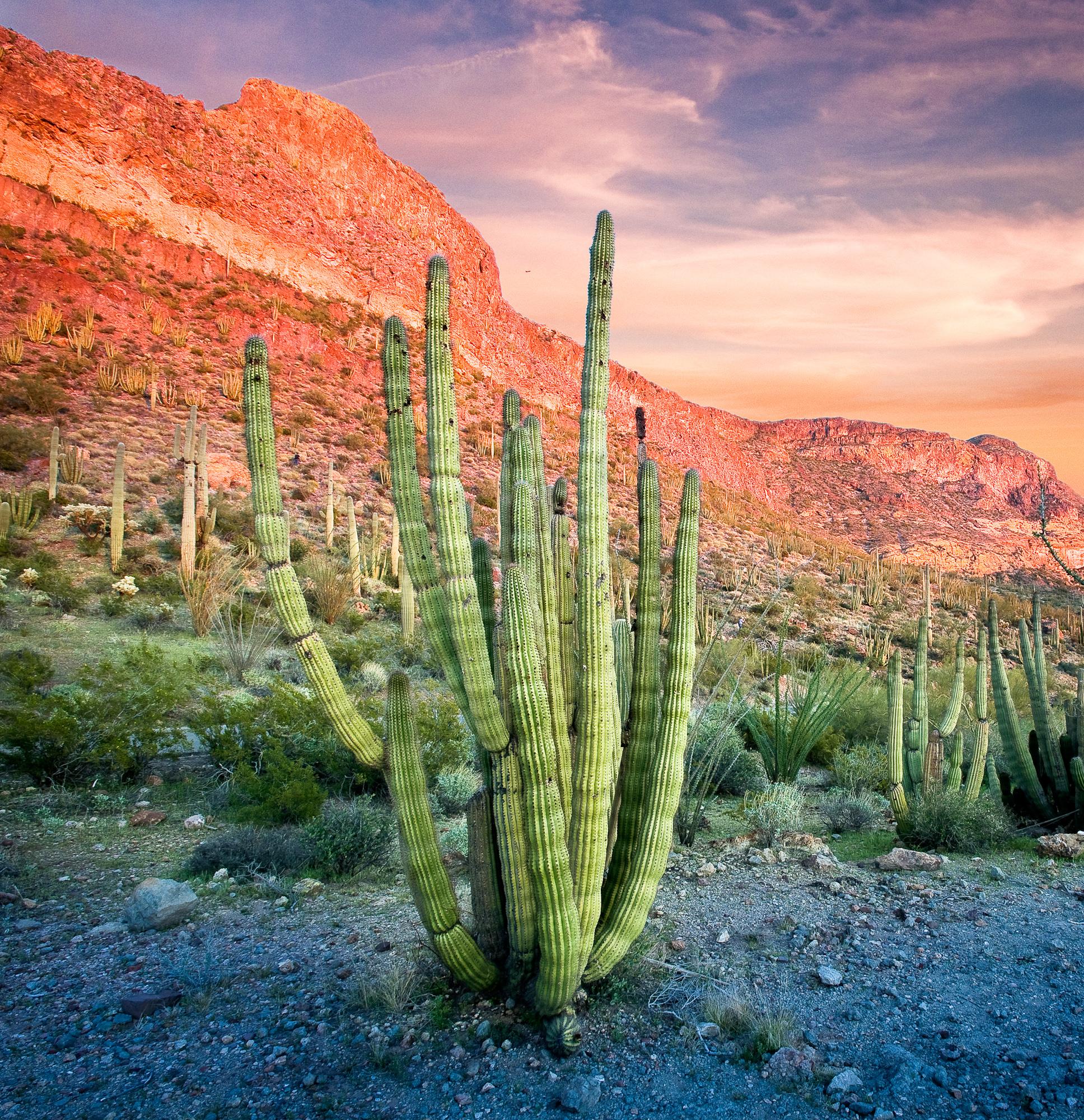
Organ Pipe Cactus National Monument
National Monument
Look closely. Look again. The sights and sounds of Organ Pipe Cactus National Monument, an International Biosphere Reserve, reveal a thriving community of plants and animals. Human stories echo throug...
23 mi from route
~58 min detour
$25
Park Closure: West and East Border Roads closed for public safety
Caution: Feral Dogs May Be Seen in Organ Pipe Cactus National Monument
An Ancestral Sonoran Desert People's farming community and "Great House" are preserved at Casa Grande Ruins. Whether a gathering place for people or simply a waypoint marker in an extensive system of...
29 mi from route
~72 min detour
Free
near mile 107.3
Park data from the National Park Service API. Alerts update every 2 hours.
More Details
What kind of drive is this?
This route is characterized as a 'turn-heavy local drive,' with only 18% of the journey on highways. Expect a dynamic driving experience that blends local roads with some faster stretches. The longest uninterrupted segment you'll encounter is 35.5 miles along the Blue Star Memorial Highway. This suggests a drive where you'll frequently be adjusting your speed and navigating through various road types, rather than a monotonous interstate cruise. The profile indicates a more engaging, less predictable path as you progress.
Only 18% highway — the rest is turn-by-turn surface driving.
24 navigation steps total — most of the decisions cluster near the start and finish.
Longest single stretch: 35.5 mi on Blue Star Memorial Highway.
How Hard Is This Drive?
7/10
Expect a hands-on drive with frequent turns and local roads rather than long highway stretches. This route has several spots where lane changes, forks, or exits need your full attention. The trickiest moment comes around 83.1 miles in near AZ 347 / South John Wayne Parkway.
Driving Effort7/10
Demanding - plan breaks and stay ahead of the key maneuvers
Balances navigation complexity with total wheel time.
This is a demanding drive. With 14 significant decision points across 130.1 miles, you will need to stay alert - especially through interchange areas and urban stretches. Consider splitting it into segments if you are not comfortable with fast highway navigation.
Where does it get tricky?
The main spots that need attention: at 83.1 miles (AZ 347 / South John Wayne Parkway): Lane positioning matters here; at 117.9 miles (AZ 101 Loop / Price Freeway): Merge point - match speed before joining. Lane positioning matters here; at 123.3 miles: Exit ramp - move to the correct lane early. Lane positioning matters here. Multiple destination signs - pick the right one.
Towns Mentioned on Route Signs
Based on OSRM destination-sign hints, not a full list of every settlement the road passes.
On the drive from Ajo, AZ to Mesa, AZ, road signs begin pointing toward Globe along the way.
Doable as a same-day drive at 2h 38m. Total distance: 130.1 miles.
Family Friendly
Moderate complexity with 1 natural rest stops along the way.
Solo Traveler
2h 38m drive, comfortable solo distance.
Scenic Drive
Mostly surface roads route profile with national parks nearby.
Frequently Asked Questions
The longest stretch is about 35.5 miles on Blue Star Memorial Highway. The full list of main roads is in the Roads section above.
It helps. This route has a higher-than-average number of complex decision points, which get harder in the dark. If the last hour of the trip is on surface roads or mountain grades, aim to arrive at Mesa, AZ before sunset when you can. Check the Trip Plan for departure windows that land you in daylight.
Only with planning. This is a long drive for kids — consider splitting it into two days rather than pushing through. Plan at least 1 meaningful breaks. Dedicated rest areas are limited, so plan gas or food stops as your bathroom breaks.
The main spots that need attention: at 83.1 miles (AZ 347 / South John Wayne Parkway): Lane positioning matters here; at 117.9 miles (AZ 101 Loop / Price Freeway): Merge point - match speed before joining. Lane positioning matters here; at 123.3 miles: Exit ramp - move to the correct lane early. Lane positioning matters here. Multiple destination signs - pick the right one.
Yes — Organ Pipe Cactus National Monument and Casa Grande Ruins National Monument. See the National Parks section for detour distances and tips on detours.
Yes. A round trip is manageable in a single day if you plan a break at Mesa, AZ before heading back.