Chisum Travel Center
0 mi from route
Compiled and reviewed by the US Trip Planner planning team at COD Solutions Oy · Last reviewed Jul 19, 2026 · Editorial standards
Drive Time
7h 45m
Distance
390.2 mi
628 km
Drive Score
10/10
Great drive
Same Day?
Yes, doable
Fuel Cost
$54
one way
EV Charging
Unknown
Estimated drive times based on typical traffic patterns. Actual times may vary with weather, construction, and real-time conditions.

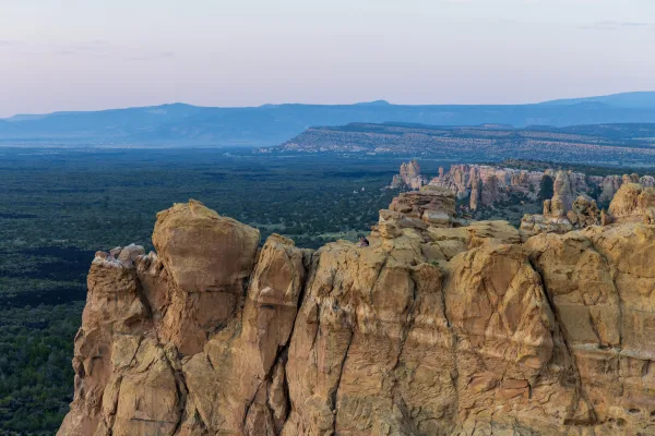
Zuni Pueblo, NM
Wikimedia Commons

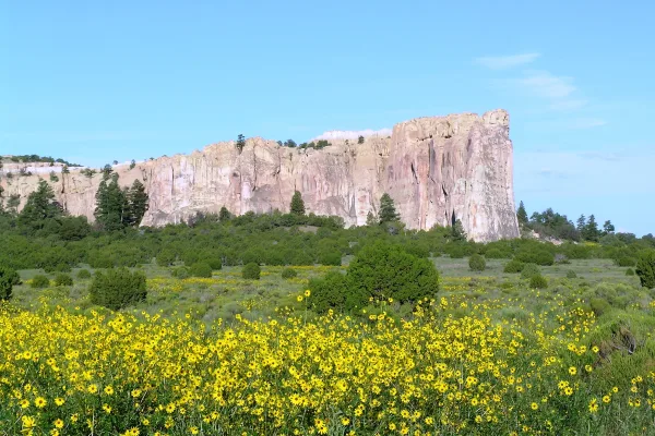
Artesia, NM
Wikimedia Commons
Spanning 390.2 miles across the Desert Southwest, this journey from Zuni Pueblo to Artesia takes approximately 7 hours and 45 minutes of driving time. Because the route is categorized as a mixed drive, you can complete it in a single long day, though it requires stamina to stay behind the wheel. Budgeting around $60 for fuel is a smart way to prepare for the trip. You will navigate a combination of I-40 and local streets like 8th Street and Southeast Main Street to reach your destination. While the trip is manageable for experienced drivers, be ready for a full day of travel that transitions you across the diverse landscapes of New Mexico.
Trip Pace
Same-day drive is realistic
A same-day return is possible, but it will make for a full day on the road.
Break Rhythm
2 planned breaks
Plan on a short reset every 3 to 4 hours to stay fresh behind the wheel.
Midpoint
195.1 miles from Zuni Pueblo, NM
A natural place for your longest stop of the day , about 3h 58m into the drive .
| Road | Distance | Duration |
|---|---|---|
| I 40 | 135.4 mi | 2h 20m |
| 8th Street | 91.9 mi | 1h 41m |
| Southeast Main Street | 29.9 mi | 35m |
| US Highway 285 | 27.4 mi | 31m |
| Ice Caves Rd. - NM53 | 25 mi | 34m |
| Ice Caves Road (cdt hiking trail) | 17.3 mi | 22m |
| Oak Street | 14.5 mi | 17m |
| Highway 53 - NM53 | 11.6 mi | 15m |
Hour-of-day weekday pattern from 43 FHWA count stations on your route.
Peak
4 PM
~2,242 veh/hr typical · worst 2,696
Quietest
3 AM
~283 veh/hr
Peak-to-quiet ratio
7.9×
busier at peak than in the quiet hours
Averaged across 51 weeks of 2023 FHWA Travel Monitoring Analysis System data. Weekday hours only (Mon–Fri).
Step-by-step road directions between Zuni Pueblo, NM and Artesia, NM.
Start on Twin Buttes Drive
Turn left onto Chavez Circle
At end of road, turn left onto NM 53
Continue on NM 53
Continue on NM 53
Continue on NM 53
Continue on NM 53
Continue on NM 53
Continue on NM 53
Continue on NM 53
Take the ramp
Merge onto I 40
Take the exit
Keep slight left at fork
Turn right onto US 285
Continue on US 60; US 285
Continue on US 54; US 60; US 285
Continue on US 285
Turn slight left onto US 285
Continue on US 285
Continue on US 285
Turn right onto US 82
Arrive at destination
To make the most of your 7-hour and 45-minute journey, plan for at least two designated stops to break up the monotony. Leaving early in the morning is highly recommended, as it allows you to handle the longest 135.4-mile stretch of I-40 before the afternoon heat or peak traffic sets in. Since you are covering a significant distance in one day, keep your $60 fuel budget in mind and top off your tank during your scheduled breaks. Pay close attention to the transition from the interstate to local roads, as navigation becomes more frequent once you exit the main highway. Using your two stops wisely will ensure you arrive in Artesia feeling refreshed rather than exhausted.
Morning Departure
Start early — leave by 6-7 AM to arrive at a reasonable hour.
Evening Departure
This is a long drive — plan for a morning departure or consider splitting it into two days.
This is a comfortable same-day trip.
Departure
Before you leave
Start with fuel, water, and navigation already sorted so the first hour feels easy.
First stop
Around 86 miles or 2h 5m in
Use this first pause for coffee, a restroom break, and a quick traffic check ahead.
Halfway reset
Around 195.1 miles or 3h 58m in
This is the best place for your longest stop, a real meal, and a full fuel check.
Final approach
Final hour starts around 6h 29m
Traffic, exits, and arrival timing usually matter more near Artesia, NM than in the middle of the route.
Open the route before leaving Zuni Pueblo, NM so your first major turns are already loaded.
Leave with enough water and a charging cable within reach, not packed away.
Check your fuel range against the first long segment, especially if you are starting outside city service areas.
Pick one backup stop option before the midpoint in case traffic changes your pacing.
Day 1
Settle into the route from Zuni Pueblo, NM
This is one driving day of about 390.2 miles and 7h 45m.
Rest stops, refuel points, and overnight suggestions along this route.

Mid-route town
Meal stop
195 mi into the route
Best for: Lunch, fuel, and a longer reset
This sits close to the middle of the route, so it works well for the longest stop of the day.
A short stop after about 86 miles helps settle the day before fatigue starts building.
The midpoint is around 195.1 miles from Zuni Pueblo, NM, which is a good place for a longer meal and fuel stop.
Before the longest stretch
Fuel checkTop up before I 40 if your tank is already low. That segment runs about 135.4 miles.
These stop ideas are pacing suggestions — the exact town or exit can change with traffic, hotel plans, and fuel range.
Picked by where they fit in your drive — first break, midpoint reset, final stretch.
Place data sourced from public business listings. Hours and availability may vary.
5 decision points cluster between mile 0.1 and 210 — GPS handles the exact turns, but know they're coming. Your lane choice matters more than the turn itself.
Turn left onto Chavez Circle
Navigation decision point
At end of road, turn left onto NM 53 / New Mexico 53
Navigation decision point
Merge onto I 40
Merge point - match speed before joining. Lane positioning matters here
Take the exit toward US 285: Vaughn, Santa Fe
Exit ramp - move to the correct lane early. Multiple destination signs - pick the right one
Keep slight left at fork
Highway fork - watch signs carefully
Regular Gas
$54.17 one way
$108.33 round trip
| Fuel Type | $/gal | One Way | Round Trip |
|---|---|---|---|
| midgrade | $3.95 | $60.60 | $121.21 |
| premium | $4.29 | $65.89 | $131.78 |
| diesel | $4.80 | $73.68 | $147.35 |
No toll roads detected on this route.
Estimated Trip Cost (one way, 1 person)
Fuel
$54
Meals
$25–$50
Total
$79–$104
Rough estimate based on US averages. Hotel $80–$140/night, meals $25–$50/day.
Estimated CO2 emission: 136.5 kg one way. Prices: EIA weekly data, 2026-07-13.
Driving Electric?
About $41 in charging · 1 stop · 66% less CO2
| Vehicle Type | kWh | Stops | DC Fast | Home Charge |
|---|---|---|---|---|
| Average EV | 117.1 | 1 | $40.97 | $18.73 |
| Efficient EV | 97.6 | 1 | $34.14 | $15.61 |
| EV Truck/SUV | 156.1 | 1 | $54.63 | $24.97 |
Gas CO2
137 kg
EV CO2
46 kg (66% less)
Plan for 1 charging stop. A 30-minute DC fast charge mid-route should be enough to complete the trip comfortably.
DC fast charging avg $0.35/kWh. Home charging avg $0.16/kWh. US grid CO2: 0.39 kg/kWh.
Current conditions at both ends of the drive.
Origin
Evening in Zuni Pueblo on Saturday
Local time
7:13 PM
MDT
Current temp
56°F
Scattered Showers And Thunderstorms then Mostly Cloudy
Flood Watch
Flood Watch issued July 16 at 8:32PM MDT until July 17 at 5:00PM MDT by NWS Albuquerque NM
Flood Watch
Flood Watch issued July 16 at 12:08PM MDT until July 17 at 6:00PM MDT by NWS Midland/Odessa TX
Destination
Evening in Artesia on Saturday
Local time
7:13 PM
MDT
Current temp
66°F
Partly Cloudy
Flood Watch
Flood Watch issued July 16 at 8:32PM MDT until July 17 at 5:00PM MDT by NWS Albuquerque NM
Flood Watch
Flood Watch issued July 16 at 12:08PM MDT until July 17 at 6:00PM MDT by NWS Midland/Odessa TX
60°F
Edgewood, NM
195 mi in
Seasonal Notes
Summer travel usually means heavier construction, hotter rest stops, and busier weekend traffic around major cities.
Winter travel shortens daylight, so a route that looks manageable on paper can feel much longer after dark.
Holiday weekends tend to make both departure and arrival windows slower than the raw route time suggests.
Time zone
Origin and destination are on the same clock, so arrival timing is easier to judge at a glance.
Temperature spread
A meaningful temperature swing is a good cue to rethink layers, water, and how soon you want to arrive.
Road read
Start early — leave by 6-7 AM to arrive at a reasonable hour.
Weather data from the National Weather Service. Conditions may change; check closer to your travel date.
Worth a detour if your schedule allows.

National Monument
Petroglyph National Monument protects one of the largest petroglyph sites in North America, featuring designs and symbols carved onto volcanic rocks by Native Americans and Spanish settlers 400 to 700...
National Monument
The richly diverse volcanic landscape of El Malpais (el-mal-pie-EES) offers solitude, recreation, and adventure. Explore incredible geologic features such as young lava flows, cinder cones, lava tubes...
National Monument
Imagine the refreshment of finding water after days of dusty travel. A reliable waterhole hidden at the base of a sandstone bluff made El Morro (the headland) a popular campsite for hundreds of years....
Park data from the National Park Service API. Alerts update every 2 hours.
Expect a varied experience on this 390.2-mile trek, where roughly 53% of your time will be spent on highways. The route features a significant 135.4-mile stretch on I-40, which serves as the primary artery for the first portion of your drive. As you transition off the interstate onto local roads, the pace shifts from high-speed travel to more localized driving patterns. This mix keeps the drive engaging, moving between wide-open highway segments and more moderate speeds as you approach your final destination. You will find that the road’s personality changes as you leave the interstate, requiring you to remain alert to shifting road conditions.
This route mixes highway mileage with some local-road sections near the start or finish. There are only a few real navigation decisions along the way. The trickiest moment comes around 0.1 miles in near Chavez Circle.
Easy - simple navigation with a manageable amount of wheel time
Balances navigation complexity with total wheel time.
The route itself is not hard, but at 7h 45m, endurance matters. Plan breaks every 2-3 hours. The 7 decision points are all manageable with basic attention.
Where does it get tricky?
The main spots that need attention: at 0.1 miles (Chavez Circle): Navigation decision point; at 0.3 miles (NM 53 / New Mexico 53): Navigation decision point; at 74.4 miles (I 40): Merge point - match speed before joining. Lane positioning matters here.
High-altitude sections with notable climbs
Total Climb
1,880 ft
Total Descent
4,781 ft
Highest Point
7,164 ft
~55.7 mi in
Elevation Range
3,776 ft
Notable High Points
Based on OSRM destination-sign hints, not a full list of every settlement the road passes.
On the drive from Zuni Pueblo, NM to Artesia, NM, road signs begin pointing toward Santa Fe along the way.
Santa Fe
Tagged by where each one fits in your drive — first break, midpoint, final stretch.
Cafe
Near the end, right off the route
Artesia, NM
Cuisine: coffee_shop
Hours: Mo-Fr 07:00-20:00; Sa 08:00-16:00
Visit websiteCafe
Near the end, short detour
Roswell, NM
Cuisine: coffee_shop
Hours: Tu-Sa 06:00-14:00
Visit websiteCafe
Near the end, short detour
Fast_food
Near the end, right off the route
Roswell, NM
Cuisine: sandwich
Hours: Mo-Sa 08:00-22:00; Su 09:00-22:00
Visit websiteFast_food
Near the end, right off the route
Roswell, NM
Cuisine: burger
Hours: Mo-Th 06:00-24:00; Fr-Sa 06:00-01:00; Su...
Visit websiteFast_food
Near the end, right off the route
Artesia, NM
Cuisine: pizza
Hours: Mo-Th 10:00-24:00; Fr-Sa 10:00-01:00; Su...
Visit websiteFast_food
Near the end, right off the route
Roswell, NM
Cuisine: sandwich
Visit websiteRestaurant
Near the end, right off the route
Cuisine: mexican
Visit websiteFast_food
Near the end, right off the route
Cuisine: burger
Visit websiteAttraction
Near the end, right off the route
Artesia, NM
Visit websiteAttraction
Near the end, right off the route
NM
Attraction
Near the end, right off the route
NM
Attraction
Near the end, right off the route
NM
Attraction
Near the end, right off the route
NM
Attraction
Near the end, right off the route
NM
Museum
Near the end, right off the route
NM
Artwork
Near the end, right off the route
Memorial
Near the end, right off the route
Artwork
Around the midpoint, right off the route
Artwork
Near the end, right off the route
Museum
Near the start, right off the route
NM
Hotel
Near the end, right off the route
Artesia
Visit websiteHotel
Near the end, right off the route
Roswell, NM
Visit websiteHotel
Near the end, right off the route
NM
Hotel
Near the end, right off the route
Motel
Near the end, right off the route
Hotel
Near the end, short detour
Roswell, NM
Visit websitePoints of interest from OpenStreetMap contributors. Listings may not reflect current hours or availability.
Founded 1905
City content from Wikivoyage (CC BY-SA 4.0) and Wikidata (CC0).
Weekend Trip
Doable as a same-day drive at 7h 45m. Total distance: 390.2 miles.
Family Friendly
Moderate complexity with 2 natural rest stops along the way.
Solo Traveler
7h 45m drive, plan rest stops for pacing.
First-Time Driver
Mostly highway driving (53%). Straightforward navigation.
Scenic Drive
Mixed highway & surface route profile with national parks nearby.
Compiled by the US Trip Planner planning team at COD Solutions Oy from open government datasets — OSRM over OpenStreetMap for geometry, EIA for fuel prices, USGS 3DEP for elevation, NPS for national parks, and FHWA TMAS for hourly traffic volumes. See our methodology for refresh cadence and limitations.
Was this helpful?
Thanks for your feedback!
Your tip has been submitted. Thanks!
/500
Recent Tips
·
Explore more options from Zuni Pueblo, NM or browse trips ending in Artesia, NM.
Looking for more statewide routes? Browse NM road trips.