Yakima, WA to Longview Heights, WA is 169.3 miles and takes about 3h 35m via US 12 and I 5, with a fuel budget near $38 and enough daylight to finish in a day. This drive stays within Washington and connects two Pacific Coast regions. It's a straightforward trip primarily on major highways, making it a good choice if you want to get to your destination efficiently. With a recommended one-day drive, you can easily fit this into a travel plan without needing an overnight stop.
Trip Pace
Same-day drive is realistic
A same-day return is realistic if you keep stops short.
Break Rhythm
1 planned break
A short stop every 2 to 3 hours is enough for this drive.
Midpoint
84.6 miles from Yakima, WA
A natural place for your longest stop of the day
, about 1h 45m into the drive
.
Main Roads
Road
Distance
Duration
US 12
136 mi
2h 45m
I 5
25.4 mi
27m
Westside Highway
1.6 mi
3m
Columbia Heights Road
1.6 mi
5m
South 1st Street
1.6 mi
3m
Nevada Drive
1.4 mi
5m
Lexington Bridge Drive
0.3 mi
<1m
Gates Road
0.1 mi
<1m
Longest stretch:
US 12
— 136 mi, about 2h 45m
Traffic on I-5
Hour-of-day weekday pattern from 6 FHWA count stations on your route.
Peak
2 PM
~2,036 veh/hr typical
· worst 2,826
Quietest
1 AM
~235 veh/hr
Peak-to-quiet ratio
8.7×
busier at peak than in the quiet hours
12a6anoon6p11p
Averaged across 52 weeks of 2023 FHWA Travel Monitoring Analysis System data. Weekday hours only (Mon–Fri).
Turn-by-Turn Driving Directions
Step-by-step road directions between Yakima, WA and Longview Heights, WA.
1
Start on South 1st Street
1.6 mi·3 min·South 1st Street
2
Continue on Selah Road
0.1 mi·12 sec·Selah Road
3
Take the ramp
111 ft·2 sec
4
Keep slight right at fork
0.2 mi·23 sec
5
Merge onto US 12
17 mi·22 min·US 12
6
Turn left onto US 12
119 mi·2 hr 22 min·US 12
7
Take the exit
0.2 mi·39 sec
Toward I 5 South: Portland
8
Merge onto I 5
25 mi·27 min·I 5
9
Take the exit
0.4 mi·48 sec
Toward Lexington Bridge Drive
10
Turn right onto Lexington Bridge Drive
0.3 mi·52 sec·Lexington Bridge Drive
11
Turn left onto WA 411
1.6 mi·3 min·Westside Highway
12
Turn right onto Nevada Drive
1.4 mi·5 min·Nevada Drive
13
Turn right onto Columbia Heights Road
1.6 mi·5 min·Columbia Heights Road
14
Turn left onto Gates Road
0.1 mi·33 sec·Gates Road
15
Continue on Laulainen Road
523 ft·27 sec·Laulainen Road
16
Turn left onto Cedar Gates Road
508 ft·24 sec·Cedar Gates Road
17
Turn right onto Alpine Way
283 ft·12 sec·Alpine Way
18
Turn right onto Crestmont Avenue
321 ft·14 sec·Crestmont Avenue
19
Turn right
29 ft·2 sec
20
Arrive at destination
Trip Plan
Given the 3h 35m estimated drive time, you can comfortably complete this trip in one day. Aim to depart in the morning to maximize daylight and allow for any unforeseen delays. There's only one recommended stop, suggesting you can cover most of the 169.3 miles in a single push. Focus on keeping your fuel tank topped up, especially before heading onto longer stretches like the 136 miles on US 12, as services can be more spread out. The $38 fuel estimate is a good baseline for budgeting.
Morning Departure
An early start around 7-8 AM gets you there with plenty of daylight left.
Evening Departure
A late afternoon start means arriving after dark. Morning is better.
You can normally do this drive in one day.
Plan roughly 1 meaningful break for fuel, food, and rest.
The halfway point lands around 84.6 miles from Yakima, WA, or about 1h 45m into the drive.
The longest continuous stretch on this route runs about 136 miles.
This is a comfortable same-day trip.
Departure
Before you leave
Start with fuel, water, and navigation already sorted so the first hour feels easy.
First stop
Around 37 miles or 48m in
Use this first pause for coffee, a restroom break, and a quick traffic check ahead.
Halfway reset
Around 84.6 miles or 1h 45m in
This is the best place for your longest stop, a real meal, and a full fuel check.
Final approach
Final hour starts around 2h 51m
Traffic, exits, and arrival timing usually matter more near Longview Heights, WA than in the middle of the route.
Before You Leave
+
Open the route before leaving Yakima, WA so your first major turns are already loaded.
+
Leave with enough water and a charging cable within reach, not packed away.
+
Check your fuel range against the first long segment, especially if you are starting outside city service areas.
Day 1
Settle into the route from Yakima, WA
This is one driving day of about 169.3 miles and 3h 35m.
Your first comfortable stop window is around 37 miles from Yakima, WA.
This route can stay practical as a one-day drive if traffic stays reasonable.
Plan about 1 real break rather than only quick fuel stops.
The longest stretch is on US 12 for about 136 miles.
Where to Stop
Rest stops, refuel points, and overnight suggestions along this route.
Place data sourced from public business listings. Hours and availability may vary.
Heads-up: tricky spots
5 of 16
5 decision points cluster between mile 1.7 and 169.2 — GPS handles the exact turns, but know they're coming. Your lane choice matters more than the turn itself.
5
1.7 mi into trip|~3m in
Keep slight right at fork
Highway fork - watch signs carefully
6
137.9 mi into trip|~2h 49m in
Take the exit toward I 5 South: Portland
Exit ramp - move to the correct lane early
Toward I 5 South: Portland
4
163.5 mi into trip|~3h 17m in
Take the exit toward Lexington Bridge Drive
Exit ramp - move to the correct lane early
Toward Lexington Bridge Drive
4
164.2 mi into trip|~3h 19m in|WA 411 / Westside Highway
Turn left onto WA 411 / Westside Highway
Navigation decision point
5
169.2 mi into trip|~3h 35m in|Alpine Way
Turn right onto Alpine Way
Navigation decision point
Fuel & Cost
Regular Gas
$32.98 one way
$65.96 round trip
$4.95/gal25.4 MPG avg59 kg CO2
Fuel Type
$/gal
One Way
Round Trip
midgrade
$5.18
$34.55
$69.11
premium
$5.39
$35.93
$71.87
diesel
$4.80
$31.97
$63.93
No toll roads detected on this route.
Estimated Trip Cost (one way, 1 person)
Fuel
$33
Meals
$25–$50
Total
$58–$83
Rough estimate based on US averages. Hotel $80–$140/night, meals $25–$50/day.
Estimated CO2 emission: 59.2 kg one way.
Prices: EIA weekly data, 2026-07-13.
Driving Electric?
About $18 in charging
· 0 stops
· 66% less CO2
Vehicle Type
kWh
Stops
DC Fast
Home Charge
Average EV
50.8
0
$17.78
$8.13
Efficient EV
42.3
0
$14.81
$6.77
EV Truck/SUV
67.7
0
$23.70
$10.84
Gas CO2
59 kg
EV CO2
20 kg (66% less)
This trip is well within single-charge range for most EVs. No charging stops needed if you start fully charged.
DC fast charging avg $0.35/kWh. Home charging avg $0.16/kWh. US grid CO2: 0.39 kg/kWh.
Travel Intel
Current conditions at both ends of the drive.
Forecast as of Jul 19, 2026
Origin
Yakima, WA
Late night
in Yakima on Sunday
Local time
4:23 AM
PDT
Current temp
59°F
Clear
N 6 to 15 mph0% chanceLive forecast
Red Flag Warning
Red Flag Warning issued July 18 at 11:40AM PDT until July 18 at 10:00PM PDT by NWS Pendleton OR
Destination
Longview Heights, WA
Late night
in Longview Heights on Sunday
Local time
4:23 AM
PDT
Current temp
53°F
Mostly Clear
NW 5 to 9 mph0% chanceLive forecast
Red Flag Warning
Red Flag Warning issued July 18 at 11:40AM PDT until July 18 at 10:00PM PDT by NWS Pendleton OR
Seasonal Notes
Summer travel usually means heavier construction, hotter rest stops, and busier weekend traffic around major cities.
Winter travel shortens daylight, so a route that looks manageable on paper can feel much longer after dark.
Holiday weekends tend to make both departure and arrival windows slower than the raw route time suggests.
Time zone
Same local time
Origin and destination are on the same clock, so arrival timing is easier to judge at a glance.
Temperature spread
6 degrees cooler at arrival
A meaningful temperature swing is a good cue to rethink layers, water, and how soon you want to arrive.
Road read
3h 35m on the road
The weather snapshot is not static. If you are leaving later, give both cities one more quick forecast check before departure.
Weather data from the National Weather Service. Conditions may change; check closer to your travel date.
National Parks Near This Route
Worth a detour if your schedule allows.
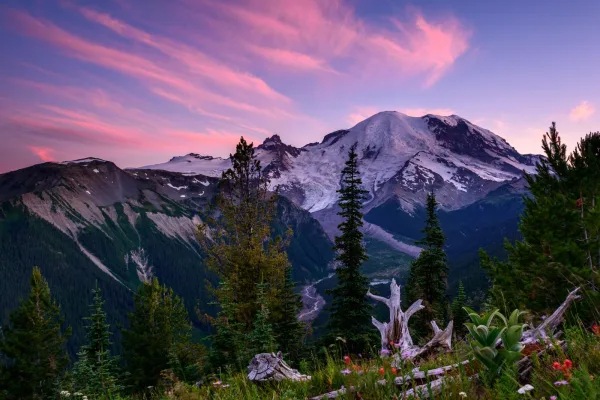
Mount Rainier National Park
National Park
Ascending to 14,410 feet above sea level, Mount Rainier stands as an icon in the Washington landscape. An active volcano, Mount Rainier is the most glaciated peak in the contiguous U.S.A., spawning fi...
13 mi from route
~34 min detour
$30
near mile 64.2
Park Closure: SR 165 Carbon River/Fairfax Bridge is closed: no access to Carbon River or Mowich Lake.
Park data from the National Park Service API. Alerts update every 2 hours.
More Details
What kind of drive is this?
This route is 95% highway, meaning you'll spend almost the entire trip on major roadways. The longest continuous stretch on a single highway is 136 miles, primarily on US 12. You'll experience a fairly consistent highway pace for most of the drive, with a transition to more local roads as you approach your destination. Expect a significant number of highway exits and merges as you navigate between US 12 and I 5.
95% highway — fuel and pacing are the main things to plan.
20 navigation steps total — most of the decisions cluster near the start and finish.
Longest single stretch: 136 mi on US 12.
How Hard Is This Drive?
4/10
This is a straightforward highway drive that stays mostly on US 12 and I 5. There are only a few real navigation decisions along the way. The trickiest moment comes around 1.7 miles in.
Driving Effort4/10
Easy - simple navigation with a manageable amount of wheel time
Balances navigation complexity with total wheel time.
This is a straightforward 3h 35m drive. You will face about 16 decision points, but nothing that requires special attention if you follow navigation.
Where does it get tricky?
The main spots that need attention: at 1.7 miles: Highway fork - watch signs carefully; at 137.9 miles: Exit ramp - move to the correct lane early; at 163.5 miles: Exit ramp - move to the correct lane early.
Elevation Profile
Hilly terrain with moderate elevation changes
3,621 ft81 ft
Total Climb
3,436 ft
Total Descent
3,608 ft
Highest Point
3,621 ft
~48.4 mi in
Elevation Range
3,540 ft
Notable High Points
3,621 ft at ~48.4 miles+562 ft prominence
Detours Along the Way
Tagged by where each one fits in your drive — first break, midpoint, final stretch.
Yakima is the principal city of the Yakima Valley, an agricultural region noted for apple, wine, and hop production on the Columbia River Plateau of Washington State. It is the county seat of Yakima County.
This article also covers the nearby communities of Union Gap and Selah.
Top landmarks
•Capitol Theatre, Yakima — theater and performing arts center in Yakima, Washington, United States
•A. E. Larson Building — building in Yakima, Washington, United States
•E. William Brackett House — house in Yakima, Washington
The longest stretch is about 136 miles on US 12. The full list of main roads is in the Roads section above.
Yes — we found about 4 rest areas or service plazas within a short detour of the route (from OpenStreetMap). See the Rest Stops tab under Nearby Places for locations and mile markers. Plan to stretch, use the bathroom, and top off fluids every 2–3 hours on longer drives.
Yes, with realistic expectations. Build in a stop roughly every 2 hours, have snacks and activities ready, and check the Nearby Places tabs for kid-friendly stops along the way.
The main spots that need attention: at 1.7 miles: Highway fork - watch signs carefully; at 137.9 miles: Exit ramp - move to the correct lane early; at 163.5 miles: Exit ramp - move to the correct lane early.
Yes — Mount Rainier National Park. See the National Parks section for detour distances and tips on detours.
Possible but tiring. At 3.6 hours each way, an in-and-out day trip would put you behind the wheel for 7.2 hours — manageable with a long break at Longview Heights, WA, but most travelers stay overnight.