Embark on a 405.5-mile journey from West Ishpeming, MI, to Flint, MI, a drive that typically takes about 6 hours and 19 minutes. This route stays within the Midwest region, traversing Michigan from top to bottom. With a fuel cost estimated around $62, this trip is well within reach for a single-day adventure. The road conditions suggest a turn-heavy local drive, meaning you'll be actively navigating rather than cruising on a highway. Plan for one stop along the way to break up the approximately 6.5-hour travel time.
Trip Pace
Same-day drive is realistic
A same-day return is possible, but it will make for a full day on the road.
Break Rhythm
2 planned breaks
Plan on a short reset every 3 to 4 hours to stay fresh behind the wheel.
Midpoint
202.3 miles from West Ishpeming, MI
A natural place for your longest stop of the day
, about 4h 6m into the drive
.
Main Roads
Road
Distance
Duration
I 75
218.3 mi
3h 44m
M-28
70.9 mi
1h 24m
US 2
65.1 mi
1h 15m
M 77
17.3 mi
20m
County Road 480
12.5 mi
18m
UAW Freeway
10 mi
10m
West Munising Avenue
2.2 mi
4m
West Division Street
2 mi
3m
Longest stretch:
I 75
— 218.3 mi, about 3h 44m
Traffic on I-75
Hour-of-day weekday pattern from 30 FHWA count stations on your route.
Peak
3 PM
~1,426 veh/hr typical
· worst 2,474
Quietest
2 AM
~59 veh/hr
Peak-to-quiet ratio
24.2×
busier at peak than in the quiet hours
12a6anoon6p11p
Averaged across 52 weeks of 2023 FHWA Travel Monitoring Analysis System data. Weekday hours only (Mon–Fri).
Turn-by-Turn Driving Directions
Step-by-step road directions between West Ishpeming, MI and Flint, MI.
1
Start on Center Street
128 ft·11 sec·Center Street
2
Turn left onto Silver Street
0.1 mi·28 sec·Silver Street
3
Turn right onto 494
0.2 mi·22 sec·South North Lake Drive
4
Continue on Greenwood Street
1.1 mi·2 min·Greenwood Street
5
Turn right onto M 28 BUS
2.0 mi·3 min·West Division Street
6
Continue on M 28 BUS
1.1 mi·1 min·County Road
7
Turn slight left onto M 28 BUS
0.3 mi·34 sec·Silver Street
8
At end of road, turn right onto M 28 BUS
0.1 mi·14 sec·Jackson Street
9
Turn right onto South Pioneer Avenue
503 ft·14 sec·South Pioneer Avenue
10
Turn left onto Rail Street
0.4 mi·32 sec·Rail Street
11
Continue on CR 480
13 mi·18 min·County Road 480
12
Turn left onto CR 551
1.8 mi·2 min·Cherry Creek Road
13
Continue on M 28
36 mi·42 min·M-28
Use the straight / right lanes.
14
Continue on M 28
2.2 mi·4 min·West Munising Avenue
15
Continue on M 28
0.2 mi·22 sec·Cedar Street
16
Continue on M 28
35 mi·41 min·M-28
17
Turn sharp right onto M 77
17 mi·20 min·M 77
18
At end of road, turn left onto US 2
65 mi·1 hr 15 min·US 2
19
Take the exit
0.3 mi·44 sec
Toward I 75 South: Mackinac Bridge
20
Merge onto I 75
94 mi·1 hr 37 min·I 75
21
Keep slight left at fork onto I 75
124 mi·2 hr 7 min·I 75
Toward I 75: Saginaw, Detroit
22
Keep slight right at fork onto I 475
10.0 mi·10 min·UAW Freeway
Exit 125Toward I 475: Downtown Flint
23
Take the exit
0.2 mi·31 sec
Exit 7Toward M 21
24
Continue on Chavez Drive
0.2 mi·34 sec·Chavez Drive
25
Turn right onto M 21
0.2 mi·31 sec·East Court Street
Use the right lane.
26
Turn left
68 ft·6 sec
27
Turn right
93 ft·6 sec
28
Arrive at destination
Trip Plan
Given the 6-hour and 19-minute duration, departing West Ishpeming in the morning allows ample time to reach Flint by evening, making it a manageable one-day trip. With a 0% highway share and a turn-heavy profile, consider breaking up the drive with a single planned stop to stretch your legs and refuel. The estimated fuel cost of $62 is a good baseline for budgeting. Keep an eye on your navigation system, especially as you transition between the various local roads like Silver Street and South North Lake Drive, to ensure you stay on track for your 405.5-mile destination.
Morning Departure
Start early — leave by 6-7 AM to arrive at a reasonable hour.
Evening Departure
This is a long drive — plan for a morning departure or consider splitting it into two days.
You can normally do this drive in one day.
Plan roughly 2 meaningful breaks for fuel, food, and rest.
The halfway point lands around 202.3 miles from West Ishpeming, MI, or about 4h 6m into the drive.
The longest continuous stretch on this route runs about 218.3 miles.
This is a comfortable same-day trip.
Departure
Before you leave
Start with fuel, water, and navigation already sorted so the first hour feels easy.
First stop
Around 89 miles or 1h 56m in
Use this first pause for coffee, a restroom break, and a quick traffic check ahead.
Halfway reset
Around 202.3 miles or 4h 6m in
This is the best place for your longest stop, a real meal, and a full fuel check.
Final approach
Final hour starts around 6h 32m
Traffic, exits, and arrival timing usually matter more near Flint, MI than in the middle of the route.
Before You Leave
+
Open the route before leaving West Ishpeming, MI so your first major turns are already loaded.
+
Leave with enough water and a charging cable within reach, not packed away.
+
Check your fuel range against the first long segment, especially if you are starting outside city service areas.
+
Pick one backup stop option before the midpoint in case traffic changes your pacing.
Day 1
Settle into the route from West Ishpeming, MI
This is one driving day of about 404.7 miles and 7h 35m.
Your first comfortable stop window is around 89 miles from West Ishpeming, MI.
This route can stay practical as a one-day drive if traffic stays reasonable.
Plan about 2 real breaks rather than only quick fuel stops.
The longest stretch is on I 75 for about 218.3 miles.
Where to Stop
Rest stops, refuel points, and overnight suggestions along this route.
Place data sourced from public business listings. Hours and availability may vary.
Heads-up: tricky spots
5 of 17
5 decision points cluster between mile 0 and 404.4 — GPS handles the exact turns, but know they're coming. Your lane choice matters more than the turn itself.
5
0 mi into trip|~0m in|Silver Street
Turn left onto Silver Street
Navigation decision point
6
4.8 mi into trip|~9m in|M 28 BUS / Jackson Street
At end of road, turn right onto M 28 BUS / Jackson Street
Complex interchange - multiple decisions in a short stretch
6
269.7 mi into trip|~5h 15m in|I 75
Keep slight left at fork onto I 75 toward I 75: Saginaw, Detroit
Highway fork - watch signs carefully. Multiple destination signs - pick the right one
Toward I 75: Saginaw, Detroit
6
393.9 mi into trip|~7h 22m in|I 475 / UAW Freeway
Keep slight right at fork onto I 475 / UAW Freeway toward I 475: Downtown Flint
Highway fork - watch signs carefully
Exit 125
Toward I 475: Downtown Flint
6
404.4 mi into trip|~7h 34m in|M 21 / East Court Street
Turn right onto M 21 / East Court Street
Lane positioning matters here
Use the right lane.
Fuel & Cost
Regular Gas
$59.76 one way
$119.53 round trip
$3.75/gal25.4 MPG avg142 kg CO2
Fuel Type
$/gal
One Way
Round Trip
midgrade
$4.14
$65.98
$131.96
premium
$4.72
$75.14
$150.28
diesel
$4.80
$76.42
$152.83
No toll roads detected on this route.
Estimated Trip Cost (one way, 1 person)
Fuel
$60
Meals
$25–$50
Total
$85–$110
Rough estimate based on US averages. Hotel $80–$140/night, meals $25–$50/day.
Estimated CO2 emission: 141.6 kg one way.
Prices: EIA weekly data, 2026-07-13.
Driving Electric?
About $42 in charging
· 1 stop
· 67% less CO2
Vehicle Type
kWh
Stops
DC Fast
Home Charge
Average EV
121.4
1
$42.49
$19.43
Efficient EV
101.2
1
$35.41
$16.19
EV Truck/SUV
161.9
2
$56.66
$25.90
Gas CO2
142 kg
EV CO2
47 kg (67% less)
Plan for 1 charging stop. A 30-minute DC fast charge mid-route should be enough to complete the trip comfortably.
DC fast charging avg $0.35/kWh. Home charging avg $0.16/kWh. US grid CO2: 0.39 kg/kWh.
Travel Intel
Current conditions at both ends of the drive.
Forecast as of Jul 17, 2026
Origin
West Ishpeming, MI
Late night
in West Ishpeming on Sunday
Local time
4:19 AM
EDT
Current temp
58°F
Smoke
SE 0 to 5 mph5% chanceLive forecast
Destination
Flint, MI
Late night
in Flint on Sunday
Local time
4:19 AM
EDT
Current temp
65°F
Smoke
SE 2 mph0% chanceLive forecast
Seasonal Notes
Summer travel usually means heavier construction, hotter rest stops, and busier weekend traffic around major cities.
Winter travel shortens daylight, so a route that looks manageable on paper can feel much longer after dark.
Holiday weekends tend to make both departure and arrival windows slower than the raw route time suggests.
Time zone
Same local time
Origin and destination are on the same clock, so arrival timing is easier to judge at a glance.
Temperature spread
7 degrees warmer at arrival
A meaningful temperature swing is a good cue to rethink layers, water, and how soon you want to arrive.
Road read
7h 35m on the road
Start early — leave by 6-7 AM to arrive at a reasonable hour.
Weather data from the National Weather Service. Conditions may change; check closer to your travel date.
National Parks Near This Route
Worth a detour if your schedule allows.
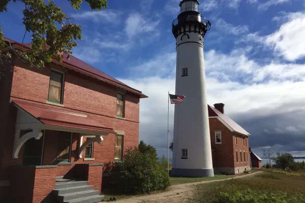
Pictured Rocks National Lakeshore
National Lakeshore
Sandstone cliffs, beaches, waterfalls, sand dunes, inland lakes, deep forest, and wild shoreline beckon you to visit Pictured Rocks National Lakeshore. The power of Lake Superior shapes the park's coa...
16 mi from route
~40 min detour
$25
near mile 69.8
Park data from the National Park Service API. Alerts update every 2 hours.
More Details
What kind of drive is this?
Expect a 'turn-heavy local drive' for this 405.5-mile trek, with 0% highway share. This means you'll spend your time on local roads like Silver Street, South North Lake Drive, and Greenwood Street, rather than high-speed interstates. The character of the drive is one of constant engagement, requiring your attention as you navigate various turns and transitions. While there's no longest uninterrupted stretch specified, the overall feel is one of consistent local road travel, offering a more grounded experience of the Michigan landscape.
72% highway — fuel and pacing are the main things to plan.
28 navigation steps total — most of the decisions cluster near the start and finish.
Longest single stretch: 218.3 mi on I 75.
How Hard Is This Drive?
4/10
This is a straightforward highway drive that stays mostly on I 75 and M-28. There are only a few real navigation decisions along the way. The trickiest moment comes early in the drive near Silver Street.
Driving Effort4/10
Easy - simple navigation with a manageable amount of wheel time
Balances navigation complexity with total wheel time.
The route itself is not hard, but at 7h 35m, endurance matters. Plan breaks every 2-3 hours. The 17 decision points are all manageable with basic attention.
Where does it get tricky?
The main spots that need attention: near the start (Silver Street): Navigation decision point; at 4.8 miles (M 28 BUS / Jackson Street): Complex interchange - multiple decisions in a short stretch; at 269.7 miles (I 75): Highway fork - watch signs carefully. Multiple destination signs - pick the right one.
Elevation Profile
Mostly flat terrain
1,435 ft593 ft
Total Climb
938 ft
Total Descent
1,620 ft
Highest Point
1,435 ft
Elevation Range
842 ft
Towns Mentioned on Route Signs
Based on OSRM destination-sign hints, not a full list of every settlement the road passes.
On the drive from West Ishpeming, MI to Flint, MI, road signs begin pointing toward Detroit along the way.
Flint is an industrial city an hour northwest of Detroit in Michigan. It was the home of many General Motors factories, including the Buick World Headquarters, Flint has fallen on hard times over the past 30 years due to the decline of the American automotive industry. Despite these misfortunes, the city has an outsized history, including decisive roles in the growth of the American labor movement and community schooling and evident in a host of extensive and well-endowed cultural institutions. Flint has seen a dramatic reduction in crime while simultaneously enjoying a revitalizing Downtown and growing colleges and universities are found within the city's limits.
Top landmarks
•Flint Institute of Arts — art school and museum in Flint, Michigan
•Capitol Theatre — movie theater and concert venue in Flint, Michigan, United States
•Robert J. Whaley House — historic house museum in Flint, Michigan
The longest stretch is about 218.3 miles on I 75. The full list of main roads is in the Roads section above.
Yes — we found about 32 rest areas or service plazas within a short detour of the route (from OpenStreetMap). See the Rest Stops tab under Nearby Places for locations and mile markers. Plan to stretch, use the bathroom, and top off fluids every 2–3 hours on longer drives.
It helps. This is a long drive, so arriving tired and in the dark compounds. If the last hour of the trip is on surface roads or mountain grades, aim to arrive at Flint, MI before sunset when you can. Check the Trip Plan for departure windows that land you in daylight.
Only with planning. This is a long drive for kids — consider splitting it into two days rather than pushing through. Plan at least 2 meaningful breaks. There are 32 rest areas along the route for bathroom stops.
The main spots that need attention: near the start (Silver Street): Navigation decision point; at 4.8 miles (M 28 BUS / Jackson Street): Complex interchange - multiple decisions in a short stretch; at 269.7 miles (I 75): Highway fork - watch signs carefully. Multiple destination signs - pick the right one.
Yes — Pictured Rocks National Lakeshore. See the National Parks section for detour distances and tips on detours.
Not recommended in a single day. At 7.6 hours each way, a round trip means 15.2 hours of driving — that is an unsafe level of fatigue for most drivers. Plan at least one night at Flint, MI before the return drive.