Embarking on the 291.3-mile journey from Upper Darby to Buffington is a commitment that requires focus, as the trip takes approximately 5 hours and 45 minutes to complete. Because this route avoids major highways entirely, it is best suited as a single-day push for those who enjoy a more hands-on driving experience. You should budget about $47 for fuel to cover the distance across Pennsylvania. While the drive remains within the Northeast region, the transition from the suburbs of Upper Darby to the more remote setting of Buffington offers a distinct change in scenery. It is a straightforward trip, though you should plan for at least one stop to break up the time behind the wheel.
Trip Pace
Same-day drive is realistic
A same-day return is possible, but it will make for a full day on the road.
Break Rhythm
1 planned break
Plan on a short reset every 3 to 4 hours to stay fresh behind the wheel.
Midpoint
145.7 miles from Upper Darby, PA
A natural place for your longest stop of the day
, about 2h 51m into the drive
.
Main Roads
Road
Distance
Duration
Pennsylvania Turnpike
236.8 mi
4h 18m
University Drive
9.9 mi
11m
PA 982
8 mi
13m
Mid-County Expressway
7 mi
9m
State Route 31
6 mi
9m
New Salem Road
5 mi
8m
Schuylkill Expressway
4.2 mi
5m
Memorial Boulevard
4 mi
4m
Longest stretch:
Pennsylvania Turnpike
— 236.8 mi, about 4h 18m
Turn-by-Turn Driving Directions
Step-by-step road directions between Upper Darby, PA and Buffington, PA.
1
Start on West Providence Road
0.3 mi·46 sec·West Providence Road
2
Turn left onto South Lansdowne Avenue
3.0 mi·8 min·South Lansdowne Avenue
Use the straight / left / right lanes.
3
Continue on Darby Road
471 ft·13 sec·Darby Road
Use the straight / left / right lanes.
4
Turn slight left onto PA 3
2.2 mi·4 min·West Chester Pike
Use the straight lane.
5
Take the exit
0.4 mi·58 sec
Toward I 476 North: Plymouth MeetingUse the straight / slight right lanes.
6
Merge onto I 476
7.0 mi·9 min·Mid-County Expressway
7
Take the exit
0.4 mi·53 sec
Exit 16BToward I 76 West: Valley ForgeUse the right lane.
8
Merge onto I 76
3.7 mi·5 min·Schuylkill Expressway
9
Take the exit
0.1 mi·10 sec
Exit 328B-A/327Toward US 202, US 422 West: King of Prussia, West Chester, PottstownUse the slight right lane.
10
Keep slight left at fork
0.3 mi·22 sec
Toward US 202 South, US 422 West: Mall Boulevard, West Chester, Pottstown, Swedesford RoadUse the straight / slight right lanes.
11
Keep slight left at fork
0.3 mi·20 sec
Toward Mall BoulevardUse the straight / slight right lanes.
12
Keep slight left at fork
0.1 mi·8 sec
Toward I 76 West: New Jersey, Harrisburg
13
Merge onto I 76
0.4 mi·52 sec·Schuylkill Expressway
Toward I 76 West: New Jersey, Harrisburg
14
Keep slight left at fork onto I 76
0.4 mi·1 min·I 76
Toward I 76 West: HarrisburgUse the slight left lane.
15
Merge onto I 76; PATP
237 mi·4 hr 18 min·Pennsylvania Turnpike
Use the straight / slight right lanes.
16
Take the exit
0.3 mi·1 min
Toward PA 31, PA 711: Ligonier, UniontownUse the slight right lane.
17
Turn right onto PA 31
6.0 mi·9 min·State Route 31
18
Continue on PA 31
0.1 mi·15 sec·Three Mile Hill
19
Turn left onto PA 982
8.0 mi·13 min·PA 982
20
Turn left onto US 119
4.0 mi·4 min·Memorial Boulevard
21
Turn straight onto US 119
0.6 mi·39 sec·Blackstone Road
22
Merge onto US 119
0.5 mi·33 sec·Morrell Avenue
23
Turn slight right onto US 119
9.9 mi·11 min·University Drive
24
Take the exit
0.3 mi·41 sec
Toward US 40 West, US 40 Business: Main StreetUse the slight right lane.
25
Turn right onto US 40
0.5 mi·1 min·National Pike
Use the right lane.
26
Turn left onto New Salem Road
5.0 mi·8 min·New Salem Road
27
Continue on East Main Street
0.4 mi·43 sec·East Main Street
28
Continue on Front Street
0.2 mi·18 sec·Front Street
29
Turn right onto One Way Road
152 ft·8 sec·One Way Road
30
Turn right
340 ft·24 sec
31
Arrive at destination
Trip Plan
Since the trip takes nearly six hours, departing early in the morning is your best strategy to ensure you arrive at your destination before dark. With only one recommended stop, you should plan your break strategically to maximize your efficiency on these slower local roads. Keep in mind that because you are not utilizing highways, your pace will be dictated by local traffic patterns and the winding nature of the route. I suggest keeping a close eye on your fuel gauge throughout the day, as local roads can sometimes lead you further from service stations than a major interstate would. Use the flexibility of this route to adjust your speed based on the conditions you encounter on the turn-heavy segments.
Morning Departure
An early start around 7-8 AM gets you there with plenty of daylight left.
Evening Departure
A late afternoon start means arriving after dark. Morning is better.
You can normally do this drive in one day.
Plan roughly 1 meaningful break for fuel, food, and rest.
The halfway point lands around 145.7 miles from Upper Darby, PA, or about 2h 51m into the drive.
The longest continuous stretch on this route runs about 236.8 miles.
This is a comfortable same-day trip.
Departure
Before you leave
Start with fuel, water, and navigation already sorted so the first hour feels easy.
First stop
Around 64 miles or 1h 22m in
Use this first pause for coffee, a restroom break, and a quick traffic check ahead.
Halfway reset
Around 145.7 miles or 2h 51m in
This is the best place for your longest stop, a real meal, and a full fuel check.
Final approach
Final hour starts around 4h 33m
Traffic, exits, and arrival timing usually matter more near Buffington, PA than in the middle of the route.
Before You Leave
+
Open the route before leaving Upper Darby, PA so your first major turns are already loaded.
+
Leave with enough water and a charging cable within reach, not packed away.
+
Check your fuel range against the first long segment, especially if you are starting outside city service areas.
Day 1
Settle into the route from Upper Darby, PA
This is one driving day of about 291.3 miles and 5h 45m.
Your first comfortable stop window is around 64 miles from Upper Darby, PA.
This route can stay practical as a one-day drive if traffic stays reasonable.
Plan about 1 real break rather than only quick fuel stops.
The longest stretch is on Pennsylvania Turnpike for about 236.8 miles.
Where to Stop
Rest stops, refuel points, and overnight suggestions along this route.
Place data sourced from public business listings. Hours and availability may vary.
Heads-up: tricky spots
5 of 21
5 decision points cluster between mile 13 and 17.8 — GPS handles the exact turns, but know they're coming. Your lane choice matters more than the turn itself.
7
13 mi into trip|~24m in
Take the exit toward I 76 West: Valley Forge
Exit ramp - move to the correct lane early. Lane positioning matters here
Use the right lane.
Exit 16B
Toward I 76 West: Valley Forge
8
17.2 mi into trip|~30m in
Take the exit toward US 202, US 422 West: King of Prussia, West Chester, Pottstown
Exit ramp - move to the correct lane early. Lane positioning matters here. Multiple destination signs - pick the right one
Use the slight right lane.
Exit 328B-A/327
Toward US 202, US 422 West: King of Prussia, We...
9
17.3 mi into trip|~30m in
Keep slight left at fork toward US 202 South, US 422 West: Mall Boulevard, West Chester, Pottstown, Swedesford Road
Highway fork - watch signs carefully. Lane positioning matters here. Multiple destination signs - pick the right one
Use the straight / slight right lanes.
Toward US 202 South, US 422 West: Mall Boulevar...
8
17.6 mi into trip|~30m in
Keep slight left at fork toward Mall Boulevard
Highway fork - watch signs carefully. Lane positioning matters here
Use the straight / slight right lanes.
Toward Mall Boulevard
7
17.8 mi into trip|~31m in
Keep slight left at fork toward I 76 West: New Jersey, Harrisburg
Highway fork - watch signs carefully. Multiple destination signs - pick the right one
Toward I 76 West: New Jersey, Harrisburg
Fuel & Cost
Regular Gas
$46.45 one way
$92.89 round trip
$4.05/gal25.4 MPG avg102 kg CO2
Fuel Type
$/gal
One Way
Round Trip
midgrade
$4.48
$51.40
$102.80
premium
$4.81
$55.14
$110.28
diesel
$4.80
$55.00
$110.01
Estimated Tolls: $30.78
Pennsylvania Turnpike
(236.8 mi)$30.78
Toll estimates based on average 2024-2025 rates. EZ-Pass/SunPass discounts may lower the actual cost.
Estimated Trip Cost (one way, 1 person)
Fuel
$46
Tolls
$31
Meals
$25–$50
Total
$102–$127
Rough estimate based on US averages. Hotel $80–$140/night, meals $25–$50/day.
Estimated CO2 emission: 101.9 kg one way.
Prices: EIA weekly data, 2026-07-13.
Driving Electric?
About $31 in charging
· 1 stop
· 67% less CO2
Vehicle Type
kWh
Stops
DC Fast
Home Charge
Average EV
87.4
1
$30.59
$13.98
Efficient EV
72.8
0
$25.49
$11.65
EV Truck/SUV
116.5
1
$40.78
$18.64
Gas CO2
102 kg
EV CO2
34 kg (67% less)
Plan for 1 charging stop. A 30-minute DC fast charge mid-route should be enough to complete the trip comfortably.
DC fast charging avg $0.35/kWh. Home charging avg $0.16/kWh. US grid CO2: 0.39 kg/kWh.
Travel Intel
Current conditions at both ends of the drive.
Forecast as of Jul 17, 2026
Origin
Upper Darby, PA
Evening
in Upper Darby on Monday
Local time
7:53 PM
EDT
Current temp
71°F
Smoke
SW 0 to 5 mph3% chanceLive forecast
Beach Hazards Statement
Beach Hazards Statement issued July 17 at 3:59PM EDT until July 18 at 8:00PM EDT by NWS Cleveland OH
Flood Watch
Flood Watch issued July 17 at 1:40PM EDT until July 19 at 2:00AM EDT by NWS Mount Holly NJ
Destination
Buffington, PA
Evening
in Buffington on Monday
Local time
7:53 PM
EDT
Current temp
69°F
Smoke
SE 5 mph32% chanceLive forecast
Beach Hazards Statement
Beach Hazards Statement issued July 17 at 3:59PM EDT until July 18 at 8:00PM EDT by NWS Cleveland OH
Flood Watch
Flood Watch issued July 17 at 1:40PM EDT until July 19 at 2:00AM EDT by NWS Mount Holly NJ
85°F
State Line, PA
146 mi in
Seasonal Notes
Summer travel usually means heavier construction, hotter rest stops, and busier weekend traffic around major cities.
Winter travel shortens daylight, so a route that looks manageable on paper can feel much longer after dark.
Holiday weekends tend to make both departure and arrival windows slower than the raw route time suggests.
Time zone
Same local time
Origin and destination are on the same clock, so arrival timing is easier to judge at a glance.
Temperature spread
2 degrees cooler at arrival
A meaningful temperature swing is a good cue to rethink layers, water, and how soon you want to arrive.
Road read
5h 45m on the road
An early start around 7-8 AM gets you there with plenty of daylight left.
Weather data from the National Weather Service. Conditions may change; check closer to your travel date.
National Parks Near This Route
Worth a detour if your schedule allows.
Carlisle Federal Indian Boarding School National Monument
National Monument
More than 7,800 children from 140 Tribes went to the Carlisle School from 1879 to 1918. The National Park Service will collaborate with families, affiliated Tribal Nations, the US Army, historians, an...
1 mi from route
~2 min detour
Free
near mile 120.6
Valley Forge is the place where George Washington and the Continental Army took refuge during the winter of 1777-1778. Today the park protects 3,500 acres of meadows, woodlands, historic landscapes, a...
The park represents the founding ideals of the nation, and preserves national and international symbols of freedom and democracy, including Independence Hall and the Liberty Bell. The Declaration of I...
Visit the house where wounded Polish freedom fighter Thaddeus Kosciuszko lived and hear how this brilliant military engineer designed successful fortifications during the American Revolution. See the...
On Tuesday morning, September 11, 2001, the U.S. came under attack when four commercial airliners were hijacked and used to strike targets on the ground. Nearly 3,000 people tragically lost their live...
8 mi from route
~19 min detour
Free
near mile 231.1
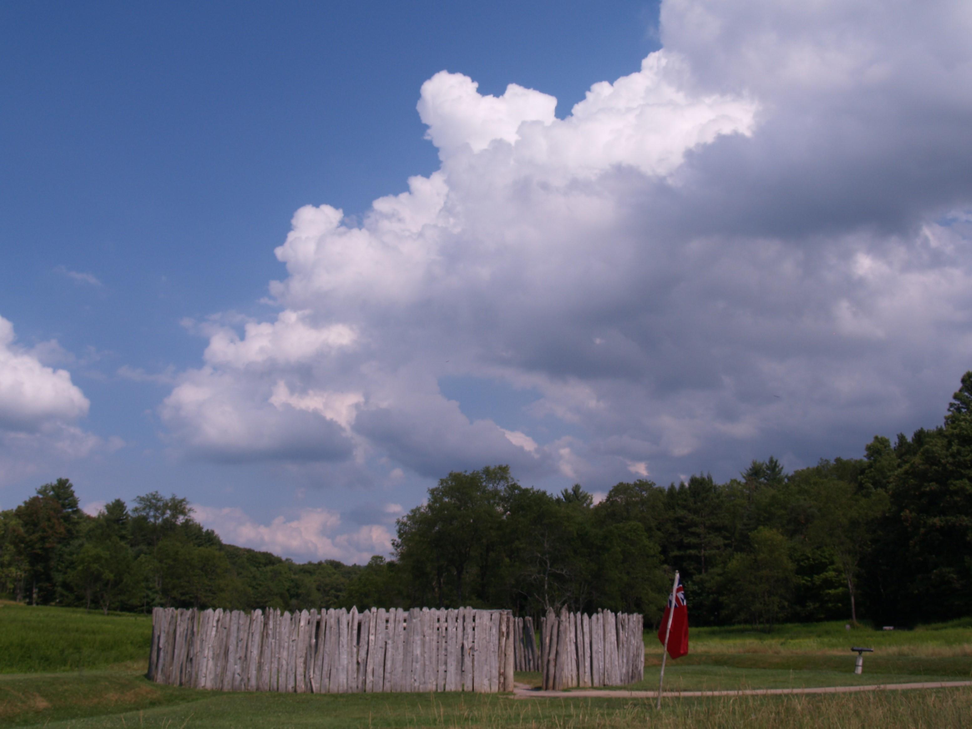
The battle at Fort Necessity in the summer of 1754 was the opening action of the French and Indian War. This war was a clash of British, French and American Indian cultures. It ended with the removal...
9 mi from route
~24 min detour
Free
near mile 281.3
Park data from the National Park Service API. Alerts update every 2 hours.
More Details
What kind of drive is this?
Expect a turn-heavy local drive rather than a mindless highway cruise, as this route features a 0% highway share. Your journey begins on South Lansdowne Avenue, which serves as the longest uninterrupted stretch of the trip, before transitioning onto Darby Road and West Chester Pike. Because you will be navigating local roads for the entirety of the 291.3 miles, you will need to remain alert to constant changes in road geometry. This is not a route for cruise control; instead, it demands your full attention as you wind your way through the state. The character of the drive is defined by its technical nature and the absence of high-speed interstate travel.
90% highway — fuel and pacing are the main things to plan.
31 navigation steps total — most of the decisions cluster near the start and finish.
Longest single stretch: 236.8 mi on Pennsylvania Turnpike.
How Hard Is This Drive?
10/10
This is a straightforward highway drive that stays mostly on Pennsylvania Turnpike and University Drive. This route has several spots where lane changes, forks, or exits need your full attention. The trickiest moment comes around 13 miles in.
Driving Effort10/10
High effort - long or complex enough to need steady focus all day
Balances navigation complexity with total wheel time.
This is a demanding drive. With 21 significant decision points across 291.3 miles, you will need to stay alert - especially through interchange areas and urban stretches. Consider splitting it into segments if you are not comfortable with fast highway navigation.
Where does it get tricky?
The main spots that need attention: at 13 miles: Exit ramp - move to the correct lane early. Lane positioning matters here; at 17.2 miles: Exit ramp - move to the correct lane early. Lane positioning matters here. Multiple destination signs - pick the right one; at 17.3 miles: Highway fork - watch signs carefully. Lane positioning matters here. Multiple destination signs - pick the right one.
Elevation Profile
Gently rolling terrain
2,387 ft56 ft
Total Climb
2,902 ft
Total Descent
1,928 ft
Highest Point
2,387 ft
~228.9 mi in
Elevation Range
2,330 ft
Towns Mentioned on Route Signs
Based on OSRM destination-sign hints, not a full list of every settlement the road passes.
Between Upper Darby, PA and Buffington, PA, road signs point toward Chester, Pottstown, Harrisburg and Uniontown.
Doable as a same-day drive at 5h 45m. Total distance: 291.3 miles.
Family Friendly
Moderate complexity with 1 natural rest stops along the way.
Solo Traveler
5h 45m drive, comfortable solo distance.
First-Time Driver
Mostly highway driving (90%). Some complex stretches to watch for.
Frequently Asked Questions
The longest stretch is about 236.8 miles on Pennsylvania Turnpike. The full list of main roads is in the Roads section above.
Expect about $30.78 in tolls one way, starting with Pennsylvania Turnpike. Most Northeast and Midwest toll agencies accept E-ZPass; in the West and Texas, transponders like TxTag or FasTrak apply. If you do not have a transponder, cashless tolling plates will mail a bill to the vehicle's registered address — usually with a surcharge, so a rental-car toll pass is often cheaper than paying by mail.
We did not find dedicated rest areas on this route. For a drive this long, plan bathroom and stretch breaks around gas stations, fast-food stops, or small-town downtowns — check the Nearby Places section for options.
It helps. This route has a higher-than-average number of complex decision points, which get harder in the dark. If the last hour of the trip is on surface roads or mountain grades, aim to arrive at Buffington, PA before sunset when you can. Check the Trip Plan for departure windows that land you in daylight.
Only with planning. This is a long drive for kids — consider splitting it into two days rather than pushing through. Plan at least 1 meaningful breaks. Dedicated rest areas are limited, so plan gas or food stops as your bathroom breaks.
The main spots that need attention: at 13 miles: Exit ramp - move to the correct lane early. Lane positioning matters here; at 17.2 miles: Exit ramp - move to the correct lane early. Lane positioning matters here. Multiple destination signs - pick the right one; at 17.3 miles: Highway fork - watch signs carefully. Lane positioning matters here. Multiple destination signs - pick the right one.
Yes — Carlisle Federal Indian Boarding School National Monument, Valley Forge National Historical Park and Independence National Historical Park (6 total within detour distance). See the National Parks section for detour distances and tips on detours.
Not recommended in a single day. At 5.8 hours each way, a round trip means 11.5 hours of driving — that is an unsafe level of fatigue for most drivers. Plan at least one night at Buffington, PA before the return drive.