
Rest Area
0 mi from route
Compiled and reviewed by the US Trip Planner planning team at COD Solutions Oy · Last reviewed Oct 17, 2026 · Editorial standards
Drive Time
8h 1m
Distance
457.8 mi
737 km
Drive Score
8/10
Great drive
Same Day?
2-day trip
Fuel Cost
$70
one way
EV Charging
Unknown
Estimated drive times based on typical traffic patterns. Actual times may vary with weather, construction, and real-time conditions.

Tulia, TX
Action Construction Equipment Ltd. - ACE

San Antonio, TX
Wikimedia Commons
Tulia to San Antonio is 457.8 miles and takes about 8h 1m via US Highway 84 and I 10, with a fuel budget near $69 and enough daylight to finish in a day.
Trip Pace
Best split across 2 days
Treat the return leg as its own travel day rather than an afterthought.
Break Rhythm
2 planned breaks
Plan on a short reset every 3 to 4 hours to stay fresh behind the wheel.
Midpoint
228.9 miles from Tulia, TX
A natural place for your longest stop of the day , about 4h into the drive .
| Road | Distance | Duration |
|---|---|---|
| US Highway 84 | 73.9 mi | 1h 14m |
| I 10 | 71.7 mi | 1h 14m |
| Marshall Formby Memorial Highway | 67 mi | 1h 7m |
| Grassmeyer Street | 41.9 mi | 44m |
| US 83 | 40 mi | 38m |
| State Highway 153 | 29.5 mi | 33m |
| Ellis Street | 29.4 mi | 31m |
| East Highway 84 | 26.9 mi | 26m |
Hour-of-day weekday pattern from 28 FHWA count stations on your route.
Peak
2 PM
~533 veh/hr typical · worst 963
Quietest
3 AM
~94 veh/hr
Peak-to-quiet ratio
5.7×
busier at peak than in the quiet hours
Averaged across 104 weeks of 2023 FHWA Travel Monitoring Analysis System data. Weekday hours only (Mon–Fri).
Step-by-step road directions between Tulia, TX and San Antonio, TX.
Start on TX 86
Continue on TX 86
Turn left onto US 87; TX 86
Turn slight right onto TX 86
Turn left onto I-27 Frontage Road
Take the ramp
Merge onto I 27
Take the exit
Turn straight onto North Interstate 27
Turn left onto North Loop 289
Take the ramp
Merge onto Loop 289
Take the exit
Keep slight right at fork
Turn straight onto Southeast Loop 289
Turn right onto Spur 331
Merge onto US 84
Continue on US 84
Continue on US 84
Continue on US 84
Continue on US 84
Turn left onto Spur 575
Turn right onto TX 207
Turn straight onto TX 207
At end of road, turn left onto US 84
Keep slight left at fork onto US 84
Take the exit
Turn slight left onto Southwest Georgia Avenue
Turn right onto TX 70
Continue on TX 70
Turn left onto TX 153
Turn right onto FM 2111
Turn left onto TX 158
At end of road, turn right onto US 67; US 83
Turn left onto US 83
Continue on US 83
Continue on US 83
Take the exit onto US 83
Continue on I 10
Keep slight right at fork onto I 10; US 87
Keep slight right at fork onto I 10; US 87
Take the exit
Turn straight onto North Pecos-La Trinidad
Keep slight right at fork onto North Pecos-La Trinidad
Turn left onto Dolorosa Street
Arrive at destination
This drive is best broken up over two days, allowing for a more relaxed pace. Plan to depart early to make the most of your first day, aiming for around 4 hours of driving. With two recommended stops, you can easily find places to refuel and stretch your legs. Keep an eye on your fuel levels, especially during the longer stretches on US Highway 84, as services can be spaced out.
Morning Departure
Start early — leave by 6-7 AM to arrive at a reasonable hour.
Evening Departure
This is a long drive — plan for a morning departure or consider splitting it into two days.
Consider an overnight stop or starting very early.
Departure
Before you leave
Start with fuel, water, and navigation already sorted so the first hour feels easy.
First stop
Around 101 miles or 1h 47m in
Use this first pause for coffee, a restroom break, and a quick traffic check ahead.
Halfway reset
Around 228.9 miles or 4h in
This is the best place for your longest stop, a real meal, and a full fuel check.
Overnight split
Day 1 wrap after about 228.9 miles or 4h
Stop before fatigue turns the last few hours into a grind. You want day two to start fresh, not just resumed.
Final approach
Final hour starts around 6h 57m
Traffic, exits, and arrival timing usually matter more near San Antonio, TX than in the middle of the route.
Open the route before leaving Tulia, TX so your first major turns are already loaded.
Leave with enough water and a charging cable within reach, not packed away.
Check your fuel range against the first long segment, especially if you are starting outside city service areas.
Pick one backup stop option before the midpoint in case traffic changes your pacing.
Treat this as a 2-day road trip and book the overnight stop before the busiest arrival window.
Day 1
Settle into the route from Tulia, TX
Aim for roughly 229 miles and 4 hours of wheel time on this day.
Day 2
Finish the approach into San Antonio, TX
Aim for roughly 229 miles and 4 hours of wheel time on this day.
Rest stops, refuel points, and overnight suggestions along this route.

Mid-route town
Overnight candidate
229 mi into the route
Best for: Hotel check-in, dinner, and a fresh start
This lines up well with a realistic day-end stop if you are breaking the drive into stages.
Find hotels in Sweetwater, TXNight 1
229 mi · about 4h in
A practical overnight split lands near Sweetwater, TX after about 229 miles or 4 hours of driving.
Find hotelsA short stop after about 101 miles helps settle the day before fatigue starts building.
The midpoint is around 228.9 miles from Tulia, TX, which is a good place for a longer meal and fuel stop.
Before the longest stretch
Fuel checkTop up before US Highway 84 if your tank is already low. That segment runs about 73.9 miles.
Overnight split
Hotel stopFor a steadier pace, wrap day one after about 229 miles or 4 hours on the road.
These stop ideas are pacing suggestions — the exact town or exit can change with traffic, hotel plans, and fuel range.
Picked by where they fit in your drive — first break, midpoint reset, final stretch.
Place data sourced from public business listings. Hours and availability may vary.
5 decision points cluster between mile 78.7 and 456.1 — GPS handles the exact turns, but know they're coming. Your lane choice matters more than the turn itself.
Keep slight right at fork toward Spur 331: Southeast Drive
Highway fork - watch signs carefully
Keep slight left at fork onto US 84 toward I 20 East, US 84 East: Abilene
Highway fork - watch signs carefully. Multiple destination signs - pick the right one
Take the exit toward SH 70 South, SH 70 Business: Sweetwater, San Angelo
Exit ramp - move to the correct lane early. Multiple destination signs - pick the right one
Take the exit onto US 83 toward I 10 East: San Antonio
Exit ramp - move to the correct lane early. Lane positioning matters here
Take the exit toward Santa Rosa Street, Downtown
Exit ramp - move to the correct lane early. Lane positioning matters here. Multiple destination signs - pick the right one
Regular Gas
$70.09 one way
$140.19 round trip
| Fuel Type | $/gal | One Way | Round Trip |
|---|---|---|---|
| midgrade | $4.29 | $77.36 | $154.71 |
| premium | $4.64 | $83.59 | $167.19 |
| diesel | $6.18 | $111.37 | $222.74 |
No toll roads detected on this route.
Estimated Trip Cost (one way, 1 person)
Fuel
$70
Hotel (1n)
$80–$140
Meals
$50–$100
Total
$200–$310
Rough estimate based on US averages. Hotel $80–$140/night, meals $25–$50/day.
Estimated CO2 emission: 160.2 kg one way. Prices: EIA weekly data, 2026-10-12.
Driving Electric?
About $48 in charging · 1 stop · 66% less CO2
| Vehicle Type | kWh | Stops | DC Fast | Home Charge |
|---|---|---|---|---|
| Average EV | 137.3 | 1 | $48.07 | $21.97 |
| Efficient EV | 114.5 | 1 | $40.06 | $18.31 |
| EV Truck/SUV | 183.1 | 2 | $64.09 | $29.30 |
Gas CO2
160 kg
EV CO2
54 kg (66% less)
Plan for 1 charging stop. A 30-minute DC fast charge mid-route should be enough to complete the trip comfortably.
DC fast charging avg $0.35/kWh. Home charging avg $0.16/kWh. US grid CO2: 0.39 kg/kWh.
Current conditions at both ends of the drive.
Origin
Afternoon in Tulia on Saturday
Local time
12:26 PM
CDT
Current temp
31°F
Patchy Frost
Rip Current Statement
Rip Current Statement issued October 17 at 3:25AM CDT until October 18 at 7:00AM CDT by NWS Brownsville TX
Flood Warning
Flood Warning issued October 17 at 2:37AM CDT until October 20 at 4:00AM CDT by NWS Norman OK
Destination
Afternoon in San Antonio on Saturday
Local time
12:26 PM
CDT
Current temp
53°F
Partly Cloudy
Rip Current Statement
Rip Current Statement issued October 17 at 3:25AM CDT until October 18 at 7:00AM CDT by NWS Brownsville TX
Flood Warning
Flood Warning issued October 17 at 2:37AM CDT until October 20 at 4:00AM CDT by NWS Norman OK
65°F
Sweetwater, TX
229 mi in
Seasonal Notes
Summer travel usually means heavier construction, hotter rest stops, and busier weekend traffic around major cities.
Winter travel shortens daylight, so a route that looks manageable on paper can feel much longer after dark.
Holiday weekends tend to make both departure and arrival windows slower than the raw route time suggests.
For long drives, weather on day two can matter just as much as conditions at departure, so check the whole travel window rather than only the first day.
Time zone
Origin and destination are on the same clock, so arrival timing is easier to judge at a glance.
Temperature spread
A meaningful temperature swing is a good cue to rethink layers, water, and how soon you want to arrive.
Road read
This is long enough that the arrival forecast matters almost as much as departure conditions. Recheck both ends before you roll.
Weather data from the National Weather Service. Conditions may change; check closer to your travel date.
Worth a detour if your schedule allows.
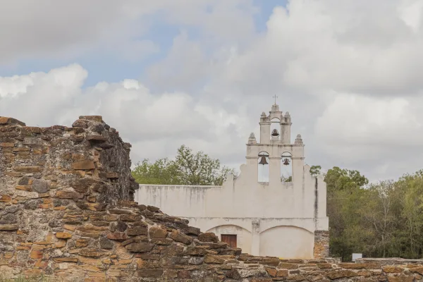
National Historical Park
Welcome to San Antonio Missions, a National Park Service site and the only UNESCO World Heritage Site in Texas. Each mission in the park is a center of community and has been since the early 1700s. Th...
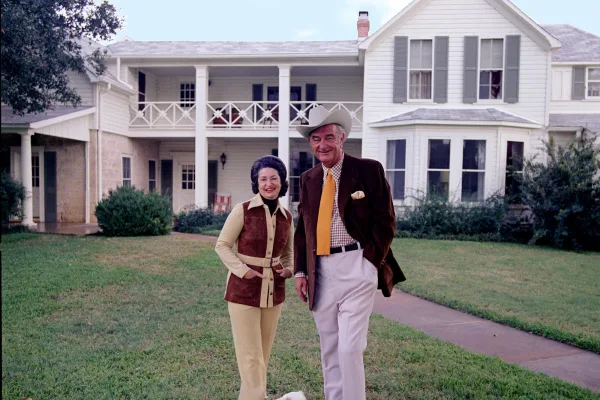
National Historical Park
Lyndon B. Johnson National Historical Park tells the story of our 36th president beginning with his ancestors until his final resting place on his beloved LBJ Ranch. This entire "circle of life" gives...
Park data from the National Park Service API. Alerts update every 2 hours.
This route spends 62% of its mileage on highways, meaning you'll experience significant stretches of high-speed cruising. You'll have a longest stretch of 73.9 miles on US Highway 84 before transitioning to other major roads. Expect mostly highway driving, with a portion on surface roads as you navigate between interstates and highways.
This is a straightforward highway drive that stays mostly on US Highway 84 and I 10. This route has several spots where lane changes, forks, or exits need your full attention. The trickiest moment comes around 78.7 miles in.
High effort - long or complex enough to need steady focus all day
Balances navigation complexity with total wheel time.
This is a demanding drive. With 28 significant decision points across 457.8 miles, you will need to stay alert - especially through interchange areas and urban stretches. Consider splitting it into segments if you are not comfortable with fast highway navigation.
Where does it get tricky?
The main spots that need attention: at 78.7 miles: Highway fork - watch signs carefully; at 189 miles (US 84): Highway fork - watch signs carefully. Multiple destination signs - pick the right one; at 195.5 miles: Exit ramp - move to the correct lane early. Multiple destination signs - pick the right one.
Gently rolling terrain
Total Climb
616 ft
Total Descent
3,448 ft
Highest Point
3,482 ft
Elevation Range
2,833 ft
Based on OSRM destination-sign hints, not a full list of every settlement the road passes.
Between Tulia, TX and San Antonio, TX, road signs point toward Loop 289, Sh 70 South, Sh 70 Business: Sweetwater and San Angelo.
Loop 289
Sh 70 South
Sh 70 Business: Sweetwater
San Angelo
Founded 1718
San Antonio is the second largest city in the state of Texas and the 7th largest in the United States. It's the 24th largest metropolitan area in the country. Visited by more than 31 million annual visitors, San Antonio is a beautiful city at the axis of three different geological terrains: Hill Country, South Texas Plains and Prairie and Lakes. There's a lot to do in this city: fine art museums, historical missions and plenty of amusement parks in addition to great dining and lots of drinking. The culture and people are vibrant and interesting. San Antonio's downtown is one of the most lively in the nation.
Top landmarks
City content from Wikivoyage (CC BY-SA 4.0) and Wikidata (CC0).
Compiled by the US Trip Planner planning team at COD Solutions Oy from open government datasets — OSRM over OpenStreetMap for geometry, EIA for fuel prices, USGS 3DEP for elevation, NPS for national parks, and FHWA TMAS for hourly traffic volumes. See our methodology for refresh cadence and limitations.
Was this helpful?
Thanks for your feedback!
Your tip has been submitted. Thanks!
/500
Recent Tips
·
Explore more options from Tulia, TX or browse trips ending in San Antonio, TX.
Looking for more statewide routes? Browse TX road trips.