Custer Southbound Rest Area
0 mi from route
Compiled and reviewed by the US Trip Planner planning team at COD Solutions Oy · Last reviewed Apr 19, 2026 · Editorial standards
Drive Time
7h 11m
Distance
383.6 mi
617 km
Drive Score
8/10
Great drive
Same Day?
Yes, doable
Fuel Cost
$80
one way
EV Charging
Excellent
15 DC fast
Estimated drive times based on typical traffic patterns. Actual times may vary with weather, construction, and real-time conditions.

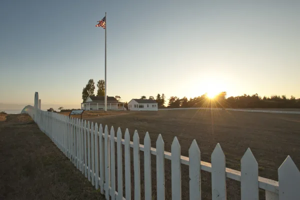
Blaine, WA
Wikimedia Commons
The drive from Spokane, WA to Blaine, WA covers 383.6 miles and takes about 7h 11m behind the wheel. This route is realistic as a one-day drive if you keep your stops efficient.
The route leans on I 90, I 5, I 405 for much of the mileage, and the overall profile is mostly highway. The longest uninterrupted segment is about 269.6 miles on I 90. At current regular gas prices, budget about $80.28 one way before food or hotel costs.
Trip Pace
Same-day drive is realistic
A same-day return is possible, but it will make for a full day on the road.
Break Rhythm
2 planned breaks
Plan on a short reset every 3 to 4 hours to stay fresh behind the wheel.
Midpoint
191.8 miles from Spokane, WA
A natural place for your longest stop of the day , about 3h 30m into the drive .
| Road | Distance | Duration |
|---|---|---|
| I 90 | 269.6 mi | 4h 53m |
| I 5 | 92.2 mi | 1h 47m |
| I 405 | 18.4 mi | 23m |
| WA 543 | 0.7 mi | 1m |
| H Street | 0.6 mi | 1m |
| North Monroe Street | 0.4 mi | 1m |
| West Freeway Avenue | 0.2 mi | <1m |
| West Main Avenue | <0.1 mi | <1m |
Step-by-step road directions between Spokane, WA and Blaine, WA.
Start on South Gorge Trail
Turn right
Turn left onto West Main Avenue
Turn right onto North Monroe Street
Turn slight right onto West Freeway Avenue
Keep slight left at fork onto West Freeway Avenue
Take the ramp
Merge onto I 90; US 2; US 395
Keep slight left at fork onto I 90; US 395
Keep slight left at fork onto I 90
Take the exit
Keep slight right at fork
Merge onto I 405
Keep slight right at fork onto I 405
Keep slight right at fork onto I 405
Take the exit
Merge onto I 5
Take the exit onto WA 543
Turn left onto H Street
Arrive at destination
Morning Departure
Start early — leave by 6-7 AM to arrive at a reasonable hour.
Evening Departure
This is a long drive — plan for a morning departure or consider splitting it into two days.
This is a comfortable same-day trip.
Departure
Before you leave
Start with fuel, water, and navigation already sorted so the first hour feels easy.
First stop
Around 84 miles or 1h 32m in
Use this first pause for coffee, a restroom break, and a quick traffic check ahead.
Halfway reset
Around 191.8 miles or 3h 30m in
This is the best place for your longest stop, a real meal, and a full fuel check.
Final approach
Final hour starts around 6h
Traffic, exits, and arrival timing usually matter more near Blaine, WA than in the middle of the route.
Open the route before leaving Spokane, WA so your first major turns are already loaded.
Leave with enough water and a charging cable within reach, not packed away.
Check your fuel range against the first long segment, especially if you are starting outside city service areas.
Pick one backup stop option before the midpoint in case traffic changes your pacing.
Day 1
Settle into the route from Spokane, WA
This is one driving day of about 383.6 miles and 7h 11m.
Rest stops, refuel points, and overnight suggestions along this route.

Mid-route town
Meal stop
192 mi into the route
Best for: Lunch, fuel, and a longer reset
This sits close to the middle of the route, so it works well for the longest stop of the day.
A short stop after about 84 miles helps settle the day before fatigue starts building.
The midpoint is around 191.8 miles from Spokane, WA, which is a good place for a longer meal and fuel stop.
Before the longest stretch
Fuel checkTop up before I 90 if your tank is already low. That segment runs about 269.6 miles.
These stop ideas are pacing suggestions — the exact town or exit can change with traffic, hotel plans, and fuel range.
Restaurants, cafes, gas stations and more along your route.
Place data sourced from public business listings. Hours and availability may vary.
5 decision points cluster between mile 0.6 and 289.6 — GPS handles the exact turns, but know they're coming. Your lane choice matters more than the turn itself.
Keep slight left at fork onto West Freeway Avenue toward I 90 West: Seattle
Highway fork - watch signs carefully
Keep slight left at fork onto I 90
Highway fork - watch signs carefully. Lane positioning matters here
Take the exit toward I 405: Renton, Everett
Exit ramp - move to the correct lane early. Lane positioning matters here. Multiple destination signs - pick the right one
Keep slight right at fork toward I 405 North: Everett, Bellevue
Highway fork - watch signs carefully. Lane positioning matters here. Multiple destination signs - pick the right one
Take the exit toward I 5 North: Everett, Vancouver British Columbia
Exit ramp - move to the correct lane early. Lane positioning matters here. Multiple destination signs - pick the right one
Regular Gas
$80.28 one way
$160.57 round trip
| Fuel Type | $/gal | One Way | Round Trip |
|---|---|---|---|
| midgrade | $5.58 | $84.20 | $168.39 |
| premium | $5.77 | $87.11 | $174.22 |
| diesel | $5.61 | $84.69 | $169.39 |
No toll roads detected on this route.
Estimated Trip Cost (one way, 1 person)
Fuel
$80
Meals
$25–$50
Total
$105–$130
Rough estimate based on US averages. Hotel $80–$140/night, meals $25–$50/day.
Estimated CO2 emission: 134.2 kg one way. Prices: EIA weekly data, 2026-04-13.
EV Charging Along Route
15 DC fast chargers · Coverage: excellent
Kroger-Fred Meyer 657 (Spokane, WA)
Spokane, WA
6 DCFC
Kalispel Tribe - Parking Garage
AIRWAY HEIGHTS, WA
3 DCFC
Kalispel Tribe - River Tower
AIRWAY HEIGHTS, WA
3 DCFC
North East Community Center
Spokane, WA
2 DCFC
Avista - Gonzaga Fleet DCFC
Spokane, WA
2 DCFC
Avista - 5 Mile STA DCFC
Spokane, WA
2 DCFC
Kendall Yards
Spokane, WA
2 DCFC
Avista - Gonzaga School of Law DCFC
Spokane, WA
2 DCFC
Station data from NREL Alternative Fuel Stations database.
Driving Electric?
About $40 in charging · 1 stop · 66% less CO2
| Vehicle Type | kWh | Stops | DC Fast | Home Charge |
|---|---|---|---|---|
| Average EV | 115.1 | 1 | $40.28 | $18.41 |
| Efficient EV | 95.9 | 1 | $33.57 | $15.34 |
| EV Truck/SUV | 153.4 | 1 | $53.70 | $24.55 |
Gas CO2
134 kg
EV CO2
45 kg (66% less)
Plan for 1 charging stop. A 30-minute DC fast charge mid-route should be enough to complete the trip comfortably.
DC fast charging avg $0.35/kWh. Home charging avg $0.16/kWh. US grid CO2: 0.39 kg/kWh.
Current conditions at both ends of the drive.
Origin
Morning in Spokane on Sunday
Local time
10:27 AM
PDT
Current temp
38°F
Partly Cloudy
Destination
Morning in Blaine on Sunday
Local time
10:27 AM
PDT
Current temp
47°F
Mostly Cloudy
59°F
Monroe, WA
192 mi in
Seasonal Notes
Summer travel usually means heavier construction, hotter rest stops, and busier weekend traffic around major cities.
Winter travel shortens daylight, so a route that looks manageable on paper can feel much longer after dark.
Holiday weekends tend to make both departure and arrival windows slower than the raw route time suggests.
Time zone
Origin and destination are on the same clock, so arrival timing is easier to judge at a glance.
Temperature spread
A meaningful temperature swing is a good cue to rethink layers, water, and how soon you want to arrive.
Road read
Start early — leave by 6-7 AM to arrive at a reasonable hour.
Weather data from the National Weather Service. Conditions may change; check closer to your travel date.
Worth a detour if your schedule allows.

National Historical Park
Seattle flourished during and after the Klondike Gold Rush. Merchants supplied people from around the world passing through this port city on their way to a remarkable adventure in the Yukon Territory...
National Historical Park
San Juan Island is well known for its splendid vistas, saltwater shores, quiet woodlands, orca whales and one of the last remaining native prairies in the Puget Sound/Northern Straits region. But it w...
Park data from the National Park Service API. Alerts update every 2 hours.
383.6 mi in 7h 11m, mostly highway — 269.6 mi of that is on I 90.
This is a straightforward highway drive that stays mostly on I 90 and I 5. This route has several spots where lane changes, forks, or exits need your full attention. The trickiest moment comes around 0.6 miles in near West Freeway Avenue.
High effort - long or complex enough to need steady focus all day
Balances navigation complexity with total wheel time.
This is a demanding drive. With 17 significant decision points across 383.6 miles, you will need to stay alert - especially through interchange areas and urban stretches. Consider splitting it into segments if you are not comfortable with fast highway navigation.
Where does it get tricky?
The main spots that need attention: at 0.6 miles (West Freeway Avenue): Highway fork - watch signs carefully; at 59.5 miles (I 90): Highway fork - watch signs carefully. Lane positioning matters here; at 270.5 miles: Exit ramp - move to the correct lane early. Lane positioning matters here. Multiple destination signs - pick the right one.
Based on OSRM destination-sign hints, not a full list of every settlement the road passes.
Between Spokane, WA and Blaine, WA, road signs point toward Everett, Bellevue and Vancouver British Columbia.
Everett
Bellevue
Vancouver British Columbia
Spokane is the second-largest city in Washington State, and the largest between Seattle and Minneapolis. It is the economic hub of the "Inland Empire", a name used for Eastern Washington and the Idaho Panhandle (pre-dating by nearly a century the use of the same title by a region in Southern California). It is at the north edge of the Palouse, where gently rolling hills of wheat fields end at the Spokane River valley. This article also includes the suburbs of Liberty Lake and Spokane Valley.
Blaine is a city in the Northwest Washington region of Washington (state). "The Peace Arch City" is the major land border crossing between Western Washington and the Lower Mainland region of British Columbia, Canada. It is on the coast of the Pacific Ocean, on Semiahmoo Bay and immediately north of Birch Bay.
City content from Wikivoyage (CC BY-SA 4.0) and Wikidata (CC0).
Weekend Trip
Doable as a same-day drive at 7h 11m. Total distance: 383.6 miles.
Family Friendly
Moderate complexity with 2 natural rest stops along the way.
Solo Traveler
7h 11m drive, plan rest stops for pacing.
Compiled by the US Trip Planner planning team at COD Solutions Oy from open government datasets — OSRM over OpenStreetMap for geometry, EIA for fuel prices, NREL for EV charging, and NPS for national parks. See our methodology for refresh cadence and limitations.
Was this helpful?
Thanks for your feedback!
Your tip has been submitted. Thanks!
/500
Recent Tips
·
Explore more options from Spokane, WA or browse trips ending in Blaine, WA.
Looking for more statewide routes? Browse WA road trips.