Spanning 82.3 miles, this trek from Smithsburg to Essex is a straightforward journey across Maryland that typically takes 1 hour and 26 minutes behind the wheel. Because the duration is relatively short, you can easily complete this trip in a single day without needing an overnight stay. Expect to budget approximately $13 for fuel, making this a budget-friendly transit through the Northeast region. You will navigate via Mapleville Road, the Dwight D. Eisenhower Highway, and local Baltimore roads to reach your destination. It is a practical route for those looking to move efficiently between these two Maryland locales, offering a direct path that avoids the complexity of longer cross-country travel.
Trip Pace
Same-day drive is realistic
A same-day return is realistic if you keep stops short.
Midpoint
41.1 miles from Smithsburg, MD
A natural place for your longest stop of the day
, about 48m into the drive
.
Main Roads
Road
Distance
Duration
Dwight D Eisenhower Highway
41 mi
44m
I 70
15.6 mi
16m
I 95
9 mi
12m
Mapleville Road
5.6 mi
9m
Baltimore Beltway
4.7 mi
6m
Eastern Avenue
2.3 mi
4m
Eastern Boulevard
1 mi
2m
East Water Street
0.6 mi
1m
Longest stretch:
Dwight D Eisenhower Highway
— 41 mi, about 44m
Turn-by-Turn Driving Directions
Step-by-step road directions between Smithsburg, MD and Essex, MD.
1
Start on MD 66
0.6 mi·1 min·East Water Street
2
Continue on MD 66
4.1 mi·6 min·Mapleville Road
3
Enter roundabout onto MD 66
155 ft·2 sec·Mapleville Road
4
Continue on MD 66
1.5 mi·2 min·Mapleville Road
5
Turn left
0.2 mi·29 sec
6
Merge onto I 70
41 mi·44 min·Dwight D Eisenhower Highway
Use the straight / slight right lanes.
7
Continue on I 70; US 40
6.5 mi·6 min·I 70; US 40
Use the straight / slight right lanes.
8
Keep slight left at fork onto I 70
9.1 mi·9 min·I 70
Toward BaltimoreUse the straight / slight right lanes.
9
Take the exit
0.2 mi·16 sec
Exit 91B-AToward I 695 North, I 695 South: New York, Towson, Baltimore, Glen BurnieUse the slight right lane.
10
Keep slight right at fork
0.5 mi·1 min
Exit 91AToward I 695 South: Baltimore, Glen BurnieUse the slight right lane.
11
Merge onto I 695
4.7 mi·6 min·Baltimore Beltway
Use the straight / slight right lanes.
12
Take the exit
0.2 mi·26 sec
Exit 11A; 11BToward I 95 North, I 95 South: Baltimore, WashingtonUse the straight / slight right lanes.
13
Keep slight left at fork
0.9 mi·1 min
Exit 11AToward I 95 North: BaltimoreUse the straight / slight right lanes.
14
Merge onto I 95
4.7 mi·6 min·I 95
Use the straight / slight right lanes.
15
Keep slight left at fork onto I 95
4.3 mi·5 min·I 95
Use the straight / slight right lanes.
16
Take the exit
0.3 mi·29 sec
Exit 59Toward MD 150: Eastern AvenueUse the straight / slight right lanes.
17
Keep slight right at fork
256 ft·8 sec
Toward MD 150 East: Eastern Avenue, East EssexUse the right lane.
18
Turn right onto MD 150
2.3 mi·4 min·Eastern Avenue
Use the straight lane.
19
Continue on MD 150
1.0 mi·2 min·Eastern Boulevard
20
Turn left onto North Taylor Avenue
211 ft·13 sec·North Taylor Avenue
21
Turn right
521 ft·38 sec
22
Arrive at destination
Trip Plan
Given the 1 hour and 26 minute duration, you have plenty of flexibility in your schedule to depart whenever suits you best. Since there are zero scheduled stops on this 82.3-mile route, it is wise to fuel up your vehicle before you leave Smithsburg to cover the $13 cost and ensure a non-stop journey. Keep a close watch on your navigation as you enter the Baltimore area, where the road density increases significantly compared to your starting point. Use the lack of required stops to your advantage by planning your own breaks based on your personal pace. Staying alert through the turn-heavy sections will make your transition into Essex much smoother.
Morning Departure
Leave by 9 AM and you'll arrive before lunch.
Evening Departure
Even a 4 PM departure gets you there before dark in summer.
You can normally do this drive in one day.
You may only need one short stretch break if traffic stays light.
The halfway point lands around 41.1 miles from Smithsburg, MD, or about 48m into the drive.
The longest continuous stretch on this route runs about 41 miles.
This is a comfortable same-day trip.
Departure
Before you leave
Start with fuel, water, and navigation already sorted so the first hour feels easy.
First stop
Around 18 miles or 23m in
Use this first pause for coffee, a restroom break, and a quick traffic check ahead.
Halfway reset
Around 41.1 miles or 48m in
This is the best place for your longest stop, a real meal, and a full fuel check.
Final approach
Final hour starts around 1h 22m
Traffic, exits, and arrival timing usually matter more near Essex, MD than in the middle of the route.
Before You Leave
+
Open the route before leaving Smithsburg, MD so your first major turns are already loaded.
Day 1
Settle into the route from Smithsburg, MD
This is one driving day of about 82.3 miles and 1h 43m.
Your first comfortable stop window is around 18 miles from Smithsburg, MD.
This route can stay practical as a one-day drive if traffic stays reasonable.
The longest stretch is on Dwight D Eisenhower Highway for about 41 miles.
Where to Stop
Rest stops, refuel points, and overnight suggestions along this route.
Place data sourced from public business listings. Hours and availability may vary.
Heads-up: tricky spots
5 of 16
5 decision points cluster between mile 63 and 78.8 — GPS handles the exact turns, but know they're coming. Your lane choice matters more than the turn itself.
8
63 mi into trip|~1h 12m in
Take the exit toward I 695 North, I 695 South: New York, Towson, Baltimore, Glen Burnie
Exit ramp - move to the correct lane early. Lane positioning matters here. Multiple destination signs - pick the right one
Use the slight right lane.
Exit 91B-A
Toward I 695 North, I 695 South: New York, Tows...
9
63.2 mi into trip|~1h 12m in
Keep slight right at fork toward I 695 South: Baltimore, Glen Burnie
Highway fork - watch signs carefully. Lane positioning matters here. Multiple destination signs - pick the right one
Use the slight right lane.
Exit 91A
Toward I 695 South: Baltimore, Glen Burnie
8
68.5 mi into trip|~1h 19m in
Take the exit toward I 95 North, I 95 South: Baltimore, Washington
Exit ramp - move to the correct lane early. Lane positioning matters here. Multiple destination signs - pick the right one
Use the straight / slight right lanes.
Exit 11A; 11B
Toward I 95 North, I 95 South: Baltimore, Washi...
8
68.7 mi into trip|~1h 20m in
Keep slight left at fork toward I 95 North: Baltimore
Highway fork - watch signs carefully. Lane positioning matters here
Use the straight / slight right lanes.
Exit 11A
Toward I 95 North: Baltimore
9
78.8 mi into trip|~1h 35m in
Keep slight right at fork toward MD 150 East: Eastern Avenue, East Essex
Highway fork - watch signs carefully. Lane positioning matters here. Multiple destination signs - pick the right one
Use the right lane.
Toward MD 150 East: Eastern Avenue, East Essex
Fuel & Cost
Regular Gas
$13.64 one way
$27.29 round trip
$4.21/gal25.4 MPG avg29 kg CO2
Fuel Type
$/gal
One Way
Round Trip
midgrade
$4.61
$14.94
$29.89
premium
$4.93
$15.96
$31.92
diesel
$5.61
$18.17
$36.34
No toll roads detected on this route.
Estimated Trip Cost (one way, 1 person)
Fuel
$14
Meals
$25–$50
Total
$39–$64
Rough estimate based on US averages. Hotel $80–$140/night, meals $25–$50/day.
Estimated CO2 emission: 28.8 kg one way.
Prices: EIA weekly data, 2026-04-13.
Driving Electric?
About $9 in charging
· 0 stops
· 66% less CO2
Vehicle Type
kWh
Stops
DC Fast
Home Charge
Average EV
24.7
0
$8.64
$3.95
Efficient EV
20.6
0
$7.20
$3.29
EV Truck/SUV
32.9
0
$11.52
$5.27
Gas CO2
29 kg
EV CO2
10 kg (66% less)
This trip is well within single-charge range for most EVs. No charging stops needed if you start fully charged.
DC fast charging avg $0.35/kWh. Home charging avg $0.16/kWh. US grid CO2: 0.39 kg/kWh.
Travel Intel
Current conditions at both ends of the drive.
Forecast as of Apr 15, 2026
Origin
Smithsburg, MD
Late night
in Smithsburg on Sunday
Local time
12:37 AM
EDT
Current temp
49°F
Unavailable
Live forecast
Destination
Essex, MD
Late night
in Essex on Sunday
Local time
12:37 AM
EDT
Current temp
74°F
Unavailable
Live forecast
73°F
Mount Airy, MD
41 mi in
Seasonal Notes
Summer travel usually means heavier construction, hotter rest stops, and busier weekend traffic around major cities.
Winter travel shortens daylight, so a route that looks manageable on paper can feel much longer after dark.
Holiday weekends tend to make both departure and arrival windows slower than the raw route time suggests.
Time zone
Same local time
Origin and destination are on the same clock, so arrival timing is easier to judge at a glance.
Temperature spread
25 degrees warmer at arrival
A meaningful temperature swing is a good cue to rethink layers, water, and how soon you want to arrive.
Road read
1h 43m on the road
Use the two city cards together: check the sky where you start, then compare it with the local time and temperature at arrival.
Weather data from the National Weather Service. Conditions may change; check closer to your travel date.
National Parks Near This Route
Worth a detour if your schedule allows.
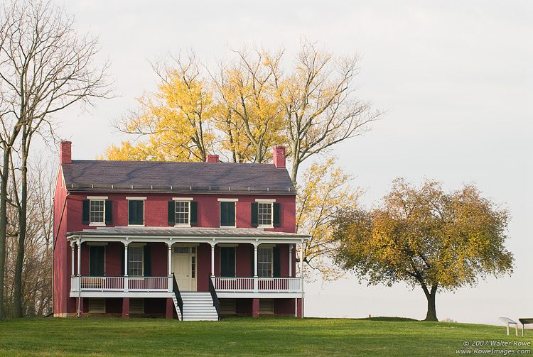
Monocacy National Battlefield
National Battlefield
During the summer of 1864, the Confederacy carried out a bold plan to turn the tide of the Civil War in their favor. They planned to capture Washington, DC and influence the election of 1864. On July...
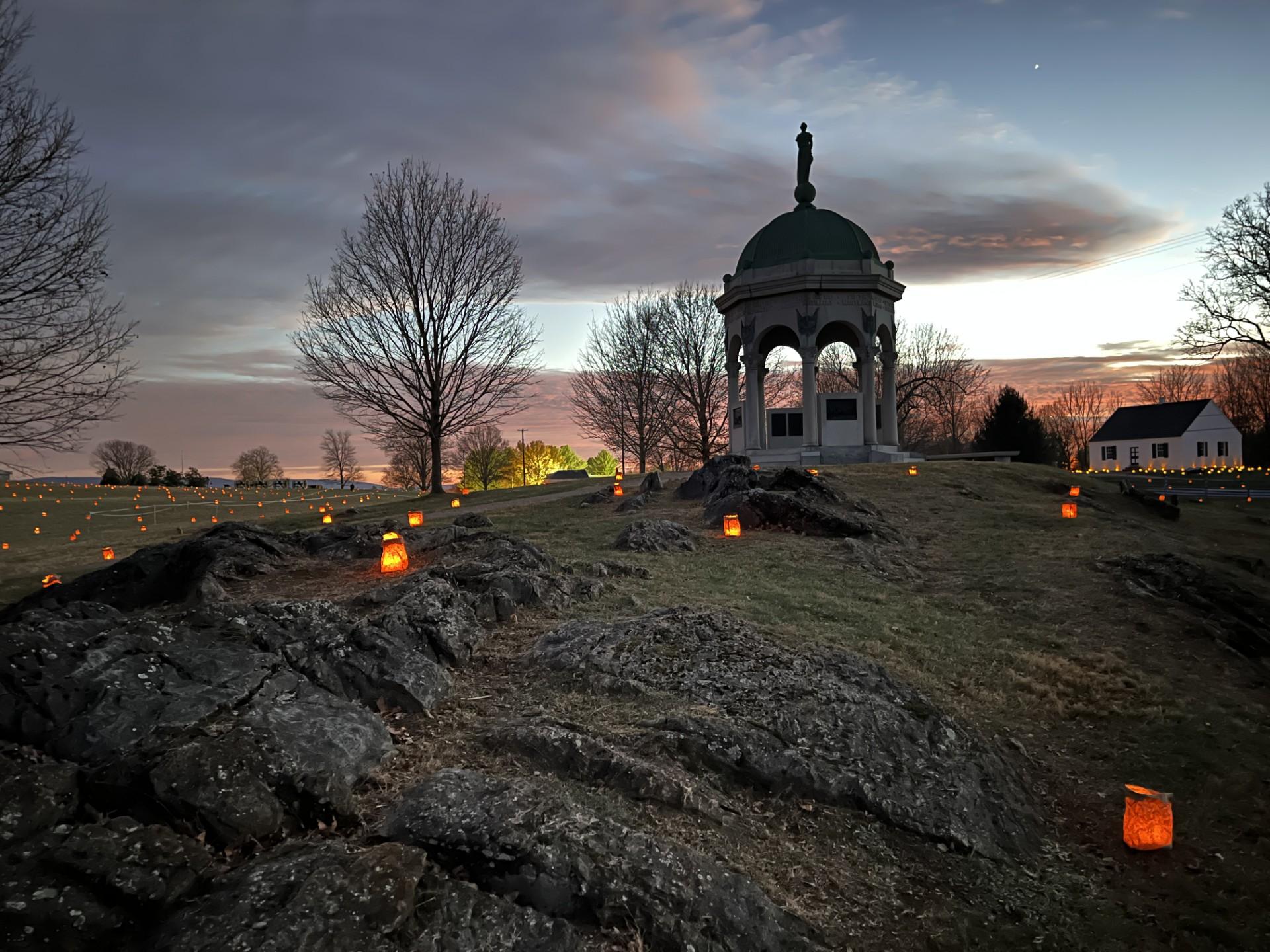
23,000 soldiers were killed, wounded or missing after twelve hours of savage combat on September 17, 1862. The Battle of Antietam ended the Confederate Army of Northern Virginia's first invasion into...
At the confluence of the Shenandoah and Potomac rivers, on the ancestral home of the Tuscarora and Shawnee people, lies Harpers Ferry. Here you can explore John Brown's Raid against slavery. Find your...
15 mi from route
~38 min detour
$20
near mile 14.2
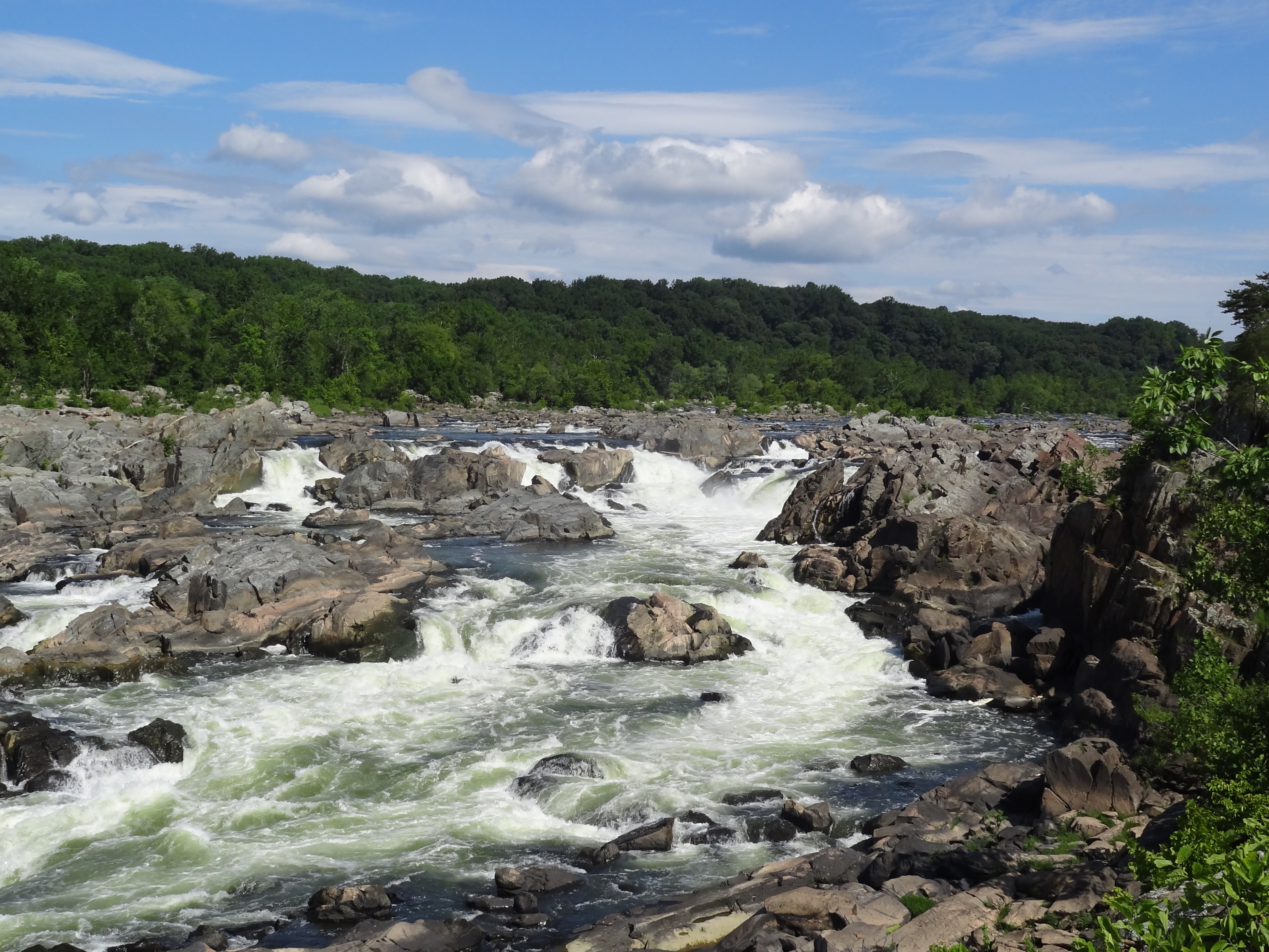
The Potomac River corridor is rich in both history and recreation, offering a chance to both explore your heritage and choose your adventure along the way. Start your journey here!
18 mi from route
~45 min detour
Free
near mile 22.7
Preserving America's early transportation history, the C&O Canal began as a dream of passage to Western wealth. Operating for nearly 100 years the canal was a lifeline for communities along the Potoma...
25 mi from route
~63 min detour
$20
near mile 39.7
Park data from the National Park Service API. Alerts update every 2 hours.
More Details
What kind of drive is this?
Expect a turn-heavy local drive as you navigate away from Smithsburg toward the Baltimore area. Unlike a monotonous interstate slog, this route requires your full attention as you transition between local roads and the Dwight D. Eisenhower Highway. With a highway share of 0%, the experience is defined by more technical, ground-level maneuvering rather than high-speed cruising. The road’s personality shifts from the quieter stretches near Smithsburg into the busier, more complex traffic patterns found as you approach Essex. Prepare for a hands-on driving experience where your focus remains on the road's curves and local intersections.
30% highway, the rest on surface roads — varied driving throughout.
22 navigation steps total — most of the decisions cluster near the start and finish.
Longest single stretch: 41 mi on Dwight D Eisenhower Highway.
How Hard Is This Drive?
10/10
This route mixes highway mileage with some local-road sections near the start or finish. This route has several spots where lane changes, forks, or exits need your full attention. The trickiest moment comes around 63 miles in.
Driving Effort10/10
Demanding - stay alert through the decision-heavy sections
Balances navigation complexity with total wheel time.
This drive requires moderate attention. Across 82.3 miles you will encounter 16 spots where lane choice or exit timing matters. Not difficult for experienced highway drivers, but worth previewing the tricky sections before you go.
Where does it get tricky?
The main spots that need attention: at 63 miles: Exit ramp - move to the correct lane early. Lane positioning matters here. Multiple destination signs - pick the right one; at 63.2 miles: Highway fork - watch signs carefully. Lane positioning matters here. Multiple destination signs - pick the right one; at 68.5 miles: Exit ramp - move to the correct lane early. Lane positioning matters here. Multiple destination signs - pick the right one.
Towns Mentioned on Route Signs
Based on OSRM destination-sign hints, not a full list of every settlement the road passes.
Between Smithsburg, MD and Essex, MD, road signs point toward Baltimore, Towson, Glen Burnie and Washington.
Southeast Baltimore, fittingly, covers the areas in the southeast of Baltimore, ranging from industrial wastelands to charming neighborhoods both quiet and hip.
Doable as a same-day drive at 1h 43m. Total distance: 82.3 miles.
Family Friendly
Moderate complexity with 0 natural rest stops along the way.
Solo Traveler
1h 43m drive, comfortable solo distance.
First-Time Driver
Mostly highway driving (30%). Some complex stretches to watch for.
Scenic Drive
Mixed highway & surface route profile with national parks nearby.
Frequently Asked Questions
The longest stretch is about 41 miles on Dwight D Eisenhower Highway. The full list of main roads is in the Roads section above.
It helps. This route has a higher-than-average number of complex decision points, which get harder in the dark. If the last hour of the trip is on surface roads or mountain grades, aim to arrive at Essex, MD before sunset when you can. Check the Trip Plan for departure windows that land you in daylight.
Yes. At under 2 hours behind the wheel, this works well for families — plan one quick stop if you have younger kids.
The main spots that need attention: at 63 miles: Exit ramp - move to the correct lane early. Lane positioning matters here. Multiple destination signs - pick the right one; at 63.2 miles: Highway fork - watch signs carefully. Lane positioning matters here. Multiple destination signs - pick the right one; at 68.5 miles: Exit ramp - move to the correct lane early. Lane positioning matters here. Multiple destination signs - pick the right one.
Yes — Monocacy National Battlefield, Antietam National Battlefield and Harpers Ferry National Historical Park (5 total within detour distance). See the National Parks section for detour distances and tips on detours.
Yes. A round trip is manageable in a single day if you plan a break at Essex, MD before heading back.