Trip from Slocomb, AL to Decatur, AL

Pin this trip

Compiled and reviewed by the US Trip Planner planning team at COD Solutions Oy · Last reviewed Jul 19, 2026 · Editorial standards

Drive Time

5h 41m

Distance

278.7 mi

449 km

Drive Score

8/10

Great drive

Same Day?

Yes, doable

Fuel Cost

$39

one way

EV Charging

Good

8 stations

Best Time to Leave

Save up to 40 min
4 AM
5h 28m ★
6 AM
5h 41m
8 AM
6h 8m
10 AM
5h 51m
12 PM
5h 48m
3 PM
5h 52m
5 PM
6h 6m
8 PM
5h 33m

Estimated drive times based on typical traffic patterns. Actual times may vary with weather, construction, and real-time conditions.

Downtown Slocomb, AL, AL

Slocomb, AL

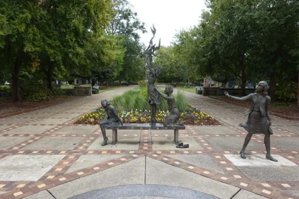
Helena Jankovičová Kováčová

Downtown Decatur, AL, AL

Decatur, AL

Wikimedia Commons

Trip Overview

Slocomb to Decatur is 278.7 miles and takes about 5h 41m via I 65 and US 231, with a fuel budget near $41 and enough daylight to finish in a day. This drive stays within Alabama, moving from the Southeast region to another part of the Southeast. Given its relatively short duration and straightforward path, it’s a practical option for a single-day trip. You’ll spend most of your time on major highways, making it a functional transit route rather than a scenic exploration.

Trip Pace

Same-day drive is realistic

A same-day return is possible, but it will make for a full day on the road.

Break Rhythm

1 planned break

Plan on a short reset every 3 to 4 hours to stay fresh behind the wheel.

Midpoint

139.4 miles from Slocomb, AL

A natural place for your longest stop of the day , about 3h 3m into the drive .

Main Roads

Road Distance Duration
I 65 161.4 mi 2h 56m
US 231 74 mi 1h 31m
College Street 8.4 mi 14m
AL 123 8.1 mi 11m
AL 103 5.5 mi 9m
Point Mallard Parkway Southeast 4.5 mi 6m
South US Highway 231 3.2 mi 5m
6th Avenue Southeast 3 mi 5m
Longest stretch: I 65 — 161.4 mi, about 2h 56m

Turn-by-Turn Driving Directions

Step-by-step road directions between Slocomb, AL and Decatur, AL.

1

Start on North Morris Street

224 ft · 15 sec · North Morris Street
2

Turn left onto AL 52

412 ft · 12 sec · West Lawrence Street
3

Turn left onto AL 103

0.4 mi · 40 sec · Commerce Street
4

Turn straight onto AL 103

2.6 mi · 4 min · North Dalton Street
5

Turn left onto AL 103

5.5 mi · 9 min · AL 103
6

Turn slight right onto AL 123

8.1 mi · 11 min · AL 123
7

At end of road, turn left onto AL 123; AL 134

8.4 mi · 14 min · College Street
8

Turn slight left onto US 231; AL 123

3.2 mi · 5 min · South US Highway 231
Use the left / straight lanes.
9

Continue on US 231; AL 27

1.5 mi · 2 min · US 231; AL 27
Use the left lane.
10

Continue on US 231

21 mi · 24 min · US 231
Use the left / straight lanes.
11

Continue on US 231; AL 10

0.4 mi · 35 sec · US 231; AL 10
12

Continue on US 231; AL 10

5.1 mi · 6 min · US 231; AL 10
Use the left lane.
13

Continue on US 231; AL 10

2.1 mi · 3 min · US 231; AL 10
Use the left lane.
14

Continue on US 231; AL 10

0.5 mi · 55 sec · US 231; AL 10
Use the straight lane.
15

Continue on US 231; AL 10

0.6 mi · 1 min · US 231; AL 10
Use the straight lane.
16

Continue on US 231; AL 10

0.7 mi · 1 min · US 231; AL 10
17

Continue on US 231; AL 10

0.2 mi · 14 sec · US 231; AL 10
18

Continue on US 231; AL 10

1.2 mi · 1 min · US 231; AL 10
Use the straight lane.
19

Continue on US 231; AL 10

1.8 mi · 2 min · US 231; AL 10
20

Continue on US 231

3.4 mi · 3 min · US 231
21

Continue on US 231

36 mi · 42 min · US 231
Use the straight lane.
22

Continue on McGehee Road

1.5 mi · 2 min · McGehee Road
Use the straight lane.
23

Turn right onto Carter Hill Road

1.1 mi · 1 min · Carter Hill Road
24

Continue on Zelda Road

1.1 mi · 2 min · Zelda Road
25

Turn right onto Ann Street

0.2 mi · 26 sec · Ann Street
26

Turn left

0.3 mi · 32 sec
Exit 3 Toward Ann Street South Use the left lane.
27

Merge onto I 85

2.5 mi · 3 min · I 85
Use the straight / slight right lanes.
28

Keep slight right at fork

0.3 mi · 43 sec
Toward I-65 North: Birmingham
29

Merge onto I 65; US 82

161 mi · 2 hr 56 min · I 65; US 82
Use the straight / slight right lanes.
30

Take the exit

0.4 mi · 51 sec
Exit 334 Toward 67: Decatur, Priceville, Somerville
31

Turn left onto AL 67

4.5 mi · 6 min · Point Mallard Parkway Southeast
Use the straight lane.
32

Turn right onto US 31

3.0 mi · 5 min · 6th Avenue Southeast
Use the straight lane.
33

Continue on US 31

0.1 mi · 14 sec · 6th Avenue Northeast
Use the straight / right lanes.
34

Turn left onto Lee Street Northeast

0.2 mi · 38 sec · Lee Street Northeast
Use the straight lane.
35

Turn right

82 ft · 6 sec
36

Arrive at destination

Trip Plan

For this 5-hour drive, leaving in the morning will give you plenty of daylight to reach Decatur. With only one recommended stop and a fuel cost around $41, you can plan your expenses easily. The longest stretch without a major road change is 161.4 miles on I 65, so consider breaking up that segment if you prefer more frequent pauses. Since this is a single-day trip, you have flexibility in your departure time, but aim to avoid heavy rush hour traffic in larger towns along I 65.

Morning Departure

An early start around 7-8 AM gets you there with plenty of daylight left.

Evening Departure

A late afternoon start means arriving after dark. Morning is better.

You can normally do this drive in one day.
Plan roughly 1 meaningful break for fuel, food, and rest.
The halfway point lands around 139.4 miles from Slocomb, AL, or about 3h 3m into the drive.
The longest continuous stretch on this route runs about 161.4 miles.

This is a comfortable same-day trip.

Departure

Before you leave

Start with fuel, water, and navigation already sorted so the first hour feels easy.

First stop

Around 61 miles or 1h 29m in

Use this first pause for coffee, a restroom break, and a quick traffic check ahead.

Halfway reset

Around 139.4 miles or 3h 3m in

This is the best place for your longest stop, a real meal, and a full fuel check.

Final approach

Final hour starts around 4h 40m

Traffic, exits, and arrival timing usually matter more near Decatur, AL than in the middle of the route.

Before You Leave

+

Open the route before leaving Slocomb, AL so your first major turns are already loaded.

+

Leave with enough water and a charging cable within reach, not packed away.

+

Check your fuel range against the first long segment, especially if you are starting outside city service areas.

Day 1

Settle into the route from Slocomb, AL

This is one driving day of about 278.7 miles and 5h 41m.

Your first comfortable stop window is around 61 miles from Slocomb, AL.
This route can stay practical as a one-day drive if traffic stays reasonable.
Plan about 1 real break rather than only quick fuel stops.
The longest stretch is on I 65 for about 161.4 miles.

Where to Stop

Rest stops, refuel points, and overnight suggestions along this route.

Downtown Coosada, AL, AL

Mid-route town

Meal stop

Coosada, AL

139 mi into the route

Best for: Lunch, fuel, and a longer reset

This sits close to the middle of the route, so it works well for the longest stop of the day.

Pacing Suggestions

Troy, AL

Fuel and coffee

A short stop after about 61 miles helps settle the day before fatigue starts building.

Columbiana, AL

Meal break

The midpoint is around 139.4 miles from Slocomb, AL, which is a good place for a longer meal and fuel stop.

Before the longest stretch

Fuel check

Top up before I 65 if your tank is already low. That segment runs about 161.4 miles.

These stop ideas are pacing suggestions — the exact town or exit can change with traffic, hotel plans, and fuel range.

Stops Along Your Drive

Picked by where they fit in your drive — first break, midpoint reset, final stretch.

Best meal stop · early in the drive

Rodeo Mexican Restaurant

4.2 ★ ★ ★ ★ ☆

Troy, Alabama

Early in the drive, right off the route

Early stretch · 1h 13m in 0.7 mi from route ~2 min detour $10 to $20

Hours: 11 am–9 pm

+13347700400

Visit website

Half Shell Oyster Bar & Grill

4.3 ★ ★ ★ ★ ☆

Troy, AL

0.7 mi

Zaxbys Chicken Fingers & Buffalo Wings

4.1 ★ ★ ★ ★ ☆

Pelham, Alabama

0.6 mi

Best coffee break · home stretch

The Mallard Coffee Company

4.8 ★ ★ ★ ★ ★

Decatur, Alabama

Near the end, right off the route

Home stretch · 0min to go 0.3 mi from route ~1 min detour $1 to $10

Hours: 7 AM–3 PM

+17706340731

Visit website

Bevelle Family Cafe

4.5 ★ ★ ★ ★ ★

Pelham, Alabama

1 mi

The Wine Bunker - Whiskey, Wine, & Coffee Bar

4.9 ★ ★ ★ ★ ★

Alabaster, Alabama

1.1 mi

Rodeo Mexican Restaurant

4.2 ★ ★ ★ ★ ☆

Early in the drive, right off the route

Early stretch 0.7 mi from route ~2 min detour $10 to $20

Troy, Alabama

Hours: 11 am–9 pm

+13347700400

Visit website

Half Shell Oyster Bar & Grill

4.3 ★ ★ ★ ★ ☆

Early in the drive, right off the route

Early stretch 0.7 mi from route ~2 min detour $10 to $20

Troy, AL

Hours: 11 am–9 pm

+13345661254

Visit website

Zaxbys Chicken Fingers & Buffalo Wings

4.1 ★ ★ ★ ★ ☆

Around the midpoint, right off the route

Final third 0.6 mi from route ~2 min detour Moderately

Pelham, Alabama

Hours: 10:30 am–9 pm

+12056634100

Visit website

Popeyes Louisiana Kitchen

3.3 ★ ★ ★ ☆ ☆

Later in the drive, right off the route

Final third 0.5 mi from route ~1 min detour $10 to $20

Birmingham, Alabama

Hours: 10 am–11 pm

+12057148066

Visit website

Tio Juan Mexican Grill

4.4 ★ ★ ★ ★ ☆

Near the end, short detour

Home stretch 1.3 mi from route ~3 min detour $10 to $20

Decatur, Alabama

+12563069992

Sonic Drive-In

3.4 ★ ★ ★ ☆ ☆

Near the end, short detour

Home stretch 1.4 mi from route ~3 min detour $10 to $20

Decatur, Alabama

Hours: 7 am–11 pm

+12565849724

Visit website

MatkaBar

4.8 ★ ★ ★ ★ ★

Around the midpoint, short detour

Early stretch 2.4 mi from route ~6 min detour $20 to $30

Montgomery, Alabama

Hours: 11 AM–2:30 PM

+13345935388

Visit website

Bay Leaf Modern Indian Cuisine & Bar - 5 Points

4.4 ★ ★ ★ ★ ☆

Later in the drive, short detour

Final third 2.7 mi from route ~7 min detour $20 to $30

Birmingham, Alabama

Hours: 11 am–2 pm

+12057773070

Visit website

The Mallard Coffee Company

4.8 ★ ★ ★ ★ ★

Near the end, right off the route

Home stretch 0.3 mi from route ~1 min detour $1 to $10

Decatur, Alabama

Hours: 7 AM–3 PM

+17706340731

Visit website

Bevelle Family Cafe

4.5 ★ ★ ★ ★ ★

Around the midpoint, right off the route

Final third 1 mi from route ~2 min detour $10 to $20

Pelham, Alabama

Hours: 10 AM–2:30 PM

+12056243041

Visit website

The Wine Bunker - Whiskey, Wine, & Coffee Bar

4.9 ★ ★ ★ ★ ★

Around the midpoint, short detour

Final third 1.1 mi from route ~3 min detour $20 to $30

Alabaster, Alabama

Hours: 3–9 PM

+12053588940

Visit website

Farmhouse Coffee

5.0 ★ ★ ★ ★ ★

Near the start, right off the route

0.1 mi from route

Slocomb, Alabama

Hours: 6:30–11:30 am

Fuse Coffee

4.9 ★ ★ ★ ★ ★

Early in the drive, short detour

Early stretch 1.2 mi from route ~3 min detour $1 to $10

Troy, Alabama

Hours: 7 am–7 pm

+13347700639

Visit website

The Bean Bro Troy

4.9 ★ ★ ★ ★ ★

Early in the drive, short detour

Early stretch 1.2 mi from route ~3 min detour $1 to $10

Troy, Alabama

Hours: 5 am–6 pm

Visit website

Ruth's Cafe

4.4 ★ ★ ★ ★ ☆

Later in the drive, short detour

Final third 1.5 mi from route ~4 min detour $10 to $20

Birmingham, Alabama

Hours: 6 AM–7 PM

+12059837932

Alicia's Coffee LLC

5.0 ★ ★ ★ ★ ★

Later in the drive, short detour

Final third 1.3 mi from route ~3 min detour

Birmingham, Alabama

Hours: 7 am–4 pm

+12055830926

Visit website

Electric Vehicle Charging Station

5.0 ★ ★ ★ ★ ★

Early in the drive, right off the route

Early stretch 0.4 mi from route ~1 min detour

Troy, Alabama

ChargePoint Charging Station

4.0 ★ ★ ★ ★ ☆

Near the end, right off the route

Home stretch 0.1 mi from route

Decatur, Alabama

Hours: Open 24 hours

Visit website

Red E Charging Station

4.0 ★ ★ ★ ★ ☆

Around the midpoint, right off the route

Halfway reset 0.6 mi from route ~2 min detour

Prattville, Alabama

Hours: Open 24 hours

EVgo Charging Station

4.3 ★ ★ ★ ★ ☆

Near the end, short detour

Home stretch 2.5 mi from route ~6 min detour

Good Hope, Alabama

Hours: Open 24 hours

+18774943833

Visit website

Tesla Supercharger

4.0 ★ ★ ★ ★ ☆

Around the midpoint, short detour

Halfway reset 2.6 mi from route ~7 min detour

Prattville, Alabama

Hours: Open 24 hours

Visit website

Red E Charging Station

5.0 ★ ★ ★ ★ ★

Around the midpoint, short detour

Early stretch 2.6 mi from route ~6 min detour

Montgomery, Alabama

Electrify America Charging Station

3.8 ★ ★ ★ ★ ☆

Around the midpoint, short detour

Final third 2.6 mi from route ~7 min detour

Alabaster, Alabama

Hours: Open 24 hours

+18336322778

Visit website

Tesla Supercharger

4.7 ★ ★ ★ ★ ★

Around the midpoint, short detour

Final third 3.1 mi from route ~8 min detour

Alabaster, Alabama

Hours: Open 24 hours

Visit website

Chilton County Rest Area (Northbound)

0 mi from route

Love's Travel Stop

0.1 mi from route

Pilot Travel Center

0.1 mi from route

Chilton County Rest Area (Southbound)

0.1 mi from route

Cullman County Rest Area

0.1 mi from route

Service Plaza

0.1 mi from route

Love's Travel Stop

0.1 mi from route

Pilot Travel Center

0.1 mi from route

Service Plaza

0.1 mi from route

Flying J Travel Center

0.2 mi from route

Love's Travel Stop

0.2 mi from route

QuikTrip

0.2 mi from route

Petro Stopping Centers

0.3 mi from route

Dale County Rest Area

1.2 mi from route

TA Express

1.4 mi from route

Service Plaza

2.4 mi from route

Carter's Sports Bar

4.6 ★ ★ ★ ★ ★

Later in the drive, right off the route

Final third 0.8 mi from route ~2 min detour

Birmingham, Alabama

Hours: 7 PM–12 AM

+12054701636

Visit website

McWane Science Center

4.7 ★ ★ ★ ★ ★

Later in the drive, short detour

Final third 1.5 mi from route ~4 min detour

Birmingham, Alabama

Hours: 9 am–5 pm

+12057148300

Visit website

Troy Arboretum

4.5 ★ ★ ★ ★ ★

Early in the drive, right off the route

Early stretch 0.8 mi from route ~2 min detour

Troy, Alabama

Subway

4.0 ★ ★ ★ ★ ☆

Early in the drive, right off the route

Early stretch 0.8 mi from route ~2 min detour Inexpensiv

Troy, Alabama

Hours: 8:30 am–9:30 pm

+13345667944

Visit website

Sloss Furnaces National Historic Landmark

4.7 ★ ★ ★ ★ ★

Later in the drive, short detour

Final third 2.1 mi from route ~5 min detour

Birmingham, Alabama

Hours: 10 am–4 pm

+12052542025

Visit website

Arlington Antebellum Home & Gardens

4.5 ★ ★ ★ ★ ★

Later in the drive, short detour

Final third 2.4 mi from route ~6 min detour

Birmingham, Alabama

Hours: 10 am–3 pm

+12057805656

Visit website

Logan's Roadhouse

3.9 ★ ★ ★ ★ ☆

Around the midpoint, short detour

Halfway reset 2.6 mi from route ~7 min detour $20 to $30

Prattville, Alabama

Hours: 11 am–10 pm

+13342859900

Visit website

Subway

3.9 ★ ★ ★ ★ ☆

Around the midpoint, short detour

Halfway reset 2.4 mi from route ~6 min detour Inexpensiv

Jemison, Alabama

Hours: 7 am–9 pm

+12056885085

Visit website

Place data sourced from public business listings. Hours and availability may vary.

Heads-up: tricky spots

5 of 16

5 decision points cluster between mile 0 and 270.6 — GPS handles the exact turns, but know they're coming. Your lane choice matters more than the turn itself.

5
0 mi into trip | ~0m in | AL 52 / West Lawrence Street

Turn left onto AL 52 / West Lawrence Street

Navigation decision point

8
106 mi into trip | ~2h 25m in

Turn left toward Ann Street South

Lane positioning matters here

Use the left lane. Exit 3 Toward Ann Street South
5
106.3 mi into trip | ~2h 26m in | I 85

Merge onto I 85

Merge point - match speed before joining. Lane positioning matters here

Use the straight / slight right lanes.
5
108.8 mi into trip | ~2h 29m in

Keep slight right at fork toward I-65 North: Birmingham

Highway fork - watch signs carefully

Toward I-65 North: Birmingham
6
270.6 mi into trip | ~5h 26m in

Take the exit toward 67: Decatur, Priceville, Somerville

Exit ramp - move to the correct lane early. Multiple destination signs - pick the right one

Exit 334 Toward 67: Decatur, Priceville, Somerville

Fuel & Cost

Regular Gas

$38.69 one way

$77.38 round trip

$3.53/gal 25.4 MPG avg 98 kg CO2
Fuel Type $/gal One Way Round Trip
midgrade $3.95 $43.29 $86.57
premium $4.29 $47.06 $94.12
diesel $4.80 $52.62 $105.25

No toll roads detected on this route.

Estimated Trip Cost (one way, 1 person)

Fuel

$39

Meals

$25–$50

Total

$64–$89

Rough estimate based on US averages. Hotel $80–$140/night, meals $25–$50/day.

Estimated CO2 emission: 97.5 kg one way. Prices: EIA weekly data, 2026-07-13.

Driving Electric?

About $29 in charging · 1 stop · 66% less CO2

Vehicle Type kWh Stops DC Fast Home Charge
Average EV 83.6 1 $29.26 $13.38
Efficient EV 69.7 0 $24.39 $11.15
EV Truck/SUV 111.5 1 $39.02 $17.84

Gas CO2

98 kg

EV CO2

33 kg (66% less)

Plan for 1 charging stop. A 30-minute DC fast charge mid-route should be enough to complete the trip comfortably.

DC fast charging avg $0.35/kWh. Home charging avg $0.16/kWh. US grid CO2: 0.39 kg/kWh.

Travel Intel

Current conditions at both ends of the drive.

Forecast as of Jul 18, 2026

Origin

Slocomb, AL

Late night in Slocomb on Sunday

Local time

3:15 AM

CDT

Current temp

75°F

Partly Cloudy

NW 5 mph 10% chance Live forecast

Destination

Decatur, AL

Late night in Decatur on Sunday

Local time

3:15 AM

CDT

Current temp

73°F

Partly Cloudy

0 mph 11% chance Live forecast

Seasonal Notes

Summer travel usually means heavier construction, hotter rest stops, and busier weekend traffic around major cities.

Winter travel shortens daylight, so a route that looks manageable on paper can feel much longer after dark.

Holiday weekends tend to make both departure and arrival windows slower than the raw route time suggests.

Time zone

Same local time

Origin and destination are on the same clock, so arrival timing is easier to judge at a glance.

Temperature spread

2 degrees cooler at arrival

A meaningful temperature swing is a good cue to rethink layers, water, and how soon you want to arrive.

Road read

5h 41m on the road

An early start around 7-8 AM gets you there with plenty of daylight left.

Weather data from the National Weather Service. Conditions may change; check closer to your travel date.

National Parks Near This Route

Worth a detour if your schedule allows.

Birmingham Civil Rights National Monument

Birmingham Civil Rights National Monument

National Monument

In 1963, images of snarling police dogs unleashed against non-violent protesters and of children being sprayed with high-pressure hoses appeared in print and television news around the world. These dr...

4 mi from route ~9 min detour Free near mile 201.8
Park Closure: A.G Gaston Motel Closed for Construction
View on nps.gov

Park data from the National Park Service API. Alerts update every 2 hours.

What kind of drive is this?

This trip is mostly highway, with 93% of the 278.7 miles on high-speed roads like I 65. You’ll experience a continuous stretch of 161.4 miles on I 65 before transitioning to other roads. Expect frequent exits and merging traffic as you navigate this primarily interstate path. The shift to surface roads like College Street will happen later in the drive.

93% highway — fuel and pacing are the main things to plan.
36 navigation steps total — most of the decisions cluster near the start and finish.
Longest single stretch: 161.4 mi on I 65.

How Hard Is This Drive?

6/10

This is a straightforward highway drive that stays mostly on I 65 and US 231. You will hit about 16 points where you need to pay attention to lane position or signs. The trickiest moment comes early in the drive near AL 52 / West Lawrence Street.

Driving Effort 6/10

Moderate - straightforward overall, but long enough or busy enough to require pacing

Balances navigation complexity with total wheel time.

This drive requires moderate attention. Across 278.7 miles you will encounter 16 spots where lane choice or exit timing matters. Not difficult for experienced highway drivers, but worth previewing the tricky sections before you go.

Where does it get tricky?

The main spots that need attention: near the start (AL 52 / West Lawrence Street): Navigation decision point; at 106 miles: Lane positioning matters here; at 106.3 miles (I 85): Merge point - match speed before joining. Lane positioning matters here.

Elevation Profile

Gently rolling terrain

714 ft 211 ft

Total Climb

1,013 ft

Total Descent

729 ft

Highest Point

714 ft

~238.9 mi in

Elevation Range

503 ft

Towns Mentioned on Route Signs

Based on OSRM destination-sign hints, not a full list of every settlement the road passes.

On the drive from Slocomb, AL to Decatur, AL, road signs begin pointing toward Ann Street South along the way.

Ann Street South

106 mi in | ~2h 25m

About the Cities

Starting in Slocomb, AL

Full guide →

Arriving in Decatur, AL

Full guide →

Founded 1821

Decatur is a city in Alabama. It is called The Ballooning Capital of Alabama.

Top landmarks

  • Princess Theatre — theater in Decatur, Alabama, United States
  • Cotaco Opera House — theater in Decatur, Alabama
  • Bank Street–Old Decatur Historic District — historic district in Alabama, United States

City content from Wikivoyage (CC BY-SA 4.0) and Wikidata (CC0).

Who Is This Route For?

Weekend Trip

Doable as a same-day drive at 5h 41m. Total distance: 278.7 miles.

Family Friendly

Moderate complexity with 1 natural rest stops along the way.

Solo Traveler

5h 41m drive, comfortable solo distance.

First-Time Driver

Mostly highway driving (93%). Some complex stretches to watch for.

Frequently Asked Questions

The longest stretch is about 161.4 miles on I 65. The full list of main roads is in the Roads section above.

Yes — we found about 16 rest areas or service plazas within a short detour of the route (from OpenStreetMap). See the Rest Stops tab under Nearby Places for locations and mile markers. Plan to stretch, use the bathroom, and top off fluids every 2–3 hours on longer drives.

It helps. This route has a higher-than-average number of complex decision points, which get harder in the dark. If the last hour of the trip is on surface roads or mountain grades, aim to arrive at Decatur, AL before sunset when you can. Check the Trip Plan for departure windows that land you in daylight.

Only with planning. This is a long drive for kids — consider splitting it into two days rather than pushing through. Plan at least 1 meaningful breaks. There are 16 rest areas along the route for bathroom stops.

The main spots that need attention: near the start (AL 52 / West Lawrence Street): Navigation decision point; at 106 miles: Lane positioning matters here; at 106.3 miles (I 85): Merge point - match speed before joining. Lane positioning matters here.

Yes — Birmingham Civil Rights National Monument. See the National Parks section for detour distances and tips on detours.

Not recommended in a single day. At 5.7 hours each way, a round trip means 11.4 hours of driving — that is an unsafe level of fatigue for most drivers. Plan at least one night at Decatur, AL before the return drive.

How this page is built

Compiled by the US Trip Planner planning team at COD Solutions Oy from open government datasets — OSRM over OpenStreetMap for geometry, EIA for fuel prices, USGS 3DEP for elevation, and NPS for national parks. See our methodology for refresh cadence and limitations.

Was this helpful?

Thanks for your feedback!

Your tip has been submitted. Thanks!

/500

Explore More

Explore more options from Slocomb, AL or browse trips ending in Decatur, AL.

Looking for more statewide routes? Browse AL road trips.