This 749.7-mile journey from Skagway to Anchorage is a substantial road trip, taking approximately 49 hours and 41 minutes of driving time. Given its length and duration, this route is definitely not a day trip and is recommended to be split over 4 days. You'll be looking at an estimated fuel cost of $162 for the entire drive. The primary roads you'll be using are various segments of the Alaska Marine Highway, including the Whittier-Yakutat, Juneau-Yakutat, and Juneau-Haines routes. This trip offers a unique Alaskan experience, connecting two significant points within the state.
Trip Pace
Best split across 4 days
Treat the return leg as its own travel day rather than an afterthought.
Break Rhythm
14 planned breaks
Plan on a short reset every 3 to 4 hours to stay fresh behind the wheel.
Midpoint
374.9 miles from Skagway, AK
A natural place for your longest stop of the day
, about 27h 36m into the drive
.
Planning your departure is key for this 4-day, 749.7-mile trip. With a total driving time of nearly 50 hours, pacing your stops is crucial. You'll have 14 designated stops to utilize, so aim to break up the driving into manageable segments each day. Keep an eye on your fuel levels, especially between ferry legs, as the estimated fuel cost is $162. A practical tip for this route is to book your Alaska Marine Highway ferry reservations well in advance, as they can fill up, especially during peak travel seasons.
Morning Departure
Start early — leave by 6-7 AM to arrive at a reasonable hour.
Evening Departure
This is a long drive — plan for a morning departure or consider splitting it into two days.
This drive is better paced as a 4-day trip.
Plan roughly 14 meaningful breaks for fuel, food, and rest.
The halfway point lands around 374.9 miles from Skagway, AK, or about 27h 36m into the drive.
The longest continuous stretch on this route runs about 334.5 miles.
Consider an overnight stop or starting very early.
Departure
Before you leave
Start with fuel, water, and navigation already sorted so the first hour feels easy.
First stop
Around 165 miles or 13h 59m in
Use this first pause for coffee, a restroom break, and a quick traffic check ahead.
Halfway reset
Around 374.9 miles or 27h 36m in
This is the best place for your longest stop, a real meal, and a full fuel check.
Overnight split
Day 1 wrap after about 187.4 miles or 15h 27m
Stop before fatigue turns the last few hours into a grind. You want day two to start fresh, not just resumed.
Final approach
Final hour starts around 48h 17m
Traffic, exits, and arrival timing usually matter more near Anchorage, AK than in the middle of the route.
Before You Leave
+
Open the route before leaving Skagway, AK so your first major turns are already loaded.
+
Leave with enough water and a charging cable within reach, not packed away.
+
Check your fuel range against the first long segment, especially if you are starting outside city service areas.
+
Pick one backup stop option before the midpoint in case traffic changes your pacing.
+
Treat this as a 4-day road trip and book the overnight stop before the busiest arrival window.
Day 1
Settle into the route from Skagway, AK
Aim for roughly 187 miles and 12.4 hours of wheel time on this day.
Day 2
Keep the middle miles efficient
Aim for roughly 187 miles and 12.4 hours of wheel time on this day.
Day 3
Keep the middle miles efficient
Aim for roughly 187 miles and 12.4 hours of wheel time on this day.
Day 4
Finish the approach into Anchorage, AK
Aim for roughly 187 miles and 12.4 hours of wheel time on this day.
Your first comfortable stop window is around 165 miles from Skagway, AK.
This route usually feels better as a 4-day drive than as one long push.
Plan about 14 real breaks rather than only quick fuel stops.
The longest stretch is on Alaska Marine Highway - Whittier-Yakutat for about 334.5 miles.
Where to Stop
Rest stops, refuel points, and overnight suggestions along this route.
Place data sourced from public business listings. Hours and availability may vary.
Heads-up: tricky spots
5 of 15
5 decision points cluster between mile 0.5 and 354.7 — GPS handles the exact turns, but know they're coming. Your lane choice matters more than the turn itself.
5
0.5 mi into trip|~0m in|AK 98 / Broadway
Turn right onto AK 98 / Broadway
Navigation decision point
6
0.8 mi into trip|~1m in
At end of road, turn right
Complex interchange - multiple decisions in a short stretch
5
15.7 mi into trip|~46m in|Alaska Marine Highway - Juneau-Haines
Turn sharp left onto Alaska Marine Highway - Juneau-Haines
Sharp turn - reduce speed on approach
5
92.1 mi into trip|~9h 16m in|Alaska Marine Highway - Juneau-Yakutat
Turn sharp right onto Alaska Marine Highway - Juneau-Yakutat
Sharp turn - reduce speed on approach
5
354.7 mi into trip|~26h 16m in|Alaska Marine Highway - Whittier-Yakutat
Turn sharp left onto Alaska Marine Highway - Whittier-Yakutat
Sharp turn - reduce speed on approach
Fuel & Cost
Regular Gas
$146.58 one way
$293.15 round trip
$4.97/gal25.4 MPG avg262 kg CO2
Fuel Type
$/gal
One Way
Round Trip
midgrade
$5.28
$155.78
$311.57
premium
$5.46
$161.01
$322.02
diesel
$4.80
$141.56
$283.12
No toll roads detected on this route.
Estimated Trip Cost (one way, 1 person)
Fuel
$147
Hotel (3n)
$240–$420
Meals
$100–$200
Total
$487–$767
Rough estimate based on US averages. Hotel $80–$140/night, meals $25–$50/day.
Estimated CO2 emission: 262.3 kg one way.
Prices: EIA weekly data, 2026-07-13.
Driving Electric?
About $79 in charging
· 2 stops
· 66% less CO2
Vehicle Type
kWh
Stops
DC Fast
Home Charge
Average EV
224.9
2
$78.72
$35.99
Efficient EV
187.4
2
$65.60
$29.99
EV Truck/SUV
299.9
3
$104.96
$47.98
Gas CO2
262 kg
EV CO2
88 kg (66% less)
Plan for 2 charging stops, roughly every 270 miles. Allow 25-40 minutes per stop at a DC fast charger.
DC fast charging avg $0.35/kWh. Home charging avg $0.16/kWh. US grid CO2: 0.39 kg/kWh.
Travel Intel
Current conditions at both ends of the drive.
Forecast as of Jul 16, 2026
Origin
Skagway, AK
Late night
in Skagway on Sunday
Local time
12:45 AM
AKDT
Current temp
66°F
Mostly Sunny
SW 15 to 20 mph0% chanceLive forecast
Special Weather Statement
Special Weather Statement issued July 16 at 10:56AM AKDT by NWS Juneau AK
Special Weather Statement
Special Weather Statement issued July 16 at 10:42AM AKDT by NWS Juneau AK
Destination
Anchorage, AK
Late night
in Anchorage on Sunday
Local time
12:45 AM
AKDT
Current temp
59°F
Light Rain
0 mph85% chanceLive forecast
Special Weather Statement
Special Weather Statement issued July 16 at 10:56AM AKDT by NWS Juneau AK
Special Weather Statement
Special Weather Statement issued July 16 at 10:42AM AKDT by NWS Juneau AK
Seasonal Notes
Summer travel usually means heavier construction, hotter rest stops, and busier weekend traffic around major cities.
Winter travel shortens daylight, so a route that looks manageable on paper can feel much longer after dark.
Holiday weekends tend to make both departure and arrival windows slower than the raw route time suggests.
For long drives, weather on day two can matter just as much as conditions at departure, so check the whole travel window rather than only the first day.
Time zone
Same local time
Origin and destination are on the same clock, so arrival timing is easier to judge at a glance.
Temperature spread
7 degrees cooler at arrival
A meaningful temperature swing is a good cue to rethink layers, water, and how soon you want to arrive.
Road read
49h 41m on the road
This is long enough that the arrival forecast matters almost as much as departure conditions. Recheck both ends before you roll.
Weather data from the National Weather Service. Conditions may change; check closer to your travel date.
National Parks Near This Route
Worth a detour if your schedule allows.
Klondike Gold Rush National Historical Park
National Historical Park
Headlines screamed "Gold!" The dream of a better life catapulted thousands of people to Alaska and the Yukon Territory. Their journey shaped them, and changed the people they encountered and the north...
Park data from the National Park Service API. Alerts update every 2 hours.
More Details
What kind of drive is this?
Expect a significant portion of this drive to take place on the Alaska Marine Highway system, as indicated by the 0% highway share. The character of this route is defined by its ferry segments, which means you'll be covering considerable distances on water between driving legs. The longest uninterrupted stretch you'll encounter is 334.5 miles on the Alaska Marine Highway - Whittier-Yakutat segment. This suggests a driving experience that is punctuated by ferry travel, offering a different pace than a continuous road journey.
0% highway, the rest on surface roads — varied driving throughout.
22 navigation steps total — most of the decisions cluster near the start and finish.
Longest single stretch: 334.5 mi on Alaska Marine Highway - Whittier-Yakutat.
How Hard Is This Drive?
7/10
At 49h 41m, this is a long-haul route where pacing matters more than any single turn. This route has several spots where lane changes, forks, or exits need your full attention. The trickiest moment comes around 0.5 miles in near AK 98 / Broadway.
Driving Effort7/10
Demanding - plan breaks and stay ahead of the key maneuvers
Balances navigation complexity with total wheel time.
This is a demanding drive. With 15 significant decision points across 749.7 miles, you will need to stay alert - especially through interchange areas and urban stretches. Consider splitting it into segments if you are not comfortable with fast highway navigation.
Where does it get tricky?
The main spots that need attention: at 0.5 miles (AK 98 / Broadway): Navigation decision point; at 0.8 miles: Complex interchange - multiple decisions in a short stretch; at 15.7 miles (Alaska Marine Highway - Juneau-Haines): Sharp turn - reduce speed on approach.
Elevation Profile
Mostly flat terrain
102 ft0 ft
Total Climb
102 ft
Total Descent
35 ft
Highest Point
102 ft
~749.7 mi in
Elevation Range
102 ft
Detours Along the Way
Tagged by where each one fits in your drive — first break, midpoint, final stretch.
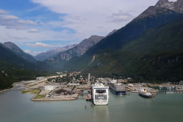
Skagway is a town with a population of less than a thousand in Southeastern Alaska. It is the northern terminus of the Alaska Marine Highway System. It sprang up during the Klondike Gold Rush of 1896-1899, and now subsists almost entirely on tourism. The historical interest and natural beauty of the area make it a worthwhile place to visit.
Anchorage is the largest city in Alaska, in the Southcentral region. Anchorage is a cosmopolitan port city with a population of 291 247 (2020). It is a consolidated city-borough referred to as a municipality. The urbanized city is defined by Muldoon Road to the east, Rabbit Creek Road to the south, and Cook Inlet to the north and west. Several small suburbs are within the Municipality of Anchorage while physically outside what most Anchorageites would call the "Anchorage" proper area. These include Eagle River and Chugiak to the north and Girdwood to the south.
Top landmarks
•Fort Richardson National Cemetery — United States National Cemetery in Anchorage, Alaska
•Alaska Native Heritage Center — cultural center in Anchorage, Alaska, United States
•Crow Creek Consolidated Gold Mining Company — historic gold mine near Girdwood, Alaska
Long-haul drive route profile with national parks nearby.
Frequently Asked Questions
The longest stretch is about 334.5 miles on Alaska Marine Highway - Whittier-Yakutat. The full list of main roads is in the Roads section above.
Yes — a 4-day pace is more comfortable than one long haul. A sensible stopping point is after roughly 187 miles on day one.
Yes — we found about 1 rest area or service plaza within a short detour of the route (from OpenStreetMap). See the Rest Stops tab under Nearby Places for locations and mile markers. Plan to stretch, use the bathroom, and top off fluids every 2–3 hours on longer drives.
It helps. This route has a higher-than-average number of complex decision points, which get harder in the dark. If the last hour of the trip is on surface roads or mountain grades, aim to arrive at Anchorage, AK before sunset when you can. Check the Trip Plan for departure windows that land you in daylight.
Only with planning. This is a long drive for kids — consider splitting it into two days rather than pushing through. Plan at least 14 meaningful breaks. There are 1 rest area along the route for bathroom stops.
Mostly yes along the main roads, but rural stretches through AK can have sparse or no coverage. Before you leave, download offline Google Maps or Apple Maps for the route, and consider downloading music or podcasts instead of streaming. If you depend on data for navigation, keep a paper backup of the turn-by-turn directions.
The main spots that need attention: at 0.5 miles (AK 98 / Broadway): Navigation decision point; at 0.8 miles: Complex interchange - multiple decisions in a short stretch; at 15.7 miles (Alaska Marine Highway - Juneau-Haines): Sharp turn - reduce speed on approach.
Yes — Klondike Gold Rush National Historical Park. See the National Parks section for detour distances and tips on detours.
Not recommended in a single day. At 49.7 hours each way, a round trip means 99.4 hours of driving — that is an unsafe level of fatigue for most drivers. Plan at least one night at Anchorage, AK before the return drive.