Traveling from San Jose to Willow Creek covers 345.7 miles and typically takes about 6 hours and 34 minutes behind the wheel. Given the duration, this route is feasible as a single-day trip if you start early, though you should budget approximately $80 for fuel to complete the journey. You will primarily utilize I-680, I-505, and CA-299 to navigate between these two Pacific Coast locations. Because the drive is highway-focused, it functions well as a direct transit rather than a slow-paced tour. If you prefer a more relaxed pace, you can easily incorporate one planned stop to break up the drive. Overall, this is a straightforward trek that gets you from the heart of the Bay Area into the mountainous terrain of Willow Creek.
Trip Pace
Same-day drive is realistic
A same-day return is possible, but it will make for a full day on the road.
Break Rhythm
1 planned break
Plan on a short reset every 3 to 4 hours to stay fresh behind the wheel.
Midpoint
172.8 miles from San Jose, CA
A natural place for your longest stop of the day
, about 3h 16m into the drive
.
Main Roads
Road
Distance
Duration
I 505
157.7 mi
2h 49m
CA 299
74 mi
1h 28m
I 680
37.3 mi
42m
Eureka Way
25 mi
29m
Dwight D. Eisenhower Highway
14.8 mi
17m
Luther E Gibson Freeway
12 mi
13m
I 880
8.5 mi
9m
Senator Daniel E Boatwright Highway
7.9 mi
9m
Longest stretch:
I 505
— 157.7 mi, about 2h 49m
Traffic on I-680
Hour-of-day weekday pattern from 16 FHWA count stations on your route.
Peak
5 PM
~7,998 veh/hr typical
Quietest
3 AM
~447 veh/hr
Peak-to-quiet ratio
17.9×
busier at peak than in the quiet hours
12a6anoon6p11p
Averaged across 35 weeks of 2023 FHWA Travel Monitoring Analysis System data. Weekday hours only (Mon–Fri).
Turn-by-Turn Driving Directions
Step-by-step road directions between San Jose, CA and Willow Creek, CA.
1
Start on North Market Street
196 ft·8 sec·North Market Street
2
Continue on Coleman Avenue
1.4 mi·2 min·Coleman Avenue
Use the straight lane.
3
Take the ramp
0.3 mi·42 sec
Toward I 880 North: OaklandUse the right lane.
4
Merge onto I 880
8.5 mi·9 min·I 880
Use the straight / slight right lanes.
5
Keep slight right at fork onto I 880
0.6 mi·41 sec·Nimitz Freeway
6
Take the exit onto CA 262
1.6 mi·2 min·CA 262
Exit 12AToward SacramentoUse the slight right lane.
7
Take the exit
0.2 mi·24 sec
Toward I 680 North: SacramentoUse the straight lane.
8
Keep slight left at fork
0.3 mi·41 sec
Toward I 680 North: SacramentoUse the straight lane.
9
Merge onto I 680
37 mi·42 min·I 680
Use the straight / slight right lanes.
10
Keep slight left at fork onto I 680
6.0 mi·6 min·Senator Daniel E Boatwright Highway
Toward I 680 North: Martinez, SacramentoUse the straight / slight right lanes.
11
Keep slight left at fork onto I 680
243 ft·3 sec·Senator Daniel E Boatwright Highway
12
Keep slight right at fork onto I 680
1.8 mi·2 min·Senator Daniel E Boatwright Highway
Use the slight right lane.
13
Keep slight right at fork onto I 680
0.4 mi·26 sec·Benicia-Martinez Bridge
14
Continue on I 680
12 mi·13 min·Luther E Gibson Freeway
Use the straight / slight right lanes.
15
Keep slight right at fork
0.4 mi·55 sec
Exit 71AToward I 80 East, CA 12 East: Fairfield, Sacramento
16
Merge onto I 80; CA 12
1.7 mi·1 min·Dwight D. Eisenhower Highway
Use the straight / slight right lanes.
17
Keep slight left at fork onto I 80
13 mi·15 min·Dwight D. Eisenhower Highway
Use the straight / slight right lanes.
18
Take the exit
0.2 mi·19 sec
Toward I 505 North: Winters, ReddingUse the straight / slight right lanes.
19
Keep slight left at fork
0.6 mi·1 min
Toward I 505 North: Winters, ReddingUse the straight / slight right lanes.
20
Continue on I 505
158 mi·2 hr 49 min·I 505
Use the straight / slight right lanes.
21
Take the exit
0.2 mi·15 sec
Exit 678Toward CA 44: Eureka, Susanville
22
Keep slight left at fork
0.9 mi·1 min
Exit 678Toward CA 44 West: Eureka, Whiskeytown National Recreation Area
23
Merge onto CA 44
1.2 mi·1 min·CA 44
Use the straight / slight right lanes.
24
Turn right onto CA 44; CA 273; US 99 Hist
489 ft·17 sec·Pine Street
Use the straight / right lanes.
25
Turn left onto CA 44; CA 273; US 99 Hist
25 mi·29 min·Eureka Way
Use the left lane.
26
Continue on CA 299
74 mi·1 hr 28 min·CA 299
27
Turn right onto CA 96
69 ft·1 sec·Bigfoot Scenic Byway
28
Arrive at destination
CA 96
Trip Plan
To make the most of this 345.7-mile journey, aim to depart early in the morning to avoid heavy traffic congestion near your starting point in San Jose. Since you have one recommended stop, use that time strategically to refuel and stretch your legs before tackling the final, more technical segments of CA-299. Keep your $80 fuel budget in mind as you plan your stops, especially since remote stretches can sometimes carry higher prices. Because the route relies heavily on major thoroughfares, keep an eye on real-time traffic updates for I-680 and I-505 to adjust your departure time accordingly. Having a flexible schedule is your best asset for managing the 6-hour and 34-minute drive comfortably.
Morning Departure
Start early — leave by 6-7 AM to arrive at a reasonable hour.
Evening Departure
This is a long drive — plan for a morning departure or consider splitting it into two days.
You can normally do this drive in one day.
Plan roughly 1 meaningful break for fuel, food, and rest.
The halfway point lands around 172.8 miles from San Jose, CA, or about 3h 16m into the drive.
The longest continuous stretch on this route runs about 157.7 miles.
This is a comfortable same-day trip.
Departure
Before you leave
Start with fuel, water, and navigation already sorted so the first hour feels easy.
First stop
Around 76 miles or 1h 30m in
Use this first pause for coffee, a restroom break, and a quick traffic check ahead.
Halfway reset
Around 172.8 miles or 3h 16m in
This is the best place for your longest stop, a real meal, and a full fuel check.
Final approach
Final hour starts around 5h 23m
Traffic, exits, and arrival timing usually matter more near Willow Creek, CA than in the middle of the route.
Before You Leave
+
Open the route before leaving San Jose, CA so your first major turns are already loaded.
+
Leave with enough water and a charging cable within reach, not packed away.
+
Check your fuel range against the first long segment, especially if you are starting outside city service areas.
Day 1
Settle into the route from San Jose, CA
This is one driving day of about 345.7 miles and 6h 34m.
Your first comfortable stop window is around 76 miles from San Jose, CA.
This route can stay practical as a one-day drive if traffic stays reasonable.
Plan about 1 real break rather than only quick fuel stops.
The longest stretch is on I 505 for about 157.7 miles.
Where to Stop
Rest stops, refuel points, and overnight suggestions along this route.
Place data sourced from public business listings. Hours and availability may vary.
Heads-up: tricky spots
5 of 22
5 decision points cluster between mile 1.5 and 85.9 — GPS handles the exact turns, but know they're coming. Your lane choice matters more than the turn itself.
7
1.5 mi into trip|~2m in
Take the ramp toward I 880 North: Oakland
Lane positioning matters here
Use the right lane.
Toward I 880 North: Oakland
7
10.9 mi into trip|~14m in|CA 262
Take the exit onto CA 262 toward Sacramento
Exit ramp - move to the correct lane early. Lane positioning matters here
Use the slight right lane.
Exit 12A
Toward Sacramento
8
12.7 mi into trip|~16m in
Keep slight left at fork toward I 680 North: Sacramento
Highway fork - watch signs carefully. Lane positioning matters here
Use the straight lane.
Toward I 680 North: Sacramento
8
50.3 mi into trip|~1h in|I 680 / Senator Daniel E Boatwright Highway
Keep slight left at fork onto I 680 / Senator Daniel E Boatwright Highway toward I 680 North: Martinez, Sacramento
Highway fork - watch signs carefully. Lane positioning matters here. Multiple destination signs - pick the right one
Use the straight / slight right lanes.
Toward I 680 North: Martinez, Sacramento
8
85.9 mi into trip|~1h 42m in
Keep slight left at fork toward I 505 North: Winters, Redding
Highway fork - watch signs carefully. Lane positioning matters here. Multiple destination signs - pick the right one
Use the straight / slight right lanes.
Toward I 505 North: Winters, Redding
Fuel & Cost
Regular Gas
$72.32 one way
$144.65 round trip
$5.31/gal25.4 MPG avg121 kg CO2
Fuel Type
$/gal
One Way
Round Trip
midgrade
$5.52
$75.11
$150.23
premium
$5.67
$77.10
$154.20
diesel
$4.80
$65.27
$130.55
No toll roads detected on this route.
Estimated Trip Cost (one way, 1 person)
Fuel
$72
Meals
$25–$50
Total
$97–$122
Rough estimate based on US averages. Hotel $80–$140/night, meals $25–$50/day.
Estimated CO2 emission: 121 kg one way.
Prices: EIA weekly data, 2026-07-13.
Driving Electric?
About $36 in charging
· 1 stop
· 67% less CO2
Vehicle Type
kWh
Stops
DC Fast
Home Charge
Average EV
103.7
1
$36.30
$16.59
Efficient EV
86.4
0
$30.25
$13.83
EV Truck/SUV
138.3
1
$48.40
$22.12
Gas CO2
121 kg
EV CO2
40 kg (67% less)
Plan for 1 charging stop. A 30-minute DC fast charge mid-route should be enough to complete the trip comfortably.
DC fast charging avg $0.35/kWh. Home charging avg $0.16/kWh. US grid CO2: 0.39 kg/kWh.
Travel Intel
Current conditions at both ends of the drive.
Forecast as of Jul 17, 2026
Origin
San Jose, CA
Late night
in San Jose on Sunday
Local time
2:08 AM
PDT
Current temp
56°F
Mostly Clear
NW 2 mph0% chanceLive forecast
Red Flag Warning
Red Flag Warning issued July 17 at 1:44AM PDT until July 17 at 8:00PM PDT by NWS Medford OR
Red Flag Warning
Red Flag Warning issued July 17 at 1:44AM PDT until July 17 at 8:00PM PDT by NWS Medford OR
Destination
Willow Creek, CA
Late night
in Willow Creek on Sunday
Local time
2:08 AM
PDT
Current temp
51°F
Mostly Clear
N 3 mph0% chanceLive forecast
Red Flag Warning
Red Flag Warning issued July 17 at 1:44AM PDT until July 17 at 8:00PM PDT by NWS Medford OR
Red Flag Warning
Red Flag Warning issued July 17 at 1:44AM PDT until July 17 at 8:00PM PDT by NWS Medford OR
Seasonal Notes
Summer travel usually means heavier construction, hotter rest stops, and busier weekend traffic around major cities.
Winter travel shortens daylight, so a route that looks manageable on paper can feel much longer after dark.
Holiday weekends tend to make both departure and arrival windows slower than the raw route time suggests.
Time zone
Same local time
Origin and destination are on the same clock, so arrival timing is easier to judge at a glance.
Temperature spread
5 degrees cooler at arrival
A meaningful temperature swing is a good cue to rethink layers, water, and how soon you want to arrive.
Road read
6h 34m on the road
Start early — leave by 6-7 AM to arrive at a reasonable hour.
Weather data from the National Weather Service. Conditions may change; check closer to your travel date.
National Parks Near This Route
Worth a detour if your schedule allows.
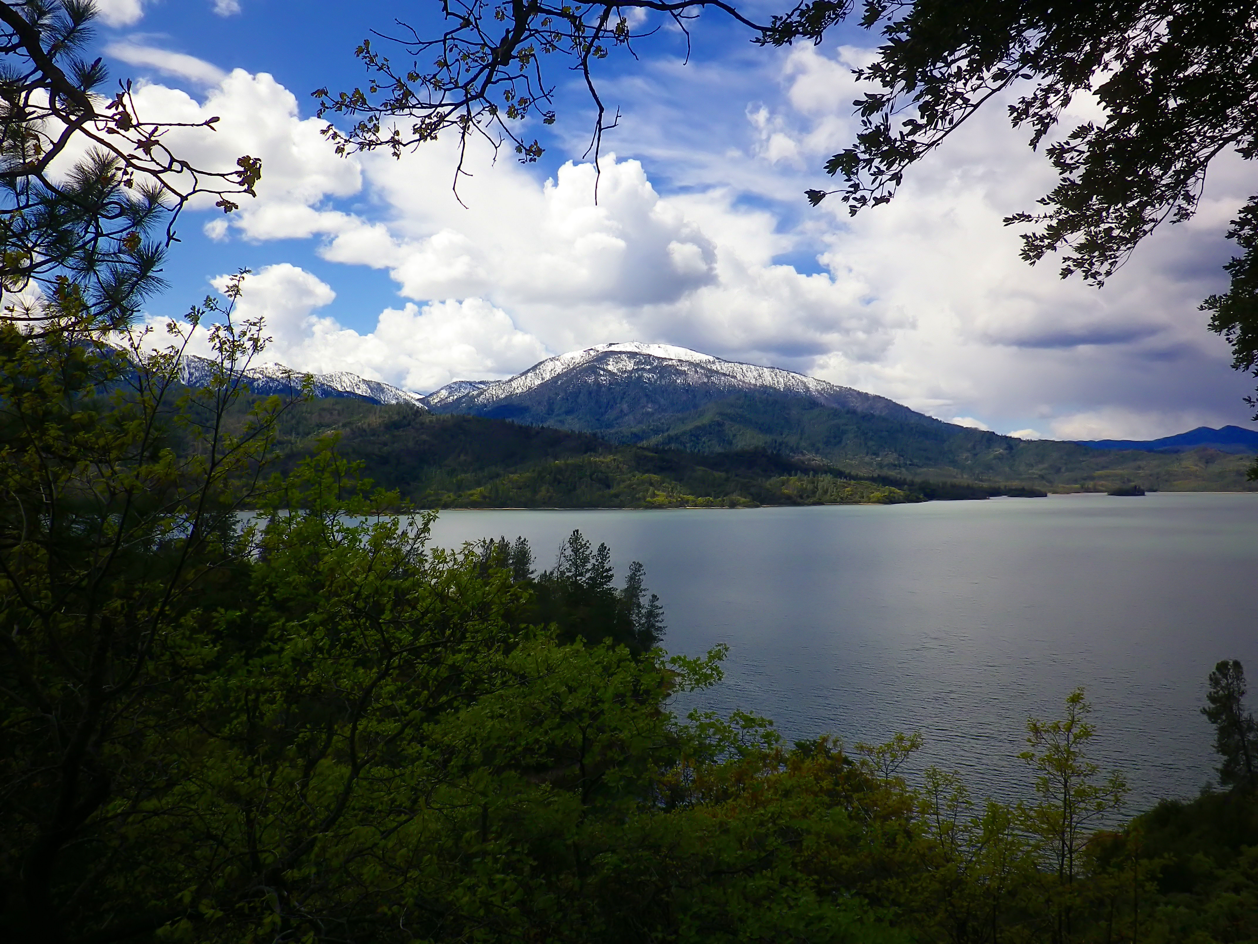
Whiskeytown National Recreation Area
National Recreation Area
Whiskeytown Lake’s crystal-clear waters are iconic, but this 42,000-acre National Recreation Area offers much more. Explore waterfalls, hike rugged trails, uncover Gold Rush history, and witness the r...
4 mi from route
~10 min detour
$15
near mile 262.2
Caution: Winter Hazards on Trails - Downed Trees and High Water
On July 17, 1944, a massive explosion jolted the San Francisco East Bay area, shattering windows and lighting up the night sky. At Port Chicago Naval Magazine, 320 men were killed instantly when two s...
5 mi from route
~14 min detour
Free
near mile 59.6
Rosie the Riveter WWII Home Front National Historical Park
National Historical Park
Celebrate and honor the contributions and sacrifices of American civilians on the WWII home front. Discover how diverse communities lived, worked, and interacted. Many faces, many stories, many truths...
16 mi from route
~41 min detour
Free
near mile 47.7
Established in 1988, San Francisco Maritime National Historical Park celebrates America’s maritime heritage on the Pacific Coast. Our 50-acre park has grown around Aquatic Park Cove, a protected area...
21 mi from route
~53 min detour
Free
near mile 47.7
Walk among old growth coast redwoods, cooling their roots in the fresh water of Redwood Creek and lifting their crowns to reach the sun and fog. Federally protected as a National Monument since 1908,...
27 mi from route
~68 min detour
$15
near mile 59.6
Experience a park so rich it supports 19 distinct ecosystems with over 2,000 plant and animal species. Go for a hike, enjoy a vista, have a picnic or learn about the centuries of overlapping history f...
29 mi from route
~74 min detour
Free
near mile 59.6
Park data from the National Park Service API. Alerts update every 2 hours.
More Details
What kind of drive is this?
Expect a trip that is 85% highway-driven, leaning heavily on high-speed transit for the majority of your travel. You will face a significant, uninterrupted stretch of 157.7 miles while on I-505, which requires steady focus and consistent pacing. As you transition onto CA-299, the character of the road shifts from wide, multi-lane interstates to a more technical driving environment. This mix keeps the experience from feeling monotonous, though you should be prepared for the change in road geometry. Navigating this route demands that you stay alert during the long interstate segments to ensure you remain fresh for the final approach.
85% highway — fuel and pacing are the main things to plan.
28 navigation steps total — most of the decisions cluster near the start and finish.
Longest single stretch: 157.7 mi on I 505.
How Hard Is This Drive?
10/10
This is a straightforward highway drive that stays mostly on I 505 and CA 299. This route has several spots where lane changes, forks, or exits need your full attention. The trickiest moment comes around 1.5 miles in.
Driving Effort10/10
High effort - long or complex enough to need steady focus all day
Balances navigation complexity with total wheel time.
This is a demanding drive. With 22 significant decision points across 345.7 miles, you will need to stay alert - especially through interchange areas and urban stretches. Consider splitting it into segments if you are not comfortable with fast highway navigation.
Where does it get tricky?
The main spots that need attention: at 1.5 miles: Lane positioning matters here; at 10.9 miles (CA 262): Exit ramp - move to the correct lane early. Lane positioning matters here; at 12.7 miles: Highway fork - watch signs carefully. Lane positioning matters here.
Elevation Profile
Hilly terrain with moderate elevation changes
2,724 ft43 ft
Total Climb
3,027 ft
Total Descent
2,517 ft
Highest Point
2,724 ft
~271.6 mi in
Elevation Range
2,681 ft
Notable High Points
2,724 ft at ~271.6 miles+1,024 ft prominence
Towns Mentioned on Route Signs
Based on OSRM destination-sign hints, not a full list of every settlement the road passes.
Between San Jose, CA and Willow Creek, CA, road signs point toward Sacramento, Redding, Susanville and Whiskeytown National Recreation Area.
Often called "the capital of Silicon Valley", San Jose is the largest city in the Bay Area, 3rd largest in California, and the 12th largest city in the United States, with a population of over 997,000 residents as of 2024. It was named the 6th safest big city in the U.S. in 2015. This clean, sprawling metropolis has sports, beautiful vistas, and ethnic enclaves and bleeds into the greater Bay Area for travelers who want to take their time in Northern California.
Top landmarks
•Winchester Mystery House — Mansion in San Jose, California.
•San Jose Diridon station — railway station complex in San Jose, California
•Rosicrucian Egyptian Museum — building in San Jose, California, United States
Doable as a same-day drive at 6h 34m. Total distance: 345.7 miles.
Family Friendly
Moderate complexity with 1 natural rest stops along the way.
Solo Traveler
6h 34m drive, plan rest stops for pacing.
Frequently Asked Questions
The longest stretch is about 157.7 miles on I 505. The full list of main roads is in the Roads section above.
Yes — we found about 26 rest areas or service plazas within a short detour of the route (from OpenStreetMap). See the Rest Stops tab under Nearby Places for locations and mile markers. Plan to stretch, use the bathroom, and top off fluids every 2–3 hours on longer drives.
It helps. This route has a higher-than-average number of complex decision points, which get harder in the dark. If the last hour of the trip is on surface roads or mountain grades, aim to arrive at Willow Creek, CA before sunset when you can. Check the Trip Plan for departure windows that land you in daylight.
Only with planning. This is a long drive for kids — consider splitting it into two days rather than pushing through. Plan at least 1 meaningful breaks. There are 26 rest areas along the route for bathroom stops.
The main spots that need attention: at 1.5 miles: Lane positioning matters here; at 10.9 miles (CA 262): Exit ramp - move to the correct lane early. Lane positioning matters here; at 12.7 miles: Highway fork - watch signs carefully. Lane positioning matters here.
Yes — Whiskeytown National Recreation Area, Port Chicago Naval Magazine National Memorial and Rosie the Riveter WWII Home Front National Historical Park (6 total within detour distance). See the National Parks section for detour distances and tips on detours.
Not recommended in a single day. At 6.6 hours each way, a round trip means 13.2 hours of driving — that is an unsafe level of fatigue for most drivers. Plan at least one night at Willow Creek, CA before the return drive.