Traveling from Rexburg to Garden City covers 310 miles across Idaho’s diverse Mountain West landscape. You should plan for a driving time of approximately 5 hours and 3 minutes, making this a manageable single-day trip if you don't mind a longer stint behind the wheel. Budget around $49 for fuel to complete the journey. The route primarily utilizes the Vietnam Veterans Memorial Highway, I-86, and the Veterans Memorial Highway to bridge the gap between these two communities. Since the entire trip takes place within the same state, you will stay within a familiar regional atmosphere while transitioning across the state's interior. It is a straightforward trek that works well for those looking to reach their destination without requiring an overnight stay.
Trip Pace
Same-day drive is realistic
A same-day return is possible, but it will make for a full day on the road.
Break Rhythm
1 planned break
Plan on a short reset every 3 to 4 hours to stay fresh behind the wheel.
Midpoint
155 miles from Rexburg, ID
A natural place for your longest stop of the day
, about 2h 32m into the drive
.
Main Roads
Road
Distance
Duration
Vietnam Veterans Memorial Highway
169 mi
2h 39m
I 86
62.7 mi
59m
Veterans Memorial Highway
46.5 mi
44m
Idaho Medal of Honor Highway
15.4 mi
16m
Yellowstone Highway
6.9 mi
7m
South Orchard Street
3.3 mi
7m
Rigby Highway
3.1 mi
3m
West Main Street
1.1 mi
2m
Longest stretch:
Vietnam Veterans Memorial Highway
— 169 mi, about 2h 39m
Traffic on I-84
Hour-of-day weekday pattern from 76 FHWA count stations on your route.
Peak
4 PM
~1,783 veh/hr typical
· worst 2,111
Quietest
2 AM
~136 veh/hr
Peak-to-quiet ratio
13.1×
busier at peak than in the quiet hours
12a6anoon6p11p
Averaged across 52 weeks of 2023 FHWA Travel Monitoring Analysis System data. Weekday hours only (Mon–Fri).
Turn-by-Turn Driving Directions
Step-by-step road directions between Rexburg, ID and Garden City, ID.
1
Start on ID 33
1.0 mi·2 min·West Main Street
2
Continue on ID 33
419 ft·12 sec·West Main Street
3
Take the ramp
0.4 mi·53 sec
Toward US 20
4
Merge onto US 20
6.9 mi·7 min·Yellowstone Highway
5
Continue on US 20
15 mi·16 min·Idaho Medal of Honor Highway
6
Continue on US 20
3.1 mi·3 min·Rigby Highway
7
Merge onto US 20
0.1 mi·14 sec·Grandview Drive
8
Take the exit onto US 20
0.3 mi·36 sec·US 20
Toward I 15 South: Arco, Pocatello
9
Merge onto I 15; US 20
47 mi·44 min·Veterans Memorial Highway
10
Take the exit
0.6 mi·43 sec
Exit 72Toward I 86 West: Chubbuck, Twin Falls
11
Continue on I 86
63 mi·59 min·I 86
12
Continue on I 84; US 30
169 mi·2 hr 39 min·Vietnam Veterans Memorial Highway
13
Take the exit
0.3 mi·42 sec
Exit 52Toward Orchard StreetUse the straight / slight right lanes.
14
Keep slight right at fork
171 ft·4 sec
15
Turn straight onto South Orchard Street
3.3 mi·7 min·South Orchard Street
Use the left lane.
16
Turn right onto US 20; US 26
0.2 mi·31 sec·West Chinden Boulevard
Use the right lane.
17
Turn left onto East 33rd Street
64 ft·2 sec·East 33rd Street
18
Arrive at destination
East 33rd Street
Trip Plan
To keep your drive comfortable, plan for at least one dedicated stop to stretch your legs during the 310-mile trek. Since this is a turn-heavy route, departing early in the morning allows you to navigate the more technical sections during daylight hours when visibility is at its best. Given the $49 estimated fuel cost, verify your tank levels before hitting the longest 169-mile stretch on the Vietnam Veterans Memorial Highway to avoid any mid-trip stress. Because this is a one-day trip, you have the flexibility to adjust your pace based on traffic conditions or personal preference. Keep a steady eye on your navigation, as the transition between the various highways and local roads requires quick adjustments throughout the day.
Morning Departure
An early start around 7-8 AM gets you there with plenty of daylight left.
Evening Departure
A late afternoon start means arriving after dark. Morning is better.
You can normally do this drive in one day.
Plan roughly 1 meaningful break for fuel, food, and rest.
The halfway point lands around 155 miles from Rexburg, ID, or about 2h 32m into the drive.
The longest continuous stretch on this route runs about 169 miles.
This is a comfortable same-day trip.
Departure
Before you leave
Start with fuel, water, and navigation already sorted so the first hour feels easy.
First stop
Around 68 miles or 1h 10m in
Use this first pause for coffee, a restroom break, and a quick traffic check ahead.
Halfway reset
Around 155 miles or 2h 32m in
This is the best place for your longest stop, a real meal, and a full fuel check.
Final approach
Final hour starts around 4h 6m
Traffic, exits, and arrival timing usually matter more near Garden City, ID than in the middle of the route.
Before You Leave
+
Open the route before leaving Rexburg, ID so your first major turns are already loaded.
+
Leave with enough water and a charging cable within reach, not packed away.
+
Check your fuel range against the first long segment, especially if you are starting outside city service areas.
Day 1
Settle into the route from Rexburg, ID
This is one driving day of about 310 miles and 5h 3m.
Your first comfortable stop window is around 68 miles from Rexburg, ID.
This route can stay practical as a one-day drive if traffic stays reasonable.
Plan about 1 real break rather than only quick fuel stops.
The longest stretch is on Vietnam Veterans Memorial Highway for about 169 miles.
Where to Stop
Rest stops, refuel points, and overnight suggestions along this route.
Place data sourced from public business listings. Hours and availability may vary.
Heads-up: tricky spots
5 of 11
5 decision points cluster between mile 27 and 310 — GPS handles the exact turns, but know they're coming. Your lane choice matters more than the turn itself.
6
27 mi into trip|~31m in|US 20
Take the exit onto US 20 toward I 15 South: Arco, Pocatello
Exit ramp - move to the correct lane early. Multiple destination signs - pick the right one
Toward I 15 South: Arco, Pocatello
6
73.8 mi into trip|~1h 16m in
Take the exit toward I 86 West: Chubbuck, Twin Falls
Exit ramp - move to the correct lane early. Multiple destination signs - pick the right one
Exit 72
Toward I 86 West: Chubbuck, Twin Falls
7
306.1 mi into trip|~4h 55m in
Take the exit toward Orchard Street
Exit ramp - move to the correct lane early. Lane positioning matters here
Use the straight / slight right lanes.
Exit 52
Toward Orchard Street
6
309.8 mi into trip|~5h 3m in|US 20; US 26 / West Chinden Boulevard
Turn right onto US 20; US 26 / West Chinden Boulevard
Lane positioning matters here
Use the right lane.
5
310 mi into trip|~5h 3m in|East 33rd Street
Turn left onto East 33rd Street
Navigation decision point
Fuel & Cost
Regular Gas
$48.32 one way
$96.64 round trip
$3.96/gal25.4 MPG avg109 kg CO2
Fuel Type
$/gal
One Way
Round Trip
midgrade
$4.17
$50.93
$101.86
premium
$4.47
$54.60
$109.21
diesel
$4.80
$58.53
$117.07
No toll roads detected on this route.
Estimated Trip Cost (one way, 1 person)
Fuel
$48
Meals
$25–$50
Total
$73–$98
Rough estimate based on US averages. Hotel $80–$140/night, meals $25–$50/day.
Estimated CO2 emission: 108.5 kg one way.
Prices: EIA weekly data, 2026-07-13.
Driving Electric?
About $33 in charging
· 1 stop
· 67% less CO2
Vehicle Type
kWh
Stops
DC Fast
Home Charge
Average EV
93
1
$32.55
$14.88
Efficient EV
77.5
0
$27.13
$12.40
EV Truck/SUV
124
1
$43.40
$19.84
Gas CO2
108 kg
EV CO2
36 kg (67% less)
Plan for 1 charging stop. A 30-minute DC fast charge mid-route should be enough to complete the trip comfortably.
DC fast charging avg $0.35/kWh. Home charging avg $0.16/kWh. US grid CO2: 0.39 kg/kWh.
Travel Intel
Current conditions at both ends of the drive.
Forecast as of Jul 17, 2026
Origin
Rexburg, ID
Late night
in Rexburg on Sunday
Local time
3:22 AM
MDT
Current temp
91°F
Slight Chance Showers And Thunderstorms
SSW 5 to 8 mph33% chanceLive forecast
Special Weather Statement
Special Weather Statement issued July 17 at 12:46PM MDT by NWS Pocatello ID
Flash Flood Watch
Flash Flood Watch issued July 17 at 1:26AM MDT until July 17 at 9:00PM MDT by NWS Pocatello ID
Destination
Garden City, ID
Late night
in Garden City on Sunday
Local time
3:22 AM
MDT
Current temp
99°F
Sunny
WNW 5 mph5% chanceLive forecast
Special Weather Statement
Special Weather Statement issued July 17 at 12:46PM MDT by NWS Pocatello ID
Flash Flood Watch
Flash Flood Watch issued July 17 at 1:26AM MDT until July 17 at 9:00PM MDT by NWS Pocatello ID
Seasonal Notes
Summer travel usually means heavier construction, hotter rest stops, and busier weekend traffic around major cities.
Winter travel shortens daylight, so a route that looks manageable on paper can feel much longer after dark.
Holiday weekends tend to make both departure and arrival windows slower than the raw route time suggests.
Time zone
Same local time
Origin and destination are on the same clock, so arrival timing is easier to judge at a glance.
Temperature spread
8 degrees warmer at arrival
A meaningful temperature swing is a good cue to rethink layers, water, and how soon you want to arrive.
Road read
5h 3m on the road
An early start around 7-8 AM gets you there with plenty of daylight left.
Weather data from the National Weather Service. Conditions may change; check closer to your travel date.
National Parks Near This Route
Worth a detour if your schedule allows.
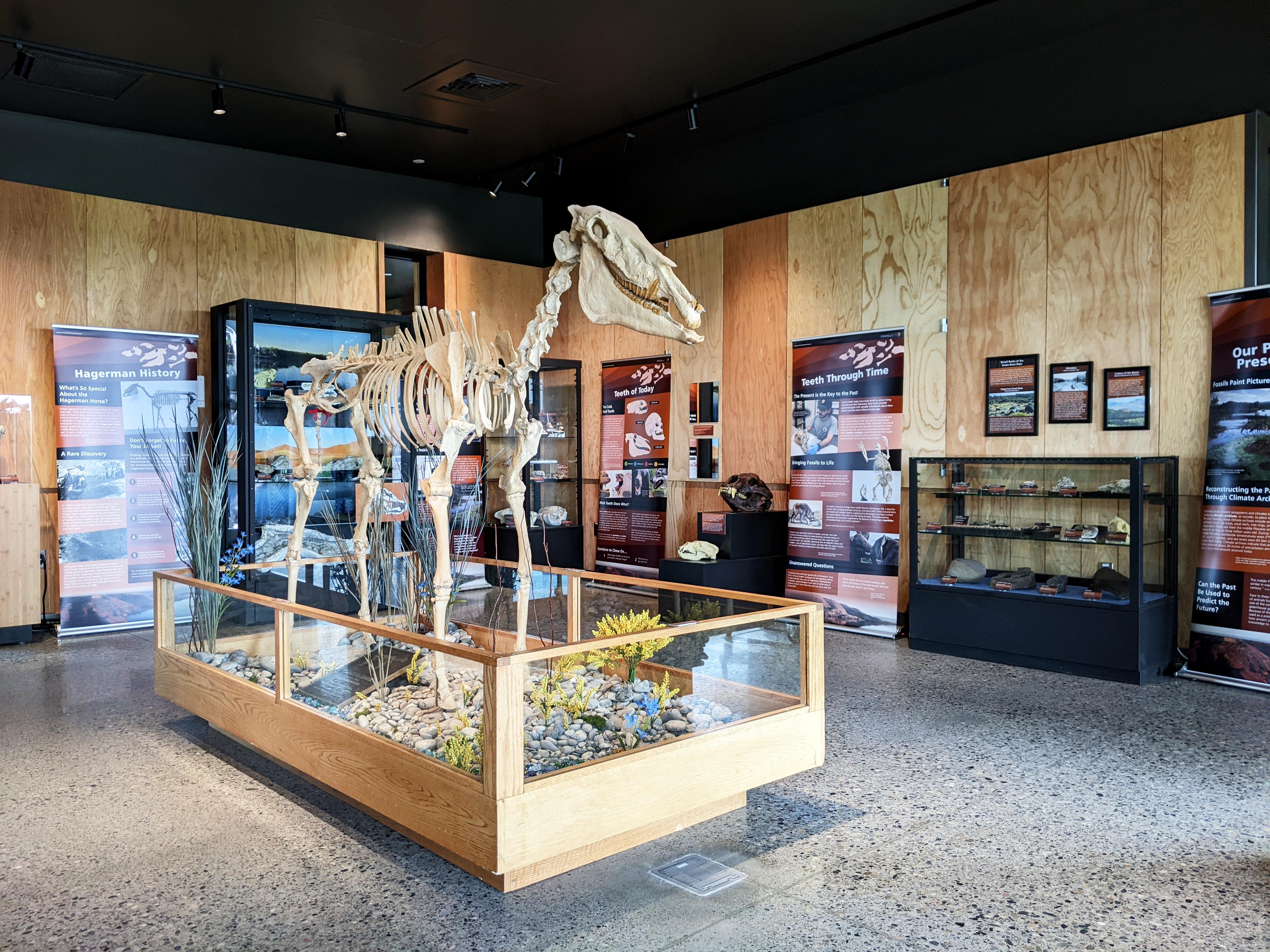
Hagerman Fossil Beds National Monument
National Monument
During the Pliocene, this place looked quite different. Lush wetlands, forests, and grasslands provided excellent habitat for a variety of animals. From fascinating, now-extinct creatures like the sab...
7 mi from route
~18 min detour
Free
near mile 213.8
Caution: Use Caution with "Fossil Beds Information" Signs
Caution: If You Can't Reach Us By Phone, Please Email Us
Park data from the National Park Service API. Alerts update every 2 hours.
More Details
What kind of drive is this?
Expect a varied driving experience that shifts from high-speed highway travel to more technical, turn-heavy local segments. With only 20% of the journey on major highways, you will spend a significant portion of your time navigating local roads that demand more focus than a typical interstate cruise. Your longest uninterrupted segment is a 169-mile stretch on the Vietnam Veterans Memorial Highway, which provides a steady rhythm before the drive transitions into more winding territory. Because the profile is characterized as a turn-heavy local drive, you should stay alert for changes in road geometry as you progress toward Garden City. It is a route that rewards attentive driving rather than mindless cruising.
Only 20% highway — the rest is turn-by-turn surface driving.
18 navigation steps total — most of the decisions cluster near the start and finish.
Longest single stretch: 169 mi on Vietnam Veterans Memorial Highway.
How Hard Is This Drive?
6/10
Expect a hands-on drive with frequent turns and local roads rather than long highway stretches. You will hit about 11 points where you need to pay attention to lane position or signs. The trickiest moment comes around 27 miles in near US 20.
Driving Effort6/10
Moderate - straightforward overall, but long enough or busy enough to require pacing
Balances navigation complexity with total wheel time.
This drive requires moderate attention. Across 310 miles you will encounter 11 spots where lane choice or exit timing matters. Not difficult for experienced highway drivers, but worth previewing the tricky sections before you go.
Where does it get tricky?
The main spots that need attention: at 27 miles (US 20): Exit ramp - move to the correct lane early. Multiple destination signs - pick the right one; at 73.8 miles: Exit ramp - move to the correct lane early. Multiple destination signs - pick the right one; at 306.1 miles: Exit ramp - move to the correct lane early. Lane positioning matters here.
Elevation Profile
Gently rolling terrain
4,866 ft2,548 ft
Total Climb
1,038 ft
Total Descent
3,237 ft
Highest Point
4,866 ft
Elevation Range
2,318 ft
Notable High Points
4,509 ft at ~132.9 miles+230 ft prominence
Towns Mentioned on Route Signs
Based on OSRM destination-sign hints, not a full list of every settlement the road passes.
Between Rexburg, ID and Garden City, ID, road signs point toward Pocatello and Twin Falls.
Rexburg is a city in Eastern Idaho. Rexburg is close to the St. Anthony Sand Dunes, the West Entrance of Yellowstone National Park and the Grand Tetons.
Top landmarks
•Jacob Spori Building — historic building at Brigham Young University Idaho in Rexburg, Idaho, United St...
•Madison County Courthouse — historic courthouse in Rexburg, Idaho, United States
Boise is the capital and largest city of Idaho. Boise offers numerous recreational opportunities, including extensive hiking and biking in the foothills to the immediate north of downtown. Boise is a regional hub for jazz, theater, and indie music, and is home to several museums.
Doable as a same-day drive at 5h 3m. Total distance: 310 miles.
Family Friendly
Moderate complexity with 1 natural rest stops along the way.
Solo Traveler
5h 3m drive, comfortable solo distance.
Scenic Drive
Mostly surface roads route profile with national parks nearby.
Frequently Asked Questions
The longest stretch is about 169 miles on Vietnam Veterans Memorial Highway. The full list of main roads is in the Roads section above.
Yes — we found about 19 rest areas or service plazas within a short detour of the route (from OpenStreetMap). See the Rest Stops tab under Nearby Places for locations and mile markers. Plan to stretch, use the bathroom, and top off fluids every 2–3 hours on longer drives.
It helps. This route has a higher-than-average number of complex decision points, which get harder in the dark. If the last hour of the trip is on surface roads or mountain grades, aim to arrive at Garden City, ID before sunset when you can. Check the Trip Plan for departure windows that land you in daylight.
Only with planning. This is a long drive for kids — consider splitting it into two days rather than pushing through. Plan at least 1 meaningful breaks. There are 19 rest areas along the route for bathroom stops.
Mostly yes along the main roads, but rural stretches through ID can have sparse or no coverage. Before you leave, download offline Google Maps or Apple Maps for the route, and consider downloading music or podcasts instead of streaming. If you depend on data for navigation, keep a paper backup of the turn-by-turn directions.
The main spots that need attention: at 27 miles (US 20): Exit ramp - move to the correct lane early. Multiple destination signs - pick the right one; at 73.8 miles: Exit ramp - move to the correct lane early. Multiple destination signs - pick the right one; at 306.1 miles: Exit ramp - move to the correct lane early. Lane positioning matters here.
Yes — Hagerman Fossil Beds National Monument. See the National Parks section for detour distances and tips on detours.
Not recommended in a single day. At 5.1 hours each way, a round trip means 10.1 hours of driving — that is an unsafe level of fatigue for most drivers. Plan at least one night at Garden City, ID before the return drive.