Black Diamond Trail Rest Area
0.1 mi from route
Compiled and reviewed by the US Trip Planner planning team at COD Solutions Oy · Last reviewed Apr 19, 2026 · Editorial standards
Drive Time
8h 4m
Distance
389.6 mi
627 km
Drive Score
9/10
Great drive
Same Day?
2-day trip
Fuel Cost
$62
one way
EV Charging
Unknown
Estimated drive times based on typical traffic patterns. Actual times may vary with weather, construction, and real-time conditions.

Rafter J Ranch, WY
Tom Fisk

Sheridan, WY
Wikimedia Commons
The drive from Rafter J Ranch, WY to Sheridan, WY covers 389.6 miles and takes about 8h 4m behind the wheel. It usually feels better as a 2-day road trip than as one long push.
The route leans on Greybull Avenue, South 1st Street, East Highway 287 for much of the mileage, and the overall profile is mostly surface roads. The longest uninterrupted segment is about 78.8 miles on Greybull Avenue. At current regular gas prices, budget about $61.74 one way before food or hotel costs.
Trip Pace
Best split across 2 days
Treat the return leg as its own travel day rather than an afterthought.
Break Rhythm
2 planned breaks
Plan on a short reset every 3 to 4 hours to stay fresh behind the wheel.
Midpoint
194.8 miles from Rafter J Ranch, WY
A natural place for your longest stop of the day , about 4h into the drive .
| Road | Distance | Duration |
|---|---|---|
| Greybull Avenue | 78.8 mi | 1h 43m |
| South 1st Street | 77.9 mi | 1h 27m |
| East Highway 287 | 53.2 mi | 1h |
| North 10th Street | 37.5 mi | 42m |
| Park Street | 32.4 mi | 39m |
| Idaho Street | 31.9 mi | 38m |
| North Highway 89 | 29.3 mi | 40m |
| North Federal Boulevard | 22.1 mi | 25m |
Step-by-step road directions between Rafter J Ranch, WY and Sheridan, WY.
Start on South Park Ranch Road
Turn sharp right onto South Park Loop Road
Continue on South Park Loop Road
Turn left onto US 26; US 89; US 189; US 191
Continue on US 26; US 89; US 189; US 191
Turn right onto West Pearl Avenue
Turn left onto South Cache Drive
Continue on US 26; US 89; US 191
Continue on US 26; US 89; US 191
Enter roundabout onto US 26; US 89; US 191
Continue on US 26; US 89; US 191
Continue on US 26; US 287
Continue on US 26; US 287
Turn right onto US 26; US 287
At end of road, turn left onto US 26; WY 789
Turn left onto US 20; WY 789
Turn left onto US 20; WY 789
Continue on US 20; WY 789
Turn left onto North Railway Avenue
Continue on Russell Avenue
Turn left onto US 16; US 20; WY 789
Turn right onto US 14
Take the ramp onto I 90; US 87
Continue on I 90; US 14; US 87
Take the exit onto I 90 Business; US 14 Business; US 87 Business
Turn right onto I 90 Business; US 14 Business; US 87 Business
Turn right onto West Loucks Street
Arrive at destination
Morning Departure
Start early — leave by 6-7 AM to arrive at a reasonable hour.
Evening Departure
This is a long drive — plan for a morning departure or consider splitting it into two days.
Consider an overnight stop or starting very early.
Departure
Before you leave
Start with fuel, water, and navigation already sorted so the first hour feels easy.
First stop
Around 86 miles or 1h 57m in
Use this first pause for coffee, a restroom break, and a quick traffic check ahead.
Halfway reset
Around 194.8 miles or 4h in
This is the best place for your longest stop, a real meal, and a full fuel check.
Overnight split
Day 1 wrap after about 194.8 miles or 4h
Stop before fatigue turns the last few hours into a grind. You want day two to start fresh, not just resumed.
Final approach
Final hour starts around 6h 46m
Traffic, exits, and arrival timing usually matter more near Sheridan, WY than in the middle of the route.
Open the route before leaving Rafter J Ranch, WY so your first major turns are already loaded.
Leave with enough water and a charging cable within reach, not packed away.
Check your fuel range against the first long segment, especially if you are starting outside city service areas.
Pick one backup stop option before the midpoint in case traffic changes your pacing.
Treat this as a 2-day road trip and book the overnight stop before the busiest arrival window.
Day 1
Settle into the route from Rafter J Ranch, WY
Aim for roughly 195 miles and 4 hours of wheel time on this day.
Day 2
Finish the approach into Sheridan, WY
Aim for roughly 195 miles and 4 hours of wheel time on this day.
Rest stops, refuel points, and overnight suggestions along this route.

Mid-route town
Overnight candidate
195 mi into the route
Best for: Hotel check-in, dinner, and a fresh start
This lines up well with a realistic day-end stop if you are breaking the drive into stages.
Find hotels in Thermopolis, WYNight 1
195 mi · about 4h in
A practical overnight split lands near Thermopolis, WY after about 195 miles or 4 hours of driving.
Find hotelsA short stop after about 86 miles helps settle the day before fatigue starts building.
The midpoint is around 194.8 miles from Rafter J Ranch, WY, which is a good place for a longer meal and fuel stop.
Before the longest stretch
Fuel checkTop up before Greybull Avenue if your tank is already low. That segment runs about 78.8 miles.
Overnight split
Hotel stopFor a steadier pace, wrap day one after about 195 miles or 4 hours on the road.
These stop ideas are pacing suggestions — the exact town or exit can change with traffic, hotel plans, and fuel range.
Restaurants, cafes, gas stations and more along your route.
Place data sourced from public business listings. Hours and availability may vary.
5 decision points cluster between mile 0.8 and 386.4 — GPS handles the exact turns, but know they're coming. Your lane choice matters more than the turn itself.
Turn sharp right onto South Park Loop Road
Sharp turn - reduce speed on approach
Turn left onto South Cache Drive
Navigation decision point
Turn right onto US 26; US 287 / South 1st Street
Lane positioning matters here
Turn left onto US 20; WY 789 / Idaho Street
Lane positioning matters here
Turn right onto I 90 Business; US 14 Business; US 87 Business / North Main Street
Lane positioning matters here
Regular Gas
$61.74 one way
$123.48 round trip
| Fuel Type | $/gal | One Way | Round Trip |
|---|---|---|---|
| midgrade | $4.22 | $64.71 | $129.43 |
| premium | $4.53 | $69.50 | $139.00 |
| diesel | $5.61 | $86.02 | $172.04 |
No toll roads detected on this route.
Estimated Trip Cost (one way, 1 person)
Fuel
$62
Hotel (1n)
$80–$140
Meals
$50–$100
Total
$192–$302
Rough estimate based on US averages. Hotel $80–$140/night, meals $25–$50/day.
Estimated CO2 emission: 136.3 kg one way. Prices: EIA weekly data, 2026-04-13.
Driving Electric?
About $41 in charging · 1 stop · 66% less CO2
| Vehicle Type | kWh | Stops | DC Fast | Home Charge |
|---|---|---|---|---|
| Average EV | 116.9 | 1 | $40.91 | $18.70 |
| Efficient EV | 97.4 | 1 | $34.09 | $15.58 |
| EV Truck/SUV | 155.8 | 1 | $54.54 | $24.93 |
Gas CO2
136 kg
EV CO2
46 kg (66% less)
Plan for 1 charging stop. A 30-minute DC fast charge mid-route should be enough to complete the trip comfortably.
DC fast charging avg $0.35/kWh. Home charging avg $0.16/kWh. US grid CO2: 0.39 kg/kWh.
Current conditions at both ends of the drive.
Origin
Morning in Rafter J Ranch on Sunday
Local time
8:38 AM
MDT
Current temp
64°F
Unavailable
Destination
Morning in Sheridan on Sunday
Local time
8:38 AM
MDT
Current temp
71°F
Unavailable
Seasonal Notes
Summer travel usually means heavier construction, hotter rest stops, and busier weekend traffic around major cities.
Winter travel shortens daylight, so a route that looks manageable on paper can feel much longer after dark.
Holiday weekends tend to make both departure and arrival windows slower than the raw route time suggests.
For long drives, weather on day two can matter just as much as conditions at departure, so check the whole travel window rather than only the first day.
Time zone
Origin and destination are on the same clock, so arrival timing is easier to judge at a glance.
Temperature spread
A meaningful temperature swing is a good cue to rethink layers, water, and how soon you want to arrive.
Road read
This is long enough that the arrival forecast matters almost as much as departure conditions. Recheck both ends before you roll.
Weather data from the National Weather Service. Conditions may change; check closer to your travel date.
Worth a detour if your schedule allows.
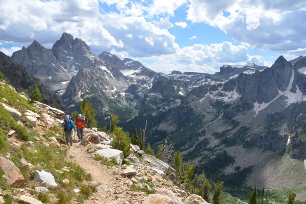
National Park
Soaring over a landscape rich with wildlife, pristine lakes, and majestic alpine vistas, the Teton Range stands as a testament to generations of stewards. For over 11,000 years, communities have thriv...
Park data from the National Park Service API. Alerts update every 2 hours.
389.6 mi in 8h 4m across surface roads — expect steady turns and local traffic rather than long highway runs.
Expect a hands-on drive with frequent turns and local roads rather than long highway stretches. There are only a few real navigation decisions along the way. The trickiest moment comes around 0.8 miles in near South Park Loop Road.
Easy - simple navigation with a manageable amount of wheel time
Balances navigation complexity with total wheel time.
The route itself is not hard, but at 8h 4m, endurance matters. Plan breaks every 2-3 hours. The 16 decision points are all manageable with basic attention.
Where does it get tricky?
The main spots that need attention: at 0.8 miles (South Park Loop Road): Sharp turn - reduce speed on approach; at 7 miles (South Cache Drive): Navigation decision point; at 92.7 miles (US 26; US 287 / South 1st Street): Lane positioning matters here.
Family Friendly
Moderate complexity with 2 natural rest stops along the way.
Solo Traveler
8h 4m drive, plan rest stops for pacing.
Scenic Drive
Mostly surface roads route profile with national parks nearby.
Compiled by the US Trip Planner planning team at COD Solutions Oy from open government datasets — OSRM over OpenStreetMap for geometry, EIA for fuel prices, and NPS for national parks. See our methodology for refresh cadence and limitations.
Was this helpful?
Thanks for your feedback!
Your tip has been submitted. Thanks!
/500
Recent Tips
·
Explore more options from Rafter J Ranch, WY or browse trips ending in Sheridan, WY.
Looking for more statewide routes? Browse WY road trips.