Sacaton Rest Area
0 mi from route
Compiled and reviewed by the US Trip Planner planning team at COD Solutions Oy · Last reviewed Jul 19, 2026 · Editorial standards
Drive Time
3h 1m
Distance
162.2 mi
261 km
Drive Score
8/10
Great drive
Same Day?
Yes, doable
Fuel Cost
$29
one way
EV Charging
Unknown
Estimated drive times based on typical traffic patterns. Actual times may vary with weather, construction, and real-time conditions.

Peoria, AZ
Wikimedia Commons

Arivaca Junction, AZ
Abhishek Navlakha
This 162.2-mile drive from Peoria, AZ, to Arivaca Junction, AZ, is easily manageable as a single-day trip, taking approximately 3 hours and 1 minute to complete. You'll primarily be on the Casa Grande-Tucson Highway, Phoenix-Casa Grande Highway, and Nogales–Tucson Highway. With an estimated fuel cost of $32, this route offers a straightforward journey through the Desert Southwest region. The drive is characterized by frequent turns, suggesting a more local and less highway-intensive experience. One stop is recommended along the way, making it a convenient option for a quick getaway or a leg of a longer adventure.
Trip Pace
Same-day drive is realistic
A same-day return is realistic if you keep stops short.
Break Rhythm
1 planned break
A short stop every 2 to 3 hours is enough for this drive.
Midpoint
81.1 miles from Peoria, AZ
A natural place for your longest stop of the day , about 1h 33m into the drive .
| Road | Distance | Duration |
|---|---|---|
| Casa Grande-Tucson Highway | 54.6 mi | 55m |
| Phoenix-Casa Grande Highway | 37.8 mi | 38m |
| Nogales–Tucson Highway | 33 mi | 37m |
| Maricopa Freeway | 16.3 mi | 18m |
| Grand Avenue | 9.3 mi | 16m |
| North Freeway | 5.4 mi | 6m |
| Black Canyon Freeway | 3.5 mi | 4m |
| US 60 | 0.5 mi | 1m |
Step-by-step road directions between Peoria, AZ and Arivaca Junction, AZ.
Start on North 83rd Avenue
Turn right onto US 60
Take the exit onto US 60
Turn left onto US 60
Turn right onto US 60
Take the exit
Merge onto I 17; US 60
Continue on I 17; US 60
Continue on I 10
Continue on I 10
Continue on I 10
Take the exit
Continue on I 19
Take the exit
Turn right onto West Arivaca Road
Continue on West Arivaca Road
Arrive at destination
Given the relatively short duration of just over 3 hours, this 162.2-mile trip offers flexibility. You can depart anytime, but starting in the morning will give you ample daylight and time for your single recommended stop. Keep an eye on your fuel, especially during the 54.6-mile stretch on the Casa Grande-Tucson Highway, as services might be more spread out. The estimated fuel cost is $32, so plan accordingly. Paying attention to the frequent turns is key to a smooth drive on this route.
Morning Departure
An early start around 7-8 AM gets you there with plenty of daylight left.
Evening Departure
A late afternoon start means arriving after dark. Morning is better.
This is a comfortable same-day trip.
Departure
Before you leave
Start with fuel, water, and navigation already sorted so the first hour feels easy.
First stop
Around 36 miles or 47m in
Use this first pause for coffee, a restroom break, and a quick traffic check ahead.
Halfway reset
Around 81.1 miles or 1h 33m in
This is the best place for your longest stop, a real meal, and a full fuel check.
Final approach
Final hour starts around 2h 27m
Traffic, exits, and arrival timing usually matter more near Arivaca Junction, AZ than in the middle of the route.
Open the route before leaving Peoria, AZ so your first major turns are already loaded.
Leave with enough water and a charging cable within reach, not packed away.
Check your fuel range against the first long segment, especially if you are starting outside city service areas.
Day 1
Settle into the route from Peoria, AZ
This is one driving day of about 162.2 miles and 3h 1m.
Rest stops, refuel points, and overnight suggestions along this route.

Mid-route town
Meal stop
81 mi into the route
Best for: Lunch, fuel, and a longer reset
This sits close to the middle of the route, so it works well for the longest stop of the day.
A short stop after about 36 miles helps settle the day before fatigue starts building.
The midpoint is around 81.1 miles from Peoria, AZ, which is a good place for a longer meal and fuel stop.
These stop ideas are pacing suggestions — the exact town or exit can change with traffic, hotel plans, and fuel range.
Picked by where they fit in your drive — first break, midpoint reset, final stretch.
Near the start, right off the route
Tempe, Arizona
Hours: 11 am–5 pm
+14805657081
Visit websiteNear the end, short detour
Green Valley, Arizona
Hours: 9:45 am–5 pm
+15209341863
Visit websiteNear the start, short detour
Phoenix, Arizona
Hours: 11 am–4 pm
+16022541200
Visit websiteLater in the drive, short detour
Tucson, Arizona
Hours: 10 am–3 pm
+15206285774
Visit websiteAround the midpoint, short detour
Casa Grande, Arizona
Hours: 5 am–11 pm
+15204218600
Visit websiteNear the start, short detour
Phoenix, Arizona
Hours: 10:30 am–4 pm
+16027162000
Visit websiteNear the start, short detour
Tempe, Arizona
+14803556060
Visit websiteNear the start, ~9 min detour
Tempe, Arizona
Place data sourced from public business listings. Hours and availability may vary.
5 decision points cluster between mile 0 and 128.2 — GPS handles the exact turns, but know they're coming. Your lane choice matters more than the turn itself.
Turn right onto US 60 / Grand Avenue
Lane positioning matters here
Turn left onto US 60 / West Thomas Road
Lane positioning matters here
Turn right onto US 60 / North Black Canyon Highway
Navigation decision point
Take the exit toward I 17 South
Exit ramp - move to the correct lane early
Take the exit toward I 19 South: Nogales
Exit ramp - move to the correct lane early. Lane positioning matters here
Regular Gas
$28.74 one way
$57.49 round trip
| Fuel Type | $/gal | One Way | Round Trip |
|---|---|---|---|
| midgrade | $4.82 | $30.78 | $61.56 |
| premium | $5.04 | $32.20 | $64.39 |
| diesel | $4.80 | $30.63 | $61.25 |
No toll roads detected on this route.
Estimated Trip Cost (one way, 1 person)
Fuel
$29
Meals
$25–$50
Total
$54–$79
Rough estimate based on US averages. Hotel $80–$140/night, meals $25–$50/day.
Estimated CO2 emission: 56.8 kg one way. Prices: EIA weekly data, 2026-07-13.
Driving Electric?
About $17 in charging · 0 stops · 67% less CO2
| Vehicle Type | kWh | Stops | DC Fast | Home Charge |
|---|---|---|---|---|
| Average EV | 48.7 | 0 | $17.03 | $7.79 |
| Efficient EV | 40.6 | 0 | $14.19 | $6.49 |
| EV Truck/SUV | 64.9 | 0 | $22.71 | $10.38 |
Gas CO2
57 kg
EV CO2
19 kg (67% less)
This trip is well within single-charge range for most EVs. No charging stops needed if you start fully charged.
DC fast charging avg $0.35/kWh. Home charging avg $0.16/kWh. US grid CO2: 0.39 kg/kWh.
Current conditions at both ends of the drive.
Origin
Late night in Peoria on Sunday
Local time
4:24 AM
MST
Current temp
82°F
Chance Showers And Thunderstorms
Flash Flood Warning
Flash Flood Warning issued July 18 at 8:18PM PDT until July 18 at 10:15PM PDT by NWS Las Vegas NV
Flash Flood Warning
Flash Flood Warning issued July 18 at 7:53PM MST until July 18 at 10:00PM MST by NWS Flagstaff AZ
Destination
Late night in Arivaca Junction on Sunday
Local time
4:24 AM
MST
Current temp
68°F
Slight Chance Showers And Thunderstorms
Flash Flood Warning
Flash Flood Warning issued July 18 at 8:18PM PDT until July 18 at 10:15PM PDT by NWS Las Vegas NV
Flash Flood Warning
Flash Flood Warning issued July 18 at 7:53PM MST until July 18 at 10:00PM MST by NWS Flagstaff AZ
Seasonal Notes
Summer travel usually means heavier construction, hotter rest stops, and busier weekend traffic around major cities.
Winter travel shortens daylight, so a route that looks manageable on paper can feel much longer after dark.
Holiday weekends tend to make both departure and arrival windows slower than the raw route time suggests.
Time zone
Origin and destination are on the same clock, so arrival timing is easier to judge at a glance.
Temperature spread
A meaningful temperature swing is a good cue to rethink layers, water, and how soon you want to arrive.
Road read
The weather snapshot is not static. If you are leaving later, give both cities one more quick forecast check before departure.
Weather data from the National Weather Service. Conditions may change; check closer to your travel date.
Worth a detour if your schedule allows.

National Monument
An Ancestral Sonoran Desert People's farming community and "Great House" are preserved at Casa Grande Ruins. Whether a gathering place for people or simply a waypoint marker in an extensive system of...
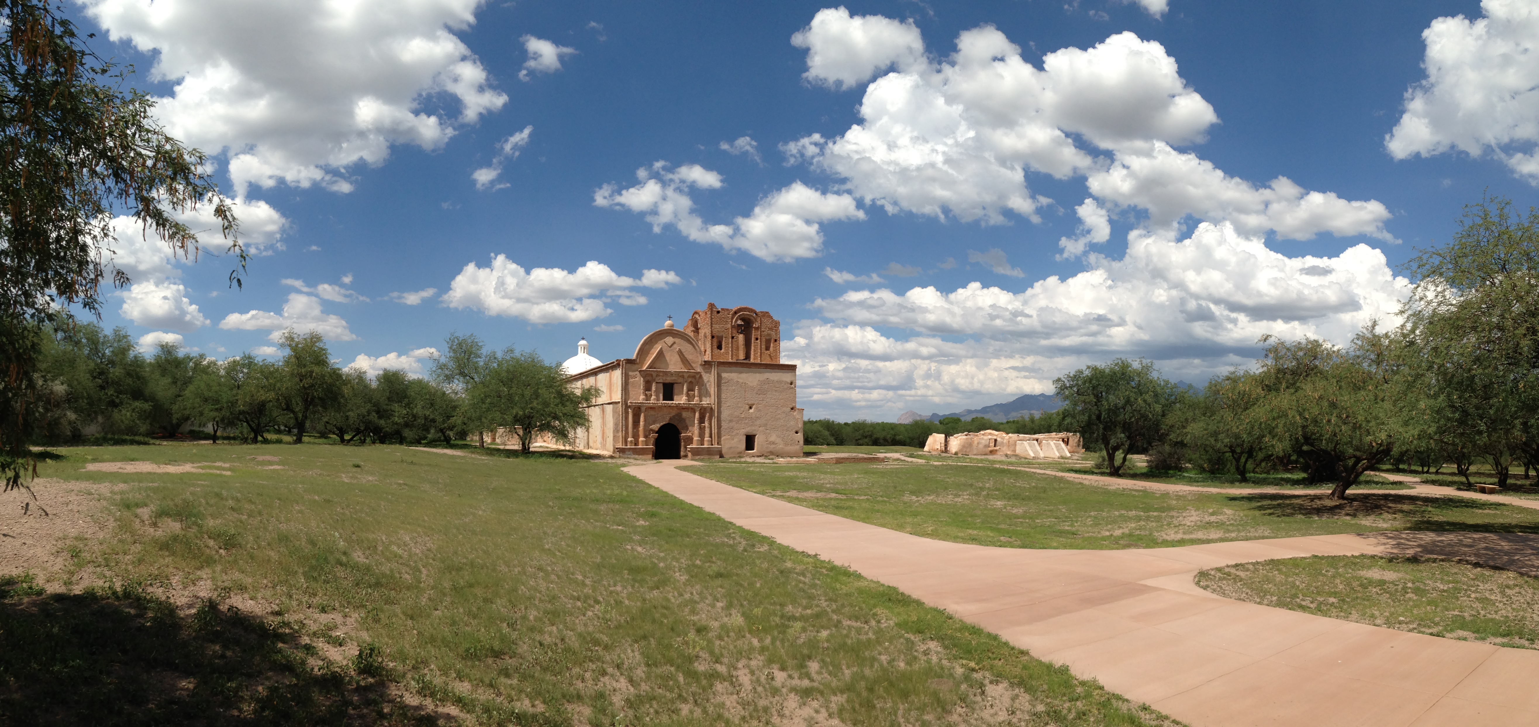
National Historical Park
Tumacácori sits at a cultural crossroads in the Santa Cruz River valley. Here O’odham, Yaqui, and Apache people met and mingled with European Jesuit and Franciscan missionaries, settlers, and soldiers...

National Park
Tucson, Arizona is home to the nation's largest cacti. The giant saguaro is the universal symbol of the American west. These majestic plants, found only in a small portion of the United States, are pr...
Park data from the National Park Service API. Alerts update every 2 hours.
Expect a "turn-heavy local drive" for this 162.2-mile journey. While 16% of the route involves highway driving, the overall feel is more about navigating local roads. The longest uninterrupted stretch you'll encounter is 54.6 miles along the Casa Grande-Tucson Highway. This suggests a drive that will require your attention with frequent adjustments rather than long periods of cruising on a single major interstate. The road's personality will likely shift as you transition between different local and highway segments.
Expect a hands-on drive with frequent turns and local roads rather than long highway stretches. You will hit about 10 points where you need to pay attention to lane position or signs. The trickiest moment comes early in the drive near US 60 / Grand Avenue.
Moderate - straightforward overall, but long enough or busy enough to require pacing
Balances navigation complexity with total wheel time.
This drive requires moderate attention. Across 162.2 miles you will encounter 10 spots where lane choice or exit timing matters. Not difficult for experienced highway drivers, but worth previewing the tricky sections before you go.
Where does it get tricky?
The main spots that need attention: near the start (US 60 / Grand Avenue): Lane positioning matters here; at 9.9 miles (US 60 / West Thomas Road): Lane positioning matters here; at 10.1 miles (US 60 / North Black Canyon Highway): Navigation decision point.
Gently rolling terrain
Total Climb
2,017 ft
Total Descent
87 ft
Highest Point
3,070 ft
~162.2 mi in
Elevation Range
2,011 ft
Peoria is a city inside of Phoenix, Arizona. Many visitors come to the area during the spring to see their favorite professional baseball team during Spring Training in the Cactus League.
Top landmarks
City content from Wikivoyage (CC BY-SA 4.0) and Wikidata (CC0).
Weekend Trip
Doable as a same-day drive at 3h 1m. Total distance: 162.2 miles.
Family Friendly
Moderate complexity with 1 natural rest stops along the way.
Solo Traveler
3h 1m drive, comfortable solo distance.
First-Time Driver
Mostly highway driving (16%). Some complex stretches to watch for.
Scenic Drive
Mostly surface roads route profile with national parks nearby.
Compiled by the US Trip Planner planning team at COD Solutions Oy from open government datasets — OSRM over OpenStreetMap for geometry, EIA for fuel prices, USGS 3DEP for elevation, and NPS for national parks. See our methodology for refresh cadence and limitations.
Was this helpful?
Thanks for your feedback!
Your tip has been submitted. Thanks!
/500
Recent Tips
·
Explore more options from Peoria, AZ or browse trips ending in Arivaca Junction, AZ.
Looking for more statewide routes? Browse AZ road trips.