Connecting Palm Bay to South Venice involves a 199.3-mile journey that typically takes about 4 hours of drive time. Since this trek is manageable in a single day, you won't need to worry about booking an overnight stay unless you prefer a slower pace. You will primarily utilize I-75 and I-4, leaving via New Haven Avenue to get started. Budgeting approximately $33 for fuel will cover your gas expenses for the trip. It is a straightforward, highway-focused drive that transitions you from the Atlantic coast toward the Gulf side of Florida. Whether you are commuting or heading out for a quick getaway, this route provides a reliable path across the state.
Trip Pace
Same-day drive is realistic
A same-day return is possible, but it will make for a full day on the road.
Break Rhythm
1 planned break
Plan on a short reset every 3 to 4 hours to stay fresh behind the wheel.
Midpoint
99.7 miles from Palm Bay, FL
A natural place for your longest stop of the day
, about 2h 3m into the drive
.
Main Roads
Road
Distance
Duration
I 75
60.9 mi
1h 5m
I 4
51.8 mi
56m
New Haven Avenue
37 mi
44m
Southern Connector Extension
8.2 mi
9m
Florida's Turnpike
5.5 mi
5m
Central Florida GreeneWay
5.2 mi
5m
Palm Bay Road Northeast
4 mi
7m
FL 681
3.9 mi
5m
Longest stretch:
I 75
— 60.9 mi, about 1h 5m
Turn-by-Turn Driving Directions
Step-by-step road directions between Palm Bay, FL and South Venice, FL.
1
Start on Palm Bay Road Northeast
4.0 mi·7 min·Palm Bay Road Northeast
2
Take the ramp
0.5 mi·1 min
Toward I 95 North: Daytona Beach
3
Merge onto I 95
3.6 mi·3 min·I 95
4
Take the exit
0.5 mi·1 min
Exit 180Toward US 192: West Melbourne, MelbourneUse the slight right lane.
5
Continue on US 192
37 mi·44 min·New Haven Avenue
Use the right lane.
6
Continue on US 192; US 441
1.2 mi·1 min·East Irlo Bronson Memorial Highway
7
Continue on US 192; US 441
2.6 mi·5 min·13th Street
8
Continue on US 192; US 441
0.2 mi·21 sec·East Irlo Bronson Memorial Highway
9
Continue on US 192; US 441
3.3 mi·5 min·Bronson Highway
Use the right lane.
10
Take the exit
0.2 mi·20 sec
Toward Ocala, Miami, Florida's Turnpike Toll
11
Keep slight left at fork
0.6 mi·1 min
Toward Florida's Turnpike North: Ocala
12
Merge onto Florida's Turnpike
5.5 mi·5 min·Florida's Turnpike
Use the straight / slight right lanes.
13
Take the exit
0.3 mi·28 sec
Exit 251Toward FL 417 Toll: Tampa, Daytona BeachUse the straight / slight right lanes.
14
Keep slight left at fork
0.8 mi·1 min
Toward FL 417 Toll South: Tampa, Disney WorldUse the straight / slight right lanes.
15
Merge onto FL 417 Toll
5.2 mi·5 min·Central Florida GreeneWay
Use the straight / slight right lanes.
16
Keep slight left at fork onto FL 417 Toll
8.2 mi·9 min·Southern Connector Extension
Use the straight / slight right lanes.
17
Merge onto I 4
52 mi·56 min·I 4
Use the straight / slight right lanes.
18
Take the exit
0.3 mi·42 sec
Exit 9Toward I 75: Ocala, NaplesUse the straight / slight right lanes.
19
Keep slight left at fork
0.8 mi·1 min
Toward I 75 South: NaplesUse the slight left lane.
20
Merge onto I 75
61 mi·1 hr 5 min·I 75
Use the straight / slight right lanes.
21
Keep slight right at fork onto FL 681
3.9 mi·5 min·FL 681
Toward FL 681: Venice, OspreyUse the straight / slight right lanes.
22
Turn straight onto US 41
2.6 mi·4 min·Tamiami Trail
23
Keep slight left at fork onto US 41
3.0 mi·5 min·US 41 By-Pass
Use the left lane.
24
Continue on US 41
1.3 mi·2 min·Tamiami Trail
25
Turn right onto West Baffin Road
0.6 mi·1 min·West Baffin Road
26
Turn right onto Sterling Road
0.3 mi·1 min·Sterling Road
27
Turn left onto Hudson Road
168 ft·7 sec·Hudson Road
28
Arrive at destination
Hudson Road
Trip Plan
Planning for this 4-hour trip is simple, as you only need to factor in one main stop to keep your energy levels up. Aim to depart outside of peak traffic hours to ensure you maintain that estimated 4-hour travel time, especially when navigating the busier sections of I-4. Because the route is highway-heavy, keep a steady eye on your fuel gauge during that long 60.9-mile stretch on I-75 to avoid any mid-route stress. Since this is a single-day journey, you have the flexibility to leave whenever suits your schedule best. Use your one planned stop as an opportunity to stretch your legs before you hit the final leg of the drive toward South Venice.
Morning Departure
An early start around 7-8 AM gets you there with plenty of daylight left.
Evening Departure
A late afternoon start means arriving after dark. Morning is better.
You can normally do this drive in one day.
Plan roughly 1 meaningful break for fuel, food, and rest.
The halfway point lands around 99.7 miles from Palm Bay, FL, or about 2h 3m into the drive.
The longest continuous stretch on this route runs about 60.9 miles.
This is a comfortable same-day trip.
Departure
Before you leave
Start with fuel, water, and navigation already sorted so the first hour feels easy.
First stop
Around 44 miles or 56m in
Use this first pause for coffee, a restroom break, and a quick traffic check ahead.
Halfway reset
Around 99.7 miles or 2h 3m in
This is the best place for your longest stop, a real meal, and a full fuel check.
Final approach
Final hour starts around 3h 13m
Traffic, exits, and arrival timing usually matter more near South Venice, FL than in the middle of the route.
Before You Leave
+
Open the route before leaving Palm Bay, FL so your first major turns are already loaded.
+
Leave with enough water and a charging cable within reach, not packed away.
+
Check your fuel range against the first long segment, especially if you are starting outside city service areas.
Day 1
Settle into the route from Palm Bay, FL
This is one driving day of about 199.3 miles and 4h.
Your first comfortable stop window is around 44 miles from Palm Bay, FL.
This route can stay practical as a one-day drive if traffic stays reasonable.
Plan about 1 real break rather than only quick fuel stops.
The longest stretch is on I 75 for about 60.9 miles.
Where to Stop
Rest stops, refuel points, and overnight suggestions along this route.
Place data sourced from public business listings. Hours and availability may vary.
Heads-up: tricky spots
5 of 19
5 decision points cluster between mile 8 and 187.6 — GPS handles the exact turns, but know they're coming. Your lane choice matters more than the turn itself.
8
8 mi into trip|~12m in
Take the exit toward US 192: West Melbourne, Melbourne
Exit ramp - move to the correct lane early. Lane positioning matters here. Multiple destination signs - pick the right one
Use the slight right lane.
Exit 180
Toward US 192: West Melbourne, Melbourne
8
59.1 mi into trip|~1h 18m in
Take the exit toward FL 417 Toll: Tampa, Daytona Beach
Exit ramp - move to the correct lane early. Lane positioning matters here. Multiple destination signs - pick the right one
Use the straight / slight right lanes.
Exit 251
Toward FL 417 Toll: Tampa, Daytona Beach
8
59.4 mi into trip|~1h 18m in
Keep slight left at fork toward FL 417 Toll South: Tampa, Disney World
Highway fork - watch signs carefully. Lane positioning matters here. Multiple destination signs - pick the right one
Use the straight / slight right lanes.
Toward FL 417 Toll South: Tampa, Disney World
8
125.5 mi into trip|~2h 31m in
Take the exit toward I 75: Ocala, Naples
Exit ramp - move to the correct lane early. Lane positioning matters here. Multiple destination signs - pick the right one
Use the straight / slight right lanes.
Exit 9
Toward I 75: Ocala, Naples
8
187.6 mi into trip|~3h 39m in|FL 681
Keep slight right at fork onto FL 681 toward FL 681: Venice, Osprey
Highway fork - watch signs carefully. Lane positioning matters here. Multiple destination signs - pick the right one
Use the straight / slight right lanes.
Toward FL 681: Venice, Osprey
Fuel & Cost
Regular Gas
$31.72 one way
$63.45 round trip
$4.04/gal25.4 MPG avg70 kg CO2
Fuel Type
$/gal
One Way
Round Trip
midgrade
$4.40
$34.51
$69.02
premium
$4.72
$37.06
$74.12
diesel
$5.61
$44.00
$88.01
Estimated Tolls: $0.38
Florida's Turnpike
(5.5 mi)$0.38
Toll estimates based on average 2024-2025 rates. EZ-Pass/SunPass discounts may lower the actual cost.
Estimated Trip Cost (one way, 1 person)
Fuel
$32
Tolls
$0
Meals
$25–$50
Total
$57–$82
Rough estimate based on US averages. Hotel $80–$140/night, meals $25–$50/day.
Estimated CO2 emission: 69.7 kg one way.
Prices: EIA weekly data, 2026-04-13.
Driving Electric?
About $21 in charging
· 0 stops
· 67% less CO2
Vehicle Type
kWh
Stops
DC Fast
Home Charge
Average EV
59.8
0
$20.93
$9.57
Efficient EV
49.8
0
$17.44
$7.97
EV Truck/SUV
79.7
0
$27.90
$12.76
Gas CO2
70 kg
EV CO2
23 kg (67% less)
This trip is well within single-charge range for most EVs. No charging stops needed if you start fully charged.
DC fast charging avg $0.35/kWh. Home charging avg $0.16/kWh. US grid CO2: 0.39 kg/kWh.
Travel Intel
Current conditions at both ends of the drive.
Forecast as of Apr 15, 2026
Origin
Palm Bay, FL
Late night
in Palm Bay on Sunday
Local time
12:25 AM
EDT
Current temp
77°F
Unavailable
Live forecast
Destination
South Venice, FL
Late night
in South Venice on Sunday
Local time
12:25 AM
EDT
Current temp
66°F
Unavailable
Live forecast
Seasonal Notes
Summer travel usually means heavier construction, hotter rest stops, and busier weekend traffic around major cities.
Winter travel shortens daylight, so a route that looks manageable on paper can feel much longer after dark.
Holiday weekends tend to make both departure and arrival windows slower than the raw route time suggests.
Time zone
Same local time
Origin and destination are on the same clock, so arrival timing is easier to judge at a glance.
Temperature spread
11 degrees cooler at arrival
A meaningful temperature swing is a good cue to rethink layers, water, and how soon you want to arrive.
Road read
4h on the road
An early start around 7-8 AM gets you there with plenty of daylight left.
Weather data from the National Weather Service. Conditions may change; check closer to your travel date.
National Parks Near This Route
Worth a detour if your schedule allows.
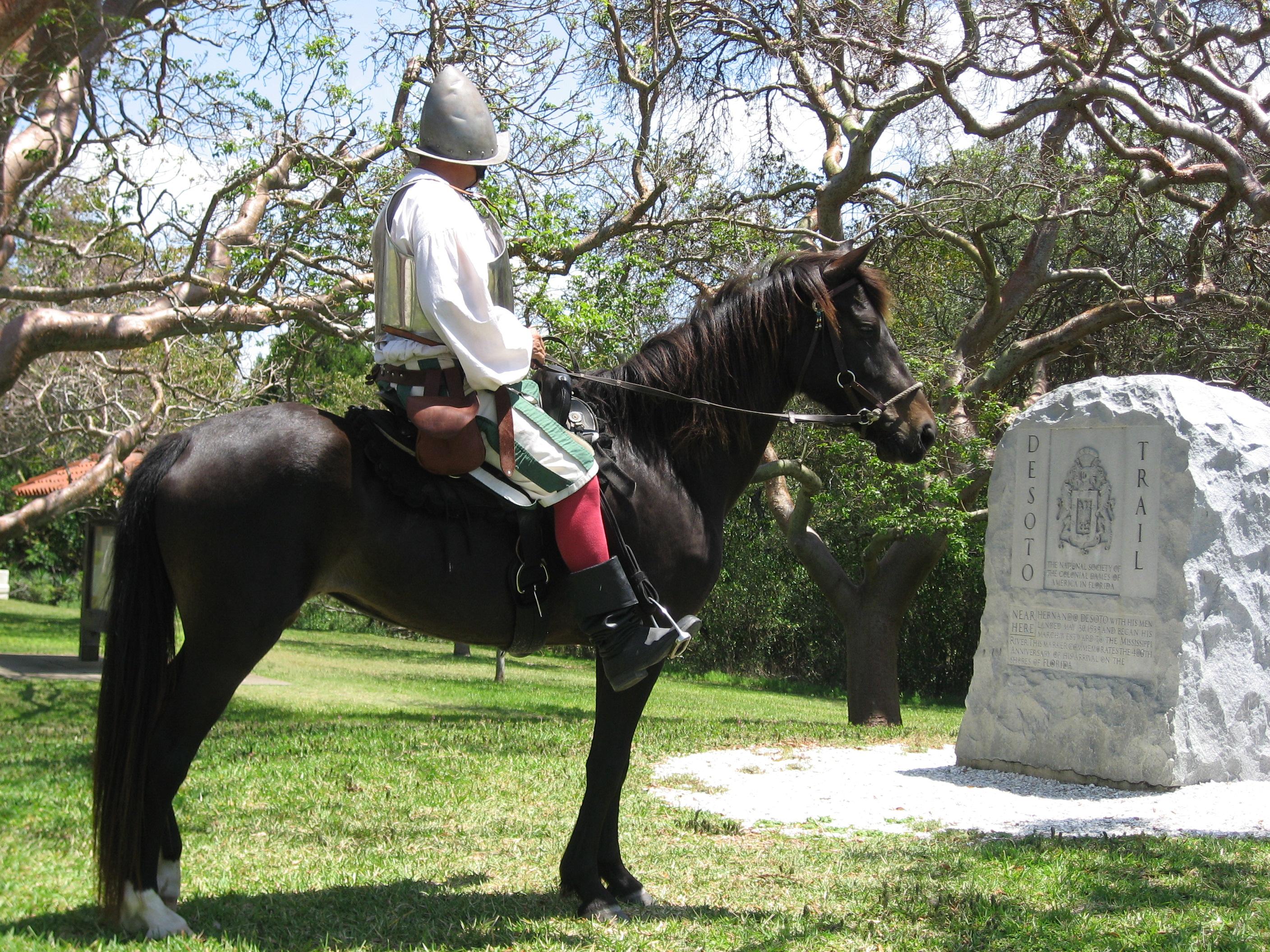
De Soto National Memorial
National Memorial
In May 1539, Conquistador Hernando de Soto’s army of soldiers, hired mercenaries, craftsmen, and clergy made landfall in Tampa Bay. They were met with fierce resistance of indigenous people protecting...
9 mi from route
~23 min detour
Free
near mile 164.9
Park data from the National Park Service API. Alerts update every 2 hours.
More Details
What kind of drive is this?
Expect a drive defined by efficiency, as 65% of your travel takes place on major highways. You will spend the bulk of your time navigating high-speed interstate corridors, including a longest uninterrupted stretch of 60.9 miles on I-75. While the initial departure from Palm Bay uses local roads like New Haven Avenue, the character of the trip shifts quickly once you merge onto the interstate system. This is a practical, no-nonsense route designed for getting you from point A to point B without unnecessary complexity. Prepare for a consistent pace behind the wheel as you move through Florida's interior toward the coast.
65% highway — fuel and pacing are the main things to plan.
28 navigation steps total — most of the decisions cluster near the start and finish.
Longest single stretch: 60.9 mi on I 75.
How Hard Is This Drive?
10/10
This is a straightforward highway drive that stays mostly on I 75 and I 4. This route has several spots where lane changes, forks, or exits need your full attention. The trickiest moment comes around 8 miles in.
Driving Effort10/10
High effort - long or complex enough to need steady focus all day
Balances navigation complexity with total wheel time.
This is a demanding drive. With 19 significant decision points across 199.3 miles, you will need to stay alert - especially through interchange areas and urban stretches. Consider splitting it into segments if you are not comfortable with fast highway navigation.
Where does it get tricky?
The main spots that need attention: at 8 miles: Exit ramp - move to the correct lane early. Lane positioning matters here. Multiple destination signs - pick the right one; at 59.1 miles: Exit ramp - move to the correct lane early. Lane positioning matters here. Multiple destination signs - pick the right one; at 59.4 miles: Highway fork - watch signs carefully. Lane positioning matters here. Multiple destination signs - pick the right one.
Elevation Profile
Mostly flat terrain
143 ft15 ft
Total Climb
156 ft
Total Descent
158 ft
Highest Point
143 ft
~99.7 mi in
Elevation Range
128 ft
Towns Mentioned on Route Signs
Based on OSRM destination-sign hints, not a full list of every settlement the road passes.
Between Palm Bay, FL and South Venice, FL, road signs point toward Ocala, Miami, Florida's Turnpike Toll, Florida's Turnpike North: Ocala, Daytona Beach and Disney World - among others.
Ocala
52.9 mi in|~1h 10m
Miami
52.9 mi in|~1h 10m
Florida's Turnpike Toll
52.9 mi in|~1h 10m
Florida's Turnpike North: Ocala
53 mi in|~1h 11m
Daytona Beach
59.1 mi in|~1h 18m
Disney World
59.4 mi in|~1h 18m
Naples
125.5 mi in|~2h 31m
Osprey
187.6 mi in|~3h 39m|via FL 681
Who Is This Route For?
Weekend Trip
Doable as a same-day drive at 4h. Total distance: 199.3 miles.
Family Friendly
Moderate complexity with 1 natural rest stops along the way.
Solo Traveler
4h drive, comfortable solo distance.
Frequently Asked Questions
The longest stretch is about 60.9 miles on I 75. The full list of main roads is in the Roads section above.
Expect about $0.38 in tolls one way, starting with Florida's Turnpike. Most Northeast and Midwest toll agencies accept E-ZPass; in the West and Texas, transponders like TxTag or FasTrak apply. If you do not have a transponder, cashless tolling plates will mail a bill to the vehicle's registered address — usually with a surcharge, so a rental-car toll pass is often cheaper than paying by mail.
We did not find dedicated rest areas on this route. For a drive this long, plan bathroom and stretch breaks around gas stations, fast-food stops, or small-town downtowns — check the Nearby Places section for options.
It helps. This route has a higher-than-average number of complex decision points, which get harder in the dark. If the last hour of the trip is on surface roads or mountain grades, aim to arrive at South Venice, FL before sunset when you can. Check the Trip Plan for departure windows that land you in daylight.
Only with planning. This is a long drive for kids — consider splitting it into two days rather than pushing through. Plan at least 1 meaningful breaks. Dedicated rest areas are limited, so plan gas or food stops as your bathroom breaks.
The main spots that need attention: at 8 miles: Exit ramp - move to the correct lane early. Lane positioning matters here. Multiple destination signs - pick the right one; at 59.1 miles: Exit ramp - move to the correct lane early. Lane positioning matters here. Multiple destination signs - pick the right one; at 59.4 miles: Highway fork - watch signs carefully. Lane positioning matters here. Multiple destination signs - pick the right one.
Yes — De Soto National Memorial. See the National Parks section for detour distances and tips on detours.
Possible but tiring. At 4.0 hours each way, an in-and-out day trip would put you behind the wheel for 8.0 hours — manageable with a long break at South Venice, FL, but most travelers stay overnight.