Origin
Oregon City, OR
Afternoon in Oregon City on Sunday
Local time
1:22 PM
PDT
Current temp
73°F
Unavailable
Live forecast
Compiled and reviewed by the US Trip Planner planning team at COD Solutions Oy · Last reviewed Apr 19, 2026 · Editorial standards
Drive Time
2h 32m
Distance
110.7 mi
178 km
Drive Score
9/10
Great drive
Same Day?
Yes, doable
Fuel Cost
$22
one way
EV Charging
Unknown
Estimated drive times based on typical traffic patterns. Actual times may vary with weather, construction, and real-time conditions.

Oregon City, OR
Wikimedia Commons

Astoria, OR
Wikimedia Commons
Oregon City to Astoria is 110.7 miles and takes about 2h 32m via Lower Columbia River Highway and I-5, with a fuel budget near $22 and enough daylight to finish in a day. This trip connects two points within the Pacific Coast region, offering a straightforward drive without significant changes in scenery or terrain. You'll primarily be on well-maintained roads, making it a practical choice for a quick excursion. Consider this route if you're looking for an easy day trip with minimal planning required.
Trip Pace
Same-day drive is realistic
A same-day return is realistic if you keep stops short.
Break Rhythm
1 planned break
A short stop every 2 to 3 hours is enough for this drive.
Midpoint
55.3 miles from Oregon City, OR
A natural place for your longest stop of the day , about 1h 8m into the drive .
| Road | Distance | Duration |
|---|---|---|
| Lower Columbia River Highway | 43.2 mi | 1h 1m |
| I 5 | 28.6 mi | 30m |
| I 205 | 28 mi | 37m |
| WA 432 | 3.6 mi | 5m |
| Oregon Way | 2.5 mi | 5m |
| Leif Erickson Drive | 1.9 mi | 3m |
| Marine Drive | 1 mi | 2m |
| Duane Street | 0.3 mi | <1m |
Step-by-step road directions between Oregon City, OR and Astoria, OR.
Start on 7th Street
Turn left onto Singer Hill Road
Turn right onto Main Street
Turn left onto 14th Street
Turn right onto OR 99E
Take the exit
Merge onto I 205
Merge onto I 5
Take the exit
Keep slight left at fork
Continue on WA 432
Turn left onto Oregon Way
Take the exit
Merge onto US 30
Continue on US 30
Continue on US 30
Turn left onto 16th Street
Turn right onto Duane Street
Turn left onto 11th Street
Turn left onto Exchange Street
Turn left
Arrive at destination
Given this is a 1-day trip covering 110.7 miles, you have significant flexibility. Leaving Oregon City in the morning allows ample time to reach Astoria before evening. With only one recommended stop, you can choose to make it a quick fuel and stretch break or a more substantial pause. Keep an eye on your fuel gauge, as the estimated cost is $22, and plan your last fill-up accordingly before heading onto the longest stretch on the Lower Columbia River Highway. This highway section is where you'll want to be most mindful of your surroundings and any potential for slower traffic.
Morning Departure
Leave by 9 AM and you'll arrive before lunch.
Evening Departure
Even a 4 PM departure gets you there before dark in summer.
This is a comfortable same-day trip.
Departure
Before you leave
Start with fuel, water, and navigation already sorted so the first hour feels easy.
First stop
Around 24 miles or 33m in
Use this first pause for coffee, a restroom break, and a quick traffic check ahead.
Halfway reset
Around 55.3 miles or 1h 8m in
This is the best place for your longest stop, a real meal, and a full fuel check.
Final approach
Final hour starts around 2h
Traffic, exits, and arrival timing usually matter more near Astoria, OR than in the middle of the route.
Open the route before leaving Oregon City, OR so your first major turns are already loaded.
Leave with enough water and a charging cable within reach, not packed away.
Check your fuel range against the first long segment, especially if you are starting outside city service areas.
Day 1
Settle into the route from Oregon City, OR
This is one driving day of about 110.7 miles and 2h 32m.
Rest stops, refuel points, and overnight suggestions along this route.

Mid-route town
Meal stop
55 mi into the route
Best for: Lunch, fuel, and a longer reset
This sits close to the middle of the route, so it works well for the longest stop of the day.
A short stop after about 24 miles helps settle the day before fatigue starts building.
The midpoint is around 55.3 miles from Oregon City, OR, which is a good place for a longer meal and fuel stop.
These stop ideas are pacing suggestions — the exact town or exit can change with traffic, hotel plans, and fuel range.
5 decision points cluster between mile 0 and 57.7 — GPS handles the exact turns, but know they're coming. Your lane choice matters more than the turn itself.
Turn left onto Singer Hill Road
Lane positioning matters here
Turn left onto 14th Street
Lane positioning matters here
Turn right onto OR 99E / McLoughlin Boulevard
Lane positioning matters here
Take the exit toward I 205 North: Seattle, The Dalles
Exit ramp - move to the correct lane early. Multiple destination signs - pick the right one
Keep slight left at fork toward WA 432 West: Talley Way, Longview
Highway fork - watch signs carefully. Multiple destination signs - pick the right one
Regular Gas
$22.05 one way
$44.11 round trip
| Fuel Type | $/gal | One Way | Round Trip |
|---|---|---|---|
| midgrade | $5.36 | $23.34 | $46.68 |
| premium | $5.59 | $24.37 | $48.73 |
| diesel | $5.61 | $24.44 | $48.88 |
No toll roads detected on this route.
Estimated Trip Cost (one way, 1 person)
Fuel
$22
Meals
$25–$50
Total
$47–$72
Rough estimate based on US averages. Hotel $80–$140/night, meals $25–$50/day.
Estimated CO2 emission: 38.7 kg one way. Prices: EIA weekly data, 2026-04-13.
Driving Electric?
About $12 in charging · 0 stops · 67% less CO2
| Vehicle Type | kWh | Stops | DC Fast | Home Charge |
|---|---|---|---|---|
| Average EV | 33.2 | 0 | $11.62 | $5.31 |
| Efficient EV | 27.7 | 0 | $9.69 | $4.43 |
| EV Truck/SUV | 44.3 | 0 | $15.50 | $7.08 |
Gas CO2
39 kg
EV CO2
13 kg (67% less)
This trip is well within single-charge range for most EVs. No charging stops needed if you start fully charged.
DC fast charging avg $0.35/kWh. Home charging avg $0.16/kWh. US grid CO2: 0.39 kg/kWh.
Current conditions at both ends of the drive.
Origin
Afternoon in Oregon City on Sunday
Local time
1:22 PM
PDT
Current temp
73°F
Unavailable
Destination
Afternoon in Astoria on Sunday
Local time
1:22 PM
PDT
Current temp
58°F
Unavailable
47°F
Longview, WA
55 mi in
Seasonal Notes
Summer travel usually means heavier construction, hotter rest stops, and busier weekend traffic around major cities.
Winter travel shortens daylight, so a route that looks manageable on paper can feel much longer after dark.
Holiday weekends tend to make both departure and arrival windows slower than the raw route time suggests.
Time zone
Origin and destination are on the same clock, so arrival timing is easier to judge at a glance.
Temperature spread
A meaningful temperature swing is a good cue to rethink layers, water, and how soon you want to arrive.
Road read
Use the two city cards together: check the sky where you start, then compare it with the local time and temperature at arrival.
Weather data from the National Weather Service. Conditions may change; check closer to your travel date.
Worth a detour if your schedule allows.
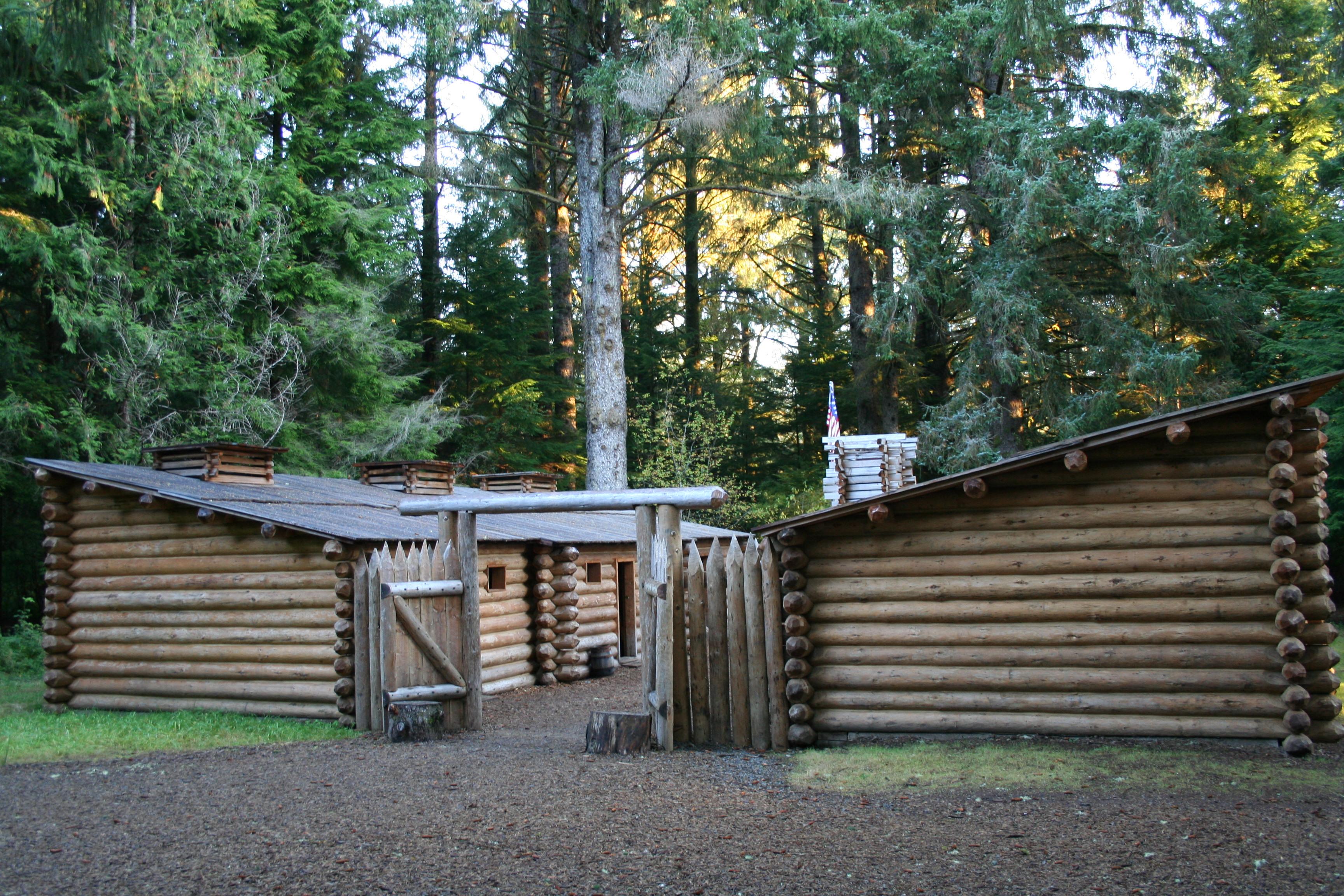
National Historical Park
Explore the timeless rainforests and majestic coastal vistas. Discover the rich heritage of the native people. Unfold the dramatic stories of America's most famous explorers. The park encompasses site...
Park data from the National Park Service API. Alerts update every 2 hours.
This route offers a mixed driving experience, with 54% of it being on highways. The longest uninterrupted stretch you'll encounter is 43.2 miles along the Lower Columbia River Highway, which likely provides a more scenic and potentially winding experience compared to the interstate sections. You can expect periods of faster travel on I-5 and I-205, interspersed with the character of the Lower Columbia River Highway. The drive progresses from more urban-influenced roads to what is likely a more open, riverside feel as you approach the coast.
This route mixes highway mileage with some local-road sections near the start or finish. This route has several spots where lane changes, forks, or exits need your full attention. The trickiest moment comes early in the drive near Singer Hill Road.
Demanding - plan breaks and stay ahead of the key maneuvers
Balances navigation complexity with total wheel time.
This is a demanding drive. With 17 significant decision points across 110.7 miles, you will need to stay alert - especially through interchange areas and urban stretches. Consider splitting it into segments if you are not comfortable with fast highway navigation.
Where does it get tricky?
The main spots that need attention: near the start (Singer Hill Road): Lane positioning matters here; at 0.5 miles (14th Street): Lane positioning matters here; at 0.5 miles (OR 99E / McLoughlin Boulevard): Lane positioning matters here.
Based on OSRM destination-sign hints, not a full list of every settlement the road passes.
On the drive from Oregon City, OR to Astoria, OR, road signs begin pointing toward Longview along the way.
Longview
Oregon City is a city of 37,000 people (2019) in the Portland Metropolitan Area. The seat of suburban Clackamas County, it is best known as being the end of the Oregon Trail. Several tourist attractions in the city commemorate this history.
Astoria is a city on the Northern Oregon Coast. It is a small rainy town on the edge of the Columbia River and the Pacific Ocean. It is famous for being the terminus for the Lewis and Clark Expedition, the setting of the movie The Goonies, and its Victorian-era homes built into the hillside overlooking the Columbia River.
City content from Wikivoyage (CC BY-SA 4.0) and Wikidata (CC0).
Weekend Trip
Doable as a same-day drive at 2h 32m. Total distance: 110.7 miles.
Family Friendly
Moderate complexity with 1 natural rest stops along the way.
Solo Traveler
2h 32m drive, comfortable solo distance.
First-Time Driver
Mostly highway driving (54%). Some complex stretches to watch for.
Scenic Drive
Mixed highway & surface route profile with national parks nearby.
Compiled by the US Trip Planner planning team at COD Solutions Oy from open government datasets — OSRM over OpenStreetMap for geometry, EIA for fuel prices, and NPS for national parks. See our methodology for refresh cadence and limitations.
Was this helpful?
Thanks for your feedback!
Your tip has been submitted. Thanks!
/500
Recent Tips
·
Explore more options from Oregon City, OR or browse trips ending in Astoria, OR.
Looking for more statewide routes? Browse OR road trips.