Traveling from Bend to Astoria covers 258.6 miles and requires about 5 hours and 56 minutes of active driving time. Because this route involves navigating through local streets like Northwest Bond, Wall, and Revere Avenue rather than utilizing major interstates, it is best suited for a focused one-day push. You should budget approximately $51 for fuel to cover the journey between these two Pacific Coast region points. While the trip is technically feasible in a single day, the turn-heavy nature of the roads means you will need to stay alert throughout the nearly six-hour duration. This drive offers a practical way to transition from the interior landscape of Bend to the coastal environment of Astoria, provided you are prepared for a consistent behind-the-wheel experience.
Trip Pace
Same-day drive is realistic
A same-day return is possible, but it will make for a full day on the road.
Break Rhythm
1 planned break
Plan on a short reset every 3 to 4 hours to stay fresh behind the wheel.
Midpoint
129.3 miles from Bend, OR
A natural place for your longest stop of the day
, about 2h 55m into the drive
.
Main Roads
Road
Distance
Duration
North Santiam Highway
78.9 mi
1h 47m
I 5
38.2 mi
45m
Northwest Sunset Highway
33.2 mi
45m
Nehalem Highway
26.1 mi
45m
Santiam Highway
25.1 mi
31m
McKenzie-Bend Highway
19 mi
24m
Sunset Highway
13.4 mi
15m
Oregon Route 103
9 mi
12m
Longest stretch:
North Santiam Highway
— 78.9 mi, about 1h 47m
Traffic on I-5
Hour-of-day weekday pattern from 15 FHWA count stations on your route.
Peak
3 PM
~4,398 veh/hr typical
Quietest
2 AM
~347 veh/hr
Peak-to-quiet ratio
12.7×
busier at peak than in the quiet hours
12a6anoon6p11p
Averaged across 45 weeks of 2023 FHWA Travel Monitoring Analysis System data. Weekday hours only (Mon–Fri).
Turn-by-Turn Driving Directions
Step-by-step road directions between Bend, OR and Astoria, OR.
1
Start on Northwest Franklin Avenue
432 ft·27 sec·Northwest Franklin Avenue
2
Turn left onto Northwest Bond Street
0.3 mi·1 min·Northwest Bond Street
3
Turn right onto Northwest Wall Street
0.5 mi·1 min·Northwest Wall Street
4
Turn right onto Northwest Revere Avenue
372 ft·10 sec·Northwest Revere Avenue
5
Continue on Northeast Revere Avenue
368 ft·17 sec·Northeast Revere Avenue
6
Turn left onto Northeast Division Street
0.6 mi·1 min·Northeast Division Street
7
Continue on Division Street
0.1 mi·15 sec·Division Street
8
Turn left onto US 20; US 97 Business
1.0 mi·2 min·Northeast 3rd Street
9
Turn slight right onto US 20; US 97 Business
0.8 mi·59 sec·McKenzie-Bend Highway
10
Enter roundabout onto US 20
133 ft·1 sec·McKenzie-Bend Highway
11
Continue on US 20
0.4 mi·35 sec·McKenzie-Bend Highway
12
Enter roundabout onto US 20
130 ft·1 sec·McKenzie-Bend Highway
13
Continue on US 20
0.7 mi·1 min·McKenzie-Bend Highway
14
Enter roundabout onto US 20
114 ft·1 sec·McKenzie-Bend Highway
15
Continue on US 20
2.0 mi·2 min·McKenzie-Bend Highway
16
Enter roundabout onto US 20
123 ft·1 sec·McKenzie-Bend Highway
17
Continue on US 20
15 mi·18 min·McKenzie-Bend Highway
18
Enter roundabout onto South Locust Street
70 ft·1 sec·South Locust Street
19
Continue on South Locust Street
0.5 mi·56 sec·South Locust Street
20
Turn left onto East Barclay Drive
0.8 mi·1 min·East Barclay Drive
21
Enter roundabout onto US 20; OR 126
17 ft·0 sec·Santiam Highway
22
Continue on US 20; OR 126
25 mi·31 min·Santiam Highway
23
Keep slight right at fork onto OR 22
51 mi·1 hr 14 min·North Santiam Highway
24
Continue on OR 22
0.5 mi·33 sec·Northeast Santiam Boulevard
25
Continue on OR 22
0.6 mi·43 sec·Northwest Santiam Boulevard
26
Continue on OR 22
28 mi·32 min·North Santiam Highway
27
Take the exit onto I 5; OR 99E
38 mi·45 min·I 5; OR 99E
Exit 1BToward I 5 North: PortlandUse the straight / slight right lanes.
28
Take the exit
0.8 mi·1 min
Exit 292AToward OR 217: Tigard, BeavertonUse the straight / slight right lanes.
29
Merge onto OR 217
6.7 mi·9 min·Beaverton-Tigard Freeway
Use the straight / slight right lanes.
30
Take the exit onto OR 217
0.9 mi·2 min·OR 217
Toward US 26 West
31
Merge onto US 26
33 mi·45 min·Northwest Sunset Highway
Use the straight / slight right lanes.
32
Continue on US 26
13 mi·15 min·Sunset Highway
33
Turn left onto OR 103
432 ft·6 sec·Oregon Route 103
34
Continue on OR 103
8.9 mi·12 min·Oregon Route 103
35
At end of road, turn left onto OR 202
26 mi·45 min·Nehalem Highway
36
Continue on OR 202
0.2 mi·24 sec·Southeast Front Street
37
Turn right onto Williamsport Road
0.9 mi·2 min·Williamsport Road
38
Continue on 16th Street
0.1 mi·17 sec·16th Street
39
Continue on Niagara Avenue
347 ft·11 sec·Niagara Avenue
40
Turn right onto 15th Street
0.2 mi·36 sec·15th Street
41
At end of road, turn left onto Jerome Avenue
358 ft·11 sec·Jerome Avenue
42
Turn right onto 14th Street
359 ft·15 sec·14th Street
43
Turn left onto Irving Avenue
0.2 mi·30 sec·Irving Avenue
44
Turn right onto 11th Street
0.2 mi·24 sec·11th Street
45
Turn right onto Exchange Street
52 ft·6 sec·Exchange Street
46
Turn left
177 ft·12 sec
47
Arrive at destination
Trip Plan
To manage the nearly six-hour drive effectively, plan to depart early in the morning to maximize daylight for your navigation. Since the route includes one scheduled stop, use that break strategically to stretch and refuel your vehicle, keeping your $51 fuel budget in mind as you plan your stops. Given that this is a turn-heavy local drive, allow for some flexibility in your arrival time to account for the slower pace of city and local roads. Because you will be navigating local streets like Northwest Bond and Wall, keep a close eye on your GPS or map to avoid missing turns in the more congested sections. Prioritizing consistent, steady progress will help you navigate the full distance comfortably within your single-day itinerary.
Morning Departure
An early start around 7-8 AM gets you there with plenty of daylight left.
Evening Departure
A late afternoon start means arriving after dark. Morning is better.
You can normally do this drive in one day.
Plan roughly 1 meaningful break for fuel, food, and rest.
The halfway point lands around 129.3 miles from Bend, OR, or about 2h 55m into the drive.
The longest continuous stretch on this route runs about 78.9 miles.
This is a comfortable same-day trip.
Departure
Before you leave
Start with fuel, water, and navigation already sorted so the first hour feels easy.
First stop
Around 57 miles or 1h 18m in
Use this first pause for coffee, a restroom break, and a quick traffic check ahead.
Halfway reset
Around 129.3 miles or 2h 55m in
This is the best place for your longest stop, a real meal, and a full fuel check.
Final approach
Final hour starts around 4h 42m
Traffic, exits, and arrival timing usually matter more near Astoria, OR than in the middle of the route.
Before You Leave
+
Open the route before leaving Bend, OR so your first major turns are already loaded.
+
Leave with enough water and a charging cable within reach, not packed away.
+
Check your fuel range against the first long segment, especially if you are starting outside city service areas.
Day 1
Settle into the route from Bend, OR
This is one driving day of about 258.6 miles and 5h 56m.
Your first comfortable stop window is around 57 miles from Bend, OR.
This route can stay practical as a one-day drive if traffic stays reasonable.
Plan about 1 real break rather than only quick fuel stops.
The longest stretch is on North Santiam Highway for about 78.9 miles.
Where to Stop
Rest stops, refuel points, and overnight suggestions along this route.
Place data sourced from public business listings. Hours and availability may vary.
Heads-up: tricky spots
5 of 27
5 decision points cluster between mile 4 and 258.1 — GPS handles the exact turns, but know they're coming. Your lane choice matters more than the turn itself.
5
4 mi into trip|~9m in|US 20 / McKenzie-Bend Highway
Enter roundabout onto US 20 / McKenzie-Bend Highway
Roundabout - know your exit number before entering
5
21.8 mi into trip|~31m in|South Locust Street
Enter roundabout onto South Locust Street
Roundabout - know your exit number before entering
7
128.2 mi into trip|~2h 54m in|I 5; OR 99E
Take the exit onto I 5; OR 99E toward I 5 North: Portland
Exit ramp - move to the correct lane early. Lane positioning matters here
Use the straight / slight right lanes.
Exit 1B
Toward I 5 North: Portland
8
166.5 mi into trip|~3h 39m in
Take the exit toward OR 217: Tigard, Beaverton
Exit ramp - move to the correct lane early. Lane positioning matters here. Multiple destination signs - pick the right one
Use the straight / slight right lanes.
Exit 292A
Toward OR 217: Tigard, Beaverton
6
258.1 mi into trip|~5h 54m in|Jerome Avenue
At end of road, turn left onto Jerome Avenue
Complex interchange - multiple decisions in a short stretch
Fuel & Cost
Regular Gas
$45.83 one way
$91.65 round trip
$4.50/gal25.4 MPG avg91 kg CO2
Fuel Type
$/gal
One Way
Round Trip
midgrade
$4.82
$49.07
$98.15
premium
$5.04
$51.33
$102.67
diesel
$4.80
$48.83
$97.66
No toll roads detected on this route.
Estimated Trip Cost (one way, 1 person)
Fuel
$46
Meals
$25–$50
Total
$71–$96
Rough estimate based on US averages. Hotel $80–$140/night, meals $25–$50/day.
Estimated CO2 emission: 90.5 kg one way.
Prices: EIA weekly data, 2026-07-13.
Driving Electric?
About $27 in charging
· 0 stops
· 67% less CO2
Vehicle Type
kWh
Stops
DC Fast
Home Charge
Average EV
77.6
0
$27.15
$12.41
Efficient EV
64.7
0
$22.63
$10.34
EV Truck/SUV
103.4
1
$36.20
$16.55
Gas CO2
90 kg
EV CO2
30 kg (67% less)
Plan for 0 charging stops, roughly every 270 miles. Allow 25-40 minutes per stop at a DC fast charger.
DC fast charging avg $0.35/kWh. Home charging avg $0.16/kWh. US grid CO2: 0.39 kg/kWh.
Travel Intel
Current conditions at both ends of the drive.
Forecast as of Jul 18, 2026
Origin
Bend, OR
Late night
in Bend on Sunday
Local time
12:03 AM
PDT
Current temp
53°F
Patchy Smoke
SW 2 mph0% chanceLive forecast
Red Flag Warning
Red Flag Warning issued July 17 at 10:38PM PDT until July 18 at 10:00PM PDT by NWS Pendleton OR
Destination
Astoria, OR
Late night
in Astoria on Sunday
Local time
12:03 AM
PDT
Current temp
54°F
Patchy Fog
WNW 1 mph0% chanceLive forecast
Red Flag Warning
Red Flag Warning issued July 17 at 10:38PM PDT until July 18 at 10:00PM PDT by NWS Pendleton OR
Seasonal Notes
Summer travel usually means heavier construction, hotter rest stops, and busier weekend traffic around major cities.
Winter travel shortens daylight, so a route that looks manageable on paper can feel much longer after dark.
Holiday weekends tend to make both departure and arrival windows slower than the raw route time suggests.
Time zone
Same local time
Origin and destination are on the same clock, so arrival timing is easier to judge at a glance.
Temperature spread
1 degrees warmer at arrival
A meaningful temperature swing is a good cue to rethink layers, water, and how soon you want to arrive.
Road read
5h 56m on the road
An early start around 7-8 AM gets you there with plenty of daylight left.
Weather data from the National Weather Service. Conditions may change; check closer to your travel date.
National Parks Near This Route
Worth a detour if your schedule allows.
Lewis and Clark National Historical Park
National Historical Park
Explore the timeless rainforests and majestic coastal vistas. Discover the rich heritage of the native people. Unfold the dramatic stories of America's most famous explorers. The park encompasses site...
7 mi from route
~16 min detour
$10
near mile 258.6
Park data from the National Park Service API. Alerts update every 2 hours.
More Details
What kind of drive is this?
Expect a technical and engaging experience rather than a monotonous interstate cruise, as this route features a 0% highway share. You will navigate a turn-heavy local drive that demands your full attention, shifting away from high-speed travel to a slower, more deliberate pace. Since the route relies on local streets rather than wide-open expressways, you should anticipate frequent adjustments and a steady rhythm throughout the entire 258.6-mile journey. The character of the road remains consistent in its local focus, ensuring you stay active at the wheel from start to finish. This is not a route designed for cruise control, but rather for drivers who prefer a hands-on navigation style.
Only 21% highway — the rest is turn-by-turn surface driving.
47 navigation steps total — most of the decisions cluster near the start and finish.
Longest single stretch: 78.9 mi on North Santiam Highway.
How Hard Is This Drive?
6/10
Expect a hands-on drive with frequent turns and local roads rather than long highway stretches. You will hit about 27 points where you need to pay attention to lane position or signs. The trickiest moment comes around 4 miles in near US 20 / McKenzie-Bend Highway.
Driving Effort6/10
Moderate - straightforward overall, but long enough or busy enough to require pacing
Balances navigation complexity with total wheel time.
This drive requires moderate attention. Across 258.6 miles you will encounter 27 spots where lane choice or exit timing matters. Not difficult for experienced highway drivers, but worth previewing the tricky sections before you go.
Where does it get tricky?
The main spots that need attention: at 4 miles (US 20 / McKenzie-Bend Highway): Roundabout - know your exit number before entering; at 21.8 miles (South Locust Street): Roundabout - know your exit number before entering; at 128.2 miles (I 5; OR 99E): Exit ramp - move to the correct lane early. Lane positioning matters here.
Elevation Profile
Hilly terrain with moderate elevation changes
3,625 ft23 ft
Total Climb
1,736 ft
Total Descent
5,338 ft
Highest Point
3,625 ft
Elevation Range
3,602 ft
Notable High Points
1,157 ft at ~203.2 miles+710 ft prominence
Towns Mentioned on Route Signs
Based on OSRM destination-sign hints, not a full list of every settlement the road passes.
On the drive from Bend, OR to Astoria, OR, road signs begin pointing toward Beaverton along the way.
Astoria is a city on the Northern Oregon Coast. It is a small rainy town on the edge of the Columbia River and the Pacific Ocean. It is famous for being the terminus for the Lewis and Clark Expedition, the setting of the movie The Goonies, and its Victorian-era homes built into the hillside overlooking the Columbia River.
Top landmarks
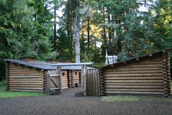
•Fort Astoria — former fortified trading post in Oregon, USA
•Astoria Column — tower in Astoria, Oregon, United States
•John Jacob Astor Hotel — historic former hotel in Astoria, Oregon, USA
Doable as a same-day drive at 5h 56m. Total distance: 258.6 miles.
Family Friendly
Moderate complexity with 1 natural rest stops along the way.
Solo Traveler
5h 56m drive, comfortable solo distance.
Scenic Drive
Mostly surface roads route profile with national parks nearby.
Frequently Asked Questions
The longest stretch is about 78.9 miles on North Santiam Highway. The full list of main roads is in the Roads section above.
Yes — we found about 14 rest areas or service plazas within a short detour of the route (from OpenStreetMap). See the Rest Stops tab under Nearby Places for locations and mile markers. Plan to stretch, use the bathroom, and top off fluids every 2–3 hours on longer drives.
It helps. This route has a higher-than-average number of complex decision points, which get harder in the dark. If the last hour of the trip is on surface roads or mountain grades, aim to arrive at Astoria, OR before sunset when you can. Check the Trip Plan for departure windows that land you in daylight.
Only with planning. This is a long drive for kids — consider splitting it into two days rather than pushing through. Plan at least 1 meaningful breaks. There are 14 rest areas along the route for bathroom stops.
The main spots that need attention: at 4 miles (US 20 / McKenzie-Bend Highway): Roundabout - know your exit number before entering; at 21.8 miles (South Locust Street): Roundabout - know your exit number before entering; at 128.2 miles (I 5; OR 99E): Exit ramp - move to the correct lane early. Lane positioning matters here.
Yes — Lewis and Clark National Historical Park. See the National Parks section for detour distances and tips on detours.
Not recommended in a single day. At 5.9 hours each way, a round trip means 11.9 hours of driving — that is an unsafe level of fatigue for most drivers. Plan at least one night at Astoria, OR before the return drive.