Traveling from Newport to West Raleigh covers 140.6 miles through the heart of North Carolina, typically taking about 2 hours and 29 minutes. Because this is a turn-heavy local drive rather than a high-speed interstate route, you should plan on this being a single-day trip. Budgeting approximately $23 for fuel will cover your transit costs, making this an affordable journey. Since both locations are situated within the Southeast region, you will experience a consistent cultural and geographic transition as you move inland. The route is straightforward enough that you won't need to worry about overnight logistics, allowing you to complete the transit in one comfortable stretch.
Trip Pace
Same-day drive is realistic
A same-day return is realistic if you keep stops short.
Break Rhythm
1 planned break
A short stop every 2 to 3 hours is enough for this drive.
Midpoint
71 miles from Newport, NC
A natural place for your longest stop of the day
, about 1h 28m into the drive
.
Main Roads
Road
Distance
Duration
US 70
80.6 mi
1h 39m
Goldsboro Bypass
20.2 mi
21m
I 40
10.8 mi
12m
US 70 BYP
10.1 mi
12m
Clayton Bypass Scenic Byway
10 mi
11m
Chatham Street
3 mi
5m
West New Bern Road
2.1 mi
3m
West Vernon Avenue
1.6 mi
2m
Longest stretch:
US 70
— 80.6 mi, about 1h 39m
Turn-by-Turn Driving Directions
Step-by-step road directions between Newport, NC and West Raleigh, NC.
1
Start on West Railroad Boulevard
76 ft·10 sec·West Railroad Boulevard
2
Turn sharp left onto Chatham Street
3.0 mi·5 min·Chatham Street
3
Merge onto US 70
57 mi·1 hr 9 min·US 70
Use the straight lane.
4
Keep slight right at fork onto US 70; US 258
2.1 mi·3 min·West New Bern Road
Use the straight lane.
5
Continue on US 70; US 258
1.6 mi·2 min·West Vernon Avenue
Use the straight / right lanes.
6
Continue on US 70
9.6 mi·11 min·US 70
Use the straight lane.
7
Continue on I 42
20 mi·21 min·Goldsboro Bypass
8
Continue on US 70
1.2 mi·1 min·US 70
Use the straight lane.
9
Continue on US 70
10 mi·14 min·US 70
Use the straight lane.
10
Continue on US 70
2.0 mi·2 min·US 70
Use the straight lane.
11
Keep slight left at fork onto US 70 BYP
10 mi·12 min·US 70 BYP
12
Continue on I 42
10.0 mi·11 min·Clayton Bypass Scenic Byway
13
Merge onto I 40
11 mi·12 min·I 40
Use the straight / slight right lanes.
14
Take the exit
0.3 mi·30 sec
Exit 298BToward NC 50 North, US 401 North, US 70 West: Raleigh DowntownUse the right lane.
15
Turn straight onto US 70; US 401; NC 50
0.9 mi·1 min·South Saunders Street
Use the straight / right lanes.
16
Turn slight right
0.3 mi·43 sec
Toward Martin Luther King Junior Boulevard, Western Boulevard
17
Turn straight onto Martin Luther King Jr Boulevard
0.2 mi·26 sec·Martin Luther King Jr Boulevard
18
Continue on Western Boulevard
1.2 mi·2 min·Western Boulevard
Use the straight / right lanes.
19
Turn slight right
429 ft·10 sec
Toward Pullen Road
20
Turn right onto Pullen Road
0.4 mi·1 min·Pullen Road
21
Enter roundabout onto Pullen Road
63 ft·2 sec·Pullen Road
22
Continue on Pullen Road
0.1 mi·25 sec·Pullen Road
23
Enter roundabout onto Hillsborough Street
205 ft·6 sec·Hillsborough Street
24
Continue on Hillsborough Street
503 ft·14 sec·Hillsborough Street
25
Turn right onto Enterprise Street
44 ft·1 sec·Enterprise Street
26
Arrive at destination
Enterprise Street
Trip Plan
Given the turn-heavy nature of this 2-hour and 29-minute drive, try to depart during daylight hours to ensure better visibility for navigation. Since there are no designated stops in the plan, you have the flexibility to pull over whenever you need a break, but keep an eye on your fuel gauge to stay within your $23 budget. Because you are navigating local roads exclusively, keep your GPS updated to handle the numerous turns along Chatham Street and West Vernon Avenue. A helpful tip for this specific route is to account for extra travel time beyond the base duration, as local traffic patterns can be more unpredictable than highway travel. Stay alert at intersections, as the constant shifting between local routes requires steady focus throughout the entire 140.6-mile journey.
Morning Departure
Leave by 9 AM and you'll arrive before lunch.
Evening Departure
Even a 4 PM departure gets you there before dark in summer.
You can normally do this drive in one day.
Plan roughly 1 meaningful break for fuel, food, and rest.
The halfway point lands around 71 miles from Newport, NC, or about 1h 28m into the drive.
The longest continuous stretch on this route runs about 80.6 miles.
This is a comfortable same-day trip.
Departure
Before you leave
Start with fuel, water, and navigation already sorted so the first hour feels easy.
First stop
Around 31 miles or 39m in
Use this first pause for coffee, a restroom break, and a quick traffic check ahead.
Halfway reset
Around 71 miles or 1h 28m in
This is the best place for your longest stop, a real meal, and a full fuel check.
Final approach
Final hour starts around 2h 22m
Traffic, exits, and arrival timing usually matter more near West Raleigh, NC than in the middle of the route.
Before You Leave
+
Open the route before leaving Newport, NC so your first major turns are already loaded.
+
Leave with enough water and a charging cable within reach, not packed away.
+
Check your fuel range against the first long segment, especially if you are starting outside city service areas.
Day 1
Settle into the route from Newport, NC
This is one driving day of about 142 miles and 2h 55m.
Your first comfortable stop window is around 31 miles from Newport, NC.
This route can stay practical as a one-day drive if traffic stays reasonable.
Plan about 1 real break rather than only quick fuel stops.
The longest stretch is on US 70 for about 80.6 miles.
Where to Stop
Rest stops, refuel points, and overnight suggestions along this route.
Place data sourced from public business listings. Hours and availability may vary.
Heads-up: tricky spots
5 of 12
5 decision points cluster between mile 0 and 138.3 — GPS handles the exact turns, but know they're coming. Your lane choice matters more than the turn itself.
5
0 mi into trip|~0m in|Chatham Street
Turn sharp left onto Chatham Street
Sharp turn - reduce speed on approach
5
3 mi into trip|~5m in|US 70
Merge onto US 70
Merge point - match speed before joining. Lane positioning matters here
Use the straight lane.
6
60.4 mi into trip|~1h 15m in|US 70; US 258 / West New Bern Road
Keep slight right at fork onto US 70; US 258 / West New Bern Road
Highway fork - watch signs carefully. Lane positioning matters here
Use the straight lane.
5
127.5 mi into trip|~2h 35m in|I 40
Merge onto I 40
Merge point - match speed before joining. Lane positioning matters here
Use the straight / slight right lanes.
8
138.3 mi into trip|~2h 47m in
Take the exit toward NC 50 North, US 401 North, US 70 West: Raleigh Downtown
Exit ramp - move to the correct lane early. Lane positioning matters here. Multiple destination signs - pick the right one
Use the right lane.
Exit 298B
Toward NC 50 North, US 401 North, US 70 West: R...
Fuel & Cost
Regular Gas
$22.21 one way
$44.41 round trip
$3.97/gal25.4 MPG avg50 kg CO2
Fuel Type
$/gal
One Way
Round Trip
midgrade
$4.34
$24.28
$48.56
premium
$4.70
$26.28
$52.56
diesel
$5.61
$31.35
$62.70
No toll roads detected on this route.
Estimated Trip Cost (one way, 1 person)
Fuel
$22
Meals
$25–$50
Total
$47–$72
Rough estimate based on US averages. Hotel $80–$140/night, meals $25–$50/day.
Estimated CO2 emission: 49.7 kg one way.
Prices: EIA weekly data, 2026-04-13.
Driving Electric?
About $15 in charging
· 0 stops
· 66% less CO2
Vehicle Type
kWh
Stops
DC Fast
Home Charge
Average EV
42.6
0
$14.91
$6.82
Efficient EV
35.5
0
$12.42
$5.68
EV Truck/SUV
56.8
0
$19.88
$9.09
Gas CO2
50 kg
EV CO2
17 kg (66% less)
This trip is well within single-charge range for most EVs. No charging stops needed if you start fully charged.
DC fast charging avg $0.35/kWh. Home charging avg $0.16/kWh. US grid CO2: 0.39 kg/kWh.
Travel Intel
Current conditions at both ends of the drive.
Forecast as of Apr 15, 2026
Origin
Newport, NC
Night
in Newport on Saturday
Local time
10:50 PM
EDT
Current temp
52°F
Unavailable
Live forecast
Destination
West Raleigh, NC
Night
in West Raleigh on Saturday
Local time
10:50 PM
EDT
Current temp
59°F
Unavailable
Live forecast
Seasonal Notes
Summer travel usually means heavier construction, hotter rest stops, and busier weekend traffic around major cities.
Winter travel shortens daylight, so a route that looks manageable on paper can feel much longer after dark.
Holiday weekends tend to make both departure and arrival windows slower than the raw route time suggests.
Time zone
Same local time
Origin and destination are on the same clock, so arrival timing is easier to judge at a glance.
Temperature spread
7 degrees warmer at arrival
A meaningful temperature swing is a good cue to rethink layers, water, and how soon you want to arrive.
Road read
2h 55m on the road
Use the two city cards together: check the sky where you start, then compare it with the local time and temperature at arrival.
Weather data from the National Weather Service. Conditions may change; check closer to your travel date.
National Parks Near This Route
Worth a detour if your schedule allows.
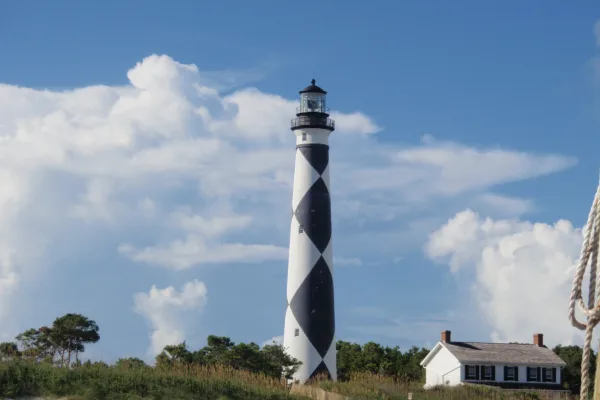
Cape Lookout National Seashore
National Seashore
A boat ride three miles off-shore brings you to the barrier islands of Cape Lookout National Seashore. Horse watching, shelling, fishing, birding, camping, lighthouse climbing, and touring historic vi...
Park data from the National Park Service API. Alerts update every 2 hours.
More Details
What kind of drive is this?
Expect a hands-on experience behind the wheel, as this 140.6-mile trek relies entirely on local roads rather than major interstates. With a 0% highway share, you will be navigating through Chatham Street, West New Bern Road, and West Vernon Avenue for the duration of the trip. The road’s personality is defined by its turn-heavy nature, requiring your full attention compared to a monotonous highway cruise. Because there are no long, uninterrupted stretches of freeway, the drive maintains a consistent, local pace from start to finish. You should be prepared for frequent adjustments and a more engaging, tactical driving environment.
71% highway — fuel and pacing are the main things to plan.
26 navigation steps total — most of the decisions cluster near the start and finish.
Longest single stretch: 80.6 mi on US 70.
How Hard Is This Drive?
7/10
This is a straightforward highway drive that stays mostly on US 70 and Goldsboro Bypass. This route has several spots where lane changes, forks, or exits need your full attention. The trickiest moment comes early in the drive near Chatham Street.
Driving Effort7/10
Demanding - plan breaks and stay ahead of the key maneuvers
Balances navigation complexity with total wheel time.
This is a demanding drive. With 12 significant decision points across 142 miles, you will need to stay alert - especially through interchange areas and urban stretches. Consider splitting it into segments if you are not comfortable with fast highway navigation.
Where does it get tricky?
The main spots that need attention: near the start (Chatham Street): Sharp turn - reduce speed on approach; at 3 miles (US 70): Merge point - match speed before joining. Lane positioning matters here; at 60.4 miles (US 70; US 258 / West New Bern Road): Highway fork - watch signs carefully. Lane positioning matters here.
Newport is a small town just outside the Crystal Coast region of North Carolina, situated on the scenic Newport River. Because it's inland, away from the touristy coastal area, and doesn't have much in the way of attractions, Newport remains a mostly residential community. However, it's in the Croatan National Forest, so if you want a convenient base to reach both the beach and the woods, Newport might be the ideal spot.
Doable as a same-day drive at 2h 55m. Total distance: 142 miles.
Family Friendly
Moderate complexity with 1 natural rest stops along the way.
Solo Traveler
2h 55m drive, comfortable solo distance.
First-Time Driver
Mostly highway driving (71%). Some complex stretches to watch for.
Frequently Asked Questions
The longest stretch is about 80.6 miles on US 70. The full list of main roads is in the Roads section above.
It helps. This route has a higher-than-average number of complex decision points, which get harder in the dark. If the last hour of the trip is on surface roads or mountain grades, aim to arrive at West Raleigh, NC before sunset when you can. Check the Trip Plan for departure windows that land you in daylight.
Only with planning. This is a long drive for kids — consider splitting it into two days rather than pushing through. Plan at least 1 meaningful breaks. Dedicated rest areas are limited, so plan gas or food stops as your bathroom breaks.
The main spots that need attention: near the start (Chatham Street): Sharp turn - reduce speed on approach; at 3 miles (US 70): Merge point - match speed before joining. Lane positioning matters here; at 60.4 miles (US 70; US 258 / West New Bern Road): Highway fork - watch signs carefully. Lane positioning matters here.
Yes — Cape Lookout National Seashore. See the National Parks section for detour distances and tips on detours.
Yes. A round trip is manageable in a single day if you plan a break at West Raleigh, NC before heading back.