Traveling from Murfreesboro to Pine Bluff covers 116.7 miles of Arkansas landscape, typically taking about 2 hours and 38 minutes behind the wheel. Because this is a manageable distance, it works perfectly as a single-day trip, meaning you won't need to worry about booking an overnight stay. You can expect to spend roughly $18 on fuel for the journey, making it a budget-friendly option for your schedule. The route primarily utilizes US 270, I-30, and AR 26 to navigate through the southeastern part of the state. It is a straightforward, highway-focused drive that connects these two regional hubs efficiently. Whether you are heading out for business or a quick change of scenery, this path provides a reliable link between the two cities.
Trip Pace
Same-day drive is realistic
A same-day return is realistic if you keep stops short.
Break Rhythm
1 planned break
A short stop every 2 to 3 hours is enough for this drive.
Midpoint
58.3 miles from Murfreesboro, AR
A natural place for your longest stop of the day
, about 1h 28m into the drive
.
Main Roads
Road
Distance
Duration
US 270
44.4 mi
51m
I 30
26.2 mi
26m
AR 26
21 mi
36m
Highway 26
9.9 mi
17m
US 65B
5.6 mi
9m
Hollywood Road
4.7 mi
8m
I 530
1 mi
<1m
State Highway 19/State Highway 26/13th Street
0.9 mi
1m
Longest stretch:
US 270
— 44.4 mi, about 51m
Turn-by-Turn Driving Directions
Step-by-step road directions between Murfreesboro, AR and Pine Bluff, AR.
1
Start on Courthouse Square
92 ft·7 sec·Courthouse Square
2
Turn sharp right onto AR 27
154 ft·3 sec·Main Street
3
Continue on AR 27
0.5 mi·55 sec·North Washington Avenue
4
Continue on AR 19; AR 27
0.5 mi·52 sec·East 13th Street
5
Turn right onto AR 19; AR 26
0.9 mi·1 min·State Highway 19/State Highway 26/13th Street
6
Continue on AR 19; AR 26
9.9 mi·17 min·Highway 26
7
Continue on AR 19; AR 26
0.9 mi·1 min·Antioch Street
8
Turn slight left onto AR 26
21 mi·36 min·AR 26
9
Continue on AR 51
4.7 mi·8 min·Hollywood Road
10
At end of road, turn right onto AR 8; AR 51
0.3 mi·31 sec·Pine Street
11
Take the ramp
0.3 mi·29 sec
Toward AR 8, AR 26, AR 51: Arkadelphia
12
Merge onto I 30
26 mi·26 min·I 30
13
Take the exit onto US 270
0.4 mi·40 sec·US 270
Toward US 270 East: Malvern
14
Turn right onto US 270
44 mi·50 min·US 270
Use the straight lane.
15
Take the exit
0.3 mi·39 sec
16
Merge onto I 530; US 65
1.0 mi·57 sec·I 530; US 65
17
Take the exit onto US 65B
5.6 mi·9 min·US 65B
18
Turn right onto North Pine Street
302 ft·18 sec·North Pine Street
19
Turn left onto West Barraque Street
312 ft·15 sec·West Barraque Street
20
Turn right onto South Main Street
349 ft·15 sec·South Main Street
21
Arrive at destination
South Main Street
Trip Plan
Since this is a relatively short drive, you have plenty of flexibility to plan your departure around your personal schedule rather than rushing to beat the clock. You should aim to complete the trip with a single, well-timed stop, which is plenty for a journey of this duration. Keep a close eye on your fuel gauge before leaving Murfreesboro, as the steady highway pace will consume your estimated $18 fuel budget consistently. Because the route relies heavily on major thoroughfares like I-30, check for any traffic alerts on those specific interstates before you head out. Prioritizing a mid-trip break during that 44.4-mile stretch on US 270 will help keep you alert and refreshed as you approach Pine Bluff.
Morning Departure
Leave by 9 AM and you'll arrive before lunch.
Evening Departure
Even a 4 PM departure gets you there before dark in summer.
You can normally do this drive in one day.
Plan roughly 1 meaningful break for fuel, food, and rest.
The halfway point lands around 58.3 miles from Murfreesboro, AR, or about 1h 28m into the drive.
The longest continuous stretch on this route runs about 44.4 miles.
This is a comfortable same-day trip.
Departure
Before you leave
Start with fuel, water, and navigation already sorted so the first hour feels easy.
First stop
Around 26 miles or 45m in
Use this first pause for coffee, a restroom break, and a quick traffic check ahead.
Halfway reset
Around 58.3 miles or 1h 28m in
This is the best place for your longest stop, a real meal, and a full fuel check.
Final approach
Final hour starts around 2h 10m
Traffic, exits, and arrival timing usually matter more near Pine Bluff, AR than in the middle of the route.
Before You Leave
+
Open the route before leaving Murfreesboro, AR so your first major turns are already loaded.
+
Leave with enough water and a charging cable within reach, not packed away.
+
Check your fuel range against the first long segment, especially if you are starting outside city service areas.
Day 1
Settle into the route from Murfreesboro, AR
This is one driving day of about 116.7 miles and 2h 38m.
Your first comfortable stop window is around 26 miles from Murfreesboro, AR.
This route can stay practical as a one-day drive if traffic stays reasonable.
Plan about 1 real break rather than only quick fuel stops.
The longest stretch is on US 270 for about 44.4 miles.
Where to Stop
Rest stops, refuel points, and overnight suggestions along this route.
Place data sourced from public business listings. Hours and availability may vary.
Heads-up: tricky spots
5 of 13
5 decision points cluster between mile 0 and 116.6 — GPS handles the exact turns, but know they're coming. Your lane choice matters more than the turn itself.
6
0 mi into trip|~0m in|AR 27 / Main Street
Turn sharp right onto AR 27 / Main Street
Sharp turn - reduce speed on approach
6
38.7 mi into trip|~1h 8m in
Take the ramp toward AR 8, AR 26, AR 51: Arkadelphia
Multiple destination signs - pick the right one
Toward AR 8, AR 26, AR 51: Arkadelphia
5
65.7 mi into trip|~1h 35m in|US 270
Turn right onto US 270
Lane positioning matters here
Use the straight lane.
5
116.5 mi into trip|~2h 38m in|West Barraque Street
Turn left onto West Barraque Street
Navigation decision point
5
116.6 mi into trip|~2h 38m in|South Main Street
Turn right onto South Main Street
Navigation decision point
Fuel & Cost
Regular Gas
$17.62 one way
$35.25 round trip
$3.84/gal25.4 MPG avg41 kg CO2
Fuel Type
$/gal
One Way
Round Trip
midgrade
$4.21
$19.35
$38.69
premium
$4.56
$20.95
$41.89
diesel
$5.61
$25.77
$51.53
No toll roads detected on this route.
Estimated Trip Cost (one way, 1 person)
Fuel
$18
Meals
$25–$50
Total
$43–$68
Rough estimate based on US averages. Hotel $80–$140/night, meals $25–$50/day.
Estimated CO2 emission: 40.8 kg one way.
Prices: EIA weekly data, 2026-04-13.
Driving Electric?
About $12 in charging
· 0 stops
· 66% less CO2
Vehicle Type
kWh
Stops
DC Fast
Home Charge
Average EV
35
0
$12.25
$5.60
Efficient EV
29.2
0
$10.21
$4.67
EV Truck/SUV
46.7
0
$16.34
$7.47
Gas CO2
41 kg
EV CO2
14 kg (66% less)
This trip is well within single-charge range for most EVs. No charging stops needed if you start fully charged.
DC fast charging avg $0.35/kWh. Home charging avg $0.16/kWh. US grid CO2: 0.39 kg/kWh.
Travel Intel
Current conditions at both ends of the drive.
Forecast as of Apr 14, 2026
Origin
Murfreesboro, AR
Morning
in Murfreesboro on Sunday
Local time
11:10 AM
CDT
Current temp
63°F
Slight Chance Showers And Thunderstorms then Mostly Cloudy
S 5 mph20% chanceLive forecast
Destination
Pine Bluff, AR
Morning
in Pine Bluff on Sunday
Local time
11:10 AM
CDT
Current temp
77°F
Unavailable
Live forecast
Seasonal Notes
Summer travel usually means heavier construction, hotter rest stops, and busier weekend traffic around major cities.
Winter travel shortens daylight, so a route that looks manageable on paper can feel much longer after dark.
Holiday weekends tend to make both departure and arrival windows slower than the raw route time suggests.
Time zone
Same local time
Origin and destination are on the same clock, so arrival timing is easier to judge at a glance.
Temperature spread
14 degrees warmer at arrival
A meaningful temperature swing is a good cue to rethink layers, water, and how soon you want to arrive.
Road read
2h 38m on the road
The weather snapshot is not static. If you are leaving later, give both cities one more quick forecast check before departure.
Weather data from the National Weather Service. Conditions may change; check closer to your travel date.
National Parks Near This Route
Worth a detour if your schedule allows.
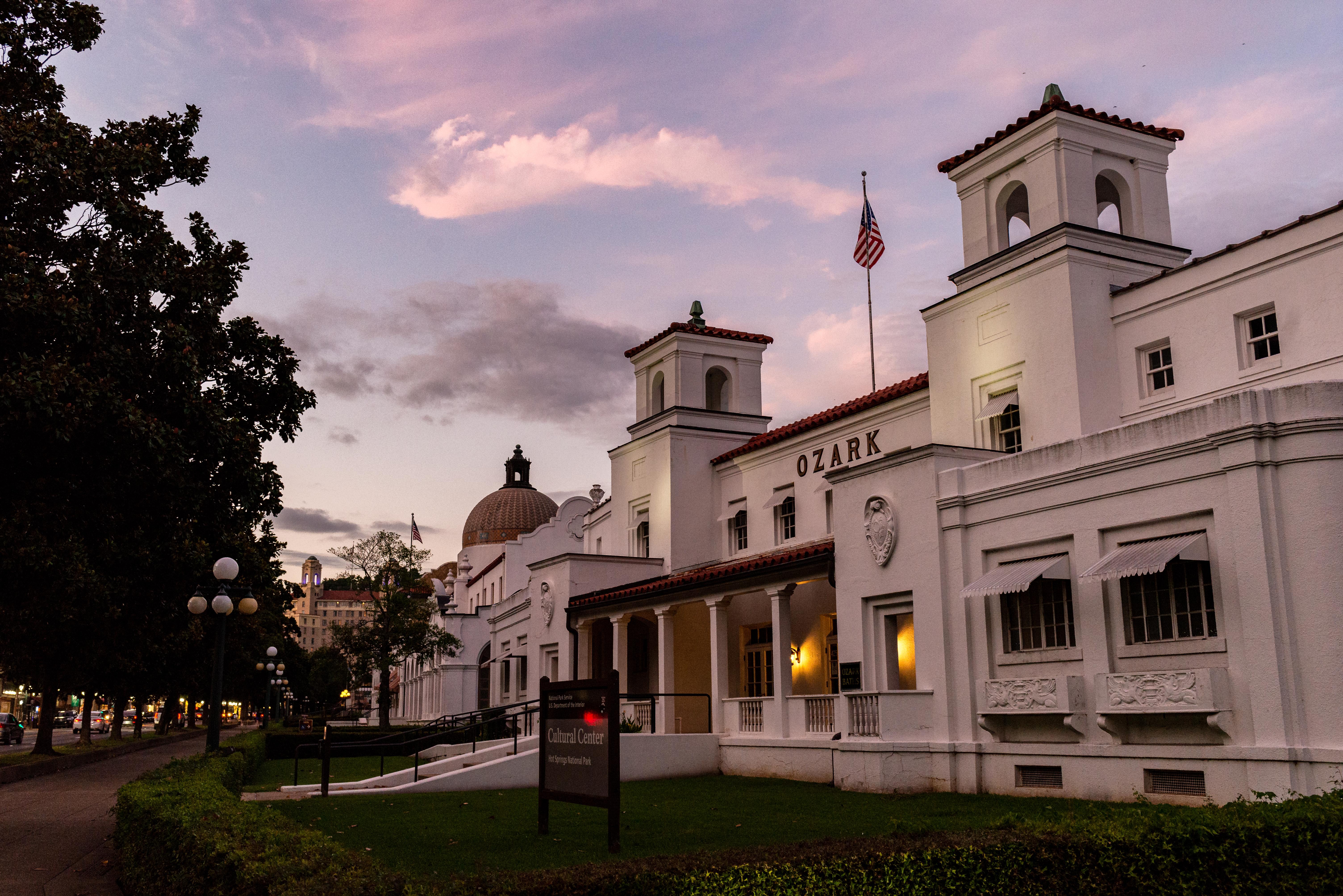
Hot Springs National Park
National Park
Hot Springs National Park has a rich cultural past. The grand architecture of our historic bathhouses is equally matched by the natural curiosities that have been drawing people here for hundreds of y...
16 mi from route
~39 min detour
Free
near mile 60.3
Park data from the National Park Service API. Alerts update every 2 hours.
More Details
What kind of drive is this?
Expect a drive dominated by high-speed transit, as 93% of the journey consists of highway travel. You will spend a significant portion of your time on major routes, including a longest uninterrupted stretch of 44.4 miles on US 270. The transition between these roads creates a consistent, fast-paced rhythm that keeps you moving toward your destination without many technical detours. While the highway-heavy profile ensures you cover ground quickly, be prepared for the steady focus required when staying on major arteries for most of the 116.7-mile trip. It is a functional, efficient route that prioritizes speed and directness over winding local backroads.
93% highway — fuel and pacing are the main things to plan.
21 navigation steps total — most of the decisions cluster near the start and finish.
Longest single stretch: 44.4 mi on US 270.
How Hard Is This Drive?
5/10
This is a straightforward highway drive that stays mostly on US 270 and I 30. You will hit about 13 points where you need to pay attention to lane position or signs. The trickiest moment comes early in the drive near AR 27 / Main Street.
Driving Effort5/10
Moderate - straightforward overall, but long enough or busy enough to require pacing
Balances navigation complexity with total wheel time.
This drive requires moderate attention. Across 116.7 miles you will encounter 13 spots where lane choice or exit timing matters. Not difficult for experienced highway drivers, but worth previewing the tricky sections before you go.
Where does it get tricky?
The main spots that need attention: near the start (AR 27 / Main Street): Sharp turn - reduce speed on approach; at 38.7 miles: Multiple destination signs - pick the right one; at 65.7 miles (US 270): Lane positioning matters here.
Doable as a same-day drive at 2h 38m. Total distance: 116.7 miles.
Family Friendly
Moderate complexity with 1 natural rest stops along the way.
Solo Traveler
2h 38m drive, comfortable solo distance.
First-Time Driver
Mostly highway driving (93%). Some complex stretches to watch for.
Frequently Asked Questions
The longest stretch is about 44.4 miles on US 270. The full list of main roads is in the Roads section above.
Yes, with realistic expectations. Build in a stop roughly every 2 hours, have snacks and activities ready, and check the Nearby Places tabs for kid-friendly stops along the way.
The main spots that need attention: near the start (AR 27 / Main Street): Sharp turn - reduce speed on approach; at 38.7 miles: Multiple destination signs - pick the right one; at 65.7 miles (US 270): Lane positioning matters here.
Yes — Hot Springs National Park. See the National Parks section for detour distances and tips on detours.
Yes. A round trip is manageable in a single day if you plan a break at Pine Bluff, AR before heading back.