Service Plaza
0 mi from route
Compiled and reviewed by the US Trip Planner planning team at COD Solutions Oy · Last reviewed Jul 19, 2026 · Editorial standards
Drive Time
4h 21m
Distance
221.5 mi
357 km
Drive Score
8/10
Great drive
Same Day?
Yes, doable
Fuel Cost
$35
one way
EV Charging
Unknown
Estimated drive times based on typical traffic patterns. Actual times may vary with weather, construction, and real-time conditions.

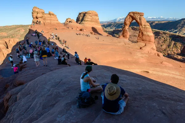
Moab, UT
Wikimedia Commons

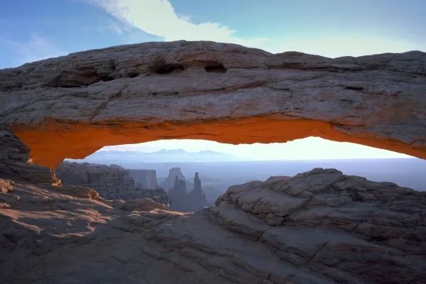
Sandy, UT
Wikimedia Commons
Moab to Sandy is 221.5 miles and takes about 4h 21m via Dinosaur Diamond Prehistoric Highway, Veterans Memorial Highway, and Main Street, with a fuel budget near $35 and enough daylight to finish in a day. This trip stays within Utah's Mountain West region, offering a mostly surface road experience. It's a straightforward drive, ideal for a single day if you're looking to connect these two points without a lengthy detour. Plan for around 172 miles on the main stretch, giving you plenty of time to enjoy the scenery and arrive comfortably.
Trip Pace
Same-day drive is realistic
A same-day return is possible, but it will make for a full day on the road.
Break Rhythm
1 planned break
Plan on a short reset every 3 to 4 hours to stay fresh behind the wheel.
Midpoint
110.8 miles from Moab, UT
A natural place for your longest stop of the day , about 2h 10m into the drive .
| Road | Distance | Duration |
|---|---|---|
| Dinosaur Diamond Prehistoric Highway | 172.1 mi | 3h 18m |
| Veterans Memorial Highway | 37.4 mi | 40m |
| Main Street | 4.2 mi | 8m |
| East US-6 | 3.6 mi | 4m |
| State Street | 1 mi | 1m |
| US 6 | 0.8 mi | 1m |
| West Highway Drive | 0.5 mi | <1m |
| US 191 | 0.5 mi | <1m |
Hour-of-day weekday pattern from 174 FHWA count stations on your route.
Peak
4 PM
~7,643 veh/hr typical
Quietest
2 AM
~333 veh/hr
Peak-to-quiet ratio
23×
busier at peak than in the quiet hours
Averaged across 52 weeks of 2023 FHWA Travel Monitoring Analysis System data. Weekday hours only (Mon–Fri).
Step-by-step road directions between Moab, UT and Sandy, UT.
Start on Center Street
Turn sharp right onto US 191
Continue on US 191
Take the exit onto US 191
Merge onto I 70; US 6; US 50; US 191
Take the exit onto US 6; US 191
Merge onto US 6; US 191
Continue on US 6; US 191
Continue on US 6; US 191
Continue on US 6; US 191
Continue on US 6
Continue on US 6
Continue on US 6
Continue on US 6
Take the exit
Merge onto I 15
Take the exit
Keep slight right at fork
Turn right onto SR 209
Turn left onto US 89
Turn right onto 8800 South
Arrive at destination
Given the 4h 21m duration, leaving Moab in the morning is best to maximize daylight. With only one recommended stop and a short drive time, you have flexibility in pacing. Keep an eye on your fuel, especially on the 172.1-mile stretch of Dinosaur Diamond Prehistoric Highway, and budget around $35 for fuel. The route's profile is mostly surface roads, so anticipate typical traffic patterns and speed limits associated with that. You can easily complete this drive in one day without needing an overnight stay.
Morning Departure
An early start around 7-8 AM gets you there with plenty of daylight left.
Evening Departure
A late afternoon start means arriving after dark. Morning is better.
This is a comfortable same-day trip.
Departure
Before you leave
Start with fuel, water, and navigation already sorted so the first hour feels easy.
First stop
Around 49 miles or 57m in
Use this first pause for coffee, a restroom break, and a quick traffic check ahead.
Halfway reset
Around 110.8 miles or 2h 10m in
This is the best place for your longest stop, a real meal, and a full fuel check.
Final approach
Final hour starts around 3h 36m
Traffic, exits, and arrival timing usually matter more near Sandy, UT than in the middle of the route.
Open the route before leaving Moab, UT so your first major turns are already loaded.
Leave with enough water and a charging cable within reach, not packed away.
Check your fuel range against the first long segment, especially if you are starting outside city service areas.
Day 1
Settle into the route from Moab, UT
This is one driving day of about 221.5 miles and 4h 21m.
Rest stops, refuel points, and overnight suggestions along this route.

Mid-route town
Meal stop
111 mi into the route
Best for: Lunch, fuel, and a longer reset
This sits close to the middle of the route, so it works well for the longest stop of the day.
A short stop after about 49 miles helps settle the day before fatigue starts building.
The midpoint is around 110.8 miles from Moab, UT, which is a good place for a longer meal and fuel stop.
Before the longest stretch
Fuel checkTop up before Dinosaur Diamond Prehistoric Highway if your tank is already low. That segment runs about 172.1 miles.
These stop ideas are pacing suggestions — the exact town or exit can change with traffic, hotel plans, and fuel range.
Picked by where they fit in your drive — first break, midpoint reset, final stretch.
Place data sourced from public business listings. Hours and availability may vary.
5 decision points cluster between mile 31.5 and 220.4 — GPS handles the exact turns, but know they're coming. Your lane choice matters more than the turn itself.
Take the exit onto US 191 toward I-70 West
Exit ramp - move to the correct lane early
Take the exit onto US 6; US 191 toward US 6 West, US 191 North: Price, Salt Lake City
Exit ramp - move to the correct lane early. Multiple destination signs - pick the right one
Take the exit toward I 15 North: Salt Lake City
Exit ramp - move to the correct lane early. Lane positioning matters here
Take the exit toward SR 209: 9000 South
Exit ramp - move to the correct lane early. Lane positioning matters here
Keep slight right at fork toward SR 209: Snowbird, Alta, Sandy
Highway fork - watch signs carefully. Multiple destination signs - pick the right one
Regular Gas
$34.52 one way
$69.05 round trip
| Fuel Type | $/gal | One Way | Round Trip |
|---|---|---|---|
| midgrade | $4.17 | $36.39 | $72.78 |
| premium | $4.47 | $39.02 | $78.03 |
| diesel | $4.80 | $41.82 | $83.65 |
No toll roads detected on this route.
Estimated Trip Cost (one way, 1 person)
Fuel
$35
Meals
$25–$50
Total
$60–$85
Rough estimate based on US averages. Hotel $80–$140/night, meals $25–$50/day.
Estimated CO2 emission: 77.5 kg one way. Prices: EIA weekly data, 2026-07-13.
Driving Electric?
About $23 in charging · 0 stops · 66% less CO2
| Vehicle Type | kWh | Stops | DC Fast | Home Charge |
|---|---|---|---|---|
| Average EV | 66.5 | 0 | $23.26 | $10.63 |
| Efficient EV | 55.4 | 0 | $19.38 | $8.86 |
| EV Truck/SUV | 88.6 | 1 | $31.01 | $14.18 |
Gas CO2
77 kg
EV CO2
26 kg (66% less)
Plan for 0 charging stops, roughly every 270 miles. Allow 25-40 minutes per stop at a DC fast charger.
DC fast charging avg $0.35/kWh. Home charging avg $0.16/kWh. US grid CO2: 0.39 kg/kWh.
Current conditions at both ends of the drive.
Origin
Late night in Moab on Sunday
Local time
4:49 AM
MDT
Current temp
96°F
Slight Chance Showers And Thunderstorms
Flash Flood Warning
Flash Flood Warning issued July 18 at 1:16PM MDT until July 18 at 5:15PM MDT by NWS Salt Lake City UT
Flood Watch
Flood Watch issued July 18 at 11:54AM MDT until July 19 at 12:00AM MDT by NWS Salt Lake City UT
Destination
Late night in Sandy on Sunday
Local time
4:49 AM
MDT
Current temp
95°F
Slight Chance Showers And Thunderstorms
Flash Flood Warning
Flash Flood Warning issued July 18 at 1:16PM MDT until July 18 at 5:15PM MDT by NWS Salt Lake City UT
Flood Watch
Flood Watch issued July 18 at 11:54AM MDT until July 19 at 12:00AM MDT by NWS Salt Lake City UT
Seasonal Notes
Summer travel usually means heavier construction, hotter rest stops, and busier weekend traffic around major cities.
Winter travel shortens daylight, so a route that looks manageable on paper can feel much longer after dark.
Holiday weekends tend to make both departure and arrival windows slower than the raw route time suggests.
Time zone
Origin and destination are on the same clock, so arrival timing is easier to judge at a glance.
Temperature spread
A meaningful temperature swing is a good cue to rethink layers, water, and how soon you want to arrive.
Road read
An early start around 7-8 AM gets you there with plenty of daylight left.
Weather data from the National Weather Service. Conditions may change; check closer to your travel date.
Worth a detour if your schedule allows.
National Park
Discover a landscape of contrasting colors, land forms, and textures unlike any other. The park has over 2,000 natural stone arches, hundreds of soaring pinnacles, massive rock fins, and giant balance...

National Monument
The visitor center, caves, and cave tours have not yet opened for the 2026 season. Hike your way past stunning vistas to explore a hidden underground world. Taste the thrill of caving as you twist and...
National Park
Canyonlands is a wilderness of canyons, buttes, and spires carved by the Colorado River and Green River. The park is divided into four distinct districts; no roads join them together. The districts sh...
Park data from the National Park Service API. Alerts update every 2 hours.
This route covers 221.5 miles, with a highway share of 2, meaning most of your time will be on surface roads. The longest continuous stretch on Dinosaur Diamond Prehistoric Highway is 172.1 miles. You'll transition from a significant highway segment to more local roads as you approach your destination. Expect to navigate through varied terrain, from open cruising to more built-up areas.
Expect a hands-on drive with frequent turns and local roads rather than long highway stretches. This route has several spots where lane changes, forks, or exits need your full attention. The trickiest moment comes around 31.5 miles in near US 191.
Demanding - plan breaks and stay ahead of the key maneuvers
Balances navigation complexity with total wheel time.
This is a demanding drive. With 12 significant decision points across 221.5 miles, you will need to stay alert - especially through interchange areas and urban stretches. Consider splitting it into segments if you are not comfortable with fast highway navigation.
Where does it get tricky?
The main spots that need attention: at 31.5 miles (US 191): Exit ramp - move to the correct lane early; at 55.4 miles (US 6; US 191): Exit ramp - move to the correct lane early. Multiple destination signs - pick the right one; at 182.4 miles: Exit ramp - move to the correct lane early. Lane positioning matters here.
High-altitude sections with notable climbs
Total Climb
3,915 ft
Total Descent
3,480 ft
Highest Point
7,316 ft
~142.4 mi in
Elevation Range
3,284 ft
Notable High Points
Based on OSRM destination-sign hints, not a full list of every settlement the road passes.
On the drive from Moab, UT to Sandy, UT, road signs begin pointing toward Salt Lake City along the way.
Salt Lake City
Founded 1878
Moab is a town in the Utah's Canyon Country and a gateway to the nearby Arches National Park and other attractions in Canyon Country.
Top landmarks
Founded 1871
Sandy is a city just south of Salt Lake City in Utah's Wasatch Range. It is one of the major suburbs of Salt Lake City.
Top landmarks
City content from Wikivoyage (CC BY-SA 4.0) and Wikidata (CC0).
Weekend Trip
Doable as a same-day drive at 4h 21m. Total distance: 221.5 miles.
Family Friendly
Moderate complexity with 1 natural rest stops along the way.
Solo Traveler
4h 21m drive, comfortable solo distance.
Scenic Drive
Mostly surface roads route profile with national parks nearby.
Compiled by the US Trip Planner planning team at COD Solutions Oy from open government datasets — OSRM over OpenStreetMap for geometry, EIA for fuel prices, USGS 3DEP for elevation, NPS for national parks, and FHWA TMAS for hourly traffic volumes. See our methodology for refresh cadence and limitations.
Was this helpful?
Thanks for your feedback!
Your tip has been submitted. Thanks!
/500
Recent Tips
·
Explore more options from Moab, UT or browse trips ending in Sandy, UT.
Looking for more statewide routes? Browse UT road trips.