Milford, NH to Claremont, NH is 61.9 miles and takes about 1 hour 49 minutes via NH 103, with a fuel budget near $10 and enough daylight to finish in a day. This drive stays within New Hampshire, moving from the Northeast region to the Northeast region. Expect a local, turn-heavy experience rather than a straightforward highway journey. Given its relatively short duration and local road focus, this route is best suited for a single-day trip where you can take your time and enjoy the scenery at a relaxed pace.
Trip Pace
Same-day drive is realistic
A same-day return is realistic if you keep stops short.
Midpoint
30.9 miles from Milford, NH
A natural place for your longest stop of the day
, about 58m into the drive
.
Main Roads
Road
Distance
Duration
NH 103
8.5 mi
15m
Weare Road
8 mi
15m
South Stark Highway
6.1 mi
10m
Bradford Road
6.1 mi
12m
South Main Street
4.8 mi
9m
John Stark Highway
4.6 mi
5m
Mont Vernon Road
3.6 mi
6m
State Route 114
3 mi
5m
Longest stretch:
NH 103
— 8.5 mi, about 15m
Turn-by-Turn Driving Directions
Step-by-step road directions between Milford, NH and Claremont, NH.
1
Start on NH 13
354 ft·7 sec·South Street
2
Turn straight onto NH 13
222 ft·6 sec·Mont Vernon Road
3
Continue on NH 13
2.4 mi·4 min·Mont Vernon Street
4
Continue on NH 13
4.8 mi·9 min·South Main Street
5
Continue on NH 13
3.6 mi·6 min·Mont Vernon Road
6
Continue on NH 77
0.3 mi·45 sec·High Street
7
Turn slight right onto NH 77
3.2 mi·7 min·Weare Road
8
Continue on NH 77
2.6 mi·4 min·Dustin Tavern Road
9
Turn straight onto NH 114; NH 77
6.1 mi·10 min·South Stark Highway
10
Continue on NH 114
4.7 mi·7 min·Weare Road
11
Continue on NH 114
0.3 mi·40 sec·Bridge Street
12
Continue on NH 114
0.5 mi·46 sec·Maple Street
13
Continue on NH 114
0.2 mi·16 sec·State Route 114
14
Continue on NH 114
2.9 mi·5 min·Bradford Road
15
Continue on State Route 114
2.8 mi·4 min·State Route 114
16
Continue on NH 114
2.6 mi·4 min·Henniker Road
17
Turn left onto NH 103
8.5 mi·15 min·NH 103
18
Continue on NH 103
0.2 mi·19 sec·State Route 103
19
Enter roundabout onto NH 103
264 ft·6 sec·State Route 103
20
Continue on NH 103
1.9 mi·3 min·State Route 103
21
Turn left onto Bradford Road
3.1 mi·7 min·Bradford Road
22
Continue on Maple Street
0.4 mi·59 sec·Maple Street
23
Continue on NH 11; NH 103
0.2 mi·12 sec·Elm Street
24
Continue on NH 11; NH 103
4.6 mi·5 min·John Stark Highway
25
Continue on NH 11; NH 103
2.3 mi·2 min·State Route 11
26
Continue on NH 11; NH 103
2.3 mi·2 min·Washington Street
27
Continue on NH 11; NH 103
0.1 mi·9 sec·Broad Street
28
Turn right onto NH 11; NH 103
463 ft·6 sec·Tremont Street
29
Keep slight right at fork onto NH 12; NH 103
0.7 mi·53 sec·Main Street
30
Turn right onto West Terrace Street
402 ft·18 sec·West Terrace Street
31
Turn right onto Front Street
0.2 mi·38 sec·Front Street
32
Arrive at destination
Front Street
Trip Plan
Since this is a single-day trip covering just under 62 miles, you have flexibility with your departure time. Leaving in the morning allows for plenty of daylight to complete the drive and any impromptu stops. While the drive is short, the numerous turns suggest you'll be averaging closer to 35 mph, so the 1 hour 49 minute estimate is accurate. Keep an eye on your fuel gauge; with a budget of around $10, you'll want to ensure you start with a full tank or plan a quick top-off in one of the small towns along NH 103.
Morning Departure
Leave by 9 AM and you'll arrive before lunch.
Evening Departure
Even a 4 PM departure gets you there before dark in summer.
You can normally do this drive in one day.
You may only need one short stretch break if traffic stays light.
The halfway point lands around 30.9 miles from Milford, NH, or about 58m into the drive.
The longest continuous stretch on this route runs about 8.5 miles.
This is a comfortable same-day trip.
Departure
Before you leave
Start with fuel, water, and navigation already sorted so the first hour feels easy.
First stop
Around 14 miles or 28m in
Use this first pause for coffee, a restroom break, and a quick traffic check ahead.
Halfway reset
Around 30.9 miles or 58m in
This is the best place for your longest stop, a real meal, and a full fuel check.
Final approach
Final hour starts around 1h 38m
Traffic, exits, and arrival timing usually matter more near Claremont, NH than in the middle of the route.
Before You Leave
+
Open the route before leaving Milford, NH so your first major turns are already loaded.
Day 1
Settle into the route from Milford, NH
This is one driving day of about 61.9 miles and 1h 49m.
Your first comfortable stop window is around 14 miles from Milford, NH.
This route can stay practical as a one-day drive if traffic stays reasonable.
The longest stretch is on NH 103 for about 8.5 miles.
Where to Stop
Rest stops, refuel points, and overnight suggestions along this route.
Place data sourced from public business listings. Hours and availability may vary.
Heads-up: tricky spots
5 of 7
5 decision points cluster between mile 45.8 and 61.7 — GPS handles the exact turns, but know they're coming. Your lane choice matters more than the turn itself.
5
45.8 mi into trip|~1h 24m in|NH 103 / State Route 103
Enter roundabout onto NH 103 / State Route 103
Roundabout - know your exit number before entering
4
60.8 mi into trip|~1h 48m in|NH 11; NH 103 / Tremont Street
Turn right onto NH 11; NH 103 / Tremont Street
Navigation decision point
4
60.9 mi into trip|~1h 48m in|NH 12; NH 103 / Main Street
Keep slight right at fork onto NH 12; NH 103 / Main Street
Highway fork - watch signs carefully
4
61.6 mi into trip|~1h 48m in|West Terrace Street
Turn right onto West Terrace Street
Navigation decision point
4
61.7 mi into trip|~1h 49m in|Front Street
Turn right onto Front Street
Navigation decision point
Fuel & Cost
Regular Gas
$9.96 one way
$19.93 round trip
$4.09/gal25.4 MPG avg22 kg CO2
Fuel Type
$/gal
One Way
Round Trip
midgrade
$4.50
$10.96
$21.93
premium
$4.86
$11.85
$23.71
diesel
$5.61
$13.67
$27.33
No toll roads detected on this route.
Estimated Trip Cost (one way, 1 person)
Fuel
$10
Meals
$25–$50
Total
$35–$60
Rough estimate based on US averages. Hotel $80–$140/night, meals $25–$50/day.
Estimated CO2 emission: 21.7 kg one way.
Prices: EIA weekly data, 2026-04-13.
Driving Electric?
About $7 in charging
· 0 stops
· 68% less CO2
Vehicle Type
kWh
Stops
DC Fast
Home Charge
Average EV
18.6
0
$6.50
$2.97
Efficient EV
15.5
0
$5.42
$2.48
EV Truck/SUV
24.8
0
$8.67
$3.96
Gas CO2
22 kg
EV CO2
7 kg (68% less)
This trip is well within single-charge range for most EVs. No charging stops needed if you start fully charged.
DC fast charging avg $0.35/kWh. Home charging avg $0.16/kWh. US grid CO2: 0.39 kg/kWh.
Travel Intel
Current conditions at both ends of the drive.
Forecast as of Apr 16, 2026
Origin
Milford, NH
Late night
in Milford on Sunday
Local time
12:42 AM
EDT
Current temp
62°F
Unavailable
Live forecast
Destination
Claremont, NH
Late night
in Claremont on Sunday
Local time
12:42 AM
EDT
Current temp
52°F
Unavailable
Live forecast
Seasonal Notes
Summer travel usually means heavier construction, hotter rest stops, and busier weekend traffic around major cities.
Winter travel shortens daylight, so a route that looks manageable on paper can feel much longer after dark.
Holiday weekends tend to make both departure and arrival windows slower than the raw route time suggests.
Time zone
Same local time
Origin and destination are on the same clock, so arrival timing is easier to judge at a glance.
Temperature spread
10 degrees cooler at arrival
A meaningful temperature swing is a good cue to rethink layers, water, and how soon you want to arrive.
Road read
1h 49m on the road
Use the two city cards together: check the sky where you start, then compare it with the local time and temperature at arrival.
Weather data from the National Weather Service. Conditions may change; check closer to your travel date.
National Parks Near This Route
Worth a detour if your schedule allows.
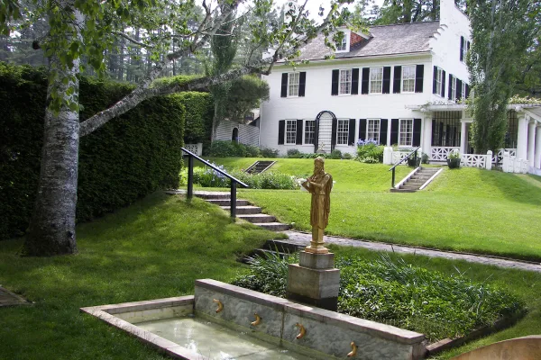
Saint-Gaudens National Historical Park
National Historical Park
Your National Park for the Arts preserves the home and studio of sculptor Augustus Saint-Gaudens (1848-1907). Here stories flow through a landscape of inspiration. Discover the history behind the capt...
Park data from the National Park Service API. Alerts update every 2 hours.
More Details
What kind of drive is this?
This is a turn-heavy local drive that features 26% highway time. You'll encounter a mix of Weare Road and South Stark Highway, interspersed with segments on NH 103. The longest stretch you'll drive uninterrupted is 8.5 miles on NH 103. The character of the road is more about navigating local byways and county roads than covering long distances quickly, so be prepared for frequent adjustments in direction and speed.
Only 26% highway — the rest is turn-by-turn surface driving.
32 navigation steps total — most of the decisions cluster near the start and finish.
Longest single stretch: 8.5 mi on NH 103.
How Hard Is This Drive?
3/10
Expect a hands-on drive with frequent turns and local roads rather than long highway stretches. There are only a few real navigation decisions along the way. The trickiest moment comes around 45.8 miles in near NH 103 / State Route 103.
Driving Effort3/10
Easy - simple navigation with a manageable amount of wheel time
Balances navigation complexity with total wheel time.
This is a straightforward 1h 49m drive. You will face about 7 decision points, but nothing that requires special attention if you follow navigation.
Where does it get tricky?
The main spots that need attention: at 45.8 miles (NH 103 / State Route 103): Roundabout - know your exit number before entering; at 60.8 miles (NH 11; NH 103 / Tremont Street): Navigation decision point; at 60.9 miles (NH 12; NH 103 / Main Street): Highway fork - watch signs carefully.
Who Is This Route For?
Weekend Trip
Doable as a same-day drive at 1h 49m. Total distance: 61.9 miles.
Family Friendly
Moderate complexity with 0 natural rest stops along the way.
Mostly surface roads route profile with national parks nearby.
Frequently Asked Questions
The longest stretch is about 8.5 miles on NH 103. The full list of main roads is in the Roads section above.
Yes. At under 2 hours behind the wheel, this works well for families — plan one quick stop if you have younger kids.
Mostly yes along the main roads, but rural stretches through NH can have sparse or no coverage. Before you leave, download offline Google Maps or Apple Maps for the route, and consider downloading music or podcasts instead of streaming. If you depend on data for navigation, keep a paper backup of the turn-by-turn directions.
The main spots that need attention: at 45.8 miles (NH 103 / State Route 103): Roundabout - know your exit number before entering; at 60.8 miles (NH 11; NH 103 / Tremont Street): Navigation decision point; at 60.9 miles (NH 12; NH 103 / Main Street): Highway fork - watch signs carefully.
Yes — Saint-Gaudens National Historical Park. See the National Parks section for detour distances and tips on detours.
Yes. A round trip is manageable in a single day if you plan a break at Claremont, NH before heading back.