This 58.7-mile drive from Laconia to Claremont, New Hampshire, is best tackled in a single day, taking about 1 hour and 45 minutes. With a fuel cost estimated at $9, it's an economical option for a short regional hop within the Northeast. The journey primarily utilizes NH 11 and NH 4A, offering a local driving experience rather than a high-speed interstate cruise. Expect a turn-heavy route that feels more like navigating through towns and countryside than covering vast distances quickly. It's a straightforward trip perfect for a leisurely afternoon or a quick connection between these two New Hampshire communities.
Trip Pace
Same-day drive is realistic
A same-day return is realistic if you keep stops short.
Midpoint
29.4 miles from Laconia, NH
A natural place for your longest stop of the day
, about 1h into the drive
.
Main Roads
Road
Distance
Duration
NH 11
14.2 mi
25m
NH 4A
7.6 mi
11m
Franklin Highway
6.5 mi
11m
Laconia Road
5 mi
9m
John Stark Highway
4.6 mi
5m
Main Street
3.6 mi
7m
East Main Street
2.9 mi
7m
Webster Lake Road
2.4 mi
5m
Longest stretch:
NH 11
— 14.2 mi, about 25m
Turn-by-Turn Driving Directions
Step-by-step road directions between Laconia, NH and Claremont, NH.
1
Start on Pleasant Street
208 ft·5 sec·Pleasant Street
2
Turn slight left onto NH 106
0.1 mi·18 sec·Main Street
3
Turn left onto NH 106
472 ft·13 sec·Veterans Square
Use the left lane.
4
Continue on NH 106
0.2 mi·35 sec·Beacon Street West
5
Keep slight right at fork onto NH 106
323 ft·12 sec·Main Street
Use the right lane.
6
Turn right onto NH 11A; US 3 Business
1.2 mi·2 min·Court Street
Use the right lane.
7
Continue on US 3; NH 11
1.6 mi·3 min·Daniel Webster Highway
8
Continue on US 3; NH 11
5.0 mi·9 min·Laconia Road
Use the left lane.
9
Continue on US 3; NH 11; NH 132
2.9 mi·7 min·East Main Street
Use the left lane.
10
Continue on US 3; NH 11
2.0 mi·6 min·Central Street
11
Turn right onto NH 3A; NH 11
1.0 mi·2 min·North Main Street
12
Turn left onto NH 11
2.4 mi·5 min·Webster Lake Road
Use the left lane.
13
Continue on NH 11
6.5 mi·11 min·Franklin Highway
14
At end of road, turn right onto US 4; NH 11
2.7 mi·6 min·Main Street
Use the right lane.
15
Continue on NH 4A; NH 11
7.6 mi·11 min·NH 4A; NH 11
16
Take the exit onto NH 11
3.4 mi·4 min·NH 11
17
Take the exit onto NH 11
0.2 mi·31 sec·NH 11
Exit 12Toward NH 11 West: New London, Sunapee, Newport, Claremont
18
Keep slight left at fork onto NH 11
154 ft·11 sec·NH 11
Exit 12Toward NH 11 West: New London, Sunapee, Newport, Claremont
19
Continue on NH 11
10 mi·20 min·NH 11
20
Turn left onto Cross Street
0.2 mi·43 sec·Cross Street
21
At end of road, turn right onto Maple Street
0.3 mi·39 sec·Maple Street
22
Continue on NH 11; NH 103
0.2 mi·12 sec·Elm Street
23
Continue on NH 11; NH 103
4.6 mi·5 min·John Stark Highway
24
Continue on NH 11; NH 103
2.3 mi·2 min·State Route 11
25
Continue on NH 11; NH 103
2.3 mi·2 min·Washington Street
26
Continue on NH 11; NH 103
0.1 mi·9 sec·Broad Street
27
Turn right onto NH 11; NH 103
463 ft·6 sec·Tremont Street
28
Keep slight right at fork onto NH 12; NH 103
0.7 mi·53 sec·Main Street
29
Turn right onto West Terrace Street
402 ft·18 sec·West Terrace Street
30
Turn right onto Front Street
0.2 mi·38 sec·Front Street
31
Arrive at destination
Front Street
Trip Plan
Given the short 1 hour and 45-minute duration, this 58.7-mile trip is easily completed in one day. Aim to depart mid-morning to avoid potential rush hour congestion and allow for a relaxed pace. While there are no designated stops in the data, the route's local character means you'll likely pass through several small towns where you can easily pull over for a break or a quick snack if needed. Keep an eye on your fuel; the estimated cost is $9, but it's always wise to start with a full tank. The longest uninterrupted stretch is 14.2 miles on NH 11, so plan accordingly if you need to stop for fuel or a rest.
Morning Departure
Leave by 9 AM and you'll arrive before lunch.
Evening Departure
Even a 4 PM departure gets you there before dark in summer.
You can normally do this drive in one day.
You may only need one short stretch break if traffic stays light.
The halfway point lands around 29.4 miles from Laconia, NH, or about 1h into the drive.
The longest continuous stretch on this route runs about 14.2 miles.
This is a comfortable same-day trip.
Departure
Before you leave
Start with fuel, water, and navigation already sorted so the first hour feels easy.
First stop
Around 13 miles or 28m in
Use this first pause for coffee, a restroom break, and a quick traffic check ahead.
Halfway reset
Around 29.4 miles or 1h in
This is the best place for your longest stop, a real meal, and a full fuel check.
Final approach
Final hour starts around 1h 34m
Traffic, exits, and arrival timing usually matter more near Claremont, NH than in the middle of the route.
Before You Leave
+
Open the route before leaving Laconia, NH so your first major turns are already loaded.
Day 1
Settle into the route from Laconia, NH
This is one driving day of about 58.7 miles and 1h 45m.
Your first comfortable stop window is around 13 miles from Laconia, NH.
This route can stay practical as a one-day drive if traffic stays reasonable.
The longest stretch is on NH 11 for about 14.2 miles.
Where to Stop
Rest stops, refuel points, and overnight suggestions along this route.
Place data sourced from public business listings. Hours and availability may vary.
Heads-up: tricky spots
5 of 14
5 decision points cluster between mile 0.1 and 37.2 — GPS handles the exact turns, but know they're coming. Your lane choice matters more than the turn itself.
7
0.1 mi into trip|~0m in|NH 106 / Veterans Square
Turn left onto NH 106 / Veterans Square
Lane positioning matters here
Use the left lane.
7
0.5 mi into trip|~1m in|NH 106 / Main Street
Keep slight right at fork onto NH 106 / Main Street
Highway fork - watch signs carefully. Lane positioning matters here
Use the right lane.
6
23.2 mi into trip|~49m in|US 4; NH 11 / Main Street
At end of road, turn right onto US 4; NH 11 / Main Street
Lane positioning matters here
Use the right lane.
6
37 mi into trip|~1h 10m in|NH 11
Take the exit onto NH 11 toward NH 11 West: New London, Sunapee, Newport, Claremont
Exit ramp - move to the correct lane early. Multiple destination signs - pick the right one
Exit 12
Toward NH 11 West: New London, Sunapee, Newport...
8
37.2 mi into trip|~1h 11m in|NH 11
Keep slight left at fork onto NH 11 toward NH 11 West: New London, Sunapee, Newport, Claremont
Highway fork - watch signs carefully. Multiple destination signs - pick the right one
Exit 12
Toward NH 11 West: New London, Sunapee, Newport...
Fuel & Cost
Regular Gas
$9.45 one way
$18.90 round trip
$4.09/gal25.4 MPG avg21 kg CO2
Fuel Type
$/gal
One Way
Round Trip
midgrade
$4.50
$10.40
$20.79
premium
$4.86
$11.24
$22.48
diesel
$5.61
$12.96
$25.92
No toll roads detected on this route.
Estimated Trip Cost (one way, 1 person)
Fuel
$9
Meals
$25–$50
Total
$34–$59
Rough estimate based on US averages. Hotel $80–$140/night, meals $25–$50/day.
Estimated CO2 emission: 20.5 kg one way.
Prices: EIA weekly data, 2026-04-13.
Driving Electric?
About $6 in charging
· 0 stops
· 67% less CO2
Vehicle Type
kWh
Stops
DC Fast
Home Charge
Average EV
17.6
0
$6.16
$2.82
Efficient EV
14.7
0
$5.14
$2.35
EV Truck/SUV
23.5
0
$8.22
$3.76
Gas CO2
21 kg
EV CO2
7 kg (67% less)
This trip is well within single-charge range for most EVs. No charging stops needed if you start fully charged.
DC fast charging avg $0.35/kWh. Home charging avg $0.16/kWh. US grid CO2: 0.39 kg/kWh.
Travel Intel
Current conditions at both ends of the drive.
Forecast as of Apr 15, 2026
Origin
Laconia, NH
Night
in Laconia on Saturday
Local time
10:53 PM
EDT
Current temp
44°F
Unavailable
Live forecast
Destination
Claremont, NH
Night
in Claremont on Saturday
Local time
10:53 PM
EDT
Current temp
52°F
Unavailable
Live forecast
56°F
Andover, NH
29 mi in
Seasonal Notes
Summer travel usually means heavier construction, hotter rest stops, and busier weekend traffic around major cities.
Winter travel shortens daylight, so a route that looks manageable on paper can feel much longer after dark.
Holiday weekends tend to make both departure and arrival windows slower than the raw route time suggests.
Time zone
Same local time
Origin and destination are on the same clock, so arrival timing is easier to judge at a glance.
Temperature spread
8 degrees warmer at arrival
A meaningful temperature swing is a good cue to rethink layers, water, and how soon you want to arrive.
Road read
1h 45m on the road
Use the two city cards together: check the sky where you start, then compare it with the local time and temperature at arrival.
Weather data from the National Weather Service. Conditions may change; check closer to your travel date.
National Parks Near This Route
Worth a detour if your schedule allows.
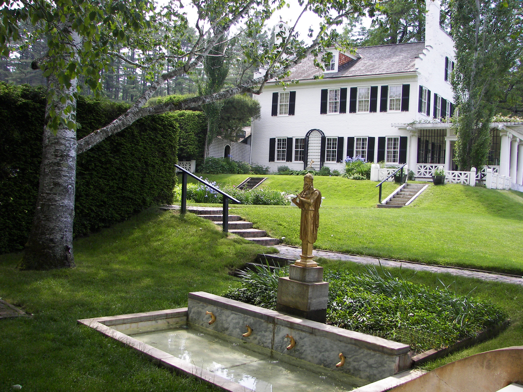
Saint-Gaudens National Historical Park
National Historical Park
Your National Park for the Arts preserves the home and studio of sculptor Augustus Saint-Gaudens (1848-1907). Here stories flow through a landscape of inspiration. Discover the history behind the capt...
Park data from the National Park Service API. Alerts update every 2 hours.
More Details
What kind of drive is this?
Expect a turn-heavy local drive for this 58.7-mile excursion. With only 28% of the route on highways, you'll spend most of your time on state routes like NH 11 and NH 4A, also known as Franklin Highway. The longest stretch you'll encounter without a significant turn or change in road type is 14.2 miles along NH 11. This road's personality is defined by its winding nature and frequent intersections, requiring your attention as you navigate through varied terrain. It's a hands-on driving experience that keeps you engaged.
Only 28% highway — the rest is turn-by-turn surface driving.
31 navigation steps total — most of the decisions cluster near the start and finish.
Longest single stretch: 14.2 mi on NH 11.
How Hard Is This Drive?
9/10
Expect a hands-on drive with frequent turns and local roads rather than long highway stretches. This route has several spots where lane changes, forks, or exits need your full attention. The trickiest moment comes around 0.1 miles in near NH 106 / Veterans Square.
Driving Effort9/10
Demanding - stay alert through the decision-heavy sections
Balances navigation complexity with total wheel time.
This drive requires moderate attention. Across 58.7 miles you will encounter 14 spots where lane choice or exit timing matters. Not difficult for experienced highway drivers, but worth previewing the tricky sections before you go.
Where does it get tricky?
The main spots that need attention: at 0.1 miles (NH 106 / Veterans Square): Lane positioning matters here; at 0.5 miles (NH 106 / Main Street): Highway fork - watch signs carefully. Lane positioning matters here; at 23.2 miles (US 4; NH 11 / Main Street): Lane positioning matters here.
Elevation Profile
Gently rolling terrain
1,251 ft307 ft
Total Climb
1,021 ft
Total Descent
1,013 ft
Highest Point
1,251 ft
~37.7 mi in
Elevation Range
944 ft
Towns Mentioned on Route Signs
Based on OSRM destination-sign hints, not a full list of every settlement the road passes.
Between Laconia, NH and Claremont, NH, road signs point toward Sunapee and Newport.
Sunapee
37 mi in|~1h 10m|via NH 11
Newport
37 mi in|~1h 10m|via NH 11
Who Is This Route For?
Weekend Trip
Doable as a same-day drive at 1h 45m. Total distance: 58.7 miles.
Family Friendly
Moderate complexity with 0 natural rest stops along the way.
Solo Traveler
1h 45m drive, comfortable solo distance.
Scenic Drive
Mostly surface roads route profile with national parks nearby.
Frequently Asked Questions
The longest stretch is about 14.2 miles on NH 11. The full list of main roads is in the Roads section above.
It helps. This route has a higher-than-average number of complex decision points, which get harder in the dark. If the last hour of the trip is on surface roads or mountain grades, aim to arrive at Claremont, NH before sunset when you can. Check the Trip Plan for departure windows that land you in daylight.
Yes. At under 2 hours behind the wheel, this works well for families — plan one quick stop if you have younger kids.
Mostly yes along the main roads, but rural stretches through NH can have sparse or no coverage. Before you leave, download offline Google Maps or Apple Maps for the route, and consider downloading music or podcasts instead of streaming. If you depend on data for navigation, keep a paper backup of the turn-by-turn directions.
The main spots that need attention: at 0.1 miles (NH 106 / Veterans Square): Lane positioning matters here; at 0.5 miles (NH 106 / Main Street): Highway fork - watch signs carefully. Lane positioning matters here; at 23.2 miles (US 4; NH 11 / Main Street): Lane positioning matters here.
Yes — Saint-Gaudens National Historical Park. See the National Parks section for detour distances and tips on detours.
Yes. A round trip is manageable in a single day if you plan a break at Claremont, NH before heading back.