Lynchburg, VA to Bristol, VA is 204.1 miles and takes about 3h 58m via I 81 and US 29, with a fuel budget near $32 and enough daylight to finish in a day. This trip primarily sticks to major highways, making it a straightforward drive across Virginia's Southeast region. With a recommended single day of travel, you'll find most of your journey is spent on the interstate, offering a convenient way to get from point A to point B. The route is efficient, designed for covering distance with minimal fuss.
Trip Pace
Same-day drive is realistic
A same-day return is realistic if you keep stops short.
Break Rhythm
1 planned break
A short stop every 2 to 3 hours is enough for this drive.
Midpoint
102.1 miles from Lynchburg, VA
A natural place for your longest stop of the day
, about 2h 6m into the drive
.
Main Roads
Road
Distance
Duration
I 81
144.5 mi
2h 38m
US 29
21.3 mi
27m
West Lynchburg Salem Turnpike
14.6 mi
18m
Blue Ridge Boulevard
5.5 mi
7m
Cloverdale Road
5 mi
6m
Lynchburg Expressway
3.5 mi
4m
US 460
2.9 mi
3m
I 77
1.3 mi
1m
Longest stretch:
I 81
— 144.5 mi, about 2h 38m
Traffic on I-81
Hour-of-day weekday pattern from 60 FHWA count stations on your route.
Peak
3 PM
~1,676 veh/hr typical
· worst 2,202
Quietest
2 AM
~236 veh/hr
Peak-to-quiet ratio
7.1×
busier at peak than in the quiet hours
12a6anoon6p11p
Averaged across 52 weeks of 2023 FHWA Travel Monitoring Analysis System data. Weekday hours only (Mon–Fri).
Turn-by-Turn Driving Directions
Step-by-step road directions between Lynchburg, VA and Bristol, VA.
1
Start on 10th Street
221 ft·13 sec·10th Street
2
Turn right onto Main Street
0.4 mi·1 min·Main Street
3
Take the ramp
0.3 mi·42 sec
4
Merge onto US 29 BUS
3.5 mi·4 min·Lynchburg Expressway
5
Take the exit
0.2 mi·43 sec
Toward VA 128 WestUse the right lane.
6
Turn sharp left onto VA 128
0.8 mi·1 min·Candlers Mountain Road
7
Keep slight right at fork
0.3 mi·29 sec
Toward US 460 West, US 29 South: Roanoke, Danville
8
Merge onto US 29; US 460
21 mi·27 min·US 29; US 460
9
Continue on US 460; VA 122
2.9 mi·3 min·US 460; VA 122
Use the straight lane.
10
Continue on US 221; US 460
15 mi·18 min·West Lynchburg Salem Turnpike
11
Continue on US 221; US 460
5.5 mi·7 min·Blue Ridge Boulevard
12
Continue on US 221; US 460
0.3 mi·32 sec·Challenger Avenue Northeast
Use the straight lane.
13
Turn right onto US 220 Alt
5.0 mi·6 min·Cloverdale Road
14
Continue on US 220
0.2 mi·13 sec·Roanoke Road
15
Take the exit
0.2 mi·22 sec
16
Merge onto I 81
76 mi·1 hr 25 min·I 81
Use the straight lane.
17
Continue on I 77; I 81; US 52
1.3 mi·1 min·I 77; I 81; US 52
Use the straight lane.
18
Keep slight left at fork onto I 81; US 52
69 mi·1 hr 13 min·I 81; US 52
Use the straight lane.
19
Take the exit
0.7 mi·1 min
Toward I 381: Bristol
20
Continue on I 381
1.0 mi·1 min·I 381
21
Continue on Commonwealth Avenue
1.1 mi·1 min·Commonwealth Avenue
Use the straight lane.
22
Turn left onto Sullins Street
114 ft·4 sec·Sullins Street
23
Arrive at destination
Sullins Street
Trip Plan
Given this is a one-day drive totaling just under 4 hours, you have a lot of flexibility with your departure time. Leaving Lynchburg in the morning will get you to Bristol with plenty of daylight to spare. The longest stretch without a major road change is over 144 miles on I 81, so plan your fuel stops accordingly before you embark on that segment. While there's only one recommended stop, consider a brief break around the midpoint of your interstate travel to stretch your legs.
Morning Departure
An early start around 7-8 AM gets you there with plenty of daylight left.
Evening Departure
A late afternoon start means arriving after dark. Morning is better.
You can normally do this drive in one day.
Plan roughly 1 meaningful break for fuel, food, and rest.
The halfway point lands around 102.1 miles from Lynchburg, VA, or about 2h 6m into the drive.
The longest continuous stretch on this route runs about 144.5 miles.
This is a comfortable same-day trip.
Departure
Before you leave
Start with fuel, water, and navigation already sorted so the first hour feels easy.
First stop
Around 45 miles or 59m in
Use this first pause for coffee, a restroom break, and a quick traffic check ahead.
Halfway reset
Around 102.1 miles or 2h 6m in
This is the best place for your longest stop, a real meal, and a full fuel check.
Final approach
Final hour starts around 3h 17m
Traffic, exits, and arrival timing usually matter more near Bristol, VA than in the middle of the route.
Before You Leave
+
Open the route before leaving Lynchburg, VA so your first major turns are already loaded.
+
Leave with enough water and a charging cable within reach, not packed away.
+
Check your fuel range against the first long segment, especially if you are starting outside city service areas.
Day 1
Settle into the route from Lynchburg, VA
This is one driving day of about 204.1 miles and 3h 58m.
Your first comfortable stop window is around 45 miles from Lynchburg, VA.
This route can stay practical as a one-day drive if traffic stays reasonable.
Plan about 1 real break rather than only quick fuel stops.
The longest stretch is on I 81 for about 144.5 miles.
Where to Stop
Rest stops, refuel points, and overnight suggestions along this route.
Place data sourced from public business listings. Hours and availability may vary.
Heads-up: tricky spots
5 of 13
5 decision points cluster between mile 4.2 and 132.6 — GPS handles the exact turns, but know they're coming. Your lane choice matters more than the turn itself.
6
4.2 mi into trip|~6m in
Take the exit toward VA 128 West
Exit ramp - move to the correct lane early. Lane positioning matters here
Use the right lane.
Toward VA 128 West
5
4.4 mi into trip|~7m in|VA 128 / Candlers Mountain Road
Turn sharp left onto VA 128 / Candlers Mountain Road
Sharp turn - reduce speed on approach
6
5.2 mi into trip|~8m in
Keep slight right at fork toward US 460 West, US 29 South: Roanoke, Danville
Highway fork - watch signs carefully. Multiple destination signs - pick the right one
Toward US 460 West, US 29 South: Roanoke, Danvi...
5
55.5 mi into trip|~1h 14m in|I 81
Merge onto I 81
Merge point - match speed before joining. Lane positioning matters here
Use the straight lane.
6
132.6 mi into trip|~2h 40m in|I 81; US 52
Keep slight left at fork onto I 81; US 52
Highway fork - watch signs carefully. Lane positioning matters here
Use the straight lane.
Fuel & Cost
Regular Gas
$30.13 one way
$60.27 round trip
$3.75/gal25.4 MPG avg71 kg CO2
Fuel Type
$/gal
One Way
Round Trip
midgrade
$4.12
$33.11
$66.23
premium
$4.49
$36.10
$72.19
diesel
$4.80
$38.54
$77.08
Estimated Tolls: $1.02
West Lynchburg Salem Turnpike
(14.6 mi)$1.02
Toll estimates based on average 2024-2025 rates. EZ-Pass/SunPass discounts may lower the actual cost.
Estimated Trip Cost (one way, 1 person)
Fuel
$30
Tolls
$1
Meals
$25–$50
Total
$56–$81
Rough estimate based on US averages. Hotel $80–$140/night, meals $25–$50/day.
Estimated CO2 emission: 71.4 kg one way.
Prices: EIA weekly data, 2026-07-13.
Driving Electric?
About $21 in charging
· 0 stops
· 66% less CO2
Vehicle Type
kWh
Stops
DC Fast
Home Charge
Average EV
61.2
0
$21.43
$9.80
Efficient EV
51
0
$17.86
$8.16
EV Truck/SUV
81.6
1
$28.57
$13.06
Gas CO2
71 kg
EV CO2
24 kg (66% less)
This trip is well within single-charge range for most EVs. No charging stops needed if you start fully charged.
DC fast charging avg $0.35/kWh. Home charging avg $0.16/kWh. US grid CO2: 0.39 kg/kWh.
Travel Intel
Current conditions at both ends of the drive.
Forecast as of Jul 17, 2026
Origin
Lynchburg, VA
Late night
in Lynchburg on Sunday
Local time
5:38 AM
EDT
Current temp
73°F
Mostly Clear
N 0 to 3 mph0% chanceLive forecast
Destination
Bristol, VA
Late night
in Bristol on Sunday
Local time
5:38 AM
EDT
Current temp
70°F
Mostly Clear
NW 0 to 5 mph2% chanceLive forecast
Seasonal Notes
Summer travel usually means heavier construction, hotter rest stops, and busier weekend traffic around major cities.
Winter travel shortens daylight, so a route that looks manageable on paper can feel much longer after dark.
Holiday weekends tend to make both departure and arrival windows slower than the raw route time suggests.
Time zone
Same local time
Origin and destination are on the same clock, so arrival timing is easier to judge at a glance.
Temperature spread
3 degrees cooler at arrival
A meaningful temperature swing is a good cue to rethink layers, water, and how soon you want to arrive.
Road read
3h 58m on the road
The weather snapshot is not static. If you are leaving later, give both cities one more quick forecast check before departure.
Weather data from the National Weather Service. Conditions may change; check closer to your travel date.
National Parks Near This Route
Worth a detour if your schedule allows.
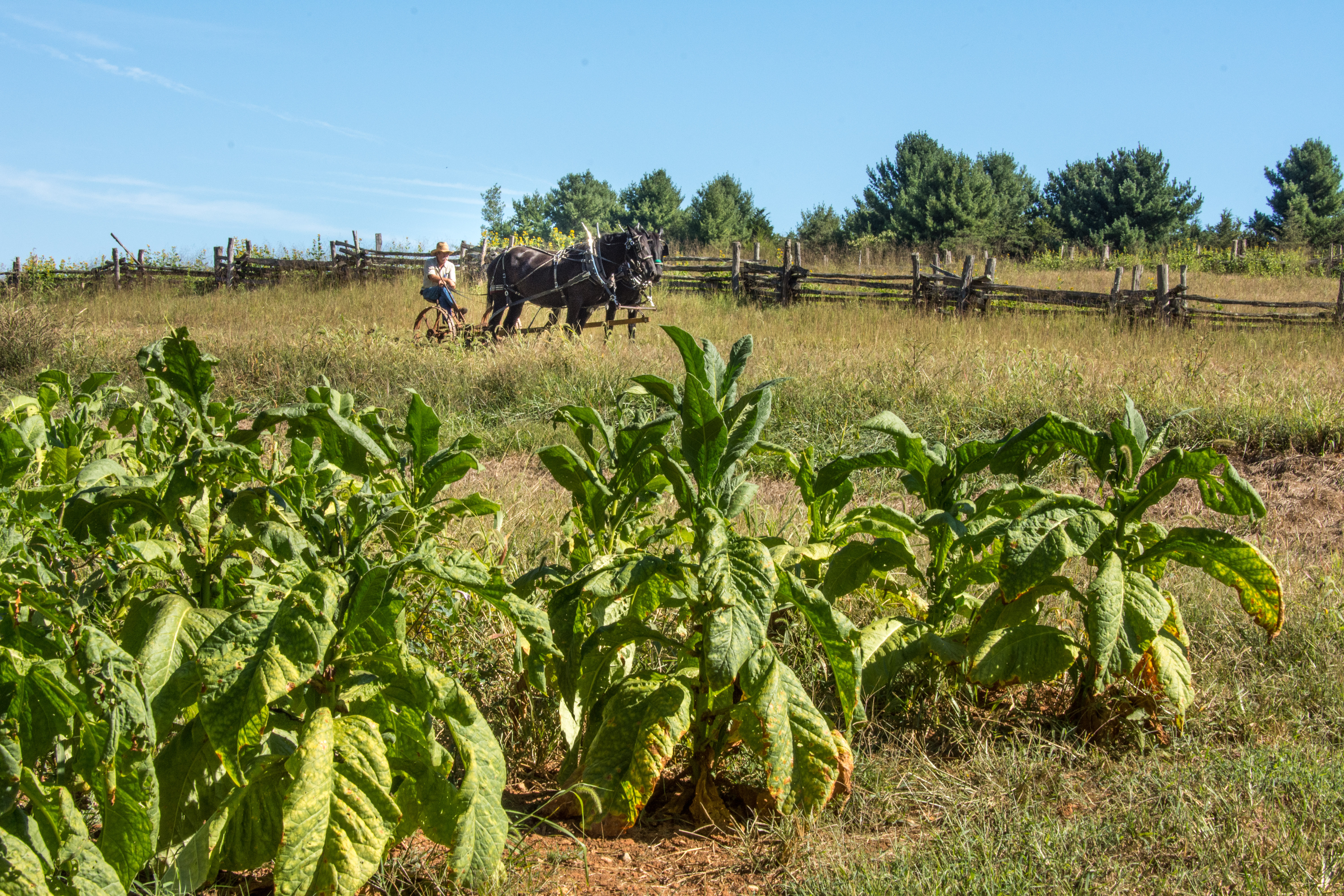
Booker T Washington National Monument
National Monument
Booker T. Washington was born a slave in April 1856 on the 207-acre farm of James Burroughs. After the Civil War, Washington became the first principal of Tuskegee Normal and Industrial School. Later...
17 mi from route
~42 min detour
Free
near mile 49.3
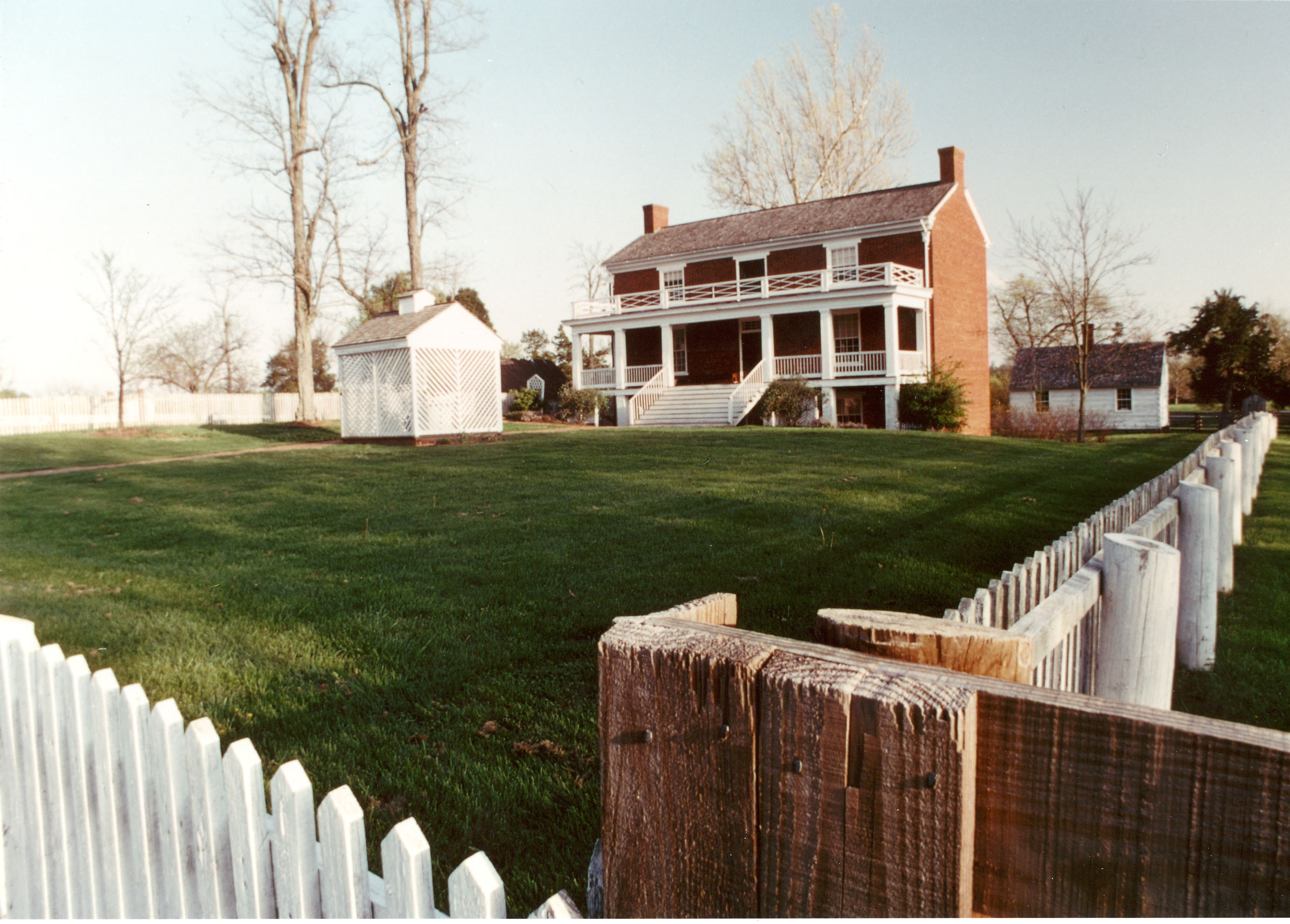
On April 9, 1865, the surrender of the Army of Northern Virginia in the McLean House in the village of Appomattox Court House, Virginia signaled the effective end of the nation's largest war. Question...
Park data from the National Park Service API. Alerts update every 2 hours.
More Details
What kind of drive is this?
This is a heavily highway-focused drive, with 93% of the route utilizing major roadways like I 81 and US 29. Expect a largely uninterrupted interstate experience, including a significant stretch of 144.5 miles on I 81 where you can maintain consistent speed. The initial part of the drive may involve segments on the West Lynchburg Salem Turnpike before merging onto the faster highway system. Overall, the character is one of efficient travel rather than winding backroads.
93% highway — fuel and pacing are the main things to plan.
23 navigation steps total — most of the decisions cluster near the start and finish.
Longest single stretch: 144.5 mi on I 81.
How Hard Is This Drive?
8/10
This is a straightforward highway drive that stays mostly on I 81 and US 29. This route has several spots where lane changes, forks, or exits need your full attention. The trickiest moment comes around 4.2 miles in.
Driving Effort8/10
Demanding - plan breaks and stay ahead of the key maneuvers
Balances navigation complexity with total wheel time.
This is a demanding drive. With 13 significant decision points across 204.1 miles, you will need to stay alert - especially through interchange areas and urban stretches. Consider splitting it into segments if you are not comfortable with fast highway navigation.
Where does it get tricky?
The main spots that need attention: at 4.2 miles: Exit ramp - move to the correct lane early. Lane positioning matters here; at 4.4 miles (VA 128 / Candlers Mountain Road): Sharp turn - reduce speed on approach; at 5.2 miles: Highway fork - watch signs carefully. Multiple destination signs - pick the right one.
Doable as a same-day drive at 3h 58m. Total distance: 204.1 miles.
Family Friendly
Moderate complexity with 1 natural rest stops along the way.
Solo Traveler
3h 58m drive, comfortable solo distance.
First-Time Driver
Mostly highway driving (93%). Some complex stretches to watch for.
Frequently Asked Questions
The longest stretch is about 144.5 miles on I 81. The full list of main roads is in the Roads section above.
Expect about $1.02 in tolls one way, starting with West Lynchburg Salem Turnpike. Most Northeast and Midwest toll agencies accept E-ZPass; in the West and Texas, transponders like TxTag or FasTrak apply. If you do not have a transponder, cashless tolling plates will mail a bill to the vehicle's registered address — usually with a surcharge, so a rental-car toll pass is often cheaper than paying by mail.
Yes — we found about 17 rest areas or service plazas within a short detour of the route (from OpenStreetMap). See the Rest Stops tab under Nearby Places for locations and mile markers. Plan to stretch, use the bathroom, and top off fluids every 2–3 hours on longer drives.
It helps. This route has a higher-than-average number of complex decision points, which get harder in the dark. If the last hour of the trip is on surface roads or mountain grades, aim to arrive at Bristol, VA before sunset when you can. Check the Trip Plan for departure windows that land you in daylight.
Only with planning. This is a long drive for kids — consider splitting it into two days rather than pushing through. Plan at least 1 meaningful breaks. There are 17 rest areas along the route for bathroom stops.
The main spots that need attention: at 4.2 miles: Exit ramp - move to the correct lane early. Lane positioning matters here; at 4.4 miles (VA 128 / Candlers Mountain Road): Sharp turn - reduce speed on approach; at 5.2 miles: Highway fork - watch signs carefully. Multiple destination signs - pick the right one.
Yes — Booker T Washington National Monument and Appomattox Court House National Historical Park. See the National Parks section for detour distances and tips on detours.
Possible but tiring. At 4.0 hours each way, an in-and-out day trip would put you behind the wheel for 8.0 hours — manageable with a long break at Bristol, VA, but most travelers stay overnight.