Traveling from Kuna to Jerome covers 130.8 miles of Mountain West terrain, making it a manageable journey that typically takes about 2 hours and 11 minutes. Because this is a turn-heavy local drive rather than a straight interstate sprint, it is best suited for a single-day trip. You should budget approximately $21 for fuel to complete the trek. While the route involves navigating North Meridian Road and West Main Street, you will spend the bulk of your time on the Vietnam Veterans Memorial Highway. Whether you are heading out for business or a quick change of scenery, the distance is short enough that you won't need to plan for an overnight stay.
Trip Pace
Same-day drive is realistic
A same-day return is realistic if you keep stops short.
Midpoint
65.4 miles from Kuna, ID
A natural place for your longest stop of the day
, about 1h 8m into the drive
.
Main Roads
Road
Distance
Duration
Vietnam Veterans Memorial Highway
120.4 mi
1h 55m
North Meridian Road
6.2 mi
8m
West Main Street
1.2 mi
1m
East Deer Flat Road
1 mi
1m
North Linder Road
0.5 mi
1m
West 4th Street
0.3 mi
<1m
North Linder Avenue
0.3 mi
<1m
State Highway 25
0.2 mi
<1m
Longest stretch:
Vietnam Veterans Memorial Highway
— 120.4 mi, about 1h 55m
Turn-by-Turn Driving Directions
Step-by-step road directions between Kuna, ID and Jerome, ID.
1
Start on West 4th Street
0.3 mi·39 sec·West 4th Street
2
At end of road, turn left onto North Linder Avenue
0.3 mi·51 sec·North Linder Avenue
3
Continue on North Linder Road
0.5 mi·1 min·North Linder Road
4
Turn right onto East Deer Flat Road
1.0 mi·1 min·East Deer Flat Road
5
Turn left onto ID 69
6.2 mi·8 min·North Meridian Road
6
Take the ramp
0.5 mi·33 sec
Toward I 84 East, US 30, ID 55: BoiseUse the right lane.
7
Merge onto I 84; US 30; ID 55
4.6 mi·5 min·Vietnam Veterans Memorial Highway
Use the straight / slight right lanes.
8
Keep slight right at fork onto I 84; US 30
116 mi·1 hr 49 min·Vietnam Veterans Memorial Highway
Use the slight right lane.
9
Take the exit
0.2 mi·32 sec
Toward ID 25: Jerome
10
Turn left onto ID 25
0.1 mi·11 sec·West Road
11
Continue on ID 25
0.2 mi·18 sec·State Highway 25
12
Continue on ID 25
1.2 mi·1 min·West Main Street
13
Arrive at destination
ID 25
Trip Plan
Since this is a straightforward 2-hour and 11-minute drive, you have plenty of flexibility regarding your departure time. You can easily complete the entire 130.8-mile distance without needing to build in scheduled stops, though taking a break to stretch is always a smart move. Because the route relies heavily on local roads, keep a close eye on your navigation system to ensure you don't miss any turns along North Meridian Road. Plan to set aside $21 for gas before you leave Kuna to avoid unnecessary stress on the road. A great way to manage this trip is to depart in the morning to take advantage of lighter traffic, giving you a smooth arrival in Jerome.
Morning Departure
Leave by 9 AM and you'll arrive before lunch.
Evening Departure
Even a 4 PM departure gets you there before dark in summer.
You can normally do this drive in one day.
You may only need one short stretch break if traffic stays light.
The halfway point lands around 65.4 miles from Kuna, ID, or about 1h 8m into the drive.
The longest continuous stretch on this route runs about 120.4 miles.
This is a comfortable same-day trip.
Departure
Before you leave
Start with fuel, water, and navigation already sorted so the first hour feels easy.
First stop
Around 29 miles or 33m in
Use this first pause for coffee, a restroom break, and a quick traffic check ahead.
Halfway reset
Around 65.4 miles or 1h 8m in
This is the best place for your longest stop, a real meal, and a full fuel check.
Final approach
Final hour starts around 1h 48m
Traffic, exits, and arrival timing usually matter more near Jerome, ID than in the middle of the route.
Before You Leave
+
Open the route before leaving Kuna, ID so your first major turns are already loaded.
+
Leave with enough water and a charging cable within reach, not packed away.
+
Check your fuel range against the first long segment, especially if you are starting outside city service areas.
Day 1
Settle into the route from Kuna, ID
This is one driving day of about 130.8 miles and 2h 11m.
Your first comfortable stop window is around 29 miles from Kuna, ID.
This route can stay practical as a one-day drive if traffic stays reasonable.
The longest stretch is on Vietnam Veterans Memorial Highway for about 120.4 miles.
Where to Stop
Rest stops, refuel points, and overnight suggestions along this route.
Place data sourced from public business listings. Hours and availability may vary.
Heads-up: tricky spots
5 of 8
5 decision points cluster between mile 0.3 and 13.3 — GPS handles the exact turns, but know they're coming. Your lane choice matters more than the turn itself.
5
0.3 mi into trip|~0m in|North Linder Avenue
At end of road, turn left onto North Linder Avenue
Navigation decision point
4
1.1 mi into trip|~2m in|East Deer Flat Road
Turn right onto East Deer Flat Road
Navigation decision point
6
8.3 mi into trip|~13m in
Take the ramp toward I 84 East, US 30, ID 55: Boise
Lane positioning matters here. Multiple destination signs - pick the right one
Use the right lane.
Toward I 84 East, US 30, ID 55: Boise
5
8.8 mi into trip|~13m in|I 84; US 30; ID 55 / Vietnam Veterans Memorial Highway
Merge onto I 84; US 30; ID 55 / Vietnam Veterans Memorial Highway
Merge point - match speed before joining. Lane positioning matters here
Use the straight / slight right lanes.
6
13.3 mi into trip|~18m in|I 84; US 30 / Vietnam Veterans Memorial Highway
Keep slight right at fork onto I 84; US 30 / Vietnam Veterans Memorial Highway
Highway fork - watch signs carefully. Lane positioning matters here
Use the slight right lane.
Fuel & Cost
Regular Gas
$20.73 one way
$41.45 round trip
$4.03/gal25.4 MPG avg46 kg CO2
Fuel Type
$/gal
One Way
Round Trip
midgrade
$4.22
$21.73
$43.45
premium
$4.53
$23.33
$46.67
diesel
$5.61
$28.88
$57.76
No toll roads detected on this route.
Estimated Trip Cost (one way, 1 person)
Fuel
$21
Meals
$25–$50
Total
$46–$71
Rough estimate based on US averages. Hotel $80–$140/night, meals $25–$50/day.
Estimated CO2 emission: 45.8 kg one way.
Prices: EIA weekly data, 2026-04-13.
Driving Electric?
About $14 in charging
· 0 stops
· 67% less CO2
Vehicle Type
kWh
Stops
DC Fast
Home Charge
Average EV
39.2
0
$13.73
$6.28
Efficient EV
32.7
0
$11.45
$5.23
EV Truck/SUV
52.3
0
$18.31
$8.37
Gas CO2
46 kg
EV CO2
15 kg (67% less)
This trip is well within single-charge range for most EVs. No charging stops needed if you start fully charged.
DC fast charging avg $0.35/kWh. Home charging avg $0.16/kWh. US grid CO2: 0.39 kg/kWh.
Travel Intel
Current conditions at both ends of the drive.
Forecast as of Apr 15, 2026
Origin
Kuna, ID
Evening
in Kuna on Saturday
Local time
8:44 PM
MDT
Current temp
62°F
Unavailable
Live forecast
Destination
Jerome, ID
Evening
in Jerome on Saturday
Local time
8:44 PM
MDT
Current temp
73°F
Unavailable
Live forecast
Seasonal Notes
Summer travel usually means heavier construction, hotter rest stops, and busier weekend traffic around major cities.
Winter travel shortens daylight, so a route that looks manageable on paper can feel much longer after dark.
Holiday weekends tend to make both departure and arrival windows slower than the raw route time suggests.
Time zone
Same local time
Origin and destination are on the same clock, so arrival timing is easier to judge at a glance.
Temperature spread
11 degrees warmer at arrival
A meaningful temperature swing is a good cue to rethink layers, water, and how soon you want to arrive.
Road read
2h 11m on the road
Use the two city cards together: check the sky where you start, then compare it with the local time and temperature at arrival.
Weather data from the National Weather Service. Conditions may change; check closer to your travel date.
National Parks Near This Route
Worth a detour if your schedule allows.
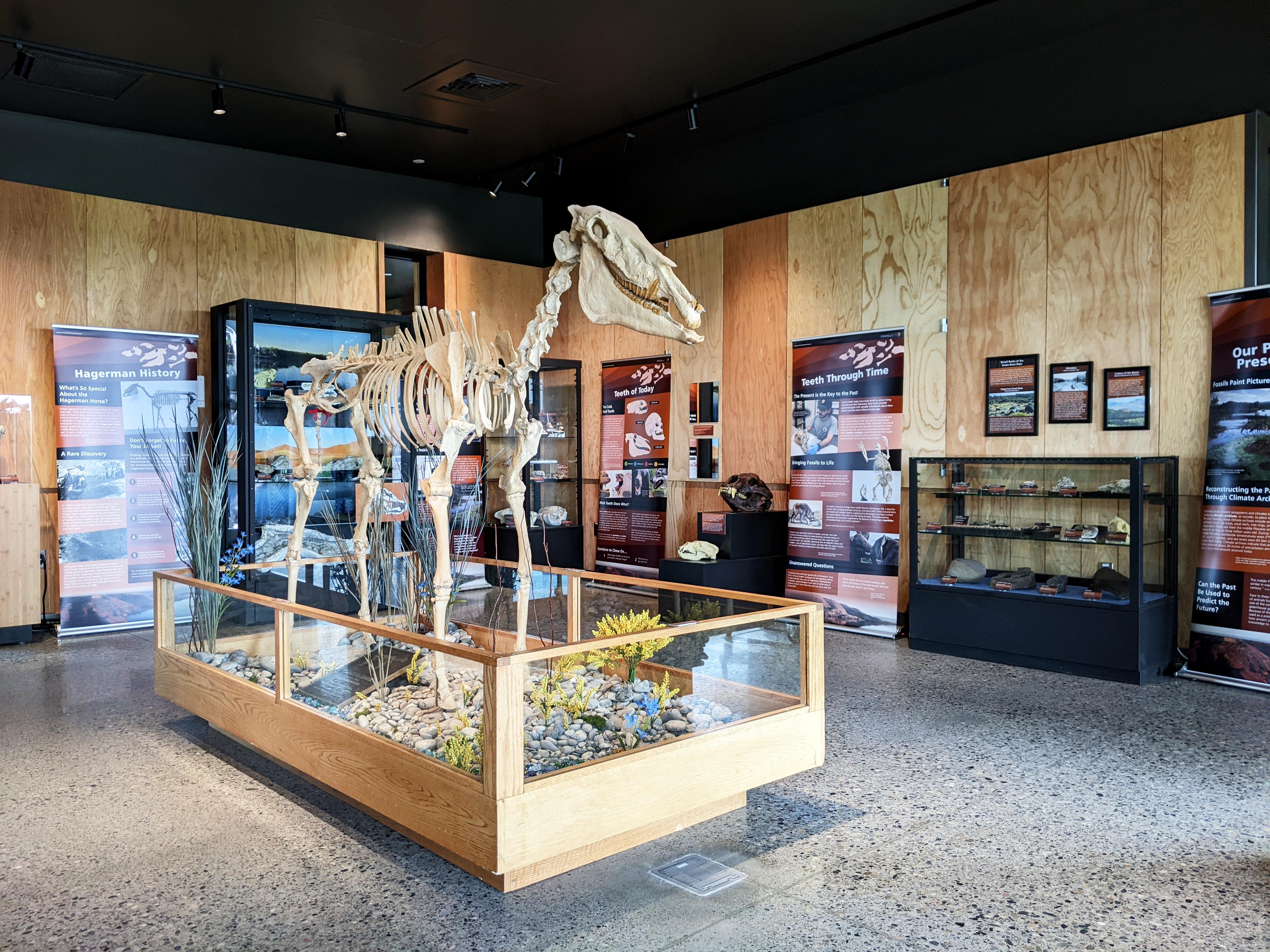
Hagerman Fossil Beds National Monument
National Monument
During the Pliocene, this place looked quite different. Lush wetlands, forests, and grasslands provided excellent habitat for a variety of animals. From fascinating, now-extinct creatures like the sab...
7 mi from route
~18 min detour
Free
near mile 112.8
Caution: Use Caution with "Fossil Beds Information" Signs
Caution: If You Can't Reach Us By Phone, Please Email Us
Park data from the National Park Service API. Alerts update every 2 hours.
More Details
What kind of drive is this?
Expect a unique driving experience that prioritizes local navigation over highway cruising, as this route features a 0% highway share. The road's personality is defined by its turn-heavy nature, requiring your full attention as you transition between local streets and the Vietnam Veterans Memorial Highway. You will encounter one primary stretch of 120.4 miles on the memorial highway, which serves as the backbone of your journey. Unlike a standard interstate grind, the constant changes in direction keep the drive engaging for those who prefer active steering. Be prepared for a winding path that demands a steady pace rather than high-speed travel.
Only 0% highway — the rest is turn-by-turn surface driving.
13 navigation steps total — most of the decisions cluster near the start and finish.
Longest single stretch: 120.4 mi on Vietnam Veterans Memorial Highway.
How Hard Is This Drive?
4/10
Expect a hands-on drive with frequent turns and local roads rather than long highway stretches. There are only a few real navigation decisions along the way. The trickiest moment comes around 0.3 miles in near North Linder Avenue.
Driving Effort4/10
Easy - simple navigation with a manageable amount of wheel time
Balances navigation complexity with total wheel time.
This is a straightforward 2h 11m drive. You will face about 8 decision points, but nothing that requires special attention if you follow navigation.
Where does it get tricky?
The main spots that need attention: at 0.3 miles (North Linder Avenue): Navigation decision point; at 1.1 miles (East Deer Flat Road): Navigation decision point; at 8.3 miles: Lane positioning matters here. Multiple destination signs - pick the right one.
Who Is This Route For?
Weekend Trip
Doable as a same-day drive at 2h 11m. Total distance: 130.8 miles.
Family Friendly
Moderate complexity with 0 natural rest stops along the way.
Mostly surface roads route profile with national parks nearby.
Frequently Asked Questions
The longest stretch is about 120.4 miles on Vietnam Veterans Memorial Highway. The full list of main roads is in the Roads section above.
Yes, with realistic expectations. Build in a stop roughly every 2 hours, have snacks and activities ready, and check the Nearby Places tabs for kid-friendly stops along the way.
Mostly yes along the main roads, but rural stretches through ID can have sparse or no coverage. Before you leave, download offline Google Maps or Apple Maps for the route, and consider downloading music or podcasts instead of streaming. If you depend on data for navigation, keep a paper backup of the turn-by-turn directions.
The main spots that need attention: at 0.3 miles (North Linder Avenue): Navigation decision point; at 1.1 miles (East Deer Flat Road): Navigation decision point; at 8.3 miles: Lane positioning matters here. Multiple destination signs - pick the right one.
Yes — Hagerman Fossil Beds National Monument. See the National Parks section for detour distances and tips on detours.
Yes. A round trip is manageable in a single day if you plan a break at Jerome, ID before heading back.