Spanning 271.8 miles across North Carolina, this trip from Kings Mountain to Jacksonville typically takes 5 hours and 44 minutes of drive time. Because the route stays within the Southeast region, you can comfortably complete the journey in one day, making it a straightforward trek from the foothills toward the coast. Budget approximately $44 for fuel to cover the distance. While the drive is manageable in a single session, the turn-heavy nature of the roads means you should plan for a focused day behind the wheel. Use this route if you prefer a direct, purposeful drive rather than a multi-day sightseeing tour.
Trip Pace
Same-day drive is realistic
A same-day return is possible, but it will make for a full day on the road.
Break Rhythm
1 planned break
Plan on a short reset every 3 to 4 hours to stay fresh behind the wheel.
Midpoint
135.9 miles from Kings Mountain, NC
A natural place for your longest stop of the day
, about 2h 50m into the drive
.
Main Roads
Road
Distance
Duration
Andrew Jackson Highway
73.3 mi
1h 26m
American Indian Highway
33.6 mi
36m
Jacksonville Highway
30.6 mi
43m
Monroe Expressway
18.7 mi
21m
Senator Marshall Arthur Rauch Highway
17.6 mi
21m
G R Kindley Freeway
14.9 mi
16m
W. Cliff Martin Highway
12.8 mi
17m
NC 210
8.7 mi
13m
Longest stretch:
Andrew Jackson Highway
— 73.3 mi, about 1h 26m
Turn-by-Turn Driving Directions
Step-by-step road directions between Kings Mountain, NC and Jacksonville, NC.
1
Start on this road
86 ft·6 sec·this road
2
Turn right onto NC 216
0.3 mi·36 sec·North Piedmont Avenue
3
Take the ramp
0.3 mi·35 sec
Toward US 74 East: Gastonia
4
Merge onto US 74
1.3 mi·1 min·Senator J. Ollie Harris Highway
5
Take the exit
0.1 mi·7 sec
Toward I 85, US 29 South: Charlotte, Spartanburg
6
Keep slight left at fork
0.8 mi·55 sec
Toward I 85 North: Gastonia, CharlotteUse the straight / slight right lanes.
7
Merge onto I 85
18 mi·21 min·Senator Marshall Arthur Rauch Highway
Use the straight lane.
8
Continue on I 85
8.5 mi·10 min·Cameron Morrison Bridge
Use the straight / slight right lanes.
9
Take the exit
0.2 mi·26 sec
Exit 36Toward NC 16: Brookshire Boulevard, Downtown CharlotteUse the slight right lane.
10
Keep slight right at fork
386 ft·11 sec
Toward NC 16 South: Downtown Charlotte, Brookshire Boulevard, Charlotte, Bank of America StadiumUse the left / right lanes.
11
Merge onto NC 16
0.3 mi·21 sec·Brookshire Boulevard
12
Continue on NC 16
3.6 mi·5 min·Brookshire Freeway
Use the straight / slight right lanes.
13
Take the exit
0.4 mi·55 sec
Exit 2BToward US 74 East, NC 27 East: Independence BoulevardUse the slight left / straight lanes.
14
Merge onto US 74; NC 27
3.3 mi·4 min·East Independence Expressway
Use the straight / right lanes.
15
Keep slight right at fork onto US 74
357 ft·4 sec·East Independence Boulevard
Toward US 74 East
16
Continue on US 74
2.1 mi·2 min·East Independence Expressway
Use the straight / right lanes.
17
Continue on US 74
2.4 mi·3 min·East Independence Boulevard
Use the straight / right lanes.
18
Continue on US 74
4.5 mi·6 min·Independence Boulevard
Use the straight lane.
19
Keep slight left at fork onto US 74 BYP
19 mi·21 min·Monroe Expressway
Exit 255Toward US 74 Toll Bypass East: Rockingham, WilmingtonUse the straight / slight right lanes.
20
Merge onto US 74
0.3 mi·27 sec·Carroll M. Edwards Highway
Use the straight lane.
21
Continue on US 74
2.9 mi·5 min·West Marshville Boulevard
22
Continue on US 74
2.5 mi·3 min·Carroll M. Edwards Highway
23
Continue on US 74
6.1 mi·8 min·W. Cliff Martin Highway
Use the straight lane.
24
Keep slight right at fork onto US 74
6.7 mi·9 min·W. Cliff Martin Highway
25
Continue on US 52; US 74; NC 742
0.7 mi·1 min·Salisbury Street
26
Continue on US 52; US 74; NC 742
2.4 mi·4 min·West Caswell Street
27
Continue on US 74
10 mi·13 min·Andrew Jackson Highway
Use the straight lane.
28
Keep slight left at fork onto US 74
1.1 mi·1 min·Andrew Jackson Highway
Toward US 74 East: Lumberton
29
Continue on US 74
15 mi·16 min·G R Kindley Freeway
Use the straight / slight right lanes.
30
Continue on US 74
9.7 mi·11 min·Andrew Jackson Highway
31
Keep slight right at fork onto US 74
10 mi·10 min·Andrew Jackson Highway
Use the straight / slight right lanes.
32
Continue on US 74
34 mi·36 min·American Indian Highway
33
Continue on US 74; NC 130
42 mi·48 min·Andrew Jackson Highway
Use the straight lane.
34
Take the exit onto NC 11
2.2 mi·2 min·General Howe Road
Use the left lane.
35
Continue on NC 11
0.2 mi·20 sec·General Howell Road
36
Continue on NC 11
7.9 mi·10 min·Gen Howe Road
37
Turn right onto NC 210
8.7 mi·13 min·NC 210
38
Continue on Malpass Corner Road
8.2 mi·11 min·Malpass Corner Road
39
At end of road, turn right onto NC 53
3.2 mi·5 min·NC 53
40
Turn left onto US 117 Business; NC 53
0.1 mi·15 sec·North Walker Street
41
Turn right onto US 117 Business; NC 53
0.2 mi·25 sec·East Bridges Street
42
Turn straight onto NC 53
31 mi·43 min·Jacksonville Highway
43
Continue on this road
433 ft·8 sec·this road
44
Turn slight right onto US 258; NC 24 Business
1.3 mi·2 min·Richlands Highway
45
Continue on US 17 Business; NC 24 Business
1.1 mi·1 min·South Marine Boulevard
46
Arrive at destination
US 17 Business; NC 24 Business
Trip Plan
Since you have nearly six hours of driving ahead, try to depart early in the morning to beat potential traffic on the local roads. Plan for at least one dedicated stop to stretch your legs, as the turn-heavy profile can be more fatiguing than a straight interstate run. Keep your fuel budget of $44 in mind when selecting your pit stop, as local gas prices can fluctuate along these secondary highways. Given that this is a single-day trip, your primary advantage is flexibility; check your navigation before leaving to ensure you are comfortable with the specific turns on the American Indian and Jacksonville Highways.
Morning Departure
An early start around 7-8 AM gets you there with plenty of daylight left.
Evening Departure
A late afternoon start means arriving after dark. Morning is better.
You can normally do this drive in one day.
Plan roughly 1 meaningful break for fuel, food, and rest.
The halfway point lands around 135.9 miles from Kings Mountain, NC, or about 2h 50m into the drive.
The longest continuous stretch on this route runs about 73.3 miles.
This is a comfortable same-day trip.
Departure
Before you leave
Start with fuel, water, and navigation already sorted so the first hour feels easy.
First stop
Around 60 miles or 1h 15m in
Use this first pause for coffee, a restroom break, and a quick traffic check ahead.
Halfway reset
Around 135.9 miles or 2h 50m in
This is the best place for your longest stop, a real meal, and a full fuel check.
Final approach
Final hour starts around 4h 33m
Traffic, exits, and arrival timing usually matter more near Jacksonville, NC than in the middle of the route.
Before You Leave
+
Open the route before leaving Kings Mountain, NC so your first major turns are already loaded.
+
Leave with enough water and a charging cable within reach, not packed away.
+
Check your fuel range against the first long segment, especially if you are starting outside city service areas.
Day 1
Settle into the route from Kings Mountain, NC
This is one driving day of about 271.8 miles and 5h 44m.
Your first comfortable stop window is around 60 miles from Kings Mountain, NC.
This route can stay practical as a one-day drive if traffic stays reasonable.
Plan about 1 real break rather than only quick fuel stops.
The longest stretch is on Andrew Jackson Highway for about 73.3 miles.
Where to Stop
Rest stops, refuel points, and overnight suggestions along this route.
Place data sourced from public business listings. Hours and availability may vary.
Heads-up: tricky spots
5 of 22
5 decision points cluster between mile 2 and 46 — GPS handles the exact turns, but know they're coming. Your lane choice matters more than the turn itself.
8
2 mi into trip|~2m in
Keep slight left at fork toward I 85 North: Gastonia, Charlotte
Highway fork - watch signs carefully. Lane positioning matters here. Multiple destination signs - pick the right one
Use the straight / slight right lanes.
Toward I 85 North: Gastonia, Charlotte
8
28.9 mi into trip|~35m in
Take the exit toward NC 16: Brookshire Boulevard, Downtown Charlotte
Exit ramp - move to the correct lane early. Lane positioning matters here. Multiple destination signs - pick the right one
Use the slight right lane.
Exit 36
Toward NC 16: Brookshire Boulevard, Downtown Ch...
9
29.1 mi into trip|~35m in
Keep slight right at fork toward NC 16 South: Downtown Charlotte, Brookshire Boulevard, Charlotte, Bank of America Stadium
Highway fork - watch signs carefully. Lane positioning matters here. Multiple destination signs - pick the right one
Use the left / right lanes.
Toward NC 16 South: Downtown Charlotte, Brooksh...
8
33.1 mi into trip|~41m in
Take the exit toward US 74 East, NC 27 East: Independence Boulevard
Exit ramp - move to the correct lane early. Lane positioning matters here. Multiple destination signs - pick the right one
Use the slight left / straight lanes.
Exit 2B
Toward US 74 East, NC 27 East: Independence Bou...
9
46 mi into trip|~59m in|US 74 BYP / Monroe Expressway
Keep slight left at fork onto US 74 BYP / Monroe Expressway toward US 74 Toll Bypass East: Rockingham, Wilmington
Highway fork - watch signs carefully. Lane positioning matters here. Multiple destination signs - pick the right one
Use the straight / slight right lanes.
Exit 255
Toward US 74 Toll Bypass East: Rockingham, Wilm...
Fuel & Cost
Regular Gas
$42.50 one way
$85.01 round trip
$3.97/gal25.4 MPG avg95 kg CO2
Fuel Type
$/gal
One Way
Round Trip
midgrade
$4.34
$46.47
$92.95
premium
$4.70
$50.30
$100.61
diesel
$5.61
$60.01
$120.02
No toll roads detected on this route.
Estimated Trip Cost (one way, 1 person)
Fuel
$43
Meals
$25–$50
Total
$68–$93
Rough estimate based on US averages. Hotel $80–$140/night, meals $25–$50/day.
Estimated CO2 emission: 95.1 kg one way.
Prices: EIA weekly data, 2026-04-13.
Driving Electric?
About $29 in charging
· 1 stop
· 66% less CO2
Vehicle Type
kWh
Stops
DC Fast
Home Charge
Average EV
81.5
1
$28.54
$13.05
Efficient EV
68
0
$23.78
$10.87
EV Truck/SUV
108.7
1
$38.05
$17.40
Gas CO2
95 kg
EV CO2
32 kg (66% less)
Plan for 1 charging stop. A 30-minute DC fast charge mid-route should be enough to complete the trip comfortably.
DC fast charging avg $0.35/kWh. Home charging avg $0.16/kWh. US grid CO2: 0.39 kg/kWh.
Travel Intel
Current conditions at both ends of the drive.
Forecast as of Apr 16, 2026
Origin
Kings Mountain, NC
Morning
in Kings Mountain on Sunday
Local time
6:16 AM
EDT
Current temp
80°F
Unavailable
Live forecast
Destination
Jacksonville, NC
Morning
in Jacksonville on Sunday
Local time
6:16 AM
EDT
Current temp
73°F
Unavailable
Live forecast
57°F
Rockingham, NC
136 mi in
Seasonal Notes
Summer travel usually means heavier construction, hotter rest stops, and busier weekend traffic around major cities.
Winter travel shortens daylight, so a route that looks manageable on paper can feel much longer after dark.
Holiday weekends tend to make both departure and arrival windows slower than the raw route time suggests.
Time zone
Same local time
Origin and destination are on the same clock, so arrival timing is easier to judge at a glance.
Temperature spread
7 degrees cooler at arrival
A meaningful temperature swing is a good cue to rethink layers, water, and how soon you want to arrive.
Road read
5h 44m on the road
An early start around 7-8 AM gets you there with plenty of daylight left.
Weather data from the National Weather Service. Conditions may change; check closer to your travel date.
National Parks Near This Route
Worth a detour if your schedule allows.
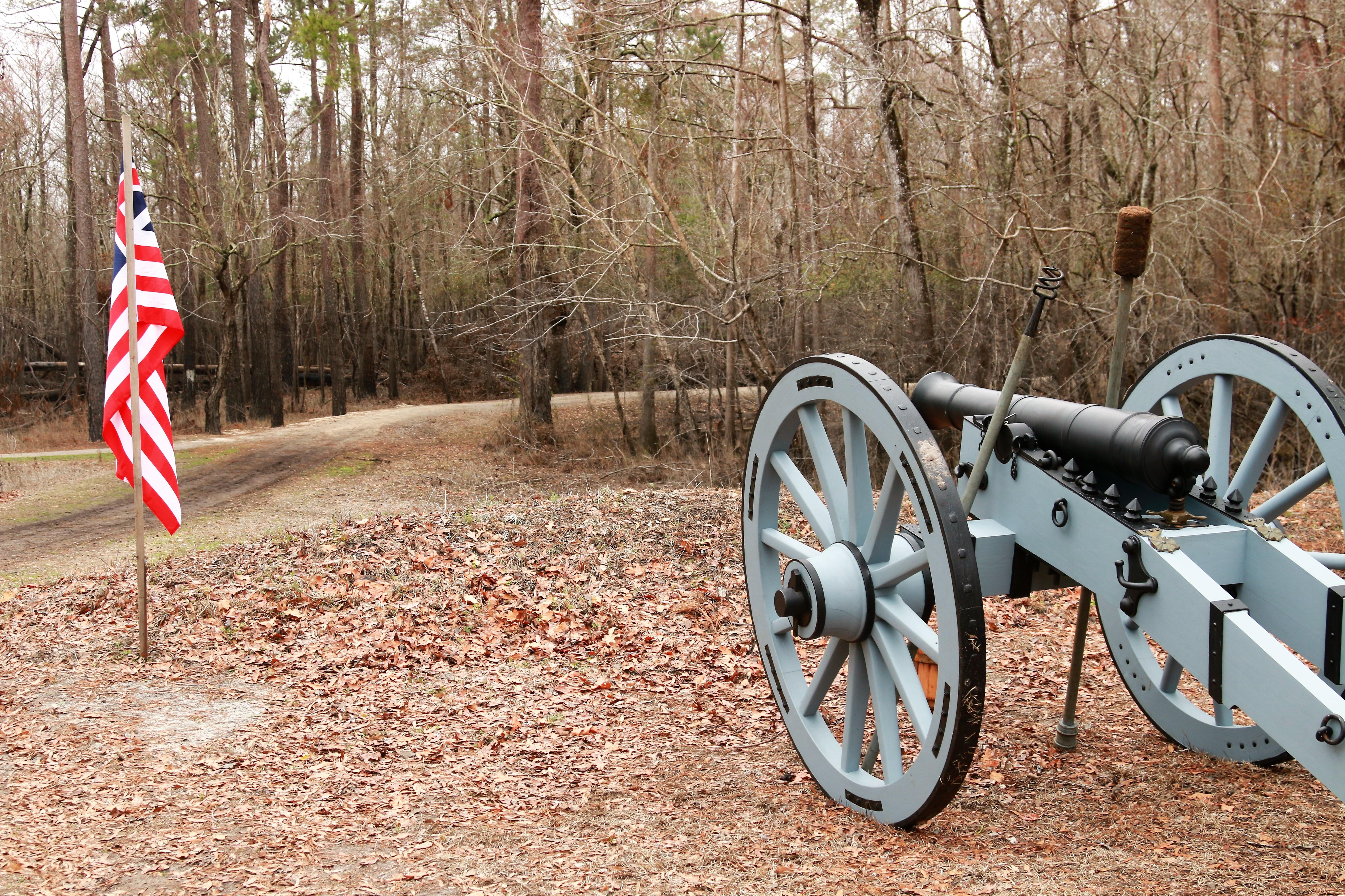
Moores Creek National Battlefield
National Battlefield
In the early morning hours of February 27, 1776, Loyalist forces charged across a partially dismantled Moores Creek Bridge. Beyond the bridge, nearly 1,000 North Carolina Patriots waited quietly with...
0 mi from route
~1 min detour
Free
near mile 224.9
Park data from the National Park Service API. Alerts update every 2 hours.
More Details
What kind of drive is this?
Expect a mix of road types, as this journey is only 20% highway-based and relies heavily on local thoroughfares like the Andrew Jackson Highway, American Indian Highway, and Jacksonville Highway. The character of the drive is distinctly turn-heavy, requiring more active attention than a standard interstate cruise. You will encounter a longest uninterrupted stretch of 73.3 miles on the Andrew Jackson Highway, which provides the most consistent pace of the trip. Transitioning between these routes requires navigating more technical local segments, so be prepared for a drive that shifts in intensity as you move across the state.
Only 20% highway — the rest is turn-by-turn surface driving.
46 navigation steps total — most of the decisions cluster near the start and finish.
Longest single stretch: 73.3 mi on Andrew Jackson Highway.
How Hard Is This Drive?
10/10
Expect a hands-on drive with frequent turns and local roads rather than long highway stretches. This route has several spots where lane changes, forks, or exits need your full attention. The trickiest moment comes around 2 miles in.
Driving Effort10/10
High effort - long or complex enough to need steady focus all day
Balances navigation complexity with total wheel time.
This is a demanding drive. With 22 significant decision points across 271.8 miles, you will need to stay alert - especially through interchange areas and urban stretches. Consider splitting it into segments if you are not comfortable with fast highway navigation.
Where does it get tricky?
The main spots that need attention: at 2 miles: Highway fork - watch signs carefully. Lane positioning matters here. Multiple destination signs - pick the right one; at 28.9 miles: Exit ramp - move to the correct lane early. Lane positioning matters here. Multiple destination signs - pick the right one; at 29.1 miles: Highway fork - watch signs carefully. Lane positioning matters here. Multiple destination signs - pick the right one.
Elevation Profile
Mostly flat terrain
1,001 ft14 ft
Total Climb
1 ft
Total Descent
988 ft
Highest Point
1,001 ft
Elevation Range
987 ft
Towns Mentioned on Route Signs
Based on OSRM destination-sign hints, not a full list of every settlement the road passes.
Between Kings Mountain, NC and Jacksonville, NC, road signs point toward Charlotte, Bank Of America Stadium and Wilmington.
Charlotte
28.9 mi in|~35m
Bank Of America Stadium
29.1 mi in|~35m
Wilmington
46 mi in|~59m|via US 74 BYP
Who Is This Route For?
Weekend Trip
Doable as a same-day drive at 5h 44m. Total distance: 271.8 miles.
Family Friendly
Moderate complexity with 1 natural rest stops along the way.
Solo Traveler
5h 44m drive, comfortable solo distance.
Scenic Drive
Mostly surface roads route profile with national parks nearby.
Frequently Asked Questions
The longest stretch is about 73.3 miles on Andrew Jackson Highway. The full list of main roads is in the Roads section above.
We did not find dedicated rest areas on this route. For a drive this long, plan bathroom and stretch breaks around gas stations, fast-food stops, or small-town downtowns — check the Nearby Places section for options.
It helps. This route has a higher-than-average number of complex decision points, which get harder in the dark. If the last hour of the trip is on surface roads or mountain grades, aim to arrive at Jacksonville, NC before sunset when you can. Check the Trip Plan for departure windows that land you in daylight.
Only with planning. This is a long drive for kids — consider splitting it into two days rather than pushing through. Plan at least 1 meaningful breaks. Dedicated rest areas are limited, so plan gas or food stops as your bathroom breaks.
The main spots that need attention: at 2 miles: Highway fork - watch signs carefully. Lane positioning matters here. Multiple destination signs - pick the right one; at 28.9 miles: Exit ramp - move to the correct lane early. Lane positioning matters here. Multiple destination signs - pick the right one; at 29.1 miles: Highway fork - watch signs carefully. Lane positioning matters here. Multiple destination signs - pick the right one.
Yes — Moores Creek National Battlefield. See the National Parks section for detour distances and tips on detours.
Not recommended in a single day. At 5.7 hours each way, a round trip means 11.5 hours of driving — that is an unsafe level of fatigue for most drivers. Plan at least one night at Jacksonville, NC before the return drive.