Traveling from Johns Creek to Brunswick covers a total of 329.8 miles through the heart of Georgia. Expect to spend approximately 6 hours and 10 minutes on the road, making this a manageable one-day trip for most drivers. You will primarily navigate via I-75, I-16, and I-95. With an estimated fuel cost of $53, it is an affordable journey between the northern suburbs and the Southeast coast. While it is certainly possible to complete the trek in a single day, be prepared for a solid block of driving time. Since the entire route stays within Georgia, you will notice the landscape transition from the rolling Piedmont to the flat, coastal terrain of the Southeast region.
Trip Pace
Same-day drive is realistic
A same-day return is possible, but it will make for a full day on the road.
Break Rhythm
1 planned break
Plan on a short reset every 3 to 4 hours to stay fresh behind the wheel.
Midpoint
164.9 miles from Johns Creek, GA
A natural place for your longest stop of the day
, about 3h 8m into the drive
.
Main Roads
Road
Distance
Duration
I 16
155.9 mi
2h 47m
I 95
62.2 mi
1h 6m
I 75
61.6 mi
1h 6m
Atlanta Bypass / The Perimeter
20.1 mi
23m
Terrell Starr Parkway
10.2 mi
11m
Peachtree Parkway
3.9 mi
6m
Peachtree Industrial Boulevard
3.7 mi
5m
Newcastle Street
2.3 mi
3m
Longest stretch:
I 16
— 155.9 mi, about 2h 47m
Traffic on I-285
Hour-of-day weekday pattern from 69 FHWA count stations on your route.
Peak
5 PM
~6,200 veh/hr typical
Quietest
2 AM
~744 veh/hr
Peak-to-quiet ratio
8.3×
busier at peak than in the quiet hours
12a6anoon6p11p
Averaged across 52 weeks of 2023 FHWA Travel Monitoring Analysis System data. Weekday hours only (Mon–Fri).
Turn-by-Turn Driving Directions
Step-by-step road directions between Johns Creek, GA and Brunswick, GA.
1
Start on Morgan Hill Court
270 ft·17 sec·Morgan Hill Court
2
Turn left onto Groomsbridge Road
0.5 mi·2 min·Groomsbridge Road
3
At end of road, turn right onto Grove Point Road
0.2 mi·45 sec·Grove Point Road
4
Turn right onto GA 141
2.1 mi·3 min·Medlock Bridge Road
Use the straight / right lanes.
5
Continue on GA 141
3.9 mi·6 min·Peachtree Parkway
Use the straight / slight left lanes.
6
Take the exit onto GA 141
0.2 mi·15 sec·GA 141
Toward GA 141 South: Doraville, Chamblee
7
Merge onto GA 141
3.7 mi·5 min·Peachtree Industrial Boulevard
Use the straight / slight right lanes.
8
Take the exit
0.4 mi·52 sec
Toward I 285 EastUse the left lane.
9
Merge onto I 285
20 mi·23 min·Atlanta Bypass / The Perimeter
Use the straight lane.
10
Take the exit
1.1 mi·2 min
Exit 52Toward I 675 South: MaconUse the straight / slight right lanes.
11
Continue on I 675
10 mi·11 min·Terrell Starr Parkway
Use the straight / slight right lanes.
12
Merge onto I 75
49 mi·53 min·I 75
Use the straight lane.
13
Keep slight left at fork onto I 75
12 mi·13 min·I 75
Toward Macon, SavannahUse the straight / slight right lanes.
14
Take the exit
1.1 mi·1 min
Exit 165Toward I 16 East: Jim Gillis Highway, SavannahUse the slight right lane.
15
Continue on I 16
156 mi·2 hr 47 min·I 16
Use the straight / slight right lanes.
16
Take the exit
0.5 mi·31 sec
Toward I 95 South: Brunswick, Jacksonville
17
Merge onto I 95
62 mi·1 hr 6 min·I 95
18
Take the exit
0.4 mi·52 sec
Exit 36AToward US 25 South, US 341 South: Brunswick
19
Merge onto US 25; US 341; GA 27
1.5 mi·2 min·New Jesup Highway
20
Continue on US 25; US 341; GA 27
0.9 mi·1 min·Norwich Street
21
Continue on US 25; US 341; GA 27
0.5 mi·47 sec·New Jesup Highway
22
Continue on US 25; US 341; GA 27
2.3 mi·3 min·Newcastle Street
23
Turn straight onto New Castle Street
0.2 mi·26 sec·New Castle Street
24
Turn left onto US 25; GA 25 Connector
0.2 mi·44 sec·Gloucester Street
25
Turn right onto Norwich Street
62 ft·2 sec·Norwich Street
26
Arrive at destination
Norwich Street
Trip Plan
To keep your drive smooth, plan for at least one dedicated stop to stretch your legs during the 6-hour journey. Since you are dealing with major interstates like I-95, try to avoid departing during peak rush hours to minimize potential traffic delays. Keep an eye on your fuel gauge before starting the 155.9-mile segment on I-16, as this will be your longest uninterrupted stretch of the trip. Having $53 set aside for gas will cover your needs, but having a little extra for convenience store snacks is always a smart move. Because the trip is short enough for a single day, you have the flexibility to leave early in the morning and arrive in Brunswick with plenty of daylight left to explore the coast.
Morning Departure
Start early — leave by 6-7 AM to arrive at a reasonable hour.
Evening Departure
This is a long drive — plan for a morning departure or consider splitting it into two days.
You can normally do this drive in one day.
Plan roughly 1 meaningful break for fuel, food, and rest.
The halfway point lands around 164.9 miles from Johns Creek, GA, or about 3h 8m into the drive.
The longest continuous stretch on this route runs about 155.9 miles.
This is a comfortable same-day trip.
Departure
Before you leave
Start with fuel, water, and navigation already sorted so the first hour feels easy.
First stop
Around 73 miles or 1h 29m in
Use this first pause for coffee, a restroom break, and a quick traffic check ahead.
Halfway reset
Around 164.9 miles or 3h 8m in
This is the best place for your longest stop, a real meal, and a full fuel check.
Final approach
Final hour starts around 5h 2m
Traffic, exits, and arrival timing usually matter more near Brunswick, GA than in the middle of the route.
Before You Leave
+
Open the route before leaving Johns Creek, GA so your first major turns are already loaded.
+
Leave with enough water and a charging cable within reach, not packed away.
+
Check your fuel range against the first long segment, especially if you are starting outside city service areas.
Day 1
Settle into the route from Johns Creek, GA
This is one driving day of about 329.8 miles and 6h 10m.
Your first comfortable stop window is around 73 miles from Johns Creek, GA.
This route can stay practical as a one-day drive if traffic stays reasonable.
Plan about 1 real break rather than only quick fuel stops.
The longest stretch is on I 16 for about 155.9 miles.
Where to Stop
Rest stops, refuel points, and overnight suggestions along this route.
Place data sourced from public business listings. Hours and availability may vary.
Heads-up: tricky spots
5 of 17
5 decision points cluster between mile 10.7 and 323.8 — GPS handles the exact turns, but know they're coming. Your lane choice matters more than the turn itself.
6
10.7 mi into trip|~18m in
Take the exit toward I 285 East
Exit ramp - move to the correct lane early. Lane positioning matters here
Use the left lane.
Toward I 285 East
7
31.3 mi into trip|~42m in
Take the exit toward I 675 South: Macon
Exit ramp - move to the correct lane early. Lane positioning matters here
Use the straight / slight right lanes.
Exit 52
Toward I 675 South: Macon
8
91.9 mi into trip|~1h 49m in|I 75
Keep slight left at fork onto I 75 toward Macon, Savannah
Highway fork - watch signs carefully. Lane positioning matters here. Multiple destination signs - pick the right one
Use the straight / slight right lanes.
Toward Macon, Savannah
8
104.1 mi into trip|~2h 3m in
Take the exit toward I 16 East: Jim Gillis Highway, Savannah
Exit ramp - move to the correct lane early. Lane positioning matters here. Multiple destination signs - pick the right one
Use the slight right lane.
Exit 165
Toward I 16 East: Jim Gillis Highway, Savannah
6
323.8 mi into trip|~5h 59m in
Take the exit toward US 25 South, US 341 South: Brunswick
Exit ramp - move to the correct lane early. Multiple destination signs - pick the right one
Exit 36A
Toward US 25 South, US 341 South: Brunswick
Fuel & Cost
Regular Gas
$48.69 one way
$97.38 round trip
$3.75/gal25.4 MPG avg115 kg CO2
Fuel Type
$/gal
One Way
Round Trip
midgrade
$4.12
$53.51
$107.02
premium
$4.49
$58.33
$116.65
diesel
$4.80
$62.27
$124.54
No toll roads detected on this route.
Estimated Trip Cost (one way, 1 person)
Fuel
$49
Meals
$25–$50
Total
$74–$99
Rough estimate based on US averages. Hotel $80–$140/night, meals $25–$50/day.
Estimated CO2 emission: 115.4 kg one way.
Prices: EIA weekly data, 2026-07-13.
Driving Electric?
About $35 in charging
· 1 stop
· 66% less CO2
Vehicle Type
kWh
Stops
DC Fast
Home Charge
Average EV
98.9
1
$34.63
$15.83
Efficient EV
82.5
0
$28.86
$13.19
EV Truck/SUV
131.9
1
$46.17
$21.11
Gas CO2
115 kg
EV CO2
39 kg (66% less)
Plan for 1 charging stop. A 30-minute DC fast charge mid-route should be enough to complete the trip comfortably.
DC fast charging avg $0.35/kWh. Home charging avg $0.16/kWh. US grid CO2: 0.39 kg/kWh.
Travel Intel
Current conditions at both ends of the drive.
Forecast as of Jul 17, 2026
Origin
Johns Creek, GA
Night
in Johns Creek on Saturday
Local time
9:32 PM
EDT
Current temp
92°F
Mostly Sunny then Showers And Thunderstorms Likely
NW 5 mph55% chanceLive forecast
Heat Advisory
Heat Advisory issued July 17 at 7:49AM EDT until July 17 at 8:00PM EDT by NWS Peachtree City GA
Destination
Brunswick, GA
Night
in Brunswick on Saturday
Local time
9:32 PM
EDT
Current temp
93°F
Sunny then Slight Chance Showers And Thunderstorms
S 5 to 12 mph19% chanceLive forecast
Heat Advisory
Heat Advisory issued July 17 at 7:49AM EDT until July 17 at 8:00PM EDT by NWS Peachtree City GA
Seasonal Notes
Summer travel usually means heavier construction, hotter rest stops, and busier weekend traffic around major cities.
Winter travel shortens daylight, so a route that looks manageable on paper can feel much longer after dark.
Holiday weekends tend to make both departure and arrival windows slower than the raw route time suggests.
Time zone
Same local time
Origin and destination are on the same clock, so arrival timing is easier to judge at a glance.
Temperature spread
1 degrees warmer at arrival
A meaningful temperature swing is a good cue to rethink layers, water, and how soon you want to arrive.
Road read
6h 10m on the road
Start early — leave by 6-7 AM to arrive at a reasonable hour.
Weather data from the National Weather Service. Conditions may change; check closer to your travel date.
National Parks Near This Route
Worth a detour if your schedule allows.
Ocmulgee Mounds National Historical Park
National Historical Park
Welcome to Ocmulgee Mounds National Historical Park. This park is a prehistoric American Indian site, where many different American Indian cultures occupied this land for thousands of years. American...
5 mi from route
~12 min detour
Free
near mile 102.4
Caution: River Trail periodically closed under I-16
Park Closure: BOARDWALK CLOSED along the River Trail
Today the river valley attracts us for so many reasons. Take a solitary walk to enjoy nature’s display, raft leisurely through the rocky shoals with friends, fish the misty waters as the sun comes up,...
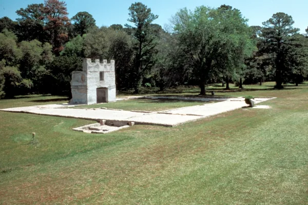
War was imminent as James Oglethorpe established Fort Frederica in 1736, to help protect the British colonies from the Spanish in Florida. Fort Frederica illustrates the story of the War of Jenkins Ea...
7 mi from route
~18 min detour
Free
near mile 318.4
Welcome to Martin Luther King, Jr. National Historical Park & Preservation District where a young boy grows up in a time of segregation. He was moved by destiny to lead the modern civil rights movemen...
8 mi from route
~20 min detour
Free
near mile 22.7
For much of the 19th century, masonry fortifications were the United States’ main defense against overseas enemies. However, during the Civil War, new technology proved its superiority over these fort...
19 mi from route
~47 min detour
$10
near mile 261.6
St Marys is the gateway to Cumberland Island, Georgia's largest and southernmost barrier island. Here pristine maritime forests, undeveloped beaches and wide marshes whisper the stories of both man an...
20 mi from route
~51 min detour
$15
near mile 329.8
Park data from the National Park Service API. Alerts update every 2 hours.
More Details
What kind of drive is this?
This trip is a quintessential highway-focused drive, with 89% of your time spent cruising on major interstates. You should be prepared for a consistent, high-speed pace as you move through the state. The most significant portion of your journey is a 155.9-mile stretch on I-16, which will require steady concentration and long periods of highway driving. Because the route relies so heavily on the interstate system, the road remains wide and predictable throughout the transition from the interior to the coast. Expect a straightforward driving experience that prioritizes efficiency and speed over technical maneuvers or winding backroads.
89% highway — fuel and pacing are the main things to plan.
26 navigation steps total — most of the decisions cluster near the start and finish.
Longest single stretch: 155.9 mi on I 16.
How Hard Is This Drive?
9/10
This is a straightforward highway drive that stays mostly on I 16 and I 95. This route has several spots where lane changes, forks, or exits need your full attention. The trickiest moment comes around 10.7 miles in.
Driving Effort9/10
High effort - long or complex enough to need steady focus all day
Balances navigation complexity with total wheel time.
This is a demanding drive. With 17 significant decision points across 329.8 miles, you will need to stay alert - especially through interchange areas and urban stretches. Consider splitting it into segments if you are not comfortable with fast highway navigation.
Where does it get tricky?
The main spots that need attention: at 10.7 miles: Exit ramp - move to the correct lane early. Lane positioning matters here; at 31.3 miles: Exit ramp - move to the correct lane early. Lane positioning matters here; at 91.9 miles (I 75): Highway fork - watch signs carefully. Lane positioning matters here. Multiple destination signs - pick the right one.
Elevation Profile
Mostly flat terrain
975 ft9 ft
Total Climb
29 ft
Total Descent
977 ft
Highest Point
975 ft
~23.6 mi in
Elevation Range
967 ft
Towns Mentioned on Route Signs
Based on OSRM destination-sign hints, not a full list of every settlement the road passes.
Between Johns Creek, GA and Brunswick, GA, road signs point toward Macon, Savannah and Jacksonville.
Atlanta is the vanguard of the New South, with the charm and elegance of the Old. It's a city that balances southern traditions with sleek modernism, and southern hospitality with three skylines and the world’s busiest airport. It's a city that has been burnt to the ground and built back up; seen the horrors of war; felt the pain of droughts and floods; and given birth to Martin Luther King, Jr., the greatest figure of the civil rights movement. Atlanta is the capital of the state of Georgia.
Top landmarks
•Autrey Mill Nature Preserve & Heritage Center — nature center in Johns Creek, Georgia, USA
Brunswick is a city in Coastal Georgia just north of Florida, the mainland gateway to several islands in the Intracoastal Waterway, including St. Simons Island and Jekyll Island.
Top landmarks
•Brunswick Old Town Historic District — historic district in Brunswick, Georgia
•Ballard School — historic school building in Brunswick, Georgia
•Windsor Park Historic District — historic district in Georgia, United States
Doable as a same-day drive at 6h 10m. Total distance: 329.8 miles.
Family Friendly
Moderate complexity with 1 natural rest stops along the way.
Solo Traveler
6h 10m drive, plan rest stops for pacing.
Frequently Asked Questions
The longest stretch is about 155.9 miles on I 16. The full list of main roads is in the Roads section above.
Yes — we found about 31 rest areas or service plazas within a short detour of the route (from OpenStreetMap). See the Rest Stops tab under Nearby Places for locations and mile markers. Plan to stretch, use the bathroom, and top off fluids every 2–3 hours on longer drives.
It helps. This route has a higher-than-average number of complex decision points, which get harder in the dark. If the last hour of the trip is on surface roads or mountain grades, aim to arrive at Brunswick, GA before sunset when you can. Check the Trip Plan for departure windows that land you in daylight.
Only with planning. This is a long drive for kids — consider splitting it into two days rather than pushing through. Plan at least 1 meaningful breaks. There are 31 rest areas along the route for bathroom stops.
The main spots that need attention: at 10.7 miles: Exit ramp - move to the correct lane early. Lane positioning matters here; at 31.3 miles: Exit ramp - move to the correct lane early. Lane positioning matters here; at 91.9 miles (I 75): Highway fork - watch signs carefully. Lane positioning matters here. Multiple destination signs - pick the right one.
Yes — Ocmulgee Mounds National Historical Park, Chattahoochee River National Recreation Area and Fort Frederica National Monument (6 total within detour distance). See the National Parks section for detour distances and tips on detours.
Not recommended in a single day. At 6.2 hours each way, a round trip means 12.4 hours of driving — that is an unsafe level of fatigue for most drivers. Plan at least one night at Brunswick, GA before the return drive.