Traveling from Isla Vista to Sacramento covers 387.2 miles and takes approximately 7 hours and 27 minutes of total drive time. Because this route relies on local roads like Abrego Road, Camino del Sur, and El Colegio Road rather than major interstates, it functions best as a single-day trip. You should budget about $91 for fuel to complete the journey. While both your starting point and destination are located within the Pacific Coast region, the shift from the immediate coast to the inland capital requires careful planning. If you prefer a steady pace, one well-timed stop will help you break up the drive comfortably.
Trip Pace
Same-day drive is realistic
A same-day return is possible, but it will make for a full day on the road.
Break Rhythm
2 planned breaks
Plan on a short reset every 3 to 4 hours to stay fresh behind the wheel.
Midpoint
193.6 miles from Isla Vista, CA
A natural place for your longest stop of the day
, about 3h 56m into the drive
.
Main Roads
Road
Distance
Duration
Westside Freeway
199.4 mi
3h 35m
El Camino Real
111.6 mi
2h 9m
CA 46
24.4 mi
28m
CA 41
20.8 mi
27m
Cabrillo Highway
11.9 mi
13m
CA 33
9.3 mi
12m
Skyline Boulevard
5.6 mi
8m
Storke Road
1.2 mi
2m
Longest stretch:
Westside Freeway
— 199.4 mi, about 3h 35m
Turn-by-Turn Driving Directions
Step-by-step road directions between Isla Vista, CA and Sacramento, CA.
1
Start on this road
90 ft·11 sec·this road
2
Turn left
259 ft·24 sec
3
Turn left onto Abrego Road
0.1 mi·29 sec·Abrego Road
4
Turn right onto Camino del Sur
0.2 mi·54 sec·Camino del Sur
5
Turn left onto El Colegio Road
0.4 mi·52 sec·El Colegio Road
6
Keep slight right at fork onto El Colegio Road
287 ft·7 sec·El Colegio Road
7
Turn straight onto Storke Road
1.2 mi·2 min·Storke Road
Use the straight lane.
8
Take the ramp
0.3 mi·32 sec
Toward US 101 North
9
Merge onto US 101
83 mi·1 hr 36 min·El Camino Real
Use the straight / slight right lanes.
10
Continue on US 101
12 mi·13 min·Cabrillo Highway
11
Continue on US 101
29 mi·32 min·El Camino Real
Use the straight lane.
12
Take the exit
0.2 mi·28 sec
Toward CA 46 East: Fresno, Bakersfield
13
Turn right onto CA 46
24 mi·28 min·CA 46
14
Merge onto CA 41; CA 46
1.4 mi·1 min·CA 41; CA 46
15
Turn slight right
490 ft·6 sec
16
Keep slight right at fork onto CA 41
19 mi·26 min·CA 41
17
Turn left onto CA 33
9.3 mi·12 min·CA 33
18
Turn right onto CA 269
5.6 mi·8 min·Skyline Boulevard
19
Continue on CA 269
0.5 mi·51 sec·South Lassen Avenue
20
Take the ramp
0.2 mi·25 sec
Toward I 5 North
21
Merge onto I 5
126 mi·2 hr 15 min·Westside Freeway
Use the straight / slight right lanes.
22
Keep slight right at fork onto I 5
26 mi·27 min·Westside Freeway
23
Keep left at fork onto I 5
48 mi·52 min·Westside Freeway
Use the straight / slight right lanes.
24
Take the exit
0.2 mi·34 sec
Exit 519BToward J Street, DowntownUse the straight / slight right lanes.
25
Turn right onto J Street
0.2 mi·25 sec·J Street
26
Turn left onto 5th Street
0.2 mi·19 sec·5th Street
Use the straight lane.
27
Turn right onto H Street
0.3 mi·40 sec·H Street
28
Turn right onto 9th Street
490 ft·15 sec·9th Street
Use the straight / right lanes.
29
Arrive at destination
9th Street
Trip Plan
To manage the 7h 27m duration effectively, aim to depart early in the morning to avoid the densest local traffic patterns. Since the route involves significant local driving, pacing is essential; plan for your single recommended stop to coincide with your fuel refill to keep your $91 budget on track. Flexibility is your biggest advantage here, as the lack of highway segments allows you to adjust your pace based on local road conditions. Keep a close eye on your navigation, as the reliance on local roads like El Colegio Road and Camino del Sur requires more frequent turns than a typical highway-based trek.
Morning Departure
Start early — leave by 6-7 AM to arrive at a reasonable hour.
Evening Departure
This is a long drive — plan for a morning departure or consider splitting it into two days.
You can normally do this drive in one day.
Plan roughly 2 meaningful breaks for fuel, food, and rest.
The halfway point lands around 193.6 miles from Isla Vista, CA, or about 3h 56m into the drive.
The longest continuous stretch on this route runs about 199.4 miles.
This is a comfortable same-day trip.
Departure
Before you leave
Start with fuel, water, and navigation already sorted so the first hour feels easy.
First stop
Around 85 miles or 1h 42m in
Use this first pause for coffee, a restroom break, and a quick traffic check ahead.
Halfway reset
Around 193.6 miles or 3h 56m in
This is the best place for your longest stop, a real meal, and a full fuel check.
Final approach
Final hour starts around 6h 19m
Traffic, exits, and arrival timing usually matter more near Sacramento, CA than in the middle of the route.
Before You Leave
+
Open the route before leaving Isla Vista, CA so your first major turns are already loaded.
+
Leave with enough water and a charging cable within reach, not packed away.
+
Check your fuel range against the first long segment, especially if you are starting outside city service areas.
+
Pick one backup stop option before the midpoint in case traffic changes your pacing.
Day 1
Settle into the route from Isla Vista, CA
This is one driving day of about 387.2 miles and 7h 27m.
Your first comfortable stop window is around 85 miles from Isla Vista, CA.
This route can stay practical as a one-day drive if traffic stays reasonable.
Plan about 2 real breaks rather than only quick fuel stops.
The longest stretch is on Westside Freeway for about 199.4 miles.
Where to Stop
Rest stops, refuel points, and overnight suggestions along this route.
Place data sourced from public business listings. Hours and availability may vary.
Heads-up: tricky spots
5 of 22
5 decision points cluster between mile 0 and 387.1 — GPS handles the exact turns, but know they're coming. Your lane choice matters more than the turn itself.
5
0 mi into trip|~0m in
Turn left
Navigation decision point
6
338.7 mi into trip|~6h 32m in|I 5 / Westside Freeway
Keep left at fork onto I 5 / Westside Freeway
Highway fork - watch signs carefully. Lane positioning matters here
Use the straight / slight right lanes.
8
386.2 mi into trip|~7h 24m in
Take the exit toward J Street, Downtown
Exit ramp - move to the correct lane early. Lane positioning matters here. Multiple destination signs - pick the right one
Use the straight / slight right lanes.
Exit 519B
Toward J Street, Downtown
7
386.6 mi into trip|~7h 25m in|5th Street
Turn left onto 5th Street
Lane positioning matters here
Use the straight lane.
7
387.1 mi into trip|~7h 26m in|9th Street
Turn right onto 9th Street
Lane positioning matters here
Use the straight / right lanes.
Fuel & Cost
Regular Gas
$89.00 one way
$177.99 round trip
$5.84/gal25.4 MPG avg136 kg CO2
Fuel Type
$/gal
One Way
Round Trip
midgrade
$6.02
$91.71
$183.42
premium
$6.18
$94.16
$188.33
diesel
$5.61
$85.49
$170.98
No toll roads detected on this route.
Estimated Trip Cost (one way, 1 person)
Fuel
$89
Meals
$25–$50
Total
$114–$139
Rough estimate based on US averages. Hotel $80–$140/night, meals $25–$50/day.
Estimated CO2 emission: 135.5 kg one way.
Prices: EIA weekly data, 2026-04-13.
Driving Electric?
About $41 in charging
· 1 stop
· 67% less CO2
Vehicle Type
kWh
Stops
DC Fast
Home Charge
Average EV
116.2
1
$40.66
$18.59
Efficient EV
96.8
1
$33.88
$15.49
EV Truck/SUV
154.9
1
$54.21
$24.78
Gas CO2
135 kg
EV CO2
45 kg (67% less)
Plan for 1 charging stop. A 30-minute DC fast charge mid-route should be enough to complete the trip comfortably.
DC fast charging avg $0.35/kWh. Home charging avg $0.16/kWh. US grid CO2: 0.39 kg/kWh.
Travel Intel
Current conditions at both ends of the drive.
Forecast as of Jun 21, 2022
Origin
Isla Vista, CA
Morning
in Isla Vista on Sunday
Local time
11:47 AM
PDT
Current temp
75°F
Unavailable
Live forecast
Destination
Sacramento, CA
Morning
in Sacramento on Sunday
Local time
11:47 AM
PDT
Current temp
68°F
Unavailable
Live forecast
Seasonal Notes
Summer travel usually means heavier construction, hotter rest stops, and busier weekend traffic around major cities.
Winter travel shortens daylight, so a route that looks manageable on paper can feel much longer after dark.
Holiday weekends tend to make both departure and arrival windows slower than the raw route time suggests.
Time zone
Same local time
Origin and destination are on the same clock, so arrival timing is easier to judge at a glance.
Temperature spread
7 degrees cooler at arrival
A meaningful temperature swing is a good cue to rethink layers, water, and how soon you want to arrive.
Road read
7h 27m on the road
Start early — leave by 6-7 AM to arrive at a reasonable hour.
Weather data from the National Weather Service. Conditions may change; check closer to your travel date.
National Parks Near This Route
Worth a detour if your schedule allows.
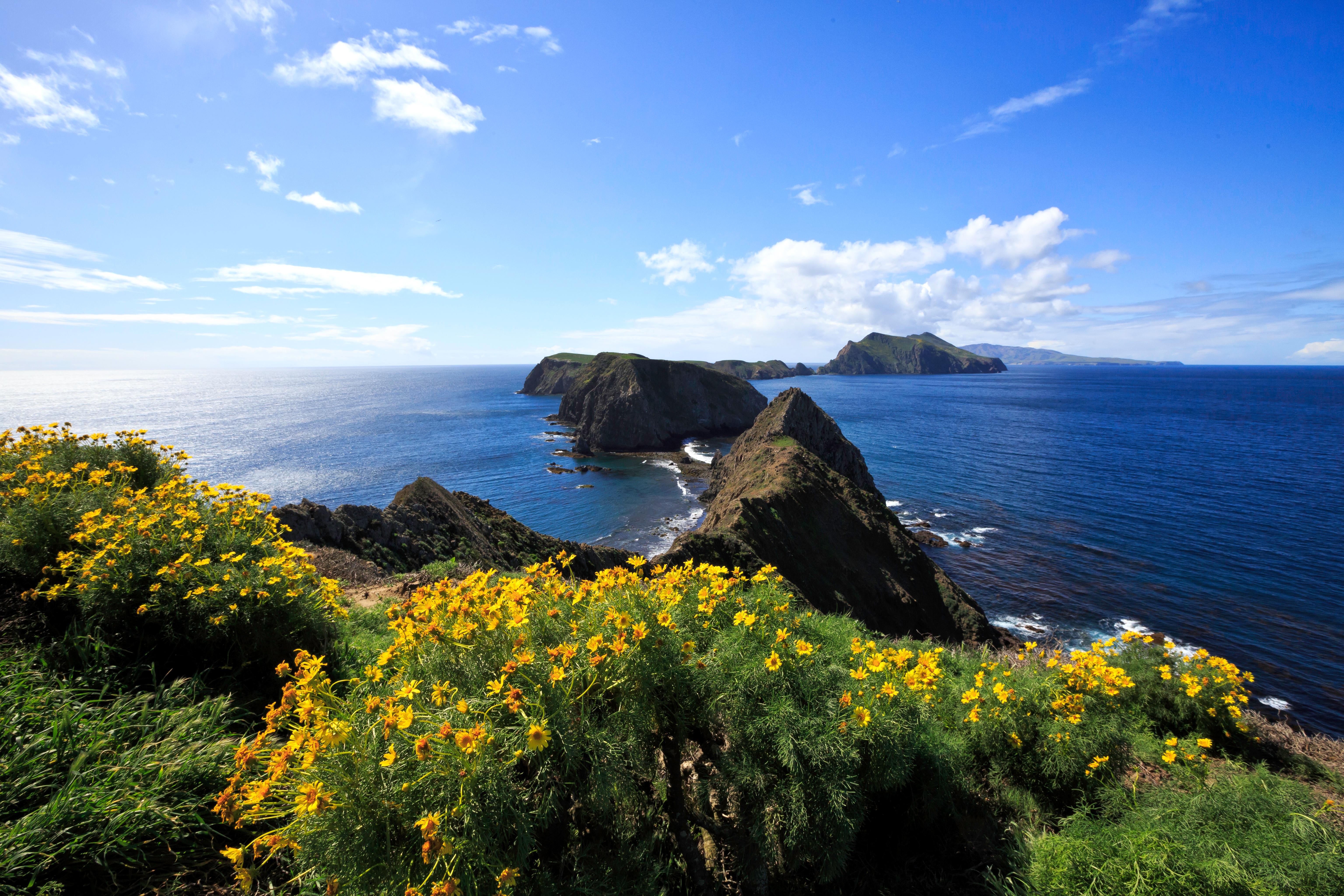
Channel Islands National Park
National Park
Channel Islands National Park encompasses five remarkable islands and their ocean environment, preserving and protecting a wealth of natural and cultural resources. Isolation over thousands of years h...
30 mi from route
~74 min detour
Free
Park Closure: Temporary Closure on Santa Rosa Island
Park data from the National Park Service API. Alerts update every 2 hours.
More Details
What kind of drive is this?
Expect a turn-heavy local drive that demands your full attention behind the wheel. Unlike a standard interstate cruise, this route features 0% highway share, meaning you will be navigating local arterial roads for the duration of the trip. The character of the road remains technical and winding, requiring you to stay alert through the various local transitions. You won't find long, monotonous stretches of highway here; instead, the path prioritizes local connectivity. Prepare for a more involved driving experience as you transition away from the coastal environment toward the Sacramento area.
66% highway — fuel and pacing are the main things to plan.
29 navigation steps total — most of the decisions cluster near the start and finish.
Longest single stretch: 199.4 mi on Westside Freeway.
How Hard Is This Drive?
8/10
This is a straightforward highway drive that stays mostly on Westside Freeway and El Camino Real. This route has several spots where lane changes, forks, or exits need your full attention. The trickiest moment comes early in the drive.
Driving Effort8/10
Demanding - plan breaks and stay ahead of the key maneuvers
Balances navigation complexity with total wheel time.
This is a demanding drive. With 22 significant decision points across 387.2 miles, you will need to stay alert - especially through interchange areas and urban stretches. Consider splitting it into segments if you are not comfortable with fast highway navigation.
Where does it get tricky?
The main spots that need attention: near the start: Navigation decision point; at 338.7 miles (I 5 / Westside Freeway): Highway fork - watch signs carefully. Lane positioning matters here; at 386.2 miles: Exit ramp - move to the correct lane early. Lane positioning matters here. Multiple destination signs - pick the right one.
Elevation Profile
Gently rolling terrain
985 ft14 ft
Total Climb
2,071 ft
Total Descent
2,088 ft
Highest Point
985 ft
~138.3 mi in
Elevation Range
971 ft
Towns Mentioned on Route Signs
Based on OSRM destination-sign hints, not a full list of every settlement the road passes.
On the drive from Isla Vista, CA to Sacramento, CA, road signs begin pointing toward Bakersfield along the way.
Sacramento is the state capital of California in the United States. It is the regional center for the Greater Sacramento metropolitan area, which dominates much of the surrounding Sacramento Valley and stretches into parts of Gold Country.
Sacramento is the oldest incorporated city in California, settled between the confluences of the Sacramento and American rivers. The city has been the site of many important historic events that have shaped California and U.S. history, most notably the California Gold Rush and location of the original terminus of the First Transcontinental Railroad. Much of this historical legacy has been preserved, especially in the historic Old Sacramento district, where buildings and railroads from that era continue to attract visitors.
However, Sacramento is not a city that is stuck in the past. As the capital of the most populous U.S.
Top landmarks
•California State Capitol — state capitol building of the U.S. state of California
•Crocker Art Museum — art museum in Sacramento, California
•Sacramento Valley Station — main railroad and light rail station in Sacramento, California
Doable as a same-day drive at 7h 27m. Total distance: 387.2 miles.
Family Friendly
Moderate complexity with 2 natural rest stops along the way.
Solo Traveler
7h 27m drive, plan rest stops for pacing.
Frequently Asked Questions
The longest stretch is about 199.4 miles on Westside Freeway. The full list of main roads is in the Roads section above.
We did not find dedicated rest areas on this route. For a drive this long, plan bathroom and stretch breaks around gas stations, fast-food stops, or small-town downtowns — check the Nearby Places section for options.
It helps. This route has a higher-than-average number of complex decision points, which get harder in the dark. If the last hour of the trip is on surface roads or mountain grades, aim to arrive at Sacramento, CA before sunset when you can. Check the Trip Plan for departure windows that land you in daylight.
Only with planning. This is a long drive for kids — consider splitting it into two days rather than pushing through. Plan at least 2 meaningful breaks. Dedicated rest areas are limited, so plan gas or food stops as your bathroom breaks.
The main spots that need attention: near the start: Navigation decision point; at 338.7 miles (I 5 / Westside Freeway): Highway fork - watch signs carefully. Lane positioning matters here; at 386.2 miles: Exit ramp - move to the correct lane early. Lane positioning matters here. Multiple destination signs - pick the right one.
Yes — Channel Islands National Park. See the National Parks section for detour distances and tips on detours.
Not recommended in a single day. At 7.5 hours each way, a round trip means 14.9 hours of driving — that is an unsafe level of fatigue for most drivers. Plan at least one night at Sacramento, CA before the return drive.