Origin
Isla Vista, CA
Morning in Isla Vista on Sunday
Local time
11:47 AM
PDT
Current temp
75°F
Unavailable
Live forecast
Compiled and reviewed by the US Trip Planner planning team at COD Solutions Oy · Last reviewed Apr 19, 2026 · Editorial standards
Drive Time
5h 48m
Distance
297.1 mi
478 km
Drive Score
8/10
Great drive
Same Day?
Yes, doable
Fuel Cost
$68
one way
EV Charging
Unknown
Estimated drive times based on typical traffic patterns. Actual times may vary with weather, construction, and real-time conditions.

Isla Vista, CA
Abhishek Navlakha
Isla Vista to Fremont is 297.1 miles and takes about 5h 48m via El Camino Real, with a fuel budget near $68 and enough daylight to finish in a day. This drive stays within California, taking you from the Pacific Coast region up toward the same region. Expect a route with a lot of turns, primarily on local roads, so it's not a high-speed dash. With a recommended one-day drive, you'll have flexibility in your schedule, but keep in mind the fuel cost will be around $68. Plan for a single stop to break up the journey.
Trip Pace
Same-day drive is realistic
A same-day return is possible, but it will make for a full day on the road.
Break Rhythm
1 planned break
Plan on a short reset every 3 to 4 hours to stay fresh behind the wheel.
Midpoint
148.6 miles from Isla Vista, CA
A natural place for your longest stop of the day , about 2h 55m into the drive .
| Road | Distance | Duration |
|---|---|---|
| El Camino Real | 229.6 mi | 4h 25m |
| South Valley Freeway | 26.3 mi | 30m |
| Nimitz Freeway | 13 mi | 14m |
| US 101 | 12.2 mi | 14m |
| Cabrillo Highway | 11.9 mi | 13m |
| Mowry Avenue | 1.4 mi | 2m |
| Storke Road | 1.2 mi | 2m |
| El Colegio Road | 0.4 mi | 1m |
Step-by-step road directions between Isla Vista, CA and Fremont, CA.
Start on this road
Turn left
Turn left onto Abrego Road
Turn right onto Camino del Sur
Turn left onto El Colegio Road
Keep slight right at fork onto El Colegio Road
Turn straight onto Storke Road
Take the ramp
Merge onto US 101
Continue on US 101
Continue on US 101
Continue on US 101
Keep slight left at fork onto US 101
Take the exit
Merge onto I 880
Keep slight right at fork onto I 880
Take the exit
Turn right onto Mowry Avenue
Arrive at destination
Given this is a single-day drive, the best time to leave Isla Vista will depend on your preference for avoiding local traffic, but aim to depart mid-morning to allow for flexibility. You'll have one recommended stop, so plan this strategically around the halfway point or where you might need to refuel. The fuel cost is estimated at $68, so ensure your tank is full before you set off. Since 229.6 miles are on El Camino Real, keep an eye out for speed limit changes and local traffic patterns, as this will dictate your overall pace more than the freeway sections.
Morning Departure
An early start around 7-8 AM gets you there with plenty of daylight left.
Evening Departure
A late afternoon start means arriving after dark. Morning is better.
This is a comfortable same-day trip.
Departure
Before you leave
Start with fuel, water, and navigation already sorted so the first hour feels easy.
First stop
Around 65 miles or 1h 18m in
Use this first pause for coffee, a restroom break, and a quick traffic check ahead.
Halfway reset
Around 148.6 miles or 2h 55m in
This is the best place for your longest stop, a real meal, and a full fuel check.
Final approach
Final hour starts around 4h 44m
Traffic, exits, and arrival timing usually matter more near Fremont, CA than in the middle of the route.
Open the route before leaving Isla Vista, CA so your first major turns are already loaded.
Leave with enough water and a charging cable within reach, not packed away.
Check your fuel range against the first long segment, especially if you are starting outside city service areas.
Day 1
Settle into the route from Isla Vista, CA
This is one driving day of about 297.1 miles and 5h 48m.
Rest stops, refuel points, and overnight suggestions along this route.

Mid-route town
Meal stop
149 mi into the route
Best for: Lunch, fuel, and a longer reset
This sits close to the middle of the route, so it works well for the longest stop of the day.
A short stop after about 65 miles helps settle the day before fatigue starts building.
The midpoint is around 148.6 miles from Isla Vista, CA, which is a good place for a longer meal and fuel stop.
Before the longest stretch
Fuel checkTop up before El Camino Real if your tank is already low. That segment runs about 229.6 miles.
These stop ideas are pacing suggestions — the exact town or exit can change with traffic, hotel plans, and fuel range.
5 decision points cluster between mile 0 and 295.5 — GPS handles the exact turns, but know they're coming. Your lane choice matters more than the turn itself.
Turn left
Navigation decision point
Keep slight left at fork onto US 101
Highway fork - watch signs carefully. Lane positioning matters here
Take the exit toward I 880 North: Oakland
Exit ramp - move to the correct lane early. Lane positioning matters here
Keep slight right at fork onto I 880 / Nimitz Freeway
Highway fork - watch signs carefully. Lane positioning matters here
Take the exit toward Mowry Avenue, Central Fremont
Exit ramp - move to the correct lane early. Lane positioning matters here. Multiple destination signs - pick the right one
Regular Gas
$68.29 one way
$136.57 round trip
| Fuel Type | $/gal | One Way | Round Trip |
|---|---|---|---|
| midgrade | $6.02 | $70.37 | $140.74 |
| premium | $6.18 | $72.25 | $144.50 |
| diesel | $5.61 | $65.60 | $131.19 |
No toll roads detected on this route.
Estimated Trip Cost (one way, 1 person)
Fuel
$68
Meals
$25–$50
Total
$93–$118
Rough estimate based on US averages. Hotel $80–$140/night, meals $25–$50/day.
Estimated CO2 emission: 103.9 kg one way. Prices: EIA weekly data, 2026-04-13.
Driving Electric?
About $31 in charging · 1 stop · 66% less CO2
| Vehicle Type | kWh | Stops | DC Fast | Home Charge |
|---|---|---|---|---|
| Average EV | 89.1 | 1 | $31.20 | $14.26 |
| Efficient EV | 74.3 | 0 | $26.00 | $11.88 |
| EV Truck/SUV | 118.8 | 1 | $41.59 | $19.01 |
Gas CO2
104 kg
EV CO2
35 kg (66% less)
Plan for 1 charging stop. A 30-minute DC fast charge mid-route should be enough to complete the trip comfortably.
DC fast charging avg $0.35/kWh. Home charging avg $0.16/kWh. US grid CO2: 0.39 kg/kWh.
Current conditions at both ends of the drive.
Origin
Morning in Isla Vista on Sunday
Local time
11:47 AM
PDT
Current temp
75°F
Unavailable
Destination
Morning in Fremont on Sunday
Local time
11:47 AM
PDT
Current temp
67°F
Unavailable
Seasonal Notes
Summer travel usually means heavier construction, hotter rest stops, and busier weekend traffic around major cities.
Winter travel shortens daylight, so a route that looks manageable on paper can feel much longer after dark.
Holiday weekends tend to make both departure and arrival windows slower than the raw route time suggests.
Time zone
Origin and destination are on the same clock, so arrival timing is easier to judge at a glance.
Temperature spread
A meaningful temperature swing is a good cue to rethink layers, water, and how soon you want to arrive.
Road read
An early start around 7-8 AM gets you there with plenty of daylight left.
Weather data from the National Weather Service. Conditions may change; check closer to your travel date.
Worth a detour if your schedule allows.

National Park
Around 23 million years ago, a series of volcanic eruptions shaped the landscape that is now Pinnacles National Park. The remnants of these ancient eruptions have formed a striking terrain of rocky sp...
National Park
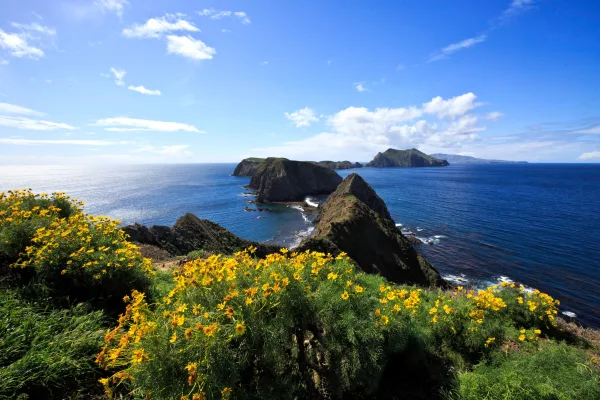
Channel Islands National Park encompasses five remarkable islands and their ocean environment, preserving and protecting a wealth of natural and cultural resources. Isolation over thousands of years h...

National Historical Park
Established in 1988, San Francisco Maritime National Historical Park celebrates America’s maritime heritage on the Pacific Coast. Our 50-acre park has grown around Aquatic Park Cove, a protected area...
Park data from the National Park Service API. Alerts update every 2 hours.
This trip is characterized as a 'Turn-heavy local drive,' with only 17% of the route on highways. You'll spend a significant portion of your time navigating El Camino Real, which accounts for the longest stretch at 229.6 miles. This means you'll experience a more intimate connection with the towns and communities along the way, rather than a blur of interstate scenery. Be prepared for frequent changes in direction and speed as you transition between local streets and freeway segments.
Expect a hands-on drive with frequent turns and local roads rather than long highway stretches. This route has several spots where lane changes, forks, or exits need your full attention. The trickiest moment comes early in the drive.
Demanding - plan breaks and stay ahead of the key maneuvers
Balances navigation complexity with total wheel time.
This is a demanding drive. With 13 significant decision points across 297.1 miles, you will need to stay alert - especially through interchange areas and urban stretches. Consider splitting it into segments if you are not comfortable with fast highway navigation.
Where does it get tricky?
The main spots that need attention: near the start: Navigation decision point; at 270.1 miles (US 101): Highway fork - watch signs carefully. Lane positioning matters here; at 282.3 miles: Exit ramp - move to the correct lane early. Lane positioning matters here.
Founded 1956
Fremont is a suburban city in the southern part of the East Bay of the San Francisco Bay Area; it is the 4th largest city in the Bay Area by population. Fremont is in the southern part of Alameda County, California, between Union City to the north, Sunol and the hills to the east, Milpitas and Santa Clara County to the south, and the San Francisco Bay to the west. The city of Newark, near the edge of the Bay, is surrounded by the city of Fremont. Fremont industry is not particularly large relative to other parts of the Bay Area, but neither is it a bedroom community. Many people in Fremont work locally in the electronics and high-tech industry, while many others commute to Silicon Valley or San Francisco locations for work.
Top landmarks
City content from Wikivoyage (CC BY-SA 4.0) and Wikidata (CC0).
Weekend Trip
Doable as a same-day drive at 5h 48m. Total distance: 297.1 miles.
Family Friendly
Moderate complexity with 1 natural rest stops along the way.
Solo Traveler
5h 48m drive, comfortable solo distance.
Scenic Drive
Mostly surface roads route profile with national parks nearby.
Compiled by the US Trip Planner planning team at COD Solutions Oy from open government datasets — OSRM over OpenStreetMap for geometry, EIA for fuel prices, and NPS for national parks. See our methodology for refresh cadence and limitations.
Was this helpful?
Thanks for your feedback!
Your tip has been submitted. Thanks!
/500
Recent Tips
·
Explore more options from Isla Vista, CA or browse trips ending in Fremont, CA.
Looking for more statewide routes? Browse CA road trips.