Traveling from Hot Springs to Rogers covers 204.5 miles and typically takes about 3 hours and 47 minutes. Since this trip stays entirely within Arkansas, you will remain in the Southeast region for the duration of your journey. Budget approximately $31 for fuel to cover the distance, making it a relatively affordable excursion. While the drive is manageable in a single day, the turn-heavy nature of the roads means you should plan for a focused experience behind the wheel. Whether you are heading north for a weekend getaway or a quick business trip, this route offers a direct path between two of the state's most popular areas.
Trip Pace
Same-day drive is realistic
A same-day return is realistic if you keep stops short.
Break Rhythm
1 planned break
A short stop every 2 to 3 hours is enough for this drive.
Midpoint
103.6 miles from Hot Springs, AR
A natural place for your longest stop of the day
, about 2h into the drive
.
Main Roads
Road
Distance
Duration
I 40
64.8 mi
1h 4m
I 49
57.7 mi
59m
AR 7
45.1 mi
51m
4th Street
14.4 mi
16m
Park Avenue
6.2 mi
9m
Union Street
4.9 mi
5m
West Main Street
4.6 mi
7m
South 8th Street
3.4 mi
6m
Longest stretch:
I 40
— 64.8 mi, about 1h 4m
Turn-by-Turn Driving Directions
Step-by-step road directions between Hot Springs, AR and Rogers, AR.
1
Start on US 70B; US 270B
82 ft·5 sec·West Grand Avenue
2
Turn right onto AR 7
1.1 mi·1 min·Central Avenue
3
Continue on AR 7
6.2 mi·9 min·Park Avenue
4
Enter roundabout onto AR 7
297 ft·3 sec·AR 7
5
Continue on AR 7
45 mi·50 min·AR 7
6
At end of road, turn right onto AR 7
0.2 mi·20 sec·AR 7
7
At end of road, turn left onto AR 7; AR 10
0.3 mi·23 sec·South Scenic 7 Drive
8
Continue on AR 7
14 mi·16 min·4th Street
9
Continue on AR 7
0.2 mi·15 sec·North State Highway 7
10
Continue on AR 22
374 ft·9 sec·AR 22
11
Turn right onto AR 7
4.9 mi·5 min·Union Street
12
Turn left onto US 64
3.1 mi·4 min·West Main Street
13
Continue on US 64
1.5 mi·2 min·West Main Street
14
Turn right onto Mission Road
0.2 mi·22 sec·Mission Road
15
Continue on Lakewood Drive
367 ft·9 sec·Lakewood Drive
16
Take the ramp
0.3 mi·38 sec
Exit 78Toward I-40
17
Merge onto I 40
65 mi·1 hr 4 min·I 40
18
Take the exit
0.4 mi·48 sec
Toward I 49 North: Fayetteville
19
Continue on I 49
46 mi·47 min·I 49
Use the slight right lane.
20
Keep slight left at fork onto I 49; US 62; US 71
11 mi·12 min·I 49; US 62; US 71
Use the straight lane.
21
Take the exit
0.3 mi·34 sec
22
Keep slight right at fork
185 ft·6 sec
23
Turn right onto AR 264
0.6 mi·1 min·West Monroe Avenue
24
Turn left onto US 71B
2.0 mi·3 min·North Bloomington Street
25
Continue on US 71B
3.4 mi·6 min·South 8th Street
26
Turn right onto West Poplar Street
0.4 mi·1 min·West Poplar Street
27
Turn left onto South 3rd Street
390 ft·18 sec·South 3rd Street
28
Turn right onto West Elm Street
99 ft·3 sec·West Elm Street
29
Arrive at destination
West Elm Street
Trip Plan
Given the technical nature of these local roads, aim to depart during daylight hours to maintain better visibility through the turns. You should plan for at least one dedicated stop along the way to break up the nearly four-hour duration and keep your focus sharp. With a fuel budget of $31, verify your tank levels before leaving Hot Springs, as local roads may offer fewer quick-access service stations than a major interstate. Because this is a relatively short trip, you have the flexibility to adjust your pace based on traffic conditions or personal fatigue. Prioritize steady, cautious navigation over speed to ensure a safe and comfortable arrival in Rogers.
Morning Departure
An early start around 7-8 AM gets you there with plenty of daylight left.
Evening Departure
A late afternoon start means arriving after dark. Morning is better.
You can normally do this drive in one day.
Plan roughly 1 meaningful break for fuel, food, and rest.
The halfway point lands around 103.6 miles from Hot Springs, AR, or about 2h into the drive.
The longest continuous stretch on this route runs about 64.8 miles.
This is a comfortable same-day trip.
Departure
Before you leave
Start with fuel, water, and navigation already sorted so the first hour feels easy.
First stop
Around 46 miles or 55m in
Use this first pause for coffee, a restroom break, and a quick traffic check ahead.
Halfway reset
Around 103.6 miles or 2h in
This is the best place for your longest stop, a real meal, and a full fuel check.
Final approach
Final hour starts around 3h 7m
Traffic, exits, and arrival timing usually matter more near Rogers, AR than in the middle of the route.
Before You Leave
+
Open the route before leaving Hot Springs, AR so your first major turns are already loaded.
+
Leave with enough water and a charging cable within reach, not packed away.
+
Check your fuel range against the first long segment, especially if you are starting outside city service areas.
Day 1
Settle into the route from Hot Springs, AR
This is one driving day of about 207.2 miles and 3h 52m.
Your first comfortable stop window is around 46 miles from Hot Springs, AR.
This route can stay practical as a one-day drive if traffic stays reasonable.
Plan about 1 real break rather than only quick fuel stops.
The longest stretch is on I 40 for about 64.8 miles.
Where to Stop
Rest stops, refuel points, and overnight suggestions along this route.
Place data sourced from public business listings. Hours and availability may vary.
Heads-up: tricky spots
5 of 17
5 decision points cluster between mile 0 and 207.2 — GPS handles the exact turns, but know they're coming. Your lane choice matters more than the turn itself.
4
0 mi into trip|~0m in|AR 7 / Central Avenue
Turn right onto AR 7 / Central Avenue
Navigation decision point
6
77.1 mi into trip|~1h 33m in
Take the ramp toward I-40
Complex interchange - multiple decisions in a short stretch
Exit 78
Toward I-40
6
189 mi into trip|~3h 27m in|I 49; US 62; US 71
Keep slight left at fork onto I 49; US 62; US 71
Highway fork - watch signs carefully. Lane positioning matters here
Use the straight lane.
5
200.6 mi into trip|~3h 40m in
Keep slight right at fork
Highway fork - watch signs carefully
5
207.2 mi into trip|~3h 52m in|West Elm Street
Turn right onto West Elm Street
Navigation decision point
Fuel & Cost
Regular Gas
$28.76 one way
$57.53 round trip
$3.53/gal25.4 MPG avg73 kg CO2
Fuel Type
$/gal
One Way
Round Trip
midgrade
$3.95
$32.18
$64.36
premium
$4.29
$34.99
$69.97
diesel
$4.80
$39.12
$78.25
No toll roads detected on this route.
Estimated Trip Cost (one way, 1 person)
Fuel
$29
Meals
$25–$50
Total
$54–$79
Rough estimate based on US averages. Hotel $80–$140/night, meals $25–$50/day.
Estimated CO2 emission: 72.5 kg one way.
Prices: EIA weekly data, 2026-07-13.
Driving Electric?
About $22 in charging
· 0 stops
· 67% less CO2
Vehicle Type
kWh
Stops
DC Fast
Home Charge
Average EV
62.2
0
$21.76
$9.95
Efficient EV
51.8
0
$18.13
$8.29
EV Truck/SUV
82.9
1
$29.01
$13.26
Gas CO2
72 kg
EV CO2
24 kg (67% less)
This trip is well within single-charge range for most EVs. No charging stops needed if you start fully charged.
DC fast charging avg $0.35/kWh. Home charging avg $0.16/kWh. US grid CO2: 0.39 kg/kWh.
Travel Intel
Current conditions at both ends of the drive.
Forecast as of Jul 19, 2026
Origin
Hot Springs, AR
Morning
in Hot Springs on Sunday
Local time
6:06 AM
CDT
Current temp
74°F
Mostly Clear
W 0 to 5 mph3% chanceLive forecast
Heat Advisory
Heat Advisory issued July 18 at 7:55PM CDT until July 19 at 9:00PM CDT by NWS Memphis TN
Heat Advisory
Heat Advisory issued July 18 at 7:40PM CDT until July 19 at 8:00PM CDT by NWS Little Rock AR
Destination
Rogers, AR
Morning
in Rogers on Sunday
Local time
6:06 AM
CDT
Current temp
72°F
Slight Chance Showers And Thunderstorms
SW 0 to 5 mph20% chanceLive forecast
Heat Advisory
Heat Advisory issued July 18 at 7:55PM CDT until July 19 at 9:00PM CDT by NWS Memphis TN
Heat Advisory
Heat Advisory issued July 18 at 7:40PM CDT until July 19 at 8:00PM CDT by NWS Little Rock AR
95°F
Delaware, AR
104 mi in
Seasonal Notes
Summer travel usually means heavier construction, hotter rest stops, and busier weekend traffic around major cities.
Winter travel shortens daylight, so a route that looks manageable on paper can feel much longer after dark.
Holiday weekends tend to make both departure and arrival windows slower than the raw route time suggests.
Time zone
Same local time
Origin and destination are on the same clock, so arrival timing is easier to judge at a glance.
Temperature spread
2 degrees cooler at arrival
A meaningful temperature swing is a good cue to rethink layers, water, and how soon you want to arrive.
Road read
3h 52m on the road
The weather snapshot is not static. If you are leaving later, give both cities one more quick forecast check before departure.
Weather data from the National Weather Service. Conditions may change; check closer to your travel date.
National Parks Near This Route
Worth a detour if your schedule allows.
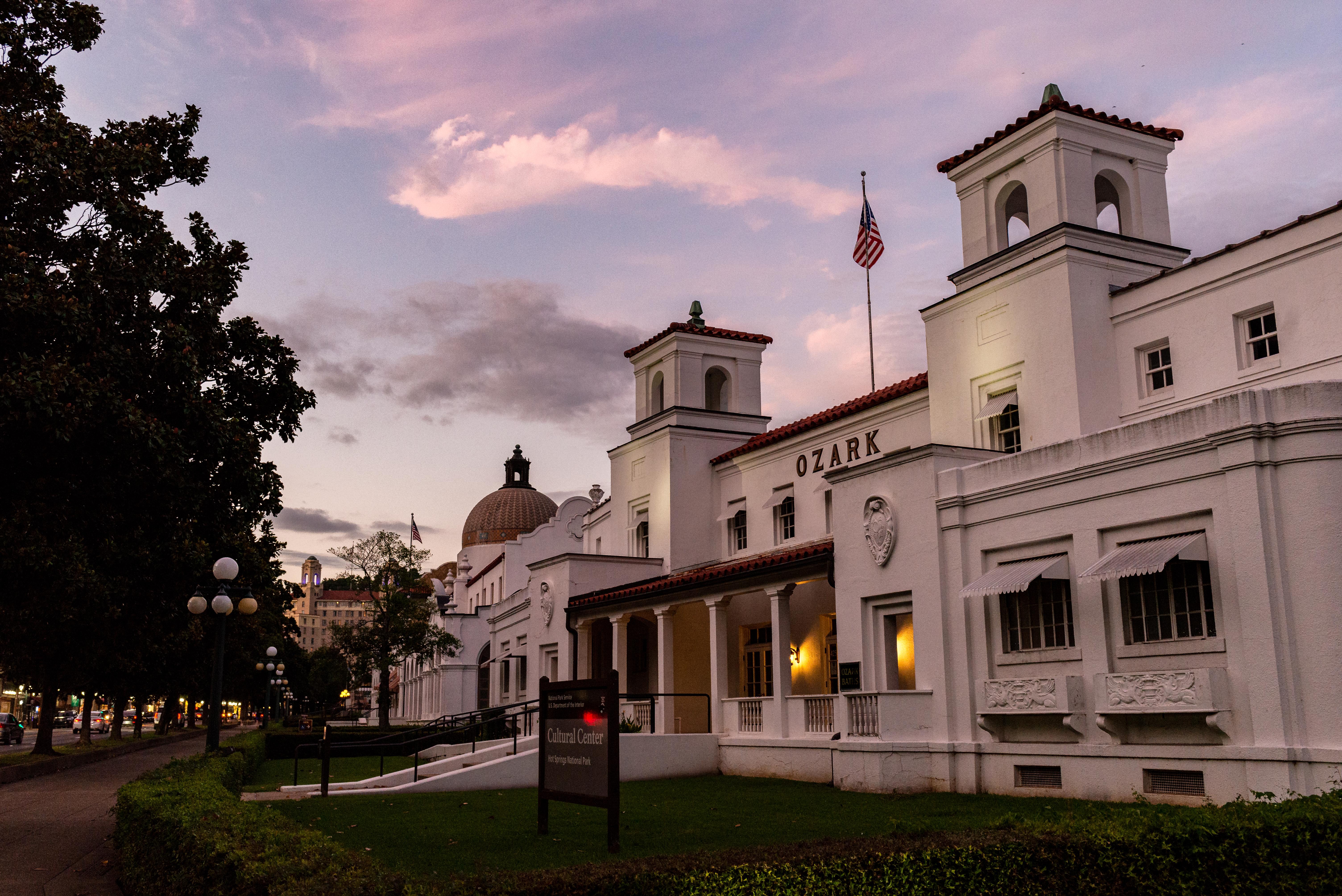
Hot Springs National Park
National Park
Hot Springs National Park has a rich cultural past. The grand architecture of our historic bathhouses is equally matched by the natural curiosities that have been drawing people here for hundreds of y...
Park data from the National Park Service API. Alerts update every 2 hours.
More Details
What kind of drive is this?
Expect a turn-heavy local drive rather than a monotonous interstate cruise, as this route features a 0% highway share. You will navigate through local roads like Central Avenue and Park Avenue, requiring your full attention as you transition between segments. Because the route relies on local infrastructure, you won't find long, uninterrupted highway stretches, meaning your speed will fluctuate significantly. The road's personality is defined by its constant curves, providing a more engaging, hands-on driving experience than standard freeway travel. Prepare for a winding journey that demands active steering throughout the entire 204.5-mile trip.
81% highway — fuel and pacing are the main things to plan.
29 navigation steps total — most of the decisions cluster near the start and finish.
Longest single stretch: 64.8 mi on I 40.
How Hard Is This Drive?
4/10
This is a straightforward highway drive that stays mostly on I 40 and I 49. There are only a few real navigation decisions along the way. The trickiest moment comes early in the drive near AR 7 / Central Avenue.
Driving Effort4/10
Easy - simple navigation with a manageable amount of wheel time
Balances navigation complexity with total wheel time.
This is a straightforward 3h 52m drive. You will face about 17 decision points, but nothing that requires special attention if you follow navigation.
Where does it get tricky?
The main spots that need attention: near the start (AR 7 / Central Avenue): Navigation decision point; at 77.1 miles: Complex interchange - multiple decisions in a short stretch; at 189 miles (I 49; US 62; US 71): Highway fork - watch signs carefully. Lane positioning matters here.
Hot Springs is a city in the Central region of Arkansas and home to Hot Springs National Park, a United States national park. It is also the childhood home of former President Bill Clinton.
Top landmarks
•Bathhouse Row — park in Hot Springs, Garland County, United States of America
•Central Avenue Historic District — historic district in Hot Springs, Arkansas, USA
•Whittington Park Historic District — historic district in Arkansas, United States
The longest stretch is about 64.8 miles on I 40. The full list of main roads is in the Roads section above.
Yes — we found about 14 rest areas or service plazas within a short detour of the route (from OpenStreetMap). See the Rest Stops tab under Nearby Places for locations and mile markers. Plan to stretch, use the bathroom, and top off fluids every 2–3 hours on longer drives.
Yes, with realistic expectations. Build in a stop roughly every 2 hours, have snacks and activities ready, and check the Nearby Places tabs for kid-friendly stops along the way.
The main spots that need attention: near the start (AR 7 / Central Avenue): Navigation decision point; at 77.1 miles: Complex interchange - multiple decisions in a short stretch; at 189 miles (I 49; US 62; US 71): Highway fork - watch signs carefully. Lane positioning matters here.
Yes — Hot Springs National Park. See the National Parks section for detour distances and tips on detours.
Possible but tiring. At 3.9 hours each way, an in-and-out day trip would put you behind the wheel for 7.7 hours — manageable with a long break at Rogers, AR, but most travelers stay overnight.