This 305.2-mile journey from Pea Ridge, AR to Rogers, AR will take approximately 4 hours and 36 minutes of driving time. Designed as a single-day trip, it has a projected fuel cost of $47. The route primarily utilizes I 40 West and I 49 North, with segments on West Monroe Avenue, making for a relatively straightforward drive within the Southeast region. While not a high-speed interstate cruise due to its turn-heavy nature, it offers a manageable day trip with a single recommended stop. You'll find this route to be a practical option for getting between these two Arkansas locations without needing an overnight stay.
Trip Pace
Same-day drive is realistic
A same-day return is possible, but it will make for a full day on the road.
Break Rhythm
1 planned break
Plan on a short reset every 3 to 4 hours to stay fresh behind the wheel.
Midpoint
152.4 miles from Pea Ridge, AR
A natural place for your longest stop of the day
, about 2h 50m into the drive
.
Main Roads
Road
Distance
Duration
US 65
229.3 mi
4h 2m
I 49
57.7 mi
59m
US 165
7 mi
10m
AR 1
3.6 mi
6m
South 8th Street
3.4 mi
6m
North Bloomington Street
2 mi
3m
West Monroe Avenue
0.6 mi
1m
West Poplar Street
0.4 mi
1m
Longest stretch:
US 65
— 229.3 mi, about 4h 2m
Turn-by-Turn Driving Directions
Step-by-step road directions between Pea Ridge, AR and Rogers, AR.
1
Start on AR 1
3.6 mi·6 min·AR 1
2
Continue on US 165
7.0 mi·10 min·US 165
3
Turn right onto US 65
88 mi·1 hr 39 min·US 65
4
Keep slight left at fork onto US 65
0.3 mi·35 sec·US 65
Exit 143AToward I 40 West, US 65 North, AR 107 North: Conway, Fort Smith
5
Keep slight left at fork onto US 65
141 mi·2 hr 22 min·US 65
Use the straight / slight right lanes.
6
Take the exit
0.4 mi·48 sec
Toward I 49 North: Fayetteville
7
Continue on I 49
46 mi·47 min·I 49
Use the slight right lane.
8
Keep slight left at fork onto I 49; US 62; US 71
11 mi·12 min·I 49; US 62; US 71
Use the straight lane.
9
Take the exit
0.3 mi·34 sec
10
Keep slight right at fork
185 ft·6 sec
11
Turn right onto AR 264
0.6 mi·1 min·West Monroe Avenue
12
Turn left onto US 71B
2.0 mi·3 min·North Bloomington Street
13
Continue on US 71B
3.4 mi·6 min·South 8th Street
14
Turn right onto West Poplar Street
0.4 mi·1 min·West Poplar Street
15
Turn left onto South 3rd Street
390 ft·18 sec·South 3rd Street
16
Turn right onto West Elm Street
99 ft·3 sec·West Elm Street
17
Arrive at destination
West Elm Street
Trip Plan
With an estimated 4 hours and 36 minutes of driving, this 305.2-mile route is comfortably achievable in one day. Plan to depart earlier in the morning to maximize daylight and allow for your single recommended stop without feeling rushed. The fuel cost is estimated at $47, so ensure your tank is full before you leave Pea Ridge, AR. Given the turn-heavy profile, pay close attention to navigation, especially as you transition between I 40 West, I 49 North, and West Monroe Avenue, to avoid unnecessary detours.
Morning Departure
An early start around 7-8 AM gets you there with plenty of daylight left.
Evening Departure
A late afternoon start means arriving after dark. Morning is better.
You can normally do this drive in one day.
Plan roughly 1 meaningful break for fuel, food, and rest.
The halfway point lands around 152.4 miles from Pea Ridge, AR, or about 2h 50m into the drive.
The longest continuous stretch on this route runs about 229.3 miles.
This is a comfortable same-day trip.
Departure
Before you leave
Start with fuel, water, and navigation already sorted so the first hour feels easy.
First stop
Around 67 miles or 1h 20m in
Use this first pause for coffee, a restroom break, and a quick traffic check ahead.
Halfway reset
Around 152.4 miles or 2h 50m in
This is the best place for your longest stop, a real meal, and a full fuel check.
Final approach
Final hour starts around 4h 29m
Traffic, exits, and arrival timing usually matter more near Rogers, AR than in the middle of the route.
Before You Leave
+
Open the route before leaving Pea Ridge, AR so your first major turns are already loaded.
+
Leave with enough water and a charging cable within reach, not packed away.
+
Check your fuel range against the first long segment, especially if you are starting outside city service areas.
Day 1
Settle into the route from Pea Ridge, AR
This is one driving day of about 304.8 miles and 5h 32m.
Your first comfortable stop window is around 67 miles from Pea Ridge, AR.
This route can stay practical as a one-day drive if traffic stays reasonable.
Plan about 1 real break rather than only quick fuel stops.
The longest stretch is on US 65 for about 229.3 miles.
Where to Stop
Rest stops, refuel points, and overnight suggestions along this route.
Place data sourced from public business listings. Hours and availability may vary.
Heads-up: tricky spots
5 of 11
5 decision points cluster between mile 98.9 and 304.8 — GPS handles the exact turns, but know they're coming. Your lane choice matters more than the turn itself.
7
98.9 mi into trip|~1h 56m in|US 65
Keep slight left at fork onto US 65 toward I 40 West, US 65 North, AR 107 North: Conway, Fort Smith
Highway fork - watch signs carefully. Multiple destination signs - pick the right one
Exit 143A
Toward I 40 West, US 65 North, AR 107 North: Co...
6
99.2 mi into trip|~1h 57m in|US 65
Keep slight left at fork onto US 65
Highway fork - watch signs carefully. Lane positioning matters here
Use the straight / slight right lanes.
6
286.6 mi into trip|~5h 7m in|I 49; US 62; US 71
Keep slight left at fork onto I 49; US 62; US 71
Highway fork - watch signs carefully. Lane positioning matters here
Use the straight lane.
5
298.2 mi into trip|~5h 20m in
Keep slight right at fork
Highway fork - watch signs carefully
5
304.8 mi into trip|~5h 32m in|West Elm Street
Turn right onto West Elm Street
Navigation decision point
Fuel & Cost
Regular Gas
$42.31 one way
$84.62 round trip
$3.53/gal25.4 MPG avg107 kg CO2
Fuel Type
$/gal
One Way
Round Trip
midgrade
$3.95
$47.34
$94.68
premium
$4.29
$51.47
$102.94
diesel
$4.80
$57.55
$115.10
No toll roads detected on this route.
Estimated Trip Cost (one way, 1 person)
Fuel
$42
Meals
$25–$50
Total
$67–$92
Rough estimate based on US averages. Hotel $80–$140/night, meals $25–$50/day.
Estimated CO2 emission: 106.6 kg one way.
Prices: EIA weekly data, 2026-07-13.
Driving Electric?
About $32 in charging
· 1 stop
· 66% less CO2
Vehicle Type
kWh
Stops
DC Fast
Home Charge
Average EV
91.4
1
$32.00
$14.63
Efficient EV
76.2
0
$26.67
$12.19
EV Truck/SUV
121.9
1
$42.67
$19.51
Gas CO2
107 kg
EV CO2
36 kg (66% less)
Plan for 1 charging stop. A 30-minute DC fast charge mid-route should be enough to complete the trip comfortably.
DC fast charging avg $0.35/kWh. Home charging avg $0.16/kWh. US grid CO2: 0.39 kg/kWh.
Travel Intel
Current conditions at both ends of the drive.
Forecast as of Jul 17, 2026
Origin
Pea Ridge, AR
Evening
in Pea Ridge on Saturday
Local time
8:32 PM
CDT
Current temp
95°F
Mostly Sunny
WSW 5 mph8% chanceLive forecast
Destination
Rogers, AR
Evening
in Rogers on Saturday
Local time
8:32 PM
CDT
Current temp
89°F
Chance Showers And Thunderstorms
SW 10 mph28% chanceLive forecast
Seasonal Notes
Summer travel usually means heavier construction, hotter rest stops, and busier weekend traffic around major cities.
Winter travel shortens daylight, so a route that looks manageable on paper can feel much longer after dark.
Holiday weekends tend to make both departure and arrival windows slower than the raw route time suggests.
Time zone
Same local time
Origin and destination are on the same clock, so arrival timing is easier to judge at a glance.
Temperature spread
6 degrees cooler at arrival
A meaningful temperature swing is a good cue to rethink layers, water, and how soon you want to arrive.
Road read
5h 32m on the road
An early start around 7-8 AM gets you there with plenty of daylight left.
Weather data from the National Weather Service. Conditions may change; check closer to your travel date.
National Parks Near This Route
Worth a detour if your schedule allows.
Arkansas Post National Memorial
National Memorial
Located at the confluence of two rivers, Arkansas Post has served as a gathering place for many cultures throughout human history - it represents cultural cooperation, conflict, synthesis, and diversi...
Park data from the National Park Service API. Alerts update every 2 hours.
More Details
What kind of drive is this?
Expect a turn-heavy local drive for this 305.2-mile trip, with a 0% highway share. This means you'll be navigating more local roads and intersections rather than long stretches of uninterrupted interstate. The nature of the route suggests frequent changes in direction and speed, so staying alert will be key. Although there isn't a defined longest uninterrupted stretch, the profile indicates a dynamic driving experience that requires your attention throughout the 4 hour and 36 minute estimated duration.
98% highway — fuel and pacing are the main things to plan.
17 navigation steps total — most of the decisions cluster near the start and finish.
Longest single stretch: 229.3 mi on US 65.
How Hard Is This Drive?
6/10
This is a straightforward highway drive that stays mostly on US 65 and I 49. You will hit about 11 points where you need to pay attention to lane position or signs. The trickiest moment comes around 98.9 miles in near US 65.
Driving Effort6/10
Moderate - straightforward overall, but long enough or busy enough to require pacing
Balances navigation complexity with total wheel time.
This drive requires moderate attention. Across 304.8 miles you will encounter 11 spots where lane choice or exit timing matters. Not difficult for experienced highway drivers, but worth previewing the tricky sections before you go.
Where does it get tricky?
The main spots that need attention: at 98.9 miles (US 65): Highway fork - watch signs carefully. Multiple destination signs - pick the right one; at 99.2 miles (US 65): Highway fork - watch signs carefully. Lane positioning matters here; at 286.6 miles (I 49; US 62; US 71): Highway fork - watch signs carefully. Lane positioning matters here.
Elevation Profile
Gently rolling terrain
1,631 ft158 ft
Total Climb
1,688 ft
Total Descent
479 ft
Highest Point
1,631 ft
~261.3 mi in
Elevation Range
1,473 ft
Towns Mentioned on Route Signs
Based on OSRM destination-sign hints, not a full list of every settlement the road passes.
On the drive from Pea Ridge, AR to Rogers, AR, road signs begin pointing toward Fort Smith along the way.
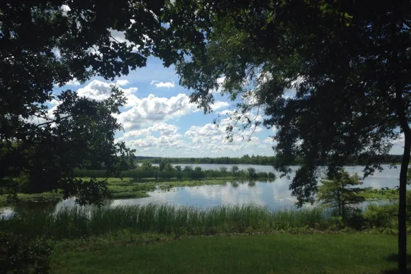
Pea Ridge, located in the picturesque Arkansas Ozarks region, is a town steeped in rich history and natural beauty. Renowned as the site of the pivotal Battle of Pea Ridge during the American Civil War, the area now hosts one of the best-preserved battlefields in the United States, the Pea Ridge National Military Park. This quaint town offers visitors a unique blend of historical exploration and scenic charm.
Doable as a same-day drive at 5h 32m. Total distance: 304.8 miles.
Family Friendly
Moderate complexity with 1 natural rest stops along the way.
Solo Traveler
5h 32m drive, comfortable solo distance.
First-Time Driver
Mostly highway driving (98%). Some complex stretches to watch for.
Frequently Asked Questions
The longest stretch is about 229.3 miles on US 65. The full list of main roads is in the Roads section above.
Yes — we found about 19 rest areas or service plazas within a short detour of the route (from OpenStreetMap). See the Rest Stops tab under Nearby Places for locations and mile markers. Plan to stretch, use the bathroom, and top off fluids every 2–3 hours on longer drives.
It helps. This route has a higher-than-average number of complex decision points, which get harder in the dark. If the last hour of the trip is on surface roads or mountain grades, aim to arrive at Rogers, AR before sunset when you can. Check the Trip Plan for departure windows that land you in daylight.
Only with planning. This is a long drive for kids — consider splitting it into two days rather than pushing through. Plan at least 1 meaningful breaks. There are 19 rest areas along the route for bathroom stops.
The main spots that need attention: at 98.9 miles (US 65): Highway fork - watch signs carefully. Multiple destination signs - pick the right one; at 99.2 miles (US 65): Highway fork - watch signs carefully. Lane positioning matters here; at 286.6 miles (I 49; US 62; US 71): Highway fork - watch signs carefully. Lane positioning matters here.
Yes — Arkansas Post National Memorial. See the National Parks section for detour distances and tips on detours.
Not recommended in a single day. At 5.5 hours each way, a round trip means 11.1 hours of driving — that is an unsafe level of fatigue for most drivers. Plan at least one night at Rogers, AR before the return drive.