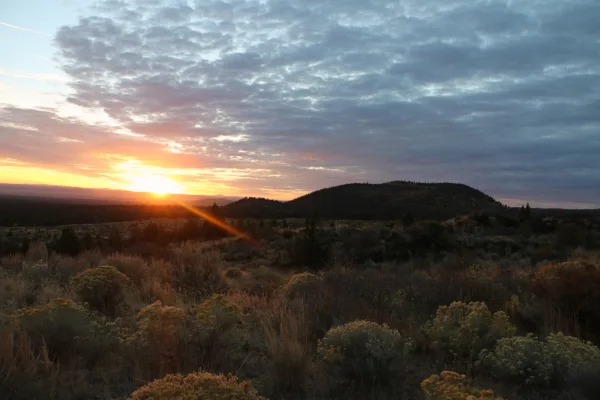
Grass Lake Rest Area
0.1 mi from route
Compiled and reviewed by the US Trip Planner planning team at COD Solutions Oy · Last reviewed Jul 20, 2026 · Editorial standards
Drive Time
3h 49m
Distance
147 mi
237 km
Drive Score
9/10
Great drive
Same Day?
Yes, doable
Fuel Cost
$31
one way
EV Charging
Unknown
Estimated drive times based on typical traffic patterns. Actual times may vary with weather, construction, and real-time conditions.

Hoskin, CA
Dominik Gryzbon

Dorris, CA
Ernesto Rosas
Hoskin, CA to Dorris, CA is 147 miles and takes about 3h 49m via CA 96 and US 97, with a fuel budget near $33 and enough daylight to finish in a day. This route stays within California, beginning in the Pacific Coast region and ending in the same region. You'll spend most of your time on highways, making it a straightforward drive. With a recommended one-day travel time, this trip is ideal for a quick transit between these two points.
Trip Pace
Same-day drive is realistic
A same-day return is realistic if you keep stops short.
Break Rhythm
1 planned break
A short stop every 2 to 3 hours is enough for this drive.
Midpoint
73.5 miles from Hoskin, CA
A natural place for your longest stop of the day , about 2h 12m into the drive .
| Road | Distance | Duration |
|---|---|---|
| CA 96 | 62 mi | 1h 32m |
| US 97 | 37.9 mi | 43m |
| 99-97 Cutoff | 18.6 mi | 30m |
| Cascade Wonderland Highway | 9.5 mi | 10m |
| CA 263 | 8 mi | 14m |
| Elk Creek Road | 7.2 mi | 27m |
| South Main Street | 0.3 mi | <1m |
| South Butte Street | 0.3 mi | <1m |
Hour-of-day weekday pattern from 2 FHWA count stations on your route.
Peak
2 PM
~962 veh/hr typical · worst 1,291
Quietest
2 AM
~111 veh/hr
Peak-to-quiet ratio
8.7×
busier at peak than in the quiet hours
Averaged across 47 weeks of 2023 FHWA Travel Monitoring Analysis System data. Weekday hours only (Mon–Fri).
Step-by-step road directions between Hoskin, CA and Dorris, CA.
Start on this road
At end of road, turn left onto Elk Creek Road
Turn straight onto CA 96
Turn right onto CA 263; US 99 Hist
Turn left onto I 5 BUS; CA 3
Take the ramp
Merge onto I 5
Take the exit onto 766
At end of road, turn left onto A12
At end of road, turn left onto US 97
Continue on US 97
Continue on US 97
Continue on US 97
Turn left onto US 97
Turn right
Arrive at destination
Given the 3h 49m duration and 147-mile distance, this route is easily manageable in a single day. Aim to depart in the morning to maximize daylight and allow for a leisurely pace. The longest stretch without a service stop is 62 miles on CA 96, so ensure you have sufficient fuel before heading onto that section. With only one recommended stop and a fuel cost estimate of $33, planning is straightforward, leaving you flexibility to depart at your convenience.
Morning Departure
An early start around 7-8 AM gets you there with plenty of daylight left.
Evening Departure
A late afternoon start means arriving after dark. Morning is better.
This is a comfortable same-day trip.
Departure
Before you leave
Start with fuel, water, and navigation already sorted so the first hour feels easy.
First stop
Around 32 miles or 1h 10m in
Use this first pause for coffee, a restroom break, and a quick traffic check ahead.
Halfway reset
Around 73.5 miles or 2h 12m in
This is the best place for your longest stop, a real meal, and a full fuel check.
Final approach
Final hour starts around 3h 18m
Traffic, exits, and arrival timing usually matter more near Dorris, CA than in the middle of the route.
Open the route before leaving Hoskin, CA so your first major turns are already loaded.
Leave with enough water and a charging cable within reach, not packed away.
Check your fuel range against the first long segment, especially if you are starting outside city service areas.
Day 1
Settle into the route from Hoskin, CA
This is one driving day of about 147 miles and 3h 49m.
Rest stops, refuel points, and overnight suggestions along this route.

Mid-route town
Meal stop
74 mi into the route
Best for: Lunch, fuel, and a longer reset
This sits close to the middle of the route, so it works well for the longest stop of the day.
A short stop after about 32 miles helps settle the day before fatigue starts building.
The midpoint is around 73.5 miles from Hoskin, CA, which is a good place for a longer meal and fuel stop.
Before the longest stretch
Fuel checkTop up before CA 96 if your tank is already low. That segment runs about 62 miles.
These stop ideas are pacing suggestions — the exact town or exit can change with traffic, hotel plans, and fuel range.
Picked by where they fit in your drive — first break, midpoint reset, final stretch.
Place data sourced from public business listings. Hours and availability may vary.
5 decision points cluster between mile 2.2 and 89.6 — GPS handles the exact turns, but know they're coming. Your lane choice matters more than the turn itself.
At end of road, turn left onto Elk Creek Road
Navigation decision point
Turn right onto CA 263; US 99 Hist
Navigation decision point
Turn left onto I 5 BUS; CA 3 / Montague Road
Navigation decision point
Take the exit onto 766 toward Montague, Grenada
Exit ramp - move to the correct lane early. Multiple destination signs - pick the right one
At end of road, turn left onto A12 / 99-97 Cutoff
Navigation decision point
Regular Gas
$30.75 one way
$61.51 round trip
| Fuel Type | $/gal | One Way | Round Trip |
|---|---|---|---|
| midgrade | $5.52 | $31.94 | $63.88 |
| premium | $5.67 | $32.79 | $65.57 |
| diesel | $4.80 | $27.76 | $55.51 |
No toll roads detected on this route.
Estimated Trip Cost (one way, 1 person)
Fuel
$31
Meals
$25–$50
Total
$56–$81
Rough estimate based on US averages. Hotel $80–$140/night, meals $25–$50/day.
Estimated CO2 emission: 51.4 kg one way. Prices: EIA weekly data, 2026-07-13.
Driving Electric?
About $15 in charging · 0 stops · 67% less CO2
| Vehicle Type | kWh | Stops | DC Fast | Home Charge |
|---|---|---|---|---|
| Average EV | 44.1 | 0 | $15.44 | $7.06 |
| Efficient EV | 36.8 | 0 | $12.86 | $5.88 |
| EV Truck/SUV | 58.8 | 0 | $20.58 | $9.41 |
Gas CO2
51 kg
EV CO2
17 kg (67% less)
This trip is well within single-charge range for most EVs. No charging stops needed if you start fully charged.
DC fast charging avg $0.35/kWh. Home charging avg $0.16/kWh. US grid CO2: 0.39 kg/kWh.
Current conditions at both ends of the drive.
Origin
Late night in Hoskin on Monday
Local time
3:36 AM
PDT
Current temp
58°F
Haze then Patchy Smoke
Beach Hazards Statement
Beach Hazards Statement issued July 18 at 7:02PM PDT until July 21 at 11:00PM PDT by NWS Los Angeles/Oxnard CA
Destination
Late night in Dorris on Monday
Local time
3:36 AM
PDT
Current temp
52°F
Patchy Smoke
Beach Hazards Statement
Beach Hazards Statement issued July 18 at 7:02PM PDT until July 21 at 11:00PM PDT by NWS Los Angeles/Oxnard CA
94°F
Montague, CA
74 mi in
Seasonal Notes
Summer travel usually means heavier construction, hotter rest stops, and busier weekend traffic around major cities.
Winter travel shortens daylight, so a route that looks manageable on paper can feel much longer after dark.
Holiday weekends tend to make both departure and arrival windows slower than the raw route time suggests.
Time zone
Origin and destination are on the same clock, so arrival timing is easier to judge at a glance.
Temperature spread
A meaningful temperature swing is a good cue to rethink layers, water, and how soon you want to arrive.
Road read
The weather snapshot is not static. If you are leaving later, give both cities one more quick forecast check before departure.
Weather data from the National Weather Service. Conditions may change; check closer to your travel date.
Worth a detour if your schedule allows.
National Monument
Lava Beds National Monument is a land of turmoil, both geological and historical. Over the last half-million years, volcanic eruptions on the Medicine Lake shield volcano have created a rugged landsca...
National Monument
Tule Lake National Monument includes both Tule Lake Segregation Center, the largest and most controversial of the sites where Japanese Americans were incarcerated during World War II, and Camp Tulelak...
Park data from the National Park Service API. Alerts update every 2 hours.
This drive is predominantly highway, with 73% of the 147 miles on major roads. You'll experience a longest stretch of 62 miles on CA 96 before transitioning to US 97. Expect a rural cruising feel for much of the trip, as you'll be on highways for a substantial portion of the 3h 49m estimated duration.
This is a straightforward highway drive that stays mostly on CA 96 and US 97. Navigation is very simple - set it and forget it for most of the drive. The trickiest moment comes around 2.2 miles in near Elk Creek Road.
Very easy - short and simple to drive
Balances navigation complexity with total wheel time.
The drive from Hoskin, CA to Dorris, CA is easy. At 3h 49m with 73% highway, most drivers will find it relaxed and low-stress.
Where does it get tricky?
The main spots that need attention: at 2.2 miles (Elk Creek Road): Navigation decision point; at 71.4 miles (CA 263; US 99 Hist): Navigation decision point; at 79.4 miles (I 5 BUS; CA 3 / Montague Road): Navigation decision point.
High-altitude sections with notable climbs
Total Climb
4,317 ft
Total Descent
2,316 ft
Highest Point
5,203 ft
~126 mi in
Elevation Range
4,095 ft
Notable High Points
Based on OSRM destination-sign hints, not a full list of every settlement the road passes.
Between Hoskin, CA and Dorris, CA, road signs point toward Montague and Grenada.
Montague
Grenada
Founded 1908
Dorris is a city in the Shasta Cascades region of California.
City content from Wikivoyage (CC BY-SA 4.0) and Wikidata (CC0).
Weekend Trip
Doable as a same-day drive at 3h 49m. Total distance: 147 miles.
Family Friendly
Moderate complexity with 1 natural rest stops along the way.
Solo Traveler
3h 49m drive, comfortable solo distance.
First-Time Driver
Mostly highway driving (73%). Straightforward navigation.
Compiled by the US Trip Planner planning team at COD Solutions Oy from open government datasets — OSRM over OpenStreetMap for geometry, EIA for fuel prices, USGS 3DEP for elevation, NPS for national parks, and FHWA TMAS for hourly traffic volumes. See our methodology for refresh cadence and limitations.
Was this helpful?
Thanks for your feedback!
Your tip has been submitted. Thanks!
/500
Recent Tips
·
Explore more options from Hoskin, CA or browse trips ending in Dorris, CA.
Looking for more statewide routes? Browse CA road trips.