Traveling from Greenville to Bayshore covers 113.3 miles, making for a straightforward trek through the Southeast that typically takes 2 hours and 34 minutes. This highway-focused drive is perfectly suited for a single-day trip, allowing you to reach your destination without the need for an overnight stay. You should budget approximately $18 for fuel to complete the journey. By utilizing a mix of Winterville Parkway, State Highway 11, and I-40, you can navigate the region efficiently. Whether you are heading out for business or a change of scenery, this route offers a predictable and practical path across North Carolina.
Trip Pace
Same-day drive is realistic
A same-day return is realistic if you keep stops short.
Break Rhythm
1 planned break
A short stop every 2 to 3 hours is enough for this drive.
Midpoint
56.6 miles from Greenville, NC
A natural place for your longest stop of the day
, about 1h 22m into the drive
.
Main Roads
Road
Distance
Duration
I 40
30.7 mi
32m
Winterville Parkway
23.5 mi
30m
State Highway 11
11.5 mi
15m
NC 41
10.1 mi
14m
North Front Street
9 mi
12m
North Jackson Street
7.8 mi
11m
John Jay Burney Jr Freeway
4.7 mi
5m
Old Pink Hill Road
4.5 mi
7m
Longest stretch:
I 40
— 30.7 mi, about 32m
Turn-by-Turn Driving Directions
Step-by-step road directions between Greenville, NC and Bayshore, NC.
1
Start on South Summit Street
0.2 mi·53 sec·South Summit Street
2
At end of road, turn right onto East 5th Street
0.3 mi·1 min·East 5th Street
3
Turn left onto South Evans Street
2.4 mi·4 min·South Evans Street
4
Turn slight right onto US 264 Alternate; NC 43
1.1 mi·2 min·Greenville Boulevard Southwest
5
Turn slight left onto NC 11; NC 903
1.7 mi·2 min·South Memorial Drive
Use the left lane.
6
Continue on NC 11; NC 903
24 mi·30 min·Winterville Parkway
7
Enter roundabout onto NC 11; NC 55
23 ft·0 sec·NC 11; NC 55
8
Continue on NC 11; NC 55
0.5 mi·1 min·NC 11; NC 55
Use the straight / right lanes.
9
Continue on NC 11; NC 55
4.5 mi·7 min·Old Pink Hill Road
Use the straight / right lanes.
10
Continue on NC 11
12 mi·15 min·State Highway 11
11
Continue on NC 11
0.8 mi·1 min·NC 11
12
Continue on NC 11
0.7 mi·1 min·North Kinston Boulevard
13
Turn left onto NC 241
9.0 mi·12 min·North Front Street
14
Keep slight left at fork onto NC 41; NC 111
7.8 mi·11 min·North Jackson Street
15
Continue on NC 41; NC 50
10 mi·14 min·NC 41; NC 50
16
Take the ramp
0.3 mi·37 sec
17
Merge onto I 40
31 mi·32 min·I 40
18
Take the exit
0.2 mi·25 sec
19
Keep slight left at fork
0.4 mi·50 sec
20
Keep slight right at fork
0.3 mi·36 sec
Toward US 17 North: Topsail Island, New Bern
21
Merge onto NC 140
4.7 mi·5 min·John Jay Burney Jr Freeway
22
Take the exit
0.3 mi·45 sec
Toward US 17 Business South: Wilmington
23
Continue on US 17
1.2 mi·2 min·US 17
Use the left / straight lanes.
24
Turn slight left onto Marsh Oaks Drive
0.9 mi·3 min·Marsh Oaks Drive
25
Arrive at destination
Marsh Oaks Drive
Trip Plan
Since this is a manageable 2-hour and 34-minute trip, you have plenty of flexibility in your departure time to avoid potential congestion. Plan for at least one stop to stretch your legs, which will help keep you alert throughout the 113.3-mile journey. Given the $18 fuel estimate, it is wise to check your levels before leaving Greenville, especially before merging onto the longer stretches of I-40. Because the route relies heavily on major thoroughfares, keep an eye on real-time traffic updates for those highway segments. Taking advantage of the route's simplicity means you can focus on a relaxed pace rather than rushing to reach Bayshore.
Morning Departure
Leave by 9 AM and you'll arrive before lunch.
Evening Departure
Even a 4 PM departure gets you there before dark in summer.
You can normally do this drive in one day.
Plan roughly 1 meaningful break for fuel, food, and rest.
The halfway point lands around 56.6 miles from Greenville, NC, or about 1h 22m into the drive.
The longest continuous stretch on this route runs about 30.7 miles.
This is a comfortable same-day trip.
Departure
Before you leave
Start with fuel, water, and navigation already sorted so the first hour feels easy.
First stop
Around 25 miles or 36m in
Use this first pause for coffee, a restroom break, and a quick traffic check ahead.
Halfway reset
Around 56.6 miles or 1h 22m in
This is the best place for your longest stop, a real meal, and a full fuel check.
Final approach
Final hour starts around 2h 7m
Traffic, exits, and arrival timing usually matter more near Bayshore, NC than in the middle of the route.
Before You Leave
+
Open the route before leaving Greenville, NC so your first major turns are already loaded.
+
Leave with enough water and a charging cable within reach, not packed away.
+
Check your fuel range against the first long segment, especially if you are starting outside city service areas.
Day 1
Settle into the route from Greenville, NC
This is one driving day of about 113.3 miles and 2h 34m.
Your first comfortable stop window is around 25 miles from Greenville, NC.
This route can stay practical as a one-day drive if traffic stays reasonable.
Plan about 1 real break rather than only quick fuel stops.
The longest stretch is on I 40 for about 30.7 miles.
Where to Stop
Rest stops, refuel points, and overnight suggestions along this route.
Place data sourced from public business listings. Hours and availability may vary.
Heads-up: tricky spots
5 of 15
5 decision points cluster between mile 0.2 and 105.8 — GPS handles the exact turns, but know they're coming. Your lane choice matters more than the turn itself.
5
0.2 mi into trip|~0m in|East 5th Street
At end of road, turn right onto East 5th Street
Navigation decision point
4
0.5 mi into trip|~1m in|South Evans Street
Turn left onto South Evans Street
Navigation decision point
4
29.3 mi into trip|~42m in|NC 11; NC 55
Enter roundabout onto NC 11; NC 55
Roundabout - know your exit number before entering
4
56.4 mi into trip|~1h 22m in|NC 41; NC 111 / North Jackson Street
Keep slight left at fork onto NC 41; NC 111 / North Jackson Street
Highway fork - watch signs carefully
6
105.8 mi into trip|~2h 22m in
Keep slight right at fork toward US 17 North: Topsail Island, New Bern
Highway fork - watch signs carefully. Multiple destination signs - pick the right one
Toward US 17 North: Topsail Island, New Bern
Fuel & Cost
Regular Gas
$17.72 one way
$35.44 round trip
$3.97/gal25.4 MPG avg40 kg CO2
Fuel Type
$/gal
One Way
Round Trip
midgrade
$4.34
$19.37
$38.75
premium
$4.70
$20.97
$41.94
diesel
$5.61
$25.02
$50.03
No toll roads detected on this route.
Estimated Trip Cost (one way, 1 person)
Fuel
$18
Meals
$25–$50
Total
$43–$68
Rough estimate based on US averages. Hotel $80–$140/night, meals $25–$50/day.
Estimated CO2 emission: 39.6 kg one way.
Prices: EIA weekly data, 2026-04-13.
Driving Electric?
About $12 in charging
· 0 stops
· 68% less CO2
Vehicle Type
kWh
Stops
DC Fast
Home Charge
Average EV
34
0
$11.90
$5.44
Efficient EV
28.3
0
$9.91
$4.53
EV Truck/SUV
45.3
0
$15.86
$7.25
Gas CO2
40 kg
EV CO2
13 kg (68% less)
This trip is well within single-charge range for most EVs. No charging stops needed if you start fully charged.
DC fast charging avg $0.35/kWh. Home charging avg $0.16/kWh. US grid CO2: 0.39 kg/kWh.
Travel Intel
Current conditions at both ends of the drive.
Forecast as of Apr 17, 2026
Origin
Greenville, NC
Late night
in Greenville on Sunday
Local time
12:26 AM
EDT
Current temp
57°F
Unavailable
Live forecast
Destination
Bayshore, NC
Late night
in Bayshore on Sunday
Local time
12:26 AM
EDT
Current temp
78°F
Unavailable
Live forecast
Seasonal Notes
Summer travel usually means heavier construction, hotter rest stops, and busier weekend traffic around major cities.
Winter travel shortens daylight, so a route that looks manageable on paper can feel much longer after dark.
Holiday weekends tend to make both departure and arrival windows slower than the raw route time suggests.
Time zone
Same local time
Origin and destination are on the same clock, so arrival timing is easier to judge at a glance.
Temperature spread
21 degrees warmer at arrival
A meaningful temperature swing is a good cue to rethink layers, water, and how soon you want to arrive.
Road read
2h 34m on the road
Use the two city cards together: check the sky where you start, then compare it with the local time and temperature at arrival.
Weather data from the National Weather Service. Conditions may change; check closer to your travel date.
National Parks Near This Route
Worth a detour if your schedule allows.
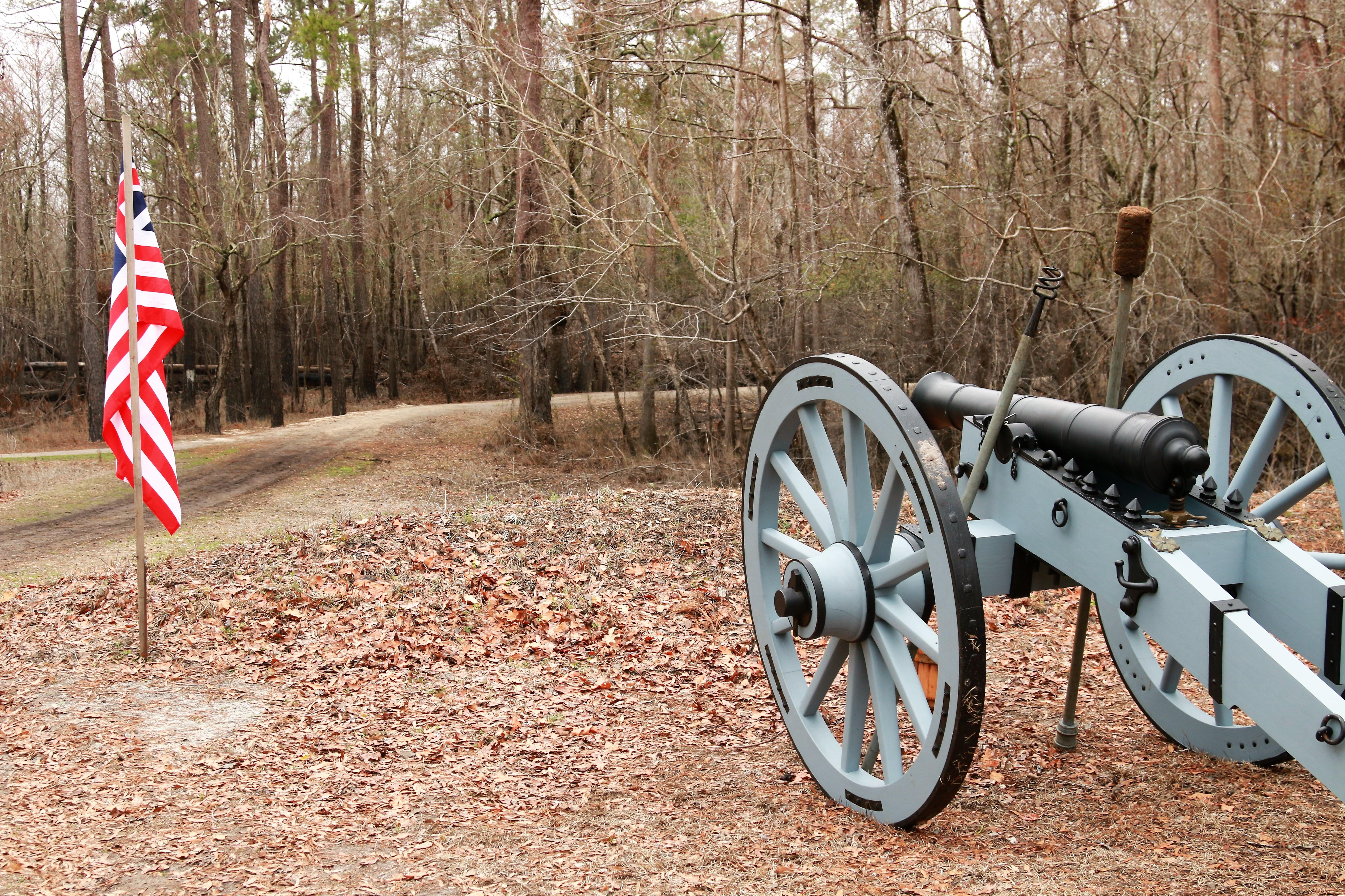
Moores Creek National Battlefield
National Battlefield
In the early morning hours of February 27, 1776, Loyalist forces charged across a partially dismantled Moores Creek Bridge. Beyond the bridge, nearly 1,000 North Carolina Patriots waited quietly with...
13 mi from route
~33 min detour
Free
near mile 93.7
Park data from the National Park Service API. Alerts update every 2 hours.
More Details
What kind of drive is this?
Expect a drive defined by its highway-centric nature, with 73% of your journey spent on high-speed roads. The route balances local connectivity with faster interstate travel, highlighted by a longest uninterrupted stretch of 30.7 miles on I-40. While you will spend time on State Highway 11 and Winterville Parkway, the interstate portions allow you to cover significant ground quickly. You will notice the character of the road shift from the more localized flow of the parkway to the steady, consistent pace of the interstate. It is a functional, no-nonsense drive that rewards drivers who appreciate a steady rhythm behind the wheel.
73% highway — fuel and pacing are the main things to plan.
25 navigation steps total — most of the decisions cluster near the start and finish.
Longest single stretch: 30.7 mi on I 40.
How Hard Is This Drive?
8/10
This is a straightforward highway drive that stays mostly on I 40 and Winterville Parkway. This route has several spots where lane changes, forks, or exits need your full attention. The trickiest moment comes around 0.2 miles in near East 5th Street.
Driving Effort8/10
Demanding - plan breaks and stay ahead of the key maneuvers
Balances navigation complexity with total wheel time.
This is a demanding drive. With 15 significant decision points across 113.3 miles, you will need to stay alert - especially through interchange areas and urban stretches. Consider splitting it into segments if you are not comfortable with fast highway navigation.
Where does it get tricky?
The main spots that need attention: at 0.2 miles (East 5th Street): Navigation decision point; at 0.5 miles (South Evans Street): Navigation decision point; at 29.3 miles (NC 11; NC 55): Roundabout - know your exit number before entering.
Elevation Profile
Mostly flat terrain
88 ft12 ft
Total Climb
89 ft
Total Descent
134 ft
Highest Point
88 ft
~56.6 mi in
Elevation Range
76 ft
Towns Mentioned on Route Signs
Based on OSRM destination-sign hints, not a full list of every settlement the road passes.
On the drive from Greenville, NC to Bayshore, NC, road signs begin pointing toward New Bern along the way.
Greenville, one of the fastest growing cities in North Carolina, is the county seat of Pitt County, and is
the principal city of the Greenville, North Carolina metropolitan area. Greenville is known as the cultural, economical, and educational hub of North Carolina's Inner Banks, the geographical area east of Raleigh and west of the North Carolina coast.
Doable as a same-day drive at 2h 34m. Total distance: 113.3 miles.
Family Friendly
Moderate complexity with 1 natural rest stops along the way.
Solo Traveler
2h 34m drive, comfortable solo distance.
First-Time Driver
Mostly highway driving (73%). Some complex stretches to watch for.
Frequently Asked Questions
The longest stretch is about 30.7 miles on I 40. The full list of main roads is in the Roads section above.
It helps. This route has a higher-than-average number of complex decision points, which get harder in the dark. If the last hour of the trip is on surface roads or mountain grades, aim to arrive at Bayshore, NC before sunset when you can. Check the Trip Plan for departure windows that land you in daylight.
Only with planning. This is a long drive for kids — consider splitting it into two days rather than pushing through. Plan at least 1 meaningful breaks. Dedicated rest areas are limited, so plan gas or food stops as your bathroom breaks.
The main spots that need attention: at 0.2 miles (East 5th Street): Navigation decision point; at 0.5 miles (South Evans Street): Navigation decision point; at 29.3 miles (NC 11; NC 55): Roundabout - know your exit number before entering.
Yes — Moores Creek National Battlefield. See the National Parks section for detour distances and tips on detours.
Yes. A round trip is manageable in a single day if you plan a break at Bayshore, NC before heading back.