Embarking from Goleta, California, to Fremont, California, this 297.9-mile journey is best tackled in a single day, taking approximately 5 hours and 46 minutes. You'll navigate primarily along El Camino Real, the South Valley Freeway, and the Nimitz Freeway, with a relatively low highway share of 17%. The estimated fuel cost for this trip is around $68. This route offers a turn-heavy local drive experience, making it a straightforward option if you're looking to cover ground efficiently within the Pacific Coast region.
Trip Pace
Same-day drive is realistic
A same-day return is possible, but it will make for a full day on the road.
Break Rhythm
1 planned break
Plan on a short reset every 3 to 4 hours to stay fresh behind the wheel.
Midpoint
148.9 miles from Goleta, CA
A natural place for your longest stop of the day
, about 2h 53m into the drive
.
Main Roads
Road
Distance
Duration
El Camino Real
231.9 mi
4h 28m
South Valley Freeway
26.3 mi
30m
Nimitz Freeway
13 mi
14m
US 101
12.2 mi
14m
Cabrillo Highway
11.9 mi
13m
Mowry Avenue
1.4 mi
2m
South Fairview Avenue
0.4 mi
<1m
Hollister Avenue
0.2 mi
<1m
Longest stretch:
El Camino Real
— 231.9 mi, about 4h 28m
Turn-by-Turn Driving Directions
Step-by-step road directions between Goleta, CA and Fremont, CA.
1
Start on Hollister Avenue
0.2 mi·34 sec·Hollister Avenue
2
Turn right onto South Fairview Avenue
0.4 mi·53 sec·South Fairview Avenue
Use the right lane.
3
Take the ramp
0.2 mi·23 sec
Toward US 101 North
4
Merge onto US 101
85 mi·1 hr 39 min·El Camino Real
Toward Buellton, Santa Maria, San FranciscoUse the straight / slight right lanes.
5
Continue on US 101
12 mi·13 min·Cabrillo Highway
6
Continue on US 101
147 mi·2 hr 48 min·El Camino Real
Use the straight lane.
7
Continue on US 101
26 mi·30 min·South Valley Freeway
Use the slight right lane.
8
Keep slight left at fork onto US 101
12 mi·14 min·US 101
Use the straight / slight right lanes.
9
Take the exit
0.2 mi·29 sec
Exit 388BToward I 880 North: OaklandUse the straight / slight right lanes.
10
Merge onto I 880
7.3 mi·8 min·Nimitz Freeway
Use the straight / slight right lanes.
11
Keep slight right at fork onto I 880
5.7 mi·6 min·Nimitz Freeway
Use the straight / slight right lanes.
12
Take the exit
0.3 mi·36 sec
Exit 17Toward Mowry Avenue, Central FremontUse the straight / slight right lanes.
13
Turn right onto Mowry Avenue
1.4 mi·2 min·Mowry Avenue
Use the right lane.
14
Arrive at destination
Mowry Avenue
Trip Plan
Given the 5-hour and 46-minute estimated duration, this route is comfortably manageable as a one-day trip. To make the most of your drive, aim to depart early in the morning to avoid potential local traffic. With only one recommended stop, you have flexibility in pacing. Keep an eye on your fuel, especially during the 231.9-mile stretch on El Camino Real, as services might be more spaced out. Planning your single stop strategically could help break up the drive nicely.
Morning Departure
An early start around 7-8 AM gets you there with plenty of daylight left.
Evening Departure
A late afternoon start means arriving after dark. Morning is better.
You can normally do this drive in one day.
Plan roughly 1 meaningful break for fuel, food, and rest.
The halfway point lands around 148.9 miles from Goleta, CA, or about 2h 53m into the drive.
The longest continuous stretch on this route runs about 231.9 miles.
This is a comfortable same-day trip.
Departure
Before you leave
Start with fuel, water, and navigation already sorted so the first hour feels easy.
First stop
Around 66 miles or 1h 17m in
Use this first pause for coffee, a restroom break, and a quick traffic check ahead.
Halfway reset
Around 148.9 miles or 2h 53m in
This is the best place for your longest stop, a real meal, and a full fuel check.
Final approach
Final hour starts around 4h 43m
Traffic, exits, and arrival timing usually matter more near Fremont, CA than in the middle of the route.
Before You Leave
+
Open the route before leaving Goleta, CA so your first major turns are already loaded.
+
Leave with enough water and a charging cable within reach, not packed away.
+
Check your fuel range against the first long segment, especially if you are starting outside city service areas.
Day 1
Settle into the route from Goleta, CA
This is one driving day of about 297.9 miles and 5h 46m.
Your first comfortable stop window is around 66 miles from Goleta, CA.
This route can stay practical as a one-day drive if traffic stays reasonable.
Plan about 1 real break rather than only quick fuel stops.
The longest stretch is on El Camino Real for about 231.9 miles.
Where to Stop
Rest stops, refuel points, and overnight suggestions along this route.
Place data sourced from public business listings. Hours and availability may vary.
Heads-up: tricky spots
5 of 9
5 decision points cluster between mile 0.8 and 296.2 — GPS handles the exact turns, but know they're coming. Your lane choice matters more than the turn itself.
7
0.8 mi into trip|~1m in|US 101 / El Camino Real
Merge onto US 101 / El Camino Real toward Buellton, Santa Maria, San Francisco
Merge point - match speed before joining. Lane positioning matters here. Multiple destination signs - pick the right one
Use the straight / slight right lanes.
Toward Buellton, Santa Maria, San Francisco
6
270.9 mi into trip|~5h 13m in|US 101
Keep slight left at fork onto US 101
Highway fork - watch signs carefully. Lane positioning matters here
Use the straight / slight right lanes.
7
283 mi into trip|~5h 27m in
Take the exit toward I 880 North: Oakland
Exit ramp - move to the correct lane early. Lane positioning matters here
Use the straight / slight right lanes.
Exit 388B
Toward I 880 North: Oakland
6
290.5 mi into trip|~5h 36m in|I 880 / Nimitz Freeway
Keep slight right at fork onto I 880 / Nimitz Freeway
Highway fork - watch signs carefully. Lane positioning matters here
Use the straight / slight right lanes.
8
296.2 mi into trip|~5h 43m in
Take the exit toward Mowry Avenue, Central Fremont
Exit ramp - move to the correct lane early. Lane positioning matters here. Multiple destination signs - pick the right one
Use the straight / slight right lanes.
Exit 17
Toward Mowry Avenue, Central Fremont
Fuel & Cost
Regular Gas
$68.47 one way
$136.94 round trip
$5.84/gal25.4 MPG avg104 kg CO2
Fuel Type
$/gal
One Way
Round Trip
midgrade
$6.02
$70.56
$141.12
premium
$6.18
$72.45
$144.89
diesel
$5.61
$65.77
$131.55
No toll roads detected on this route.
Estimated Trip Cost (one way, 1 person)
Fuel
$68
Meals
$25–$50
Total
$93–$118
Rough estimate based on US averages. Hotel $80–$140/night, meals $25–$50/day.
Estimated CO2 emission: 104.2 kg one way.
Prices: EIA weekly data, 2026-04-13.
Driving Electric?
About $31 in charging
· 1 stop
· 66% less CO2
Vehicle Type
kWh
Stops
DC Fast
Home Charge
Average EV
89.4
1
$31.28
$14.30
Efficient EV
74.5
0
$26.07
$11.92
EV Truck/SUV
119.2
1
$41.71
$19.07
Gas CO2
104 kg
EV CO2
35 kg (66% less)
Plan for 1 charging stop. A 30-minute DC fast charge mid-route should be enough to complete the trip comfortably.
DC fast charging avg $0.35/kWh. Home charging avg $0.16/kWh. US grid CO2: 0.39 kg/kWh.
Travel Intel
Current conditions at both ends of the drive.
Forecast as of Apr 20, 2026
Origin
Goleta, CA
Late night
in Goleta on Tuesday
Local time
4:42 AM
PDT
Current temp
65°F
Unavailable
Live forecast
Destination
Fremont, CA
Late night
in Fremont on Tuesday
Local time
4:42 AM
PDT
Current temp
49°F
Unavailable
Live forecast
Seasonal Notes
Summer travel usually means heavier construction, hotter rest stops, and busier weekend traffic around major cities.
Winter travel shortens daylight, so a route that looks manageable on paper can feel much longer after dark.
Holiday weekends tend to make both departure and arrival windows slower than the raw route time suggests.
Time zone
Same local time
Origin and destination are on the same clock, so arrival timing is easier to judge at a glance.
Temperature spread
16 degrees cooler at arrival
A meaningful temperature swing is a good cue to rethink layers, water, and how soon you want to arrive.
Road read
5h 46m on the road
An early start around 7-8 AM gets you there with plenty of daylight left.
Weather data from the National Weather Service. Conditions may change; check closer to your travel date.
National Parks Near This Route
Worth a detour if your schedule allows.
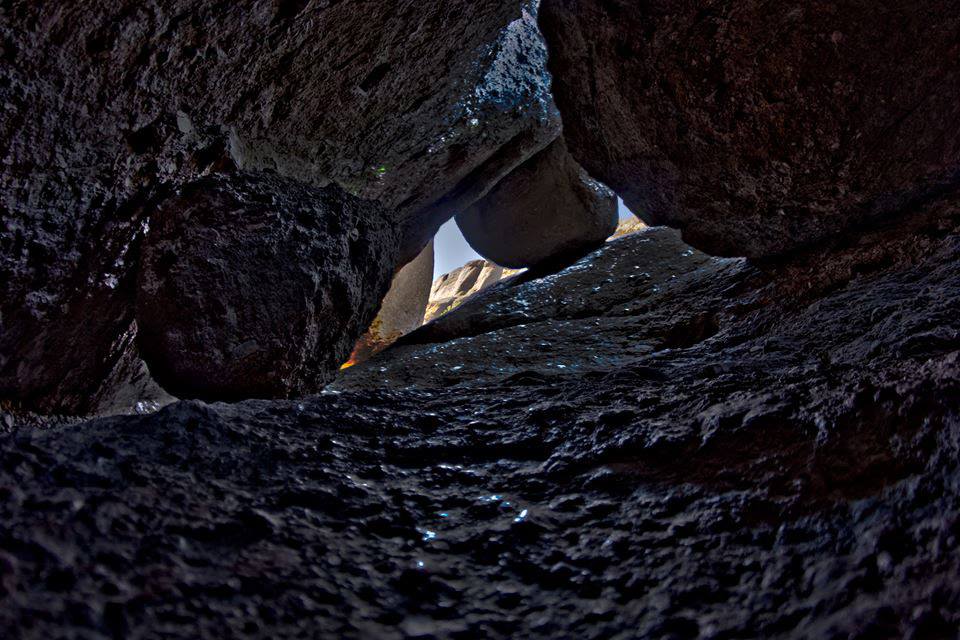
Pinnacles National Park
National Park
Around 23 million years ago, a series of volcanic eruptions shaped the landscape that is now Pinnacles National Park. The remnants of these ancient eruptions have formed a striking terrain of rocky sp...
10 mi from route
~24 min detour
$30
near mile 195.2
Established in 1988, San Francisco Maritime National Historical Park celebrates America’s maritime heritage on the Pacific Coast. Our 50-acre park has grown around Aquatic Park Cove, a protected area...
30 mi from route
~75 min detour
Free
near mile 297.9
Park data from the National Park Service API. Alerts update every 2 hours.
More Details
What kind of drive is this?
Expect a drive characterized by frequent turns, typical of local surface streets. While 17% of the route is on highways, the majority of your time will be spent on roads like El Camino Real. The longest continuous stretch you'll experience is 231.9 miles on El Camino Real, which means you'll have ample opportunity to observe the changing scenery along this historic corridor. This isn't a high-speed interstate cruise; rather, it's a more engaged driving experience where you'll be adjusting speed and direction frequently.
Only 17% highway — the rest is turn-by-turn surface driving.
14 navigation steps total — most of the decisions cluster near the start and finish.
Longest single stretch: 231.9 mi on El Camino Real.
How Hard Is This Drive?
7/10
Expect a hands-on drive with frequent turns and local roads rather than long highway stretches. This route has several spots where lane changes, forks, or exits need your full attention. The trickiest moment comes around 0.8 miles in near US 101 / El Camino Real.
Driving Effort7/10
Demanding - plan breaks and stay ahead of the key maneuvers
Balances navigation complexity with total wheel time.
This is a demanding drive. With 9 significant decision points across 297.9 miles, you will need to stay alert - especially through interchange areas and urban stretches. Consider splitting it into segments if you are not comfortable with fast highway navigation.
Where does it get tricky?
The main spots that need attention: at 0.8 miles (US 101 / El Camino Real): Merge point - match speed before joining. Lane positioning matters here. Multiple destination signs - pick the right one; at 270.9 miles (US 101): Highway fork - watch signs carefully. Lane positioning matters here; at 283 miles: Exit ramp - move to the correct lane early. Lane positioning matters here.
Fremont is a suburban city in the southern part of the East Bay of the San Francisco Bay Area; it is the 4th largest city in the Bay Area by population. Fremont is in the southern part of Alameda County, California, between Union City to the north, Sunol and the hills to the east, Milpitas and Santa Clara County to the south, and the San Francisco Bay to the west. The city of Newark, near the edge of the Bay, is surrounded by the city of Fremont.
Fremont industry is not particularly large relative to other parts of the Bay Area, but neither is it a bedroom community. Many people in Fremont work locally in the electronics and high-tech industry, while many others commute to Silicon Valley or San Francisco locations for work.
Top landmarks
•Mission San José — 18th-century Spanish mission in Fremont, California
•Ardenwood Historic Farm — human settlement in California, United States of America
•Niles Depot Museum — railway museum in Niles, California
Doable as a same-day drive at 5h 46m. Total distance: 297.9 miles.
Family Friendly
Moderate complexity with 1 natural rest stops along the way.
Solo Traveler
5h 46m drive, comfortable solo distance.
Scenic Drive
Mostly surface roads route profile with national parks nearby.
Frequently Asked Questions
The longest stretch is about 231.9 miles on El Camino Real. The full list of main roads is in the Roads section above.
Yes — we found about 5 rest areas or service plazas within a short detour of the route (from OpenStreetMap). See the Rest Stops tab under Nearby Places for locations and mile markers. Plan to stretch, use the bathroom, and top off fluids every 2–3 hours on longer drives.
It helps. This route has a higher-than-average number of complex decision points, which get harder in the dark. If the last hour of the trip is on surface roads or mountain grades, aim to arrive at Fremont, CA before sunset when you can. Check the Trip Plan for departure windows that land you in daylight.
Only with planning. This is a long drive for kids — consider splitting it into two days rather than pushing through. Plan at least 1 meaningful breaks. There are 5 rest areas along the route for bathroom stops.
The main spots that need attention: at 0.8 miles (US 101 / El Camino Real): Merge point - match speed before joining. Lane positioning matters here. Multiple destination signs - pick the right one; at 270.9 miles (US 101): Highway fork - watch signs carefully. Lane positioning matters here; at 283 miles: Exit ramp - move to the correct lane early. Lane positioning matters here.
Yes — Pinnacles National Park and San Francisco Maritime National Historical Park. See the National Parks section for detour distances and tips on detours.
Not recommended in a single day. At 5.8 hours each way, a round trip means 11.6 hours of driving — that is an unsafe level of fatigue for most drivers. Plan at least one night at Fremont, CA before the return drive.