This 282.8-mile journey from Goleta, California to San Jose, California is a manageable one-day trip, estimated to take about 5 hours and 29 minutes. You'll navigate a mix of local roads and freeways, with El Camino Real playing a significant role for a substantial portion of the drive. The estimated fuel cost for this trip is around $65. This route stays within the Pacific Coast region, offering a familiar landscape as you travel north. It's a drive that can be completed in a single day, but be prepared for a more engaged driving experience than a pure interstate cruise.
Trip Pace
Same-day drive is realistic
A same-day return is possible, but it will make for a full day on the road.
Break Rhythm
1 planned break
Plan on a short reset every 3 to 4 hours to stay fresh behind the wheel.
Midpoint
141.4 miles from Goleta, CA
A natural place for your longest stop of the day
, about 2h 44m into the drive
.
Main Roads
Road
Distance
Duration
El Camino Real
231.9 mi
4h 28m
South Valley Freeway
26.3 mi
30m
Cabrillo Highway
11.9 mi
13m
CA 85
5.2 mi
6m
Guadalupe Parkway
4.3 mi
5m
Guadalupe Freeway
0.4 mi
<1m
South Fairview Avenue
0.4 mi
<1m
Hollister Avenue
0.2 mi
<1m
Longest stretch:
El Camino Real
— 231.9 mi, about 4h 28m
Turn-by-Turn Driving Directions
Step-by-step road directions between Goleta, CA and San Jose, CA.
1
Start on Hollister Avenue
0.2 mi·34 sec·Hollister Avenue
2
Turn right onto South Fairview Avenue
0.4 mi·53 sec·South Fairview Avenue
Use the right lane.
3
Take the ramp
0.2 mi·23 sec
Toward US 101 North
4
Merge onto US 101
85 mi·1 hr 39 min·El Camino Real
Toward Buellton, Santa Maria, San FranciscoUse the straight / slight right lanes.
5
Continue on US 101
12 mi·13 min·Cabrillo Highway
6
Continue on US 101
147 mi·2 hr 48 min·El Camino Real
Use the straight lane.
7
Continue on US 101
26 mi·30 min·South Valley Freeway
Use the slight right lane.
8
Keep slight right at fork onto CA 85
5.2 mi·6 min·CA 85
Exit 377BToward CA 85 North: Cupertino, Mountain ViewUse the slight right lane.
9
Take the exit
0.6 mi·51 sec
Exit 5AToward CA 87 North: Downtown San JoseUse the straight / slight right lanes.
10
Continue on CA 87
4.3 mi·5 min·Guadalupe Parkway
Use the straight / slight right lanes.
11
Continue on CA 87
0.4 mi·29 sec·Guadalupe Freeway
Use the straight / slight right lanes.
12
Take the exit
0.2 mi·19 sec
Exit 6Toward CA 82Use the straight / slight right lanes.
13
Keep slight left at fork
0.5 mi·51 sec
Toward CA 87 North: Santa Clara Street, Julian StreetUse the slight left lane.
14
Keep slight left at fork
0.3 mi·35 sec
Toward CA 87 NorthUse the straight / slight right lanes.
15
Keep slight right at fork
0.2 mi·26 sec
Exit 6BToward Julian StreetUse the straight / slight right lanes.
16
Turn right onto West Saint James Street
0.2 mi·28 sec·West Saint James Street
Use the straight lane.
17
Turn left onto North Market Street
416 ft·8 sec·North Market Street
18
Arrive at destination
North Market Street
Trip Plan
Given the 5-hour and 29-minute duration, starting your drive from Goleta in the morning is advisable to maximize daylight and minimize potential traffic. While the route has only one recommended stop, you'll want to take advantage of opportunities to stretch your legs and refuel, especially during the longest stretch on El Camino Real. Keep an eye on your fuel gauge, as much of this route is not on high-speed highways. The flexibility of a single-day trip means you can adjust your pace, but be prepared for the turn-heavy nature of the drive.
Morning Departure
An early start around 7-8 AM gets you there with plenty of daylight left.
Evening Departure
A late afternoon start means arriving after dark. Morning is better.
You can normally do this drive in one day.
Plan roughly 1 meaningful break for fuel, food, and rest.
The halfway point lands around 141.4 miles from Goleta, CA, or about 2h 44m into the drive.
The longest continuous stretch on this route runs about 231.9 miles.
This is a comfortable same-day trip.
Departure
Before you leave
Start with fuel, water, and navigation already sorted so the first hour feels easy.
First stop
Around 62 miles or 1h 13m in
Use this first pause for coffee, a restroom break, and a quick traffic check ahead.
Halfway reset
Around 141.4 miles or 2h 44m in
This is the best place for your longest stop, a real meal, and a full fuel check.
Final approach
Final hour starts around 4h 29m
Traffic, exits, and arrival timing usually matter more near San Jose, CA than in the middle of the route.
Before You Leave
+
Open the route before leaving Goleta, CA so your first major turns are already loaded.
+
Leave with enough water and a charging cable within reach, not packed away.
+
Check your fuel range against the first long segment, especially if you are starting outside city service areas.
Day 1
Settle into the route from Goleta, CA
This is one driving day of about 282.8 miles and 5h 29m.
Your first comfortable stop window is around 62 miles from Goleta, CA.
This route can stay practical as a one-day drive if traffic stays reasonable.
Plan about 1 real break rather than only quick fuel stops.
The longest stretch is on El Camino Real for about 231.9 miles.
Where to Stop
Rest stops, refuel points, and overnight suggestions along this route.
Place data sourced from public business listings. Hours and availability may vary.
Heads-up: tricky spots
5 of 11
5 decision points cluster between mile 0.8 and 282.4 — GPS handles the exact turns, but know they're coming. Your lane choice matters more than the turn itself.
7
0.8 mi into trip|~1m in|US 101 / El Camino Real
Merge onto US 101 / El Camino Real toward Buellton, Santa Maria, San Francisco
Merge point - match speed before joining. Lane positioning matters here. Multiple destination signs - pick the right one
Use the straight / slight right lanes.
Toward Buellton, Santa Maria, San Francisco
9
270.9 mi into trip|~5h 13m in|CA 85
Keep slight right at fork onto CA 85 toward CA 85 North: Cupertino, Mountain View
Highway fork - watch signs carefully. Lane positioning matters here. Multiple destination signs - pick the right one
Use the slight right lane.
Exit 377B
Toward CA 85 North: Cupertino, Mountain View
7
276.1 mi into trip|~5h 19m in
Take the exit toward CA 87 North: Downtown San Jose
Exit ramp - move to the correct lane early. Lane positioning matters here
Use the straight / slight right lanes.
Exit 5A
Toward CA 87 North: Downtown San Jose
8
281.6 mi into trip|~5h 26m in
Keep slight left at fork toward CA 87 North: Santa Clara Street, Julian Street
Highway fork - watch signs carefully. Lane positioning matters here. Multiple destination signs - pick the right one
Use the slight left lane.
Toward CA 87 North: Santa Clara Street, Julian...
9
282.4 mi into trip|~5h 28m in
Keep slight right at fork toward Julian Street
Highway fork - watch signs carefully. Lane positioning matters here
Use the straight / slight right lanes.
Exit 6B
Toward Julian Street
Fuel & Cost
Regular Gas
$59.17 one way
$118.33 round trip
$5.31/gal25.4 MPG avg99 kg CO2
Fuel Type
$/gal
One Way
Round Trip
midgrade
$5.52
$61.45
$122.90
premium
$5.67
$63.07
$126.15
diesel
$4.80
$53.40
$106.80
No toll roads detected on this route.
Estimated Trip Cost (one way, 1 person)
Fuel
$59
Meals
$25–$50
Total
$84–$109
Rough estimate based on US averages. Hotel $80–$140/night, meals $25–$50/day.
Estimated CO2 emission: 98.9 kg one way.
Prices: EIA weekly data, 2026-07-13.
Driving Electric?
About $30 in charging
· 1 stop
· 67% less CO2
Vehicle Type
kWh
Stops
DC Fast
Home Charge
Average EV
84.8
1
$29.69
$13.57
Efficient EV
70.7
0
$24.75
$11.31
EV Truck/SUV
113.1
1
$39.59
$18.10
Gas CO2
99 kg
EV CO2
33 kg (67% less)
Plan for 1 charging stop. A 30-minute DC fast charge mid-route should be enough to complete the trip comfortably.
DC fast charging avg $0.35/kWh. Home charging avg $0.16/kWh. US grid CO2: 0.39 kg/kWh.
Travel Intel
Current conditions at both ends of the drive.
Forecast as of Jul 18, 2026
Origin
Goleta, CA
Evening
in Goleta on Monday
Local time
5:38 PM
PDT
Current temp
64°F
Patchy Fog
SSE 0 to 5 mph5% chanceLive forecast
Flash Flood Warning
Flash Flood Warning issued July 17 at 6:44PM PDT until July 17 at 9:45PM PDT by NWS Las Vegas NV
Red Flag Warning
Red Flag Warning issued July 17 at 2:01PM PDT until July 17 at 8:00PM PDT by NWS Medford OR
Destination
San Jose, CA
Evening
in San Jose on Monday
Local time
5:38 PM
PDT
Current temp
56°F
Mostly Clear
NW 1 to 9 mph0% chanceLive forecast
Flash Flood Warning
Flash Flood Warning issued July 17 at 6:44PM PDT until July 17 at 9:45PM PDT by NWS Las Vegas NV
Red Flag Warning
Red Flag Warning issued July 17 at 2:01PM PDT until July 17 at 8:00PM PDT by NWS Medford OR
Seasonal Notes
Summer travel usually means heavier construction, hotter rest stops, and busier weekend traffic around major cities.
Winter travel shortens daylight, so a route that looks manageable on paper can feel much longer after dark.
Holiday weekends tend to make both departure and arrival windows slower than the raw route time suggests.
Time zone
Same local time
Origin and destination are on the same clock, so arrival timing is easier to judge at a glance.
Temperature spread
8 degrees cooler at arrival
A meaningful temperature swing is a good cue to rethink layers, water, and how soon you want to arrive.
Road read
5h 29m on the road
An early start around 7-8 AM gets you there with plenty of daylight left.
Weather data from the National Weather Service. Conditions may change; check closer to your travel date.
National Parks Near This Route
Worth a detour if your schedule allows.
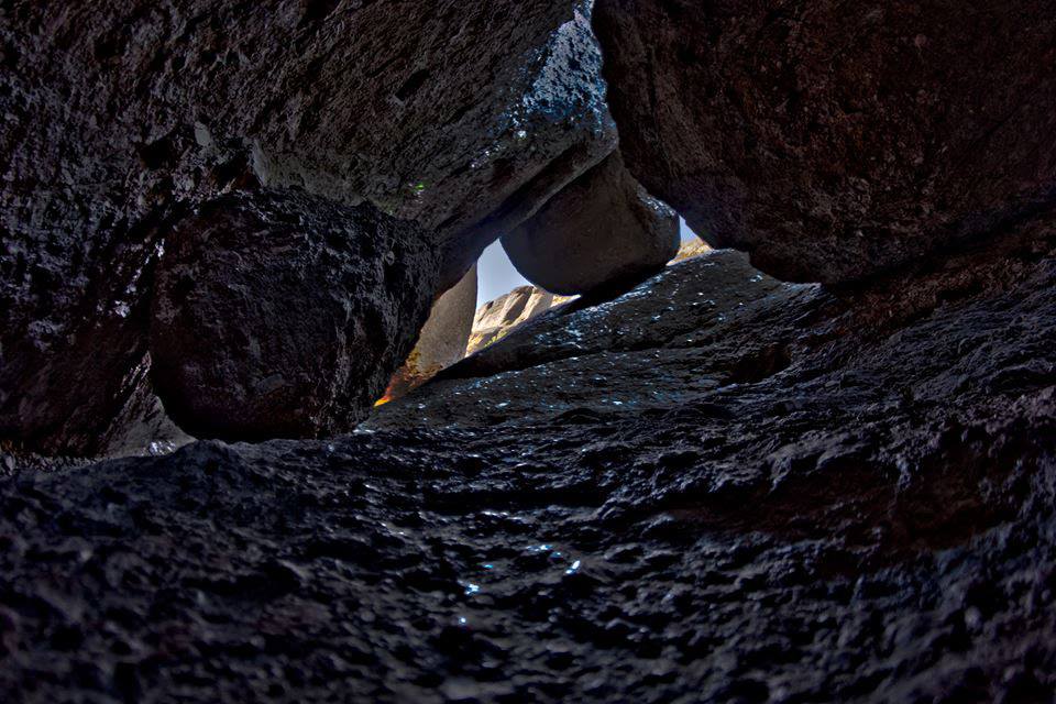
Pinnacles National Park
National Park
Around 23 million years ago, a series of volcanic eruptions shaped the landscape that is now Pinnacles National Park. The remnants of these ancient eruptions have formed a striking terrain of rocky sp...
Park data from the National Park Service API. Alerts update every 2 hours.
More Details
What kind of drive is this?
Expect a turn-heavy local drive on this route, with only 13% of the journey on highways. The longest uninterrupted stretch you'll encounter is 231.9 miles on El Camino Real, indicating a significant portion of your time will be spent on this historic road. This suggests a driving experience that is more about navigating local thoroughfares and less about high-speed freeway travel. The character of the road will likely evolve as you move from coastal areas inland and through various communities, requiring your attention to be more consistently on the road.
Only 13% highway — the rest is turn-by-turn surface driving.
18 navigation steps total — most of the decisions cluster near the start and finish.
Longest single stretch: 231.9 mi on El Camino Real.
How Hard Is This Drive?
7/10
Expect a hands-on drive with frequent turns and local roads rather than long highway stretches. This route has several spots where lane changes, forks, or exits need your full attention. The trickiest moment comes around 0.8 miles in near US 101 / El Camino Real.
Driving Effort7/10
Demanding - plan breaks and stay ahead of the key maneuvers
Balances navigation complexity with total wheel time.
This is a demanding drive. With 11 significant decision points across 282.8 miles, you will need to stay alert - especially through interchange areas and urban stretches. Consider splitting it into segments if you are not comfortable with fast highway navigation.
Where does it get tricky?
The main spots that need attention: at 0.8 miles (US 101 / El Camino Real): Merge point - match speed before joining. Lane positioning matters here. Multiple destination signs - pick the right one; at 270.9 miles (CA 85): Highway fork - watch signs carefully. Lane positioning matters here. Multiple destination signs - pick the right one; at 276.1 miles: Exit ramp - move to the correct lane early. Lane positioning matters here.
Goleta (go-lee-ta) is a city a few miles west of Santa Barbara and part of the contiguous urban area of Santa Barbara, within Santa Barbara County, California. This article also covers the unincorporated community of Isla Vista, which is home to the University of California at Santa Barbara.
Often called "the capital of Silicon Valley", San Jose is the largest city in the Bay Area, 3rd largest in California, and the 12th largest city in the United States, with a population of over 997,000 residents as of 2024. It was named the 6th safest big city in the U.S. in 2015. This clean, sprawling metropolis has sports, beautiful vistas, and ethnic enclaves and bleeds into the greater Bay Area for travelers who want to take their time in Northern California.
Top landmarks
•Winchester Mystery House — Mansion in San Jose, California.
•San Jose Diridon station — railway station complex in San Jose, California
•Rosicrucian Egyptian Museum — building in San Jose, California, United States
Doable as a same-day drive at 5h 29m. Total distance: 282.8 miles.
Family Friendly
Moderate complexity with 1 natural rest stops along the way.
Solo Traveler
5h 29m drive, comfortable solo distance.
Scenic Drive
Mostly surface roads route profile with national parks nearby.
Frequently Asked Questions
The longest stretch is about 231.9 miles on El Camino Real. The full list of main roads is in the Roads section above.
Yes — we found about 7 rest areas or service plazas within a short detour of the route (from OpenStreetMap). See the Rest Stops tab under Nearby Places for locations and mile markers. Plan to stretch, use the bathroom, and top off fluids every 2–3 hours on longer drives.
It helps. This route has a higher-than-average number of complex decision points, which get harder in the dark. If the last hour of the trip is on surface roads or mountain grades, aim to arrive at San Jose, CA before sunset when you can. Check the Trip Plan for departure windows that land you in daylight.
Only with planning. This is a long drive for kids — consider splitting it into two days rather than pushing through. Plan at least 1 meaningful breaks. There are 7 rest areas along the route for bathroom stops.
The main spots that need attention: at 0.8 miles (US 101 / El Camino Real): Merge point - match speed before joining. Lane positioning matters here. Multiple destination signs - pick the right one; at 270.9 miles (CA 85): Highway fork - watch signs carefully. Lane positioning matters here. Multiple destination signs - pick the right one; at 276.1 miles: Exit ramp - move to the correct lane early. Lane positioning matters here.
Yes — Pinnacles National Park. See the National Parks section for detour distances and tips on detours.
Not recommended in a single day. At 5.5 hours each way, a round trip means 11.0 hours of driving — that is an unsafe level of fatigue for most drivers. Plan at least one night at San Jose, CA before the return drive.