Traveling from Glendale to Kayenta covers 290.2 miles, typically taking about 5 hours and 29 minutes of drive time. You will navigate via the Arizona Veterans Highway, the Flagstaff-Cameron Highway, and the Navajo Trail to complete the journey. Given the duration, this route functions best as a single-day trip, allowing you to reach your destination by evening. Budget roughly $58 for fuel to cover the distance between these two Desert Southwest locations. Because the trip is straightforward, you can easily manage it in one go without the need for an overnight split.
Trip Pace
Same-day drive is realistic
A same-day return is possible, but it will make for a full day on the road.
Break Rhythm
1 planned break
Plan on a short reset every 3 to 4 hours to stay fresh behind the wheel.
Midpoint
145.1 miles from Glendale, AZ
A natural place for your longest stop of the day
, about 2h 37m into the drive
.
Step-by-step road directions between Glendale, AZ and Kayenta, AZ.
1
Start on US 60
0.3 mi·31 sec·Grand Avenue
2
Turn sharp right onto West Myrtle Avenue
0.2 mi·47 sec·West Myrtle Avenue
3
Turn left onto North 59th Avenue
0.7 mi·1 min·North 59th Avenue
Use the left lane.
4
Turn right onto West Northern Avenue
4.2 mi·8 min·West Northern Avenue
Use the right lane.
5
Turn slight left
439 ft·18 sec
6
Turn straight onto North Black Canyon Highway
0.1 mi·13 sec·North Black Canyon Highway
7
Take the ramp
0.1 mi·19 sec
Toward I 17 North: Flagstaff
8
Merge onto I 17
32 mi·34 min·Black Canyon Freeway
Use the straight / slight right lanes.
9
Continue on I 17
8.9 mi·9 min·Phoenix–Cordes Junction Highway
Use the straight / slight right lanes.
10
Continue on I 17
13 mi·13 min·Arizona Veterans Highway
11
Keep slight left at fork onto I 17
77 mi·1 hr 17 min·Arizona Veterans Highway
12
Continue on I 17; AZ 89A
0.6 mi·43 sec·Prescott–Flagstaff Highway
13
Take the exit
0.5 mi·1 min
Toward I 40 East, Albuquerque
14
Merge onto I 40
5.1 mi·5 min·Purple Heart Trail
15
Take the exit
0.3 mi·35 sec
Toward US 89 North: Page
16
Turn left onto US 180; I 40 Bus
0.5 mi·50 sec·Country Club Drive
Use the left / straight lanes.
17
Turn right onto US 89
2.3 mi·3 min·Flagstaff-Cameron Highway
Use the right lane.
18
Continue on US 89
6.4 mi·8 min·US Highway 89
19
Continue on US 89
38 mi·44 min·Flagstaff-Cameron Highway
20
Enter roundabout onto US 89
156 ft·2 sec·Cameron-Bitter Springs Highway
21
Continue on US 89
1.4 mi·2 min·Cameron-Bitter Springs Highway
22
Continue on US 89
0.3 mi·27 sec·US 89
23
Continue on US 89
14 mi·16 min·Cameron-Bitter Springs Highway
24
Turn right onto US 160
82 mi·1 hr 34 min·Navajo Trail
25
Turn left onto US 163
1.4 mi·2 min·Kayenta-Utah State Line Highway
26
Turn left
0.1 mi·32 sec
27
Turn left onto Comb Ridge Road
42 ft·1 sec·Comb Ridge Road
28
Arrive at destination
Comb Ridge Road
Trip Plan
To keep your drive manageable, plan for at least one dedicated stop to break up the 5.5-hour duration. Leaving early in the morning is your best strategy to avoid fatigue and ensure you arrive with plenty of daylight to navigate the final local stretches. Keep a close eye on your fuel gauge, as the $58 estimate can fluctuate depending on your vehicle's efficiency and local pricing along the way. Since this is a turn-heavy route, ensure your GPS is updated before departure to help you navigate the transition between the Arizona Veterans Highway and the Navajo Trail smoothly.
Morning Departure
An early start around 7-8 AM gets you there with plenty of daylight left.
Evening Departure
A late afternoon start means arriving after dark. Morning is better.
You can normally do this drive in one day.
Plan roughly 1 meaningful break for fuel, food, and rest.
The halfway point lands around 145.1 miles from Glendale, AZ, or about 2h 37m into the drive.
The longest continuous stretch on this route runs about 90.6 miles.
This is a comfortable same-day trip.
Departure
Before you leave
Start with fuel, water, and navigation already sorted so the first hour feels easy.
First stop
Around 64 miles or 1h 13m in
Use this first pause for coffee, a restroom break, and a quick traffic check ahead.
Halfway reset
Around 145.1 miles or 2h 37m in
This is the best place for your longest stop, a real meal, and a full fuel check.
Final approach
Final hour starts around 4h 28m
Traffic, exits, and arrival timing usually matter more near Kayenta, AZ than in the middle of the route.
Before You Leave
+
Open the route before leaving Glendale, AZ so your first major turns are already loaded.
+
Leave with enough water and a charging cable within reach, not packed away.
+
Check your fuel range against the first long segment, especially if you are starting outside city service areas.
Day 1
Settle into the route from Glendale, AZ
This is one driving day of about 290.2 miles and 5h 29m.
Your first comfortable stop window is around 64 miles from Glendale, AZ.
This route can stay practical as a one-day drive if traffic stays reasonable.
Plan about 1 real break rather than only quick fuel stops.
The longest stretch is on Arizona Veterans Highway for about 90.6 miles.
Where to Stop
Rest stops, refuel points, and overnight suggestions along this route.
Place data sourced from public business listings. Hours and availability may vary.
Heads-up: tricky spots
5 of 16
5 decision points cluster between mile 0.5 and 144.4 — GPS handles the exact turns, but know they're coming. Your lane choice matters more than the turn itself.
5
0.5 mi into trip|~1m in|North 59th Avenue
Turn left onto North 59th Avenue
Lane positioning matters here
Use the left lane.
6
1.3 mi into trip|~2m in|West Northern Avenue
Turn right onto West Northern Avenue
Lane positioning matters here
Use the right lane.
5
5.9 mi into trip|~12m in|I 17 / Black Canyon Freeway
Merge onto I 17 / Black Canyon Freeway
Merge point - match speed before joining. Lane positioning matters here
Use the straight / slight right lanes.
6
143.9 mi into trip|~2h 35m in|US 180; I 40 Bus / Country Club Drive
Turn left onto US 180; I 40 Bus / Country Club Drive
Lane positioning matters here
Use the left / straight lanes.
6
144.4 mi into trip|~2h 36m in|US 89 / Flagstaff-Cameron Highway
Turn right onto US 89 / Flagstaff-Cameron Highway
Lane positioning matters here
Use the right lane.
Fuel & Cost
Regular Gas
$51.42 one way
$102.85 round trip
$4.50/gal25.4 MPG avg102 kg CO2
Fuel Type
$/gal
One Way
Round Trip
midgrade
$4.82
$55.07
$110.14
premium
$5.04
$57.61
$115.21
diesel
$4.80
$54.80
$109.59
No toll roads detected on this route.
Estimated Trip Cost (one way, 1 person)
Fuel
$51
Meals
$25–$50
Total
$76–$101
Rough estimate based on US averages. Hotel $80–$140/night, meals $25–$50/day.
Estimated CO2 emission: 101.5 kg one way.
Prices: EIA weekly data, 2026-07-13.
Driving Electric?
About $30 in charging
· 1 stop
· 67% less CO2
Vehicle Type
kWh
Stops
DC Fast
Home Charge
Average EV
87.1
1
$30.47
$13.93
Efficient EV
72.6
0
$25.39
$11.61
EV Truck/SUV
116.1
1
$40.63
$18.57
Gas CO2
102 kg
EV CO2
34 kg (67% less)
Plan for 1 charging stop. A 30-minute DC fast charge mid-route should be enough to complete the trip comfortably.
DC fast charging avg $0.35/kWh. Home charging avg $0.16/kWh. US grid CO2: 0.39 kg/kWh.
Travel Intel
Current conditions at both ends of the drive.
Forecast as of Jul 17, 2026
Origin
Glendale, AZ
Late night
in Glendale on Sunday
Local time
12:04 AM
MST
Current temp
93°F
Slight Chance Showers And Thunderstorms
SE 5 mph10% chanceLive forecast
Severe Thunderstorm Warning
Severe Thunderstorm Warning issued July 17 at 4:17PM MST until July 17 at 4:45PM MST by NWS Phoenix AZ
Flash Flood Warning
Flash Flood Warning issued July 17 at 4:10PM MST until July 17 at 7:15PM MST by NWS Phoenix AZ
Destination
Kayenta, AZ
Late night
in Kayenta on Sunday
Local time
1:04 AM
MDT
Current temp
86°F
Showers And Thunderstorms Likely
SW 6 mph56% chanceLive forecast
Severe Thunderstorm Warning
Severe Thunderstorm Warning issued July 17 at 4:17PM MST until July 17 at 4:45PM MST by NWS Phoenix AZ
Flash Flood Warning
Flash Flood Warning issued July 17 at 4:10PM MST until July 17 at 7:15PM MST by NWS Phoenix AZ
Seasonal Notes
Summer travel usually means heavier construction, hotter rest stops, and busier weekend traffic around major cities.
Winter travel shortens daylight, so a route that looks manageable on paper can feel much longer after dark.
Holiday weekends tend to make both departure and arrival windows slower than the raw route time suggests.
Time zone
1 hour later
The destination clock does not match departure time, so double-check hotel check-in windows and late arrival plans.
Temperature spread
7 degrees cooler at arrival
A meaningful temperature swing is a good cue to rethink layers, water, and how soon you want to arrive.
Road read
5h 29m on the road
An early start around 7-8 AM gets you there with plenty of daylight left.
Weather data from the National Weather Service. Conditions may change; check closer to your travel date.
National Parks Near This Route
Worth a detour if your schedule allows.
Montezuma Castle National Monument
National Monument
Established December 8, 1906, Montezuma Castle is the third National Monument dedicated to preserving Native American culture. This 20 room high-rise apartment, nestled into a towering limestone cliff...
The lava flow lies on the land like a dream, a wonderland of rock. A thousand years ago the ground was torn open and lava erupted into the sky, forever changing the landscape and the lives of the peop...
5 mi from route
~13 min detour
$25
near mile 160.1
Since time immemorial, Indigenous Peoples have lived and traveled throughout Walnut Canyon’s dynamic landscape. Vibrant communities built their homes in the cliffs and farmed along the canyon’s rim. T...
8 mi from route
~19 min detour
$25
near mile 140.1
Nestled between the Painted Desert and ponderosa highlands of northern Arizona, Wupatki National Monument is an unlikely landscape for a thriving community. The early 1100's marked a time of cooler an...
8 mi from route
~19 min detour
$25
near mile 170.1
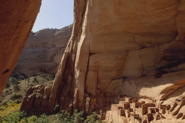
For centuries, the Hopi, San Juan Southern Paiute, Zuni, and Navajo people have lived in the canyons. Springs fed farmlands on the canyon floor and homes were built in the natural sandstone alcoves. T...
9 mi from route
~23 min detour
Free
near mile 280.2
Water flows under and through this landscape, feeding the growth of people and towns. The Verde Valley is watered by snowmelt, summer monsoons, and springs that well up from the ancient sedimentary ro...
15 mi from route
~37 min detour
$10
near mile 90.1
Park data from the National Park Service API. Alerts update every 2 hours.
More Details
What kind of drive is this?
Expect a turn-heavy local drive that demands your full attention rather than a monotonous interstate cruise. With only 13% of the journey on major highways, you will spend most of your time navigating local roads that shift in character as you head north. Your longest uninterrupted segment spans 90.6 miles while on the Arizona Veterans Highway, providing a significant chunk of steady travel. The remaining distance requires more frequent adjustments, making this a route where the road feel changes noticeably as you progress toward Kayenta.
Only 13% highway — the rest is turn-by-turn surface driving.
28 navigation steps total — most of the decisions cluster near the start and finish.
Longest single stretch: 90.6 mi on Arizona Veterans Highway.
How Hard Is This Drive?
6/10
Expect a hands-on drive with frequent turns and local roads rather than long highway stretches. You will hit about 16 points where you need to pay attention to lane position or signs. The trickiest moment comes around 0.5 miles in near North 59th Avenue.
Driving Effort6/10
Moderate - straightforward overall, but long enough or busy enough to require pacing
Balances navigation complexity with total wheel time.
This drive requires moderate attention. Across 290.2 miles you will encounter 16 spots where lane choice or exit timing matters. Not difficult for experienced highway drivers, but worth previewing the tricky sections before you go.
Where does it get tricky?
The main spots that need attention: at 0.5 miles (North 59th Avenue): Lane positioning matters here; at 1.3 miles (West Northern Avenue): Lane positioning matters here; at 5.9 miles (I 17 / Black Canyon Freeway): Merge point - match speed before joining. Lane positioning matters here.
Elevation Profile
Mountain driving with significant elevation changes
6,860 ft1,128 ft
Total Climb
8,091 ft
Total Descent
3,579 ft
Highest Point
6,860 ft
~145.1 mi in
Elevation Range
5,732 ft
Notable High Points
6,860 ft at ~145.1 miles+157 ft prominence
6,686 ft at ~269.5 miles+822 ft prominence
Towns Mentioned on Route Signs
Based on OSRM destination-sign hints, not a full list of every settlement the road passes.
On the drive from Glendale, AZ to Kayenta, AZ, road signs begin pointing toward Albuquerque along the way.
Glendale is one of the largest suburbs in the metropolitan Phoenix area, and is rapidly growing as a media/entertainment center in the Valley of the Sun. It was home to over 250,000 people in 2019.
Top landmarks
•Catlin Court Historic District — historic district in Glendale, Arizona, USA
•Floralcroft Historic District — historic district in Glendale. Arizona
Kayenta is a small town near the northern border of Arizona and part of the Navajo Nation. The population was 5,189 at the 2010 census. Kayenta is 22 miles (35 km) south of Monument Valley and contains a number of hotels and motels which service visitors to Monument Valley.
Doable as a same-day drive at 5h 29m. Total distance: 290.2 miles.
Family Friendly
Moderate complexity with 1 natural rest stops along the way.
Solo Traveler
5h 29m drive, comfortable solo distance.
Scenic Drive
Mostly surface roads route profile with national parks nearby.
Frequently Asked Questions
The longest stretch is about 90.6 miles on Arizona Veterans Highway. The full list of main roads is in the Roads section above.
Yes — we found about 7 rest areas or service plazas within a short detour of the route (from OpenStreetMap). See the Rest Stops tab under Nearby Places for locations and mile markers. Plan to stretch, use the bathroom, and top off fluids every 2–3 hours on longer drives.
It helps. This route has a higher-than-average number of complex decision points, which get harder in the dark. If the last hour of the trip is on surface roads or mountain grades, aim to arrive at Kayenta, AZ before sunset when you can. Check the Trip Plan for departure windows that land you in daylight.
Only with planning. This is a long drive for kids — consider splitting it into two days rather than pushing through. Plan at least 1 meaningful breaks. There are 7 rest areas along the route for bathroom stops.
The main spots that need attention: at 0.5 miles (North 59th Avenue): Lane positioning matters here; at 1.3 miles (West Northern Avenue): Lane positioning matters here; at 5.9 miles (I 17 / Black Canyon Freeway): Merge point - match speed before joining. Lane positioning matters here.
Yes — Montezuma Castle National Monument, Sunset Crater Volcano National Monument and Walnut Canyon National Monument (6 total within detour distance). See the National Parks section for detour distances and tips on detours.
Not recommended in a single day. At 5.5 hours each way, a round trip means 11.0 hours of driving — that is an unsafe level of fatigue for most drivers. Plan at least one night at Kayenta, AZ before the return drive.