Fort Payne, AL to Madison, AL is 78.8 miles and takes about 1 hour 41 minutes via John T Reid Parkway, with a fuel budget near $12 and enough daylight to finish in a day. This short trip stays within Alabama, moving from the Southeast region to another part of the Southeast. The route offers a mixed driving experience, balancing highway cruising with surface roads. It's a straightforward drive, perfect for a single-day excursion when you don't want to spend too much time on the road.
Trip Pace
Same-day drive is realistic
A same-day return is realistic if you keep stops short.
Midpoint
39.4 miles from Fort Payne, AL
A natural place for your longest stop of the day
, about 53m into the drive
.
Main Roads
Road
Distance
Duration
John T Reid Parkway
46.1 mi
54m
Tammy Little Drive
12.7 mi
17m
East Main Street
8.9 mi
12m
Glenn Boulevard Southwest
4.9 mi
7m
Madison Boulevard
2.5 mi
3m
Hughes Road
1.3 mi
2m
Gault Avenue North
1 mi
2m
Mill Road
0.3 mi
<1m
Longest stretch:
John T Reid Parkway
— 46.1 mi, about 54m
Turn-by-Turn Driving Directions
Step-by-step road directions between Fort Payne, AL and Madison, AL.
1
Start on US 11; AL 35
1.0 mi·2 min·Gault Avenue North
2
Turn right onto AL 35
4.9 mi·7 min·Glenn Boulevard Southwest
3
Continue on AL 35
8.9 mi·12 min·East Main Street
4
Continue on AL 35
13 mi·17 min·Tammy Little Drive
5
Turn left
0.2 mi·33 sec
Toward US 72, AL 279
6
Merge onto US 72; AL 279
46 mi·54 min·John T Reid Parkway
7
Take the exit
0.7 mi·1 min
Exit 13Toward Madison Boulevard
8
Continue on Madison Boulevard
2.5 mi·3 min·Madison Boulevard
9
Turn right onto Hughes Road
1.3 mi·2 min·Hughes Road
10
Turn left onto Mill Road
0.3 mi·50 sec·Mill Road
11
Turn left onto Church Street
70 ft·1 sec·Church Street
12
Arrive at destination
Church Street
Trip Plan
With a total drive time of just under two hours, this is an easy same-day trip. Consider leaving in the morning to give yourself maximum flexibility for any unscheduled stops. Since the drive is relatively short, you won't need to plan for extensive rest breaks, but it's always wise to take a short pause every hour or so. Keep an eye on your fuel gauge, as the estimated cost is only $12, suggesting limited fuel stations directly on the most efficient path for much of the way.
Morning Departure
Leave by 9 AM and you'll arrive before lunch.
Evening Departure
Even a 4 PM departure gets you there before dark in summer.
You can normally do this drive in one day.
You may only need one short stretch break if traffic stays light.
The halfway point lands around 39.4 miles from Fort Payne, AL, or about 53m into the drive.
The longest continuous stretch on this route runs about 46.1 miles.
This is a comfortable same-day trip.
Departure
Before you leave
Start with fuel, water, and navigation already sorted so the first hour feels easy.
First stop
Around 17 miles or 24m in
Use this first pause for coffee, a restroom break, and a quick traffic check ahead.
Halfway reset
Around 39.4 miles or 53m in
This is the best place for your longest stop, a real meal, and a full fuel check.
Final approach
Final hour starts around 1h 25m
Traffic, exits, and arrival timing usually matter more near Madison, AL than in the middle of the route.
Before You Leave
+
Open the route before leaving Fort Payne, AL so your first major turns are already loaded.
Day 1
Settle into the route from Fort Payne, AL
This is one driving day of about 78.8 miles and 1h 41m.
Your first comfortable stop window is around 17 miles from Fort Payne, AL.
This route can stay practical as a one-day drive if traffic stays reasonable.
The longest stretch is on John T Reid Parkway for about 46.1 miles.
Where to Stop
Rest stops, refuel points, and overnight suggestions along this route.
Place data sourced from public business listings. Hours and availability may vary.
Heads-up: tricky spots
5 of 6
5 decision points cluster between mile 1 and 78.7 — GPS handles the exact turns, but know they're coming. Your lane choice matters more than the turn itself.
3
1 mi into trip|~2m in|AL 35 / Glenn Boulevard Southwest
Turn right onto AL 35 / Glenn Boulevard Southwest
Navigation decision point
5
27.6 mi into trip|~38m in
Turn left toward US 72, AL 279
Multiple destination signs - pick the right one
Toward US 72, AL 279
3
27.8 mi into trip|~39m in|US 72; AL 279 / John T Reid Parkway
Merge onto US 72; AL 279 / John T Reid Parkway
Merge point - match speed before joining
5
73.8 mi into trip|~1h 33m in
Take the exit toward Madison Boulevard
Exit ramp - move to the correct lane early
Exit 13
Toward Madison Boulevard
4
78.7 mi into trip|~1h 41m in|Church Street
Turn left onto Church Street
Navigation decision point
Fuel & Cost
Regular Gas
$11.90 one way
$23.80 round trip
$3.84/gal25.4 MPG avg28 kg CO2
Fuel Type
$/gal
One Way
Round Trip
midgrade
$4.21
$13.06
$26.13
premium
$4.56
$14.14
$28.29
diesel
$5.61
$17.40
$34.80
No toll roads detected on this route.
Estimated Trip Cost (one way, 1 person)
Fuel
$12
Meals
$25–$50
Total
$37–$62
Rough estimate based on US averages. Hotel $80–$140/night, meals $25–$50/day.
Estimated CO2 emission: 27.6 kg one way.
Prices: EIA weekly data, 2026-04-13.
Driving Electric?
About $8 in charging
· 0 stops
· 68% less CO2
Vehicle Type
kWh
Stops
DC Fast
Home Charge
Average EV
23.6
0
$8.27
$3.78
Efficient EV
19.7
0
$6.90
$3.15
EV Truck/SUV
31.5
0
$11.03
$5.04
Gas CO2
28 kg
EV CO2
9 kg (68% less)
This trip is well within single-charge range for most EVs. No charging stops needed if you start fully charged.
DC fast charging avg $0.35/kWh. Home charging avg $0.16/kWh. US grid CO2: 0.39 kg/kWh.
Travel Intel
Current conditions at both ends of the drive.
Forecast as of Apr 18, 2026
Origin
Fort Payne, AL
Late night
in Fort Payne on Tuesday
Local time
5:36 AM
CDT
Current temp
55°F
Unavailable
Live forecast
Destination
Madison, AL
Late night
in Madison on Tuesday
Local time
5:36 AM
CDT
Current temp
84°F
Partly Sunny then Chance Showers And Thunderstorms
WSW 10 mph44% chanceLive forecast
57°F
Grant, AL
39 mi in
Seasonal Notes
Summer travel usually means heavier construction, hotter rest stops, and busier weekend traffic around major cities.
Winter travel shortens daylight, so a route that looks manageable on paper can feel much longer after dark.
Holiday weekends tend to make both departure and arrival windows slower than the raw route time suggests.
Time zone
Same local time
Origin and destination are on the same clock, so arrival timing is easier to judge at a glance.
Temperature spread
29 degrees warmer at arrival
A meaningful temperature swing is a good cue to rethink layers, water, and how soon you want to arrive.
Road read
1h 41m on the road
The weather snapshot is not static. If you are leaving later, give both cities one more quick forecast check before departure.
Weather data from the National Weather Service. Conditions may change; check closer to your travel date.
National Parks Near This Route
Worth a detour if your schedule allows.
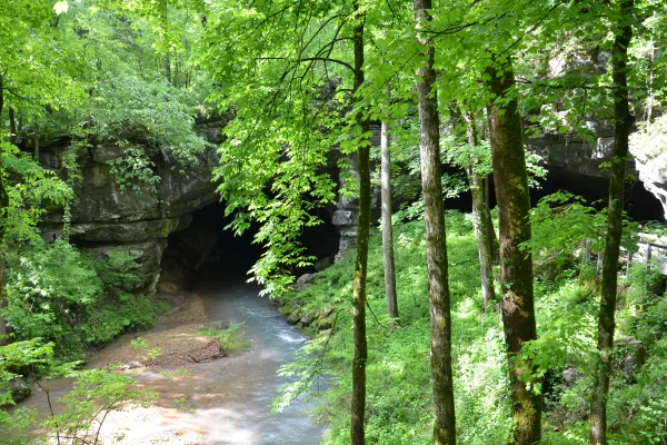
Russell Cave National Monument
National Monument
Russell Cave National Monument is an archeological site with one of the most complete records of prehistoric cultures in the Southeast. In the 1950s, archeologists uncovered a large quantity of artifa...
24 mi from route
~61 min detour
Free
near mile 27.2
Park data from the National Park Service API. Alerts update every 2 hours.
More Details
What kind of drive is this?
This route is 58% highway, so you'll spend a significant portion of your 1 hour and 41-minute drive on faster roads. The longest continuous stretch on a highway is 46.1 miles along John T Reid Parkway. Expect the transition from highway to surface roads to happen around the halfway point of your drive. You'll notice the change from higher-speed travel to more local road conditions as you progress.
58% highway, the rest on surface roads — varied driving throughout.
12 navigation steps total — most of the decisions cluster near the start and finish.
Longest single stretch: 46.1 mi on John T Reid Parkway.
How Hard Is This Drive?
1/10
This route mixes highway mileage with some local-road sections near the start or finish. Navigation is very simple - set it and forget it for most of the drive. The trickiest moment comes around 1 miles in near AL 35 / Glenn Boulevard Southwest.
Driving Effort1/10
Very easy - short and simple to drive
Balances navigation complexity with total wheel time.
The drive from Fort Payne, AL to Madison, AL is easy. At 1h 41m with 58% highway, most drivers will find it relaxed and low-stress.
Where does it get tricky?
The main spots that need attention: at 1 miles (AL 35 / Glenn Boulevard Southwest): Navigation decision point; at 27.6 miles: Multiple destination signs - pick the right one; at 27.8 miles (US 72; AL 279 / John T Reid Parkway): Merge point - match speed before joining.
Madison, the capital of Wisconsin, is situated on an isthmus between Lake Mendota and Lake Monona. As the anchor of the Greater Madison Area, it is home to the University of Wisconsin — Madison, one of the premier universities in the United States. It is a vibrant city known for its natural beauty, vibrant cultural scene, and academic excellence. Visitors can enjoy a variety of activities such as hiking, biking, and exploring the city's many museums and art galleries. The city is also known for its diverse and delicious food options.
Mixed highway & surface route profile with national parks nearby.
Frequently Asked Questions
The longest stretch is about 46.1 miles on John T Reid Parkway. The full list of main roads is in the Roads section above.
Yes — we found about 1 rest area or service plaza within a short detour of the route (from OpenStreetMap). See the Rest Stops tab under Nearby Places for locations and mile markers. Plan to stretch, use the bathroom, and top off fluids every 2–3 hours on longer drives.
Yes. At under 2 hours behind the wheel, this works well for families — plan one quick stop if you have younger kids.
The main spots that need attention: at 1 miles (AL 35 / Glenn Boulevard Southwest): Navigation decision point; at 27.6 miles: Multiple destination signs - pick the right one; at 27.8 miles (US 72; AL 279 / John T Reid Parkway): Merge point - match speed before joining.
Yes — Russell Cave National Monument. See the National Parks section for detour distances and tips on detours.
Yes. A round trip is manageable in a single day if you plan a break at Madison, AL before heading back.