Detroit to Elk Rapids is 252.9 miles and takes about 4h 49m via I 75 and M 72, with a fuel budget near $39 and enough daylight to finish in a day. This trip stays within Michigan, moving from the Midwest's more urbanized areas toward its northern lake regions. It's a straightforward, mostly highway drive that should be manageable for a single day. Plan for a relatively quick transit with minimal complications.
Trip Pace
Same-day drive is realistic
A same-day return is possible, but it will make for a full day on the road.
Break Rhythm
1 planned break
Plan on a short reset every 3 to 4 hours to stay fresh behind the wheel.
Midpoint
126.4 miles from Detroit, MI
A natural place for your longest stop of the day
, about 2h 17m into the drive
.
Main Roads
Road
Distance
Duration
I 75
142.5 mi
2h 26m
Walter P. Chrysler Freeway
60 mi
1h 5m
M 72
24.4 mi
33m
Elk Lake Road
8.2 mi
14m
M-72 West
7.7 mi
10m
East M 72
3.6 mi
5m
South Cedar Street
2 mi
3m
BL I 75
1.8 mi
4m
Longest stretch:
I 75
— 142.5 mi, about 2h 26m
Traffic on I-75
Hour-of-day weekday pattern from 63 FHWA count stations on your route.
Peak
4 PM
~2,839 veh/hr typical
· worst 3,897
Quietest
2 AM
~177 veh/hr
Peak-to-quiet ratio
16×
busier at peak than in the quiet hours
12a6anoon6p11p
Averaged across 52 weeks of 2023 FHWA Travel Monitoring Analysis System data. Weekday hours only (Mon–Fri).
Turn-by-Turn Driving Directions
Step-by-step road directions between Detroit, MI and Elk Rapids, MI.
1
Start on Cadillac Square
0.1 mi·28 sec·Cadillac Square
2
Continue on Cadillac Square
97 ft·3 sec·Cadillac Square
Toward M 3 NorthUse the left lane.
3
Turn slight left onto M 3
0.2 mi·38 sec·Randolph Street
4
Turn right onto Monroe Street
0.4 mi·1 min·Monroe Street
Use the right lane.
5
At end of road, turn left onto Chrysler Drive
34 ft·1 sec·Chrysler Drive
Use the left lane.
6
Take the ramp
0.2 mi·20 sec
7
Merge onto I 375
60 mi·1 hr 5 min·Walter P. Chrysler Freeway
Toward I 75 North: FlintUse the straight / slight right lanes.
8
Keep slight left at fork onto I 75
52 mi·56 min·I 75
Toward I 75: Saginaw
9
Keep slight left at fork onto I 75; US 23
63 mi·1 hr 3 min·I 75; US 23
10
Keep slight left at fork onto I 75
27 mi·27 min·I 75
11
Take the exit onto BL I 75
1.8 mi·4 min·BL I 75
Toward I 75 Business Loop, M 72: Downtown Grayling, Traverse City
12
Turn left onto M 72; M 93
24 mi·33 min·M 72; M 93
13
At end of road, turn right onto US 131; M 72; M 66
2.0 mi·3 min·South Cedar Street
14
Turn left onto M 72
1.0 mi·1 min·West Mile Road Northwest
15
Continue on M 72
7.7 mi·10 min·M-72 West
16
Continue on M 72
3.6 mi·5 min·East M 72
17
Turn right onto CR 605
8.2 mi·14 min·Elk Lake Road
18
At end of road, turn right onto US 31
0.4 mi·49 sec·South US 31 Highway
19
Turn left onto First Street
0.3 mi·1 min·First Street
20
Turn right onto Spruce Street
0.1 mi·24 sec·Spruce Street
21
Arrive at destination
Spruce Street
Trip Plan
To make the most of this 4h 49m drive, consider an early morning departure from Detroit to avoid potential traffic. With only one recommended stop and a fuel cost around $39, this trip is easily done in a single day. The longest stretch of highway is 142.5 miles, so plan your break before or after this segment. Keep an eye on your fuel gauge, especially as you approach the final 81% of the drive, which is on faster roads. You'll be switching to M 72 for the last part of the journey, so be prepared for a change in speed and road conditions.
Morning Departure
An early start around 7-8 AM gets you there with plenty of daylight left.
Evening Departure
A late afternoon start means arriving after dark. Morning is better.
You can normally do this drive in one day.
Plan roughly 1 meaningful break for fuel, food, and rest.
The halfway point lands around 126.4 miles from Detroit, MI, or about 2h 17m into the drive.
The longest continuous stretch on this route runs about 142.5 miles.
This is a comfortable same-day trip.
Departure
Before you leave
Start with fuel, water, and navigation already sorted so the first hour feels easy.
First stop
Around 56 miles or 1h 2m in
Use this first pause for coffee, a restroom break, and a quick traffic check ahead.
Halfway reset
Around 126.4 miles or 2h 17m in
This is the best place for your longest stop, a real meal, and a full fuel check.
Final approach
Final hour starts around 3h 41m
Traffic, exits, and arrival timing usually matter more near Elk Rapids, MI than in the middle of the route.
Before You Leave
+
Open the route before leaving Detroit, MI so your first major turns are already loaded.
+
Leave with enough water and a charging cable within reach, not packed away.
+
Check your fuel range against the first long segment, especially if you are starting outside city service areas.
Day 1
Settle into the route from Detroit, MI
This is one driving day of about 252.9 miles and 4h 49m.
Your first comfortable stop window is around 56 miles from Detroit, MI.
This route can stay practical as a one-day drive if traffic stays reasonable.
Plan about 1 real break rather than only quick fuel stops.
The longest stretch is on I 75 for about 142.5 miles.
Where to Stop
Rest stops, refuel points, and overnight suggestions along this route.
Place data sourced from public business listings. Hours and availability may vary.
Heads-up: tricky spots
5 of 17
5 decision points cluster between mile 0.1 and 60.9 — GPS handles the exact turns, but know they're coming. Your lane choice matters more than the turn itself.
5
0.1 mi into trip|~0m in|Cadillac Square
Continue onto Cadillac Square toward M 3 North
Lane positioning matters here
Use the left lane.
Toward M 3 North
5
0.3 mi into trip|~1m in|Monroe Street
Turn right onto Monroe Street
Lane positioning matters here
Use the right lane.
6
0.7 mi into trip|~2m in|Chrysler Drive
At end of road, turn left onto Chrysler Drive
Lane positioning matters here
Use the left lane.
6
0.9 mi into trip|~2m in|I 375 / Walter P. Chrysler Freeway
Merge onto I 375 / Walter P. Chrysler Freeway toward I 75 North: Flint
Merge point - match speed before joining. Lane positioning matters here
Use the straight / slight right lanes.
Toward I 75 North: Flint
5
60.9 mi into trip|~1h 7m in|I 75
Keep slight left at fork onto I 75 toward I 75: Saginaw
Highway fork - watch signs carefully
Toward I 75: Saginaw
Fuel & Cost
Regular Gas
$37.35 one way
$74.70 round trip
$3.75/gal25.4 MPG avg89 kg CO2
Fuel Type
$/gal
One Way
Round Trip
midgrade
$4.14
$41.23
$82.46
premium
$4.72
$46.96
$93.91
diesel
$4.80
$47.75
$95.50
No toll roads detected on this route.
Estimated Trip Cost (one way, 1 person)
Fuel
$37
Meals
$25–$50
Total
$62–$87
Rough estimate based on US averages. Hotel $80–$140/night, meals $25–$50/day.
Estimated CO2 emission: 88.5 kg one way.
Prices: EIA weekly data, 2026-07-13.
Driving Electric?
About $27 in charging
· 0 stops
· 66% less CO2
Vehicle Type
kWh
Stops
DC Fast
Home Charge
Average EV
75.9
0
$26.55
$12.14
Efficient EV
63.2
0
$22.13
$10.12
EV Truck/SUV
101.2
1
$35.41
$16.19
Gas CO2
88 kg
EV CO2
30 kg (66% less)
Plan for 0 charging stops, roughly every 270 miles. Allow 25-40 minutes per stop at a DC fast charger.
DC fast charging avg $0.35/kWh. Home charging avg $0.16/kWh. US grid CO2: 0.39 kg/kWh.
Travel Intel
Current conditions at both ends of the drive.
Forecast as of Jul 18, 2026
Origin
Detroit, MI
Late night
in Detroit on Sunday
Local time
5:39 AM
EDT
Current temp
92°F
Partly Sunny then Slight Chance Showers And Thunderstorms
W 9 to 16 mph66% chanceLive forecast
Beach Hazards Statement
Beach Hazards Statement issued July 18 at 6:07AM EDT until July 19 at 5:00AM EDT by NWS Northern Indiana
Beach Hazards Statement
Beach Hazards Statement issued July 18 at 4:41AM EDT until July 18 at 10:00PM EDT by NWS Detroit/Pontiac MI
Destination
Elk Rapids, MI
Late night
in Elk Rapids on Sunday
Local time
5:39 AM
EDT
Current temp
75°F
Chance Showers And Thunderstorms then Areas Of Smoke
NW 10 to 15 mph34% chanceLive forecast
Beach Hazards Statement
Beach Hazards Statement issued July 18 at 6:07AM EDT until July 19 at 5:00AM EDT by NWS Northern Indiana
Beach Hazards Statement
Beach Hazards Statement issued July 18 at 4:41AM EDT until July 18 at 10:00PM EDT by NWS Detroit/Pontiac MI
Seasonal Notes
Summer travel usually means heavier construction, hotter rest stops, and busier weekend traffic around major cities.
Winter travel shortens daylight, so a route that looks manageable on paper can feel much longer after dark.
Holiday weekends tend to make both departure and arrival windows slower than the raw route time suggests.
Time zone
Same local time
Origin and destination are on the same clock, so arrival timing is easier to judge at a glance.
Temperature spread
17 degrees cooler at arrival
A meaningful temperature swing is a good cue to rethink layers, water, and how soon you want to arrive.
Road read
4h 49m on the road
An early start around 7-8 AM gets you there with plenty of daylight left.
Weather data from the National Weather Service. Conditions may change; check closer to your travel date.
National Parks Near This Route
Worth a detour if your schedule allows.
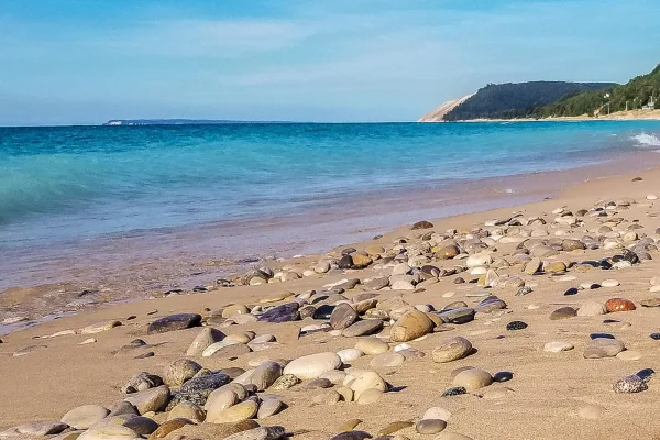
Sleeping Bear Dunes National Lakeshore
National Lakeshore
Miles of sand beach, bluffs that tower 450’ above Lake Michigan, lush forests, clear inland lakes, unique flora and fauna make up the natural world of Sleeping Bear Dunes. High dunes afford spectacula...
30 mi from route
~75 min detour
$25
near mile 252.9
Caution: May Prescribed Fire in Platte Plains Area
Park data from the National Park Service API. Alerts update every 2 hours.
More Details
What kind of drive is this?
This route is 81% highway, so you'll spend most of your time on high-speed roads. The longest stretch of continuous highway driving is 142.5 miles on I 75. You'll transition from freeway driving to surface roads for the final portion of the trip. Expect to notice a shift in the surrounding landscape as you move from denser areas to more open cruising.
81% highway — fuel and pacing are the main things to plan.
21 navigation steps total — most of the decisions cluster near the start and finish.
Longest single stretch: 142.5 mi on I 75.
How Hard Is This Drive?
6/10
This is a straightforward highway drive that stays mostly on I 75 and Walter P. Chrysler Freeway. You will hit about 17 points where you need to pay attention to lane position or signs. The trickiest moment comes around 0.1 miles in near Cadillac Square.
Driving Effort6/10
Moderate - straightforward overall, but long enough or busy enough to require pacing
Balances navigation complexity with total wheel time.
This drive requires moderate attention. Across 252.9 miles you will encounter 17 spots where lane choice or exit timing matters. Not difficult for experienced highway drivers, but worth previewing the tricky sections before you go.
Where does it get tricky?
The main spots that need attention: at 0.1 miles (Cadillac Square): Lane positioning matters here; at 0.3 miles (Monroe Street): Lane positioning matters here; at 0.7 miles (Chrysler Drive): Lane positioning matters here.
Elevation Profile
Gently rolling terrain
1,267 ft591 ft
Total Climb
1,072 ft
Total Descent
1,073 ft
Highest Point
1,267 ft
~198.7 mi in
Elevation Range
676 ft
Towns Mentioned on Route Signs
Based on OSRM destination-sign hints, not a full list of every settlement the road passes.
Between Detroit, MI and Elk Rapids, MI, road signs point toward M 72: Downtown Grayling and Traverse City.
Detroit is a major metropolis in the US state of Michigan that has had a profound impact on the world. From the advent of the automotive assembly line to the Motown sound, modern techno and rock music, Detroit continues to shape both American and global culture. The city has seen many of its historic buildings renovated, and is bustling with new developments and attractions that complement its world-class museums and theatres. After a long economic slump and decrease in population, Detroit has developed a reputation for crime and urban decline, but revitalization means that it is an exciting destination filled with technological advance and historic charm.
Top landmarks
•Detroit Institute of Arts — art museum in Detroit, Michigan
•Michigan Central Station — historic former railroad station in Detroit, Michigan
•Fisher Building — skyscraper in Detroit, Michigan, United States, including the Fisher Theater
Doable as a same-day drive at 4h 49m. Total distance: 252.9 miles.
Family Friendly
Moderate complexity with 1 natural rest stops along the way.
Solo Traveler
4h 49m drive, comfortable solo distance.
First-Time Driver
Mostly highway driving (81%). Some complex stretches to watch for.
Frequently Asked Questions
The longest stretch is about 142.5 miles on I 75. The full list of main roads is in the Roads section above.
Yes — we found about 19 rest areas or service plazas within a short detour of the route (from OpenStreetMap). See the Rest Stops tab under Nearby Places for locations and mile markers. Plan to stretch, use the bathroom, and top off fluids every 2–3 hours on longer drives.
It helps. This route has a higher-than-average number of complex decision points, which get harder in the dark. If the last hour of the trip is on surface roads or mountain grades, aim to arrive at Elk Rapids, MI before sunset when you can. Check the Trip Plan for departure windows that land you in daylight.
Only with planning. This is a long drive for kids — consider splitting it into two days rather than pushing through. Plan at least 1 meaningful breaks. There are 19 rest areas along the route for bathroom stops.
The main spots that need attention: at 0.1 miles (Cadillac Square): Lane positioning matters here; at 0.3 miles (Monroe Street): Lane positioning matters here; at 0.7 miles (Chrysler Drive): Lane positioning matters here.
Yes — Sleeping Bear Dunes National Lakeshore. See the National Parks section for detour distances and tips on detours.
Possible but tiring. At 4.8 hours each way, an in-and-out day trip would put you behind the wheel for 9.7 hours — manageable with a long break at Elk Rapids, MI, but most travelers stay overnight.