This 365.3-mile journey from Crete, Nebraska, to Alliance, Nebraska, is designed as a single-day adventure, estimated to take approximately 7 hours and 3 minutes of driving. Primarily utilizing Highway 2, with brief segments on Southwest 1st Street and I-80, this route offers a highway-focused experience across the Great Plains. With a projected fuel cost of around $57 and two recommended stops, it's a manageable drive for a determined traveler. The longest stretch without a break is about 150 miles on Highway 2, so planning for breaks is key. This trip is ideal for those who prefer consistent progress and don't mind a day spent primarily on the road.
Trip Pace
Same-day drive is realistic
A same-day return is possible, but it will make for a full day on the road.
Break Rhythm
2 planned breaks
Plan on a short reset every 3 to 4 hours to stay fresh behind the wheel.
Midpoint
182.6 miles from Crete, NE
A natural place for your longest stop of the day
, about 3h 27m into the drive
.
Main Roads
Road
Distance
Duration
Highway 2
150 mi
2h 53m
Southwest 1st Street
82.4 mi
1h 37m
I 80
56.2 mi
56m
West Highway 2
15.7 mi
18m
Highway 33
10 mi
11m
420th Road
8.7 mi
10m
Perkins Road
8.3 mi
9m
State Highway 2
6 mi
6m
Longest stretch:
Highway 2
— 150 mi, about 2h 53m
Traffic on I-80
Hour-of-day weekday pattern from 14 FHWA count stations on your route.
Peak
4 PM
~918 veh/hr typical
· worst 1,243
Quietest
2 AM
~127 veh/hr
Peak-to-quiet ratio
7.2×
busier at peak than in the quiet hours
12a6anoon6p11p
Averaged across 32 weeks of 2023 FHWA Travel Monitoring Analysis System data. Weekday hours only (Mon–Fri).
Turn-by-Turn Driving Directions
Step-by-step road directions between Crete, NE and Alliance, NE.
1
Start on Main Avenue
0.2 mi·29 sec·Main Avenue
2
Turn right onto N-33; N-103
0.2 mi·24 sec·West 13th Street
3
Keep slight left at fork onto N-33; N-103
0.9 mi·1 min·West Highway 33
4
Continue on N-33
10.0 mi·11 min·Highway 33
5
At end of road, turn left onto US 6; N-15
5.6 mi·6 min·Highway 6
6
Continue on US 6
1.0 mi·1 min·1st Street
7
Turn right onto L-80E
3.0 mi·3 min·Highway 80E
8
Continue on L-80E
8.7 mi·10 min·420th Road
9
Take the ramp
0.4 mi·45 sec
Toward I 80 west
10
Merge onto I 80
56 mi·56 min·I 80
11
Take the exit
0.3 mi·34 sec
Toward US 34, US 281: Grand Island, Hastings
12
Keep slight right at fork
0.2 mi·28 sec
Toward US 34, US 281: Grand Island, Hastings
13
Merge onto US 34; US 281; I 80 Alt
4.5 mi·5 min·US Highway 281
14
Continue on US 281; N-2; I 80 Alt
4.3 mi·6 min·Highway 281
15
Take the exit onto N-2
0.3 mi·36 sec·N-2
Toward NE 2 West: Broken Bow
16
Continue on N-2
16 mi·18 min·West Highway 2
17
Continue on N-2
2.7 mi·3 min·West Nebraska Highway 2
18
Continue on N-2
58 mi·1 hr 6 min·Highway 2
19
Continue on N-2; N-92
2.1 mi·2 min·South E Street
20
Continue on N-2; N-92
67 mi·1 hr 17 min·Highway 2
21
Continue on N-2
0.7 mi·44 sec·Court Street
22
Continue on N-2
25 mi·29 min·Highway 2
23
Continue on N-2
82 mi·1 hr 37 min·Southwest 1st Street
24
Continue on N-2
0.5 mi·37 sec·1st Street
25
Continue on N-2
6.0 mi·6 min·State Highway 2
26
Continue on N-2
8.3 mi·9 min·Perkins Road
27
Continue on N-2
0.3 mi·44 sec·East 3rd Street
28
Turn right onto Mississippi Avenue
0.3 mi·57 sec·Mississippi Avenue
29
Turn left onto East 8th Street
0.4 mi·1 min·East 8th Street
30
Turn left onto Laramie Avenue
184 ft·8 sec·Laramie Avenue
31
Arrive at destination
Laramie Avenue
Trip Plan
To make the most of this 7-hour, 365.3-mile drive, consider an early morning departure from Crete to maximize daylight and allow for your two planned stops. The longest stretch of 150 miles on Highway 2 means you'll want to ensure you're fueled up and have essentials before embarking on that segment. Since this is a one-day trip, flexibility is your advantage; use your stops for stretching, grabbing a quick bite, or simply enjoying the open road. Keep an eye on your fuel gauge, especially as you approach the longer stretches, to avoid any unnecessary delays.
Morning Departure
Start early — leave by 6-7 AM to arrive at a reasonable hour.
Evening Departure
This is a long drive — plan for a morning departure or consider splitting it into two days.
You can normally do this drive in one day.
Plan roughly 2 meaningful breaks for fuel, food, and rest.
The halfway point lands around 182.6 miles from Crete, NE, or about 3h 27m into the drive.
The longest continuous stretch on this route runs about 150 miles.
This is a comfortable same-day trip.
Departure
Before you leave
Start with fuel, water, and navigation already sorted so the first hour feels easy.
First stop
Around 80 miles or 1h 27m in
Use this first pause for coffee, a restroom break, and a quick traffic check ahead.
Halfway reset
Around 182.6 miles or 3h 27m in
This is the best place for your longest stop, a real meal, and a full fuel check.
Final approach
Final hour starts around 5h 50m
Traffic, exits, and arrival timing usually matter more near Alliance, NE than in the middle of the route.
Before You Leave
+
Open the route before leaving Crete, NE so your first major turns are already loaded.
+
Leave with enough water and a charging cable within reach, not packed away.
+
Check your fuel range against the first long segment, especially if you are starting outside city service areas.
+
Pick one backup stop option before the midpoint in case traffic changes your pacing.
Day 1
Settle into the route from Crete, NE
This is one driving day of about 365.3 miles and 7h 3m.
Your first comfortable stop window is around 80 miles from Crete, NE.
This route can stay practical as a one-day drive if traffic stays reasonable.
Plan about 2 real breaks rather than only quick fuel stops.
The longest stretch is on Highway 2 for about 150 miles.
Where to Stop
Rest stops, refuel points, and overnight suggestions along this route.
Place data sourced from public business listings. Hours and availability may vary.
Heads-up: tricky spots
5 of 13
5 decision points cluster between mile 0.2 and 86.5 — GPS handles the exact turns, but know they're coming. Your lane choice matters more than the turn itself.
5
0.2 mi into trip|~0m in|N-33; N-103 / West 13th Street
Turn right onto N-33; N-103 / West 13th Street
Navigation decision point
4
0.4 mi into trip|~0m in|N-33; N-103 / West Highway 33
Keep slight left at fork onto N-33; N-103 / West Highway 33
Highway fork - watch signs carefully
5
29.6 mi into trip|~36m in
Take the ramp toward I 80 west
Navigation decision point
Toward I 80 west
5
86.2 mi into trip|~1h 33m in
Take the exit toward US 34, US 281: Grand Island, Hastings
Exit ramp - move to the correct lane early. Multiple destination signs - pick the right one
Toward US 34, US 281: Grand Island, Hastings
7
86.5 mi into trip|~1h 33m in
Keep slight right at fork toward US 34, US 281: Grand Island, Hastings
Highway fork - watch signs carefully. Multiple destination signs - pick the right one
Toward US 34, US 281: Grand Island, Hastings
Fuel & Cost
Regular Gas
$53.95 one way
$107.89 round trip
$3.75/gal25.4 MPG avg128 kg CO2
Fuel Type
$/gal
One Way
Round Trip
midgrade
$4.14
$59.56
$119.11
premium
$4.72
$67.82
$135.65
diesel
$4.80
$68.98
$137.95
No toll roads detected on this route.
Estimated Trip Cost (one way, 1 person)
Fuel
$54
Meals
$25–$50
Total
$79–$104
Rough estimate based on US averages. Hotel $80–$140/night, meals $25–$50/day.
Estimated CO2 emission: 127.8 kg one way.
Prices: EIA weekly data, 2026-07-13.
Driving Electric?
About $38 in charging
· 1 stop
· 66% less CO2
Vehicle Type
kWh
Stops
DC Fast
Home Charge
Average EV
109.6
1
$38.36
$17.53
Efficient EV
91.3
1
$31.96
$14.61
EV Truck/SUV
146.1
1
$51.14
$23.38
Gas CO2
128 kg
EV CO2
43 kg (66% less)
Plan for 1 charging stop. A 30-minute DC fast charge mid-route should be enough to complete the trip comfortably.
DC fast charging avg $0.35/kWh. Home charging avg $0.16/kWh. US grid CO2: 0.39 kg/kWh.
Travel Intel
Current conditions at both ends of the drive.
Forecast as of Jul 17, 2026
Origin
Crete, NE
Night
in Crete on Saturday
Local time
9:53 PM
CDT
Current temp
70°F
Mostly Clear
S 7 mph2% chanceLive forecast
Heat Advisory
Heat Advisory issued July 17 at 1:31AM CDT until July 17 at 9:00PM CDT by NWS Sioux Falls SD
Destination
Alliance, NE
Evening
in Alliance on Saturday
Local time
8:53 PM
MDT
Current temp
63°F
Clear
S 10 mph1% chanceLive forecast
Heat Advisory
Heat Advisory issued July 17 at 1:31AM CDT until July 17 at 9:00PM CDT by NWS Sioux Falls SD
63°F
Eddyville, NE
183 mi in
Seasonal Notes
Summer travel usually means heavier construction, hotter rest stops, and busier weekend traffic around major cities.
Winter travel shortens daylight, so a route that looks manageable on paper can feel much longer after dark.
Holiday weekends tend to make both departure and arrival windows slower than the raw route time suggests.
Time zone
1 hour earlier
The destination clock does not match departure time, so double-check hotel check-in windows and late arrival plans.
Temperature spread
7 degrees cooler at arrival
A meaningful temperature swing is a good cue to rethink layers, water, and how soon you want to arrive.
Road read
7h 3m on the road
Start early — leave by 6-7 AM to arrive at a reasonable hour.
Weather data from the National Weather Service. Conditions may change; check closer to your travel date.
National Parks Near This Route
Worth a detour if your schedule allows.
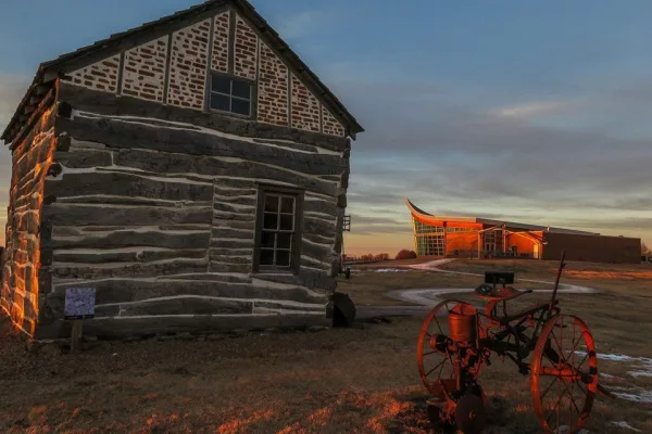
Homestead National Historical Park
National Historical Park
The Homestead Act of 1862 transformed the world. Millions were invited to file claims including families, women, immigrants, and formerly enslaved people. Over 10 percent of the United States was home...
Park data from the National Park Service API. Alerts update every 2 hours.
More Details
What kind of drive is this?
Expect a highway-centric drive for about 71% of this 365.3-mile route. The main artery, Highway 2, forms the backbone of this trip, offering a consistent pace for extended periods. You'll encounter your longest uninterrupted stretch here, covering approximately 150 miles. While the route is predominantly highway, there are brief transitions onto local roads like Southwest 1st Street and sections of I-80, adding a bit of variety. This drive is characterized by its straightforwardness, allowing you to cover significant ground efficiently across the Nebraska landscape.
71% highway — fuel and pacing are the main things to plan.
31 navigation steps total — most of the decisions cluster near the start and finish.
Longest single stretch: 150 mi on Highway 2.
How Hard Is This Drive?
5/10
This is a straightforward highway drive that stays mostly on Highway 2 and Southwest 1st Street. You will hit about 13 points where you need to pay attention to lane position or signs. The trickiest moment comes around 0.2 miles in near N-33; N-103 / West 13th Street.
Driving Effort5/10
Moderate - straightforward overall, but long enough or busy enough to require pacing
Balances navigation complexity with total wheel time.
This drive requires moderate attention. Across 365.3 miles you will encounter 13 spots where lane choice or exit timing matters. Not difficult for experienced highway drivers, but worth previewing the tricky sections before you go.
Where does it get tricky?
The main spots that need attention: at 0.2 miles (N-33; N-103 / West 13th Street): Navigation decision point; at 0.4 miles (N-33; N-103 / West Highway 33): Highway fork - watch signs carefully; at 29.6 miles: Navigation decision point.
Elevation Profile
Gently rolling terrain
3,965 ft1,357 ft
Total Climb
2,613 ft
Total Descent
5 ft
Highest Point
3,965 ft
~365.3 mi in
Elevation Range
2,608 ft
Towns Mentioned on Route Signs
Based on OSRM destination-sign hints, not a full list of every settlement the road passes.
On the drive from Crete, NE to Alliance, NE, road signs begin pointing toward Hastings along the way.
Doable as a same-day drive at 7h 3m. Total distance: 365.3 miles.
Family Friendly
Moderate complexity with 2 natural rest stops along the way.
Solo Traveler
7h 3m drive, plan rest stops for pacing.
First-Time Driver
Mostly highway driving (71%). Some complex stretches to watch for.
Frequently Asked Questions
The longest stretch is about 150 miles on Highway 2. The full list of main roads is in the Roads section above.
Yes — we found about 8 rest areas or service plazas within a short detour of the route (from OpenStreetMap). See the Rest Stops tab under Nearby Places for locations and mile markers. Plan to stretch, use the bathroom, and top off fluids every 2–3 hours on longer drives.
It helps. This is a long drive, so arriving tired and in the dark compounds. If the last hour of the trip is on surface roads or mountain grades, aim to arrive at Alliance, NE before sunset when you can. Check the Trip Plan for departure windows that land you in daylight.
Only with planning. This is a long drive for kids — consider splitting it into two days rather than pushing through. Plan at least 2 meaningful breaks. There are 8 rest areas along the route for bathroom stops.
Mostly yes along the main roads, but rural stretches through NE can have sparse or no coverage. Before you leave, download offline Google Maps or Apple Maps for the route, and consider downloading music or podcasts instead of streaming. If you depend on data for navigation, keep a paper backup of the turn-by-turn directions.
The main spots that need attention: at 0.2 miles (N-33; N-103 / West 13th Street): Navigation decision point; at 0.4 miles (N-33; N-103 / West Highway 33): Highway fork - watch signs carefully; at 29.6 miles: Navigation decision point.
Yes — Homestead National Historical Park. See the National Parks section for detour distances and tips on detours.
Not recommended in a single day. At 7.1 hours each way, a round trip means 14.1 hours of driving — that is an unsafe level of fatigue for most drivers. Plan at least one night at Alliance, NE before the return drive.