Rest Area
0 mi from route
Compiled and reviewed by the US Trip Planner planning team at COD Solutions Oy · Last reviewed Jul 19, 2026 · Editorial standards
Drive Time
6h 16m
Distance
310.7 mi
500 km
Drive Score
9/10
Great drive
Same Day?
Yes, doable
Fuel Cost
$46
one way
EV Charging
Unknown
Estimated drive times based on typical traffic patterns. Actual times may vary with weather, construction, and real-time conditions.

Council Bluffs, IA
Wikimedia Commons

Elkader, IA
Quang Nguyen Vinh
Council Bluffs, IA to Elkader, IA is 310.7 miles and takes about 6h 16m via I 80 and US 20, with a fuel budget near $55 and enough daylight to finish in a day. This trip stays within the Midwest, traversing Iowa for its entirety. Most of the drive is on highways, making it a straightforward connection between these two points. With a recommended one-day drive, you can expect a relatively efficient transit, with the bulk of your travel on major interstates before transitioning to US highways. Consider this route if you need a direct path across the state with minimal complexity.
Trip Pace
Same-day drive is realistic
A same-day return is possible, but it will make for a full day on the road.
Break Rhythm
1 planned break
Plan on a short reset every 3 to 4 hours to stay fresh behind the wheel.
Midpoint
155.4 miles from Council Bluffs, IA
A natural place for your longest stop of the day , about 2h 56m into the drive .
| Road | Distance | Duration |
|---|---|---|
| I 80 | 132.7 mi | 2h 24m |
| US 20 | 57.1 mi | 1h 5m |
| Northeast Hubbell Road | 35.2 mi | 41m |
| Sanford Avenue | 15.9 mi | 21m |
| State Highway 13 | 13.1 mi | 17m |
| Washburn Avenue | 12.5 mi | 17m |
| 240th Street | 6.3 mi | 9m |
| Marsh Avenue | 5.9 mi | 8m |
Hour-of-day weekday pattern from 14 FHWA count stations on your route.
Peak
4 PM
~3,197 veh/hr typical
Quietest
2 AM
~230 veh/hr
Peak-to-quiet ratio
13.9×
busier at peak than in the quiet hours
Averaged across 50 weeks of 2023 FHWA Travel Monitoring Analysis System data. Weekday hours only (Mon–Fri).
Step-by-step road directions between Council Bluffs, IA and Elkader, IA.
Start on West Broadway
Continue on West Broadway
Continue on West Kanesville Boulevard
Take the ramp
Merge onto I 80
Keep slight right at fork onto I 80
Keep slight left at fork onto I 80
Take the exit onto US 65
Turn left onto US 65; IA 330
Continue on US 65; IA 330
Turn left onto IA 330
Continue on IA 330
Continue on IA 330
Turn left onto IA 14
Turn right onto IA 14; IA 175
Turn left onto M Avenue
Continue on County Road T37
Turn sharp right onto 210th Street
Turn left onto IA 14
Take the ramp
Merge onto US 20
Keep slight left at fork onto US 20
Take the exit
Turn left onto IA 187
Continue on IA 187
Enter roundabout onto IA 3
Continue on IA 3
Continue on IA 3
Continue on IA 3
Turn left onto IA 13
Continue on IA 13
Turn left onto IA 56
Continue on IA 56
Arrive at destination
Given the 6h 16m estimated drive time and 310.7 miles, leaving Council Bluffs in the morning is recommended to make the most of daylight. The longest stretch without a potential stop is 132.7 miles on I 80, so ensure you have adequate fuel before embarking on that segment. With a $55 fuel cost estimate, you can budget accordingly. Since this is a one-day trip, you have flexibility, but planning your transition from I 80 to US 20 will be key to a smooth continuation towards Elkader.
Morning Departure
Start early — leave by 6-7 AM to arrive at a reasonable hour.
Evening Departure
This is a long drive — plan for a morning departure or consider splitting it into two days.
This is a comfortable same-day trip.
Departure
Before you leave
Start with fuel, water, and navigation already sorted so the first hour feels easy.
First stop
Around 68 miles or 1h 18m in
Use this first pause for coffee, a restroom break, and a quick traffic check ahead.
Halfway reset
Around 155.4 miles or 2h 56m in
This is the best place for your longest stop, a real meal, and a full fuel check.
Final approach
Final hour starts around 5h 2m
Traffic, exits, and arrival timing usually matter more near Elkader, IA than in the middle of the route.
Open the route before leaving Council Bluffs, IA so your first major turns are already loaded.
Leave with enough water and a charging cable within reach, not packed away.
Check your fuel range against the first long segment, especially if you are starting outside city service areas.
Day 1
Settle into the route from Council Bluffs, IA
This is one driving day of about 310.7 miles and 6h 16m.
Rest stops, refuel points, and overnight suggestions along this route.

Mid-route town
Meal stop
155 mi into the route
Best for: Lunch, fuel, and a longer reset
This sits close to the middle of the route, so it works well for the longest stop of the day.
A short stop after about 68 miles helps settle the day before fatigue starts building.
The midpoint is around 155.4 miles from Council Bluffs, IA, which is a good place for a longer meal and fuel stop.
Before the longest stretch
Fuel checkTop up before I 80 if your tank is already low. That segment runs about 132.7 miles.
These stop ideas are pacing suggestions — the exact town or exit can change with traffic, hotel plans, and fuel range.
Picked by where they fit in your drive — first break, midpoint reset, final stretch.
Place data sourced from public business listings. Hours and availability may vary.
5 decision points cluster between mile 5.2 and 211.2 — GPS handles the exact turns, but know they're coming. Your lane choice matters more than the turn itself.
Take the ramp
Lane positioning matters here
Keep slight right at fork onto I 80 toward I 35, I 80 East: Chicago, Minneapolis, Kansas City
Highway fork - watch signs carefully. Lane positioning matters here. Multiple destination signs - pick the right one
Keep slight left at fork onto I 80
Highway fork - watch signs carefully. Lane positioning matters here
Take the exit onto US 65 toward US 6 West, US 65 North, IA 330 North: Marshalltown, Bondurant
Exit ramp - move to the correct lane early. Lane positioning matters here. Multiple destination signs - pick the right one
Turn sharp right onto 210th Street
Sharp turn - reduce speed on approach
Regular Gas
$45.88 one way
$91.77 round trip
| Fuel Type | $/gal | One Way | Round Trip |
|---|---|---|---|
| midgrade | $4.14 | $50.65 | $101.31 |
| premium | $4.72 | $57.69 | $115.37 |
| diesel | $4.80 | $58.67 | $117.33 |
No toll roads detected on this route.
Estimated Trip Cost (one way, 1 person)
Fuel
$46
Meals
$25–$50
Total
$71–$96
Rough estimate based on US averages. Hotel $80–$140/night, meals $25–$50/day.
Estimated CO2 emission: 108.7 kg one way. Prices: EIA weekly data, 2026-07-13.
Driving Electric?
About $33 in charging · 1 stop · 67% less CO2
| Vehicle Type | kWh | Stops | DC Fast | Home Charge |
|---|---|---|---|---|
| Average EV | 93.2 | 1 | $32.62 | $14.91 |
| Efficient EV | 77.7 | 0 | $27.19 | $12.43 |
| EV Truck/SUV | 124.3 | 1 | $43.50 | $19.88 |
Gas CO2
109 kg
EV CO2
36 kg (67% less)
Plan for 1 charging stop. A 30-minute DC fast charge mid-route should be enough to complete the trip comfortably.
DC fast charging avg $0.35/kWh. Home charging avg $0.16/kWh. US grid CO2: 0.39 kg/kWh.
Current conditions at both ends of the drive.
Origin
Evening in Council Bluffs on Saturday
Local time
8:24 PM
CDT
Current temp
94°F
Slight Chance Showers And Thunderstorms
Heat Advisory
Heat Advisory issued July 17 at 12:32PM CDT until July 18 at 7:00PM CDT by NWS Quad Cities IA IL
Heat Advisory
Heat Advisory issued July 17 at 10:31AM CDT until July 17 at 9:00PM CDT by NWS Sioux Falls SD
Destination
Evening in Elkader on Saturday
Local time
8:24 PM
CDT
Current temp
92°F
Slight Chance Showers And Thunderstorms
Heat Advisory
Heat Advisory issued July 17 at 12:32PM CDT until July 18 at 7:00PM CDT by NWS Quad Cities IA IL
Heat Advisory
Heat Advisory issued July 17 at 10:31AM CDT until July 17 at 9:00PM CDT by NWS Sioux Falls SD
Seasonal Notes
Summer travel usually means heavier construction, hotter rest stops, and busier weekend traffic around major cities.
Winter travel shortens daylight, so a route that looks manageable on paper can feel much longer after dark.
Holiday weekends tend to make both departure and arrival windows slower than the raw route time suggests.
Time zone
Origin and destination are on the same clock, so arrival timing is easier to judge at a glance.
Temperature spread
A meaningful temperature swing is a good cue to rethink layers, water, and how soon you want to arrive.
Road read
Start early — leave by 6-7 AM to arrive at a reasonable hour.
Weather data from the National Weather Service. Conditions may change; check closer to your travel date.
Worth a detour if your schedule allows.
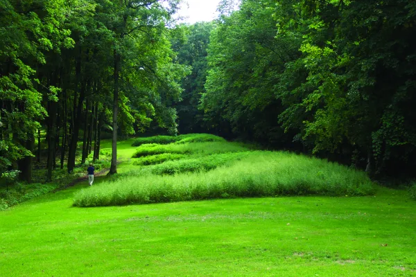
National Monument
The mounds preserved here are considered sacred by many Americans, especially the Monument's 20 culturally associated American Indian tribes. A visit offers opportunities to contemplate the meanings o...
Park data from the National Park Service API. Alerts update every 2 hours.
This drive is mostly highway, with 66% of the 310.7 miles on high-speed roads. You'll experience a long stretch of 132.7 miles on I 80 before transitioning to US 20. This means you'll likely encounter a good number of exits and highway interchanges during the first part of your trip. The latter portion will shift to more rural cruising as you move away from the interstate system.
This is a straightforward highway drive that stays mostly on I 80 and US 20. This route has several spots where lane changes, forks, or exits need your full attention. The trickiest moment comes around 5.2 miles in.
Demanding - plan breaks and stay ahead of the key maneuvers
Balances navigation complexity with total wheel time.
This is a demanding drive. With 19 significant decision points across 310.7 miles, you will need to stay alert - especially through interchange areas and urban stretches. Consider splitting it into segments if you are not comfortable with fast highway navigation.
Where does it get tricky?
The main spots that need attention: at 5.2 miles: Lane positioning matters here; at 119.2 miles (I 80): Highway fork - watch signs carefully. Lane positioning matters here. Multiple destination signs - pick the right one; at 133.6 miles (I 80): Highway fork - watch signs carefully. Lane positioning matters here.
Mostly flat terrain
Total Climb
785 ft
Total Descent
1,042 ft
Highest Point
1,348 ft
~66.6 mi in
Elevation Range
616 ft
Based on OSRM destination-sign hints, not a full list of every settlement the road passes.
Between Council Bluffs, IA and Elkader, IA, road signs point toward Minneapolis, Kansas City and Bondurant.
Minneapolis
Kansas City
Bondurant
Tagged by where each one fits in your drive — first break, midpoint, final stretch.
Cafe
Near the start, right off the route
Council Bluffs, IA
Cafe
Around the midpoint, short detour
Altoona, IA
Cuisine: coffee_shop
Hours: Mo-Fr 04:30-20:00; Sa 05:00-20:30; Su 05...
Visit websiteCafe
Near the start, right off the route
Cuisine: coffee_shop
Cafe
Near the start, short detour
Cuisine: coffee_shop
Cafe
Near the start, short detour
Cuisine: american
Visit websiteCafe
Near the start, short detour
Council Bluffs, IA
Cuisine: coffee_shop
Visit websiteFast_food
Near the end, right off the route
Elkader, IA
Cuisine: sandwich
Hours: 09:30-20:00
Visit websiteFast_food
Near the start, right off the route
Council Bluffs, IA
Cuisine: pizza
Visit websiteFast_food
Around the midpoint, right off the route
Altoona, IA
Cuisine: chicken
Visit websiteFast_food
Around the midpoint, right off the route
Altoona, IA
Cuisine: tex-mex
Hours: 10:30-23:00
Visit websiteRestaurant
Around the midpoint, right off the route
Altoona, IA
Cuisine: grill
Hours: Mo-Su 11:00-21:00
Visit websiteRestaurant
Around the midpoint, right off the route
Altoona
Cuisine: american
Visit websiteCamp_site
Near the end, right off the route
Elkader, IA
Visit websiteAttraction
Near the start, right off the route
IA
Camp_site
Near the end, right off the route
Attraction
Around the midpoint, right off the route
Attraction
Around the midpoint, right off the route
Attraction
Around the midpoint, right off the route
Museum
Near the end, right off the route
IA
Visit websiteMonument
Near the start, right off the route
Artwork
Near the start, right off the route
Museum
Near the start, right off the route
Monument
Near the start, right off the route
Museum
Near the start, short detour
IA
Visit websiteCamp_site
Near the end, right off the route
Elkader, IA
Visit websiteCamp_site
Near the end, right off the route
Hotel
Around the midpoint, right off the route
Altoona
Motel
Around the midpoint, short detour
Des Moines
Hotel
Near the end, short detour
Hotel
Later in the drive, short detour
Waterloo, IA
Visit websitePoints of interest from OpenStreetMap contributors. Listings may not reflect current hours or availability.
Founded 1854
Council Bluffs is a city in Southwest Iowa, just across the Missouri River from Omaha. It is known for its casinos and ties to the transcontinental railroad. It is sometimes called "Iowa's Leading Edge."
Top landmarks
Founded 1846
Top landmarks
City content from Wikivoyage (CC BY-SA 4.0) and Wikidata (CC0).
Weekend Trip
Doable as a same-day drive at 6h 16m. Total distance: 310.7 miles.
Family Friendly
Moderate complexity with 1 natural rest stops along the way.
Solo Traveler
6h 16m drive, plan rest stops for pacing.
Compiled by the US Trip Planner planning team at COD Solutions Oy from open government datasets — OSRM over OpenStreetMap for geometry, EIA for fuel prices, USGS 3DEP for elevation, NPS for national parks, and FHWA TMAS for hourly traffic volumes. See our methodology for refresh cadence and limitations.
Was this helpful?
Thanks for your feedback!
Your tip has been submitted. Thanks!
/500
Recent Tips
·
Explore more options from Council Bluffs, IA or browse trips ending in Elkader, IA.
Looking for more statewide routes? Browse IA road trips.