Spanning 283.1 miles across Iowa, this trip from Elkader to Sioux City takes approximately 4 hours and 34 minutes of driving time. Because this is a turn-heavy local drive rather than a straight interstate sprint, it is best approached as a full-day journey. You should set aside a budget of about $43 for fuel to cover the distance. While the drive is manageable within a single day, the winding nature of the roads means you will spend more time actively behind the wheel than on a typical highway route. Both the starting point and destination are nestled within the Midwest, providing a consistent regional experience throughout your travel.
Trip Pace
Same-day drive is realistic
A same-day return is possible, but it will make for a full day on the road.
Break Rhythm
1 planned break
Plan on a short reset every 3 to 4 hours to stay fresh behind the wheel.
Midpoint
141.7 miles from Elkader, IA
A natural place for your longest stop of the day
, about 2h 52m into the drive
.
Main Roads
Road
Distance
Duration
Avenue of the Saints
160.2 mi
3h 4m
Highway 20
42.9 mi
53m
US 20
33.8 mi
38m
State Highway 13
13.1 mi
17m
Washburn Avenue
12.3 mi
16m
160th Street
6.4 mi
7m
C Avenue
3.1 mi
4m
State Highway 3
2.9 mi
3m
Longest stretch:
Avenue of the Saints
— 160.2 mi, about 3h 4m
Turn-by-Turn Driving Directions
Step-by-step road directions between Elkader, IA and Sioux City, IA.
1
Start on IA 56
0.2 mi·19 sec·South 1st Street
2
Continue on IA 56
0.7 mi·1 min·Strawberry Point Road
3
Turn right onto IA 13
13 mi·17 min·State Highway 13
4
Continue on IA 13
0.8 mi·2 min·Elkader Street
5
Turn right onto IA 3
0.8 mi·1 min·West Mission Street
6
Continue on IA 3
2.9 mi·3 min·State Highway 3
7
Continue on IA 3
2.0 mi·2 min·40th Street
8
Enter roundabout onto IA 187
210 ft·3 sec·C Avenue
9
Continue on IA 187
3.0 mi·4 min·C Avenue
10
Continue on IA 187
12 mi·16 min·Washburn Avenue
11
Take the ramp
0.4 mi·45 sec
12
Merge onto US 20
34 mi·38 min·US 20
13
Keep slight left at fork onto US 20; IA 27
160 mi·3 hr 4 min·Avenue of the Saints
14
Continue on US 20
6.4 mi·7 min·160th Street
15
Continue on US 20
1.9 mi·2 min·United States Highway 20
16
Continue on US 20
43 mi·53 min·Highway 20
Use the straight lane.
17
Turn right onto South Fairmount Street
0.6 mi·1 min·South Fairmount Street
Use the right lane.
18
Continue on 6th Street
0.9 mi·2 min·6th Street
19
Turn right onto Court Street
0.2 mi·39 sec·Court Street
20
Turn left onto 9th Street
0.2 mi·45 sec·9th Street
21
Turn right
115 ft·8 sec
22
Arrive at destination
Trip Plan
Since this is a turn-heavy route, plan to leave early in the morning to ensure you have plenty of daylight for the winding sections. You only have one planned stop on this 4-hour and 34-minute trip, so choose your break location carefully to maximize your comfort. Keep in mind that the $43 fuel estimate is based on local road driving, which can sometimes be less efficient than sustained highway speeds. Because you are avoiding major interstates entirely, use a reliable GPS to stay on track through the various local road transitions. Flexibility is your greatest asset here, so don't hesitate to pull over if you need a quick rest during the longer stretches of the drive.
Morning Departure
An early start around 7-8 AM gets you there with plenty of daylight left.
Evening Departure
A late afternoon start means arriving after dark. Morning is better.
You can normally do this drive in one day.
Plan roughly 1 meaningful break for fuel, food, and rest.
The halfway point lands around 141.7 miles from Elkader, IA, or about 2h 52m into the drive.
The longest continuous stretch on this route runs about 160.2 miles.
This is a comfortable same-day trip.
Departure
Before you leave
Start with fuel, water, and navigation already sorted so the first hour feels easy.
First stop
Around 62 miles or 1h 20m in
Use this first pause for coffee, a restroom break, and a quick traffic check ahead.
Halfway reset
Around 141.7 miles or 2h 52m in
This is the best place for your longest stop, a real meal, and a full fuel check.
Final approach
Final hour starts around 4h 37m
Traffic, exits, and arrival timing usually matter more near Sioux City, IA than in the middle of the route.
Before You Leave
+
Open the route before leaving Elkader, IA so your first major turns are already loaded.
+
Leave with enough water and a charging cable within reach, not packed away.
+
Check your fuel range against the first long segment, especially if you are starting outside city service areas.
Day 1
Settle into the route from Elkader, IA
This is one driving day of about 283.5 miles and 5h 43m.
Your first comfortable stop window is around 62 miles from Elkader, IA.
This route can stay practical as a one-day drive if traffic stays reasonable.
Plan about 1 real break rather than only quick fuel stops.
The longest stretch is on Avenue of the Saints for about 160.2 miles.
Where to Stop
Rest stops, refuel points, and overnight suggestions along this route.
Place data sourced from public business listings. Hours and availability may vary.
Heads-up: tricky spots
5 of 10
5 decision points cluster between mile 14.9 and 283.4 — GPS handles the exact turns, but know they're coming. Your lane choice matters more than the turn itself.
4
14.9 mi into trip|~21m in|IA 3 / West Mission Street
Turn right onto IA 3 / West Mission Street
Navigation decision point
4
20.6 mi into trip|~29m in|IA 187 / C Avenue
Enter roundabout onto IA 187 / C Avenue
Roundabout - know your exit number before entering
6
281.5 mi into trip|~5h 38m in|South Fairmount Street
Turn right onto South Fairmount Street
Lane positioning matters here
Use the right lane.
5
283.2 mi into trip|~5h 42m in|9th Street
Turn left onto 9th Street
Navigation decision point
5
283.4 mi into trip|~5h 43m in
Turn right
Navigation decision point
Fuel & Cost
Regular Gas
$41.87 one way
$83.73 round trip
$3.75/gal25.4 MPG avg99 kg CO2
Fuel Type
$/gal
One Way
Round Trip
midgrade
$4.14
$46.22
$92.44
premium
$4.72
$52.64
$105.27
diesel
$4.80
$53.53
$107.06
No toll roads detected on this route.
Estimated Trip Cost (one way, 1 person)
Fuel
$42
Meals
$25–$50
Total
$67–$92
Rough estimate based on US averages. Hotel $80–$140/night, meals $25–$50/day.
Estimated CO2 emission: 99.2 kg one way.
Prices: EIA weekly data, 2026-07-13.
Driving Electric?
About $30 in charging
· 1 stop
· 67% less CO2
Vehicle Type
kWh
Stops
DC Fast
Home Charge
Average EV
85.1
1
$29.77
$13.61
Efficient EV
70.9
0
$24.81
$11.34
EV Truck/SUV
113.4
1
$39.69
$18.14
Gas CO2
99 kg
EV CO2
33 kg (67% less)
Plan for 1 charging stop. A 30-minute DC fast charge mid-route should be enough to complete the trip comfortably.
DC fast charging avg $0.35/kWh. Home charging avg $0.16/kWh. US grid CO2: 0.39 kg/kWh.
Travel Intel
Current conditions at both ends of the drive.
Forecast as of Jul 18, 2026
Origin
Elkader, IA
Late night
in Elkader on Sunday
Local time
4:40 AM
CDT
Current temp
73°F
Mostly Clear
SW 7 mph1% chanceLive forecast
Heat Advisory
Heat Advisory issued July 17 at 8:35PM CDT until July 18 at 7:00PM CDT by NWS Quad Cities IA IL
Heat Advisory
Heat Advisory issued July 17 at 10:31AM CDT until July 17 at 9:00PM CDT by NWS Sioux Falls SD
Destination
Sioux City, IA
Late night
in Sioux City on Sunday
Local time
4:40 AM
CDT
Current temp
72°F
Clear
S 0 to 5 mph1% chanceLive forecast
Heat Advisory
Heat Advisory issued July 17 at 8:35PM CDT until July 18 at 7:00PM CDT by NWS Quad Cities IA IL
Heat Advisory
Heat Advisory issued July 17 at 10:31AM CDT until July 17 at 9:00PM CDT by NWS Sioux Falls SD
62°F
Hampton, IA
142 mi in
Seasonal Notes
Summer travel usually means heavier construction, hotter rest stops, and busier weekend traffic around major cities.
Winter travel shortens daylight, so a route that looks manageable on paper can feel much longer after dark.
Holiday weekends tend to make both departure and arrival windows slower than the raw route time suggests.
Time zone
Same local time
Origin and destination are on the same clock, so arrival timing is easier to judge at a glance.
Temperature spread
1 degrees cooler at arrival
A meaningful temperature swing is a good cue to rethink layers, water, and how soon you want to arrive.
Road read
5h 43m on the road
An early start around 7-8 AM gets you there with plenty of daylight left.
Weather data from the National Weather Service. Conditions may change; check closer to your travel date.
National Parks Near This Route
Worth a detour if your schedule allows.
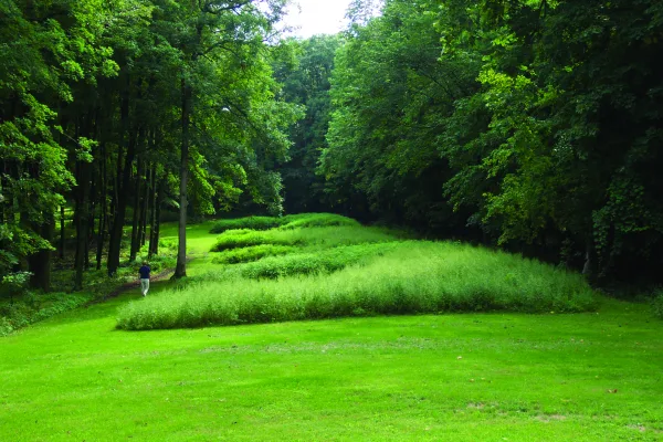
Effigy Mounds National Monument
National Monument
The mounds preserved here are considered sacred by many Americans, especially the Monument's 20 culturally associated American Indian tribes. A visit offers opportunities to contemplate the meanings o...
Park data from the National Park Service API. Alerts update every 2 hours.
More Details
What kind of drive is this?
Expect a very different experience than the standard interstate grind, as this route features zero percent highway travel. You will navigate a series of local roads, including Strawberry Point Road, Highway 13, and Elkader Street, which give the trip a technical, turn-heavy character. Because the path relies entirely on local infrastructure, the drive requires constant attention rather than the passive cruising found on major interstates. The route demands patience as you navigate the turns that define this 283.1-mile journey. Prepare for a hands-on driving experience that prioritizes local navigation over high-speed connectivity.
33% highway, the rest on surface roads — varied driving throughout.
22 navigation steps total — most of the decisions cluster near the start and finish.
Longest single stretch: 160.2 mi on Avenue of the Saints.
How Hard Is This Drive?
3/10
This route mixes highway mileage with some local-road sections near the start or finish. There are only a few real navigation decisions along the way. The trickiest moment comes around 14.9 miles in near IA 3 / West Mission Street.
Driving Effort3/10
Easy - simple navigation with a manageable amount of wheel time
Balances navigation complexity with total wheel time.
This is a straightforward 5h 43m drive. You will face about 10 decision points, but nothing that requires special attention if you follow navigation.
Where does it get tricky?
The main spots that need attention: at 14.9 miles (IA 3 / West Mission Street): Navigation decision point; at 20.6 miles (IA 187 / C Avenue): Roundabout - know your exit number before entering; at 281.5 miles (South Fairmount Street): Lane positioning matters here.
Sioux City is on the western edge of the state of Iowa. It is on the Missouri River and many parts of Sioux City are among the unique Loess Hills formations.
Top landmarks
•Sergeant Floyd — museum boat in Sioux City, Iowa, United States
•Woodbury County Courthouse — county courthouse in Sioux City, United States of America
•St. Boniface Catholic Church — church building in Sioux City, United States of America
Mixed highway & surface route profile with national parks nearby.
Frequently Asked Questions
The longest stretch is about 160.2 miles on Avenue of the Saints. The full list of main roads is in the Roads section above.
Yes — we found about 10 rest areas or service plazas within a short detour of the route (from OpenStreetMap). See the Rest Stops tab under Nearby Places for locations and mile markers. Plan to stretch, use the bathroom, and top off fluids every 2–3 hours on longer drives.
Only with planning. This is a long drive for kids — consider splitting it into two days rather than pushing through. Plan at least 1 meaningful breaks. There are 10 rest areas along the route for bathroom stops.
The main spots that need attention: at 14.9 miles (IA 3 / West Mission Street): Navigation decision point; at 20.6 miles (IA 187 / C Avenue): Roundabout - know your exit number before entering; at 281.5 miles (South Fairmount Street): Lane positioning matters here.
Yes — Effigy Mounds National Monument. See the National Parks section for detour distances and tips on detours.
Not recommended in a single day. At 5.7 hours each way, a round trip means 11.5 hours of driving — that is an unsafe level of fatigue for most drivers. Plan at least one night at Sioux City, IA before the return drive.