Rest Area
0.1 mi from route
Compiled and reviewed by the US Trip Planner planning team at COD Solutions Oy · Last reviewed Jul 19, 2026 · Editorial standards
Drive Time
5h 32m
Distance
236.4 mi
380 km
Drive Score
8/10
Great drive
Same Day?
Yes, doable
Fuel Cost
$36
one way
EV Charging
Unknown
Estimated drive times based on typical traffic patterns. Actual times may vary with weather, construction, and real-time conditions.

Colorado Springs, CO
Wikimedia Commons

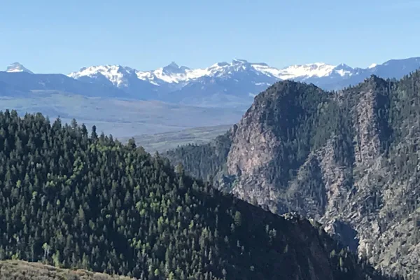
Montrose, CO
Wikimedia Commons
Colorado Springs to Montrose is 236.4 miles and takes about 5h 32m via US 50, US 24, and US 285, with a fuel budget near $36 and enough daylight to finish in a day. This trip stays within Colorado, connecting two points in the Mountain West region. It's a straightforward, mostly highway drive, making it a good option for a single-day transit. The route is efficient for covering ground, so plan to use it when you want to get from point A to point B without extensive detours. Expect a direct path that prioritizes reaching your destination.
Trip Pace
Same-day drive is realistic
A same-day return is possible, but it will make for a full day on the road.
Break Rhythm
1 planned break
Plan on a short reset every 3 to 4 hours to stay fresh behind the wheel.
Midpoint
118.2 miles from Colorado Springs, CO
A natural place for your longest stop of the day , about 2h 41m into the drive .
| Road | Distance | Duration |
|---|---|---|
| US 50 | 123.2 mi | 2h 57m |
| US 24 | 71.7 mi | 1h 27m |
| US 285 | 21 mi | 33m |
| Midland Expressway | 15.7 mi | 23m |
| West Cimarron Street | 2.4 mi | 3m |
| West Colorado Avenue | 0.9 mi | 2m |
| South 2nd Street | 0.7 mi | 2m |
| South Limit Street | 0.2 mi | <1m |
Step-by-step road directions between Colorado Springs, CO and Montrose, CO.
Start on East Pikes Peak Avenue
Turn left onto South Nevada Avenue
Turn right onto East Colorado Avenue
Continue on West Colorado Avenue
Turn sharp left onto South Limit Street
Turn right onto US 24
Continue on US 24
Keep slight right at fork onto US 24; CO 67
Continue on US 24; CO 9
At end of road, turn left onto US 24; US 285
At end of road, turn left onto US 285
Continue on US 285
Turn sharp right onto US 50
Turn left onto South San Juan Avenue
Turn right onto South 2nd Street
Turn right onto US 550
Turn right onto South 1st Street
Arrive at destination
Given the 5h 32m duration, leaving Colorado Springs in the morning is ideal to maximize daylight for arrival in Montrose. With a single day recommended and 98% highway driving, you won't need to split the drive, offering flexibility in your departure time. The $36 fuel estimate is helpful for budgeting. Pay attention to signs directing you onto US 50, as this highway constitutes the longest continuous section of your trip at 123.2 miles. Plan for a single fuel stop if needed, as the route is efficient and doesn't necessitate frequent refueling.
Morning Departure
An early start around 7-8 AM gets you there with plenty of daylight left.
Evening Departure
A late afternoon start means arriving after dark. Morning is better.
This is a comfortable same-day trip.
Departure
Before you leave
Start with fuel, water, and navigation already sorted so the first hour feels easy.
First stop
Around 52 miles or 1h 10m in
Use this first pause for coffee, a restroom break, and a quick traffic check ahead.
Halfway reset
Around 118.2 miles or 2h 41m in
This is the best place for your longest stop, a real meal, and a full fuel check.
Final approach
Final hour starts around 4h 29m
Traffic, exits, and arrival timing usually matter more near Montrose, CO than in the middle of the route.
Open the route before leaving Colorado Springs, CO so your first major turns are already loaded.
Leave with enough water and a charging cable within reach, not packed away.
Check your fuel range against the first long segment, especially if you are starting outside city service areas.
Day 1
Settle into the route from Colorado Springs, CO
This is one driving day of about 236.4 miles and 5h 32m.
Rest stops, refuel points, and overnight suggestions along this route.

Mid-route town
Meal stop
118 mi into the route
Best for: Lunch, fuel, and a longer reset
This sits close to the middle of the route, so it works well for the longest stop of the day.
A short stop after about 52 miles helps settle the day before fatigue starts building.
The midpoint is around 118.2 miles from Colorado Springs, CO, which is a good place for a longer meal and fuel stop.
Before the longest stretch
Fuel checkTop up before US 50 if your tank is already low. That segment runs about 123.2 miles.
These stop ideas are pacing suggestions — the exact town or exit can change with traffic, hotel plans, and fuel range.
Picked by where they fit in your drive — first break, midpoint reset, final stretch.
Near the end, right off the route
Montrose, Colorado
Hours: 10 am–5 pm
+19709649995
Visit websiteNear the start, short detour
Woodland Park, Colorado
Hours: 9 am–6 pm
+17196861820
Visit websiteNear the start, ~12 min detour
Colorado Springs, Colorado
Hours: 9 am–5 pm
+17196339925
Visit websitePlace data sourced from public business listings. Hours and availability may vary.
5 decision points cluster between mile 0.1 and 235.4 — GPS handles the exact turns, but know they're coming. Your lane choice matters more than the turn itself.
Turn right onto East Colorado Avenue
Navigation decision point
Turn sharp left onto South Limit Street
Sharp turn - reduce speed on approach
At end of road, turn left onto US 24; US 285
Navigation decision point
At end of road, turn left onto US 285
Navigation decision point
Turn left onto South San Juan Avenue
Lane positioning matters here
Regular Gas
$36.05 one way
$72.09 round trip
| Fuel Type | $/gal | One Way | Round Trip |
|---|---|---|---|
| midgrade | $4.12 | $38.32 | $76.63 |
| premium | $4.45 | $41.44 | $82.89 |
| diesel | $4.80 | $44.64 | $89.27 |
No toll roads detected on this route.
Estimated Trip Cost (one way, 1 person)
Fuel
$36
Meals
$25–$50
Total
$61–$86
Rough estimate based on US averages. Hotel $80–$140/night, meals $25–$50/day.
Estimated CO2 emission: 82.7 kg one way. Prices: EIA weekly data, 2026-07-13.
Driving Electric?
About $25 in charging · 0 stops · 66% less CO2
| Vehicle Type | kWh | Stops | DC Fast | Home Charge |
|---|---|---|---|---|
| Average EV | 70.9 | 0 | $24.82 | $11.35 |
| Efficient EV | 59.1 | 0 | $20.69 | $9.46 |
| EV Truck/SUV | 94.6 | 1 | $33.10 | $15.13 |
Gas CO2
83 kg
EV CO2
28 kg (66% less)
Plan for 0 charging stops, roughly every 270 miles. Allow 25-40 minutes per stop at a DC fast charger.
DC fast charging avg $0.35/kWh. Home charging avg $0.16/kWh. US grid CO2: 0.39 kg/kWh.
Current conditions at both ends of the drive.
Origin
Late night in Colorado Springs on Sunday
Local time
1:07 AM
MDT
Current temp
90°F
Mostly Sunny
Heat Advisory
Heat Advisory issued July 18 at 4:46AM MDT until July 20 at 9:00PM MDT by NWS Denver CO
Destination
Late night in Montrose on Sunday
Local time
1:07 AM
MDT
Current temp
88°F
Mostly Sunny then Chance Showers And Thunderstorms
Heat Advisory
Heat Advisory issued July 18 at 4:46AM MDT until July 20 at 9:00PM MDT by NWS Denver CO
Seasonal Notes
Summer travel usually means heavier construction, hotter rest stops, and busier weekend traffic around major cities.
Winter travel shortens daylight, so a route that looks manageable on paper can feel much longer after dark.
Holiday weekends tend to make both departure and arrival windows slower than the raw route time suggests.
Time zone
Origin and destination are on the same clock, so arrival timing is easier to judge at a glance.
Temperature spread
A meaningful temperature swing is a good cue to rethink layers, water, and how soon you want to arrive.
Road read
An early start around 7-8 AM gets you there with plenty of daylight left.
Weather data from the National Weather Service. Conditions may change; check closer to your travel date.
Worth a detour if your schedule allows.
National Recreation Area
Three reservoirs and surrounding lands make up this recreation area in western Colorado. It is a landscape of tradeoffs; natural and human made features exist together. Geologic wonders are abundant f...

National Monument
Beneath a grassy mountain valley in central Colorado lies one of the richest and most diverse fossil deposits in the world. Petrified redwood stumps up to 14 feet wide and thousands of detailed fossil...

National Park
Big enough to be overwhelming, yet still intimate enough to feel the pulse of time. Come see some of the steepest cliffs, oldest rock, and craggiest spires in North America. Forces of nature and the G...
Park data from the National Park Service API. Alerts update every 2 hours.
This drive is 98% highway, meaning you'll spend most of your time on high-speed roads. The longest stretch without a significant change in road type is 123.2 miles along US 50. Given the highway-heavy profile, anticipate relatively consistent speeds and fewer opportunities for quick stops compared to routes with more surface streets. You'll notice the efficiency of covering long distances on these primary routes. The road virtually ends its highway designation only in the immediate vicinity of your start and end points.
This is a straightforward highway drive that stays mostly on US 50 and US 24. There are only a few real navigation decisions along the way. The trickiest moment comes around 0.1 miles in near East Colorado Avenue.
Easy - simple navigation with a manageable amount of wheel time
Balances navigation complexity with total wheel time.
This is a straightforward 5h 32m drive. You will face about 11 decision points, but nothing that requires special attention if you follow navigation.
Where does it get tricky?
The main spots that need attention: at 0.1 miles (East Colorado Avenue): Navigation decision point; at 1.2 miles (South Limit Street): Sharp turn - reduce speed on approach; at 77.5 miles (US 24; US 285): Navigation decision point.
Mountain driving with significant elevation changes
Total Climb
5,878 ft
Total Descent
6,077 ft
Highest Point
9,701 ft
~135.1 mi in
Elevation Range
3,892 ft
Notable High Points
Founded 1871
Colorado Springs is a city of about 490,000 in the western U.S. state of Colorado. The seat of El Paso County, the city lies 63 miles (101 km) south of Denver at the foot of Pikes Peak in South Central Colorado.
Top landmarks
Founded 1882
Montrose is a town in the Uncompahgre Valley in Southwestern Colorado. It is a gateway to both Black Canyon of the Gunnison National Park to its east and Telluride and other ski areas in the San Juan Mountains to the south. It is also home to the West Elks American Viticultural Area (AVA), part of Colorado's Wine Country and the highest wine vineyards in North America.
Top landmarks
City content from Wikivoyage (CC BY-SA 4.0) and Wikidata (CC0).
Weekend Trip
Doable as a same-day drive at 5h 32m. Total distance: 236.4 miles.
Family Friendly
Moderate complexity with 1 natural rest stops along the way.
Solo Traveler
5h 32m drive, comfortable solo distance.
First-Time Driver
Mostly highway driving (98%). Straightforward navigation.
Compiled by the US Trip Planner planning team at COD Solutions Oy from open government datasets — OSRM over OpenStreetMap for geometry, EIA for fuel prices, USGS 3DEP for elevation, and NPS for national parks. See our methodology for refresh cadence and limitations.
Was this helpful?
Thanks for your feedback!
Your tip has been submitted. Thanks!
/500
Recent Tips
·
Explore more options from Colorado Springs, CO or browse trips ending in Montrose, CO.
Looking for more statewide routes? Browse CO road trips.