If you are planning to travel from Colorado Springs to Rangely, prepare for a significant trek across the Mountain West that covers 342.7 miles. The journey typically takes about 7 hours and 14 minutes, making it a demanding drive for a single day. You will start by navigating local streets like North Cascade Avenue and West Bijou Street before transitioning onto I-25. Budgeting around $52 for fuel is a smart move for this specific distance. Because the road is quite turn-heavy and requires focused attention, you should decide if you are comfortable with a long stint behind the wheel or if you would prefer to break the journey up. It is a straightforward trip across the state, but the duration demands careful planning to ensure you arrive safely.
Trip Pace
Same-day drive is realistic
A same-day return is possible, but it will make for a full day on the road.
Break Rhythm
2 planned breaks
Plan on a short reset every 3 to 4 hours to stay fresh behind the wheel.
Midpoint
171.4 miles from Colorado Springs, CO
A natural place for your longest stop of the day
, about 3h 13m into the drive
.
Main Roads
Road
Distance
Duration
I 70
170.8 mi
3h 12m
Ronald Reagan Highway
60.9 mi
1h 5m
CO 64
55 mi
1h 28m
Government Road
37.1 mi
59m
West 6th Avenue Freeway
7.6 mi
9m
Monument Valley Freeway
5.7 mi
6m
Whiteriver Avenue
1.5 mi
3m
Dinosaur Diamond Prehistoric Highway
0.9 mi
1m
Longest stretch:
I 70
— 170.8 mi, about 3h 12m
Traffic on I-70
Hour-of-day weekday pattern from 16 FHWA count stations on your route.
Peak
4 PM
~1,405 veh/hr typical
· worst 1,990
Quietest
2 AM
~79 veh/hr
Peak-to-quiet ratio
17.8×
busier at peak than in the quiet hours
12a6anoon6p11p
Averaged across 52 weeks of 2023 FHWA Travel Monitoring Analysis System data. Weekday hours only (Mon–Fri).
Turn-by-Turn Driving Directions
Step-by-step road directions between Colorado Springs, CO and Rangely, CO.
1
Start on East Pikes Peak Avenue
0.2 mi·47 sec·East Pikes Peak Avenue
2
Turn right onto North Cascade Avenue
0.2 mi·42 sec·North Cascade Avenue
3
Turn left onto West Bijou Street
0.2 mi·26 sec·West Bijou Street
Use the left lane.
4
Take the ramp
0.4 mi·51 sec
Toward I 25
5
Merge onto I 25
5.7 mi·6 min·Monument Valley Freeway
Use the straight / slight right lanes.
6
Continue on I 25
61 mi·1 hr 5 min·Ronald Reagan Highway
Use the straight / slight right lanes.
7
Take the exit
0.2 mi·23 sec
Exit 209A-BToward US 6 West: 6th AvenueUse the slight right lane.
8
Keep slight right at fork
0.4 mi·53 sec
Exit 209BToward US 6 West: 6th Avenue, LakewoodUse the straight / slight right lanes.
9
Continue on US 6
0.9 mi·1 min·Dinosaur Diamond Prehistoric Highway
10
Keep slight left at fork onto US 6
0.1 mi·10 sec·US 6
Toward US 6
11
Merge onto US 6
7.6 mi·9 min·West 6th Avenue Freeway
Use the straight / slight right lanes.
12
Take the exit
0.7 mi·55 sec
Toward I 70 West: Grand JunctionUse the slight right lane.
13
Merge onto I 70
171 mi·3 hr 12 min·I 70
Use the straight / slight right lanes.
14
Take the exit
0.2 mi·27 sec
Toward CO 13 North: Rifle, Meeker
15
Turn right onto CO 13
0.3 mi·35 sec·CO 13
16
Turn slight right onto Whiteriver Avenue
1.5 mi·3 min·Whiteriver Avenue
17
Turn right onto CO 13
0.3 mi·26 sec·Railroad Avenue
18
Continue on CO 13
37 mi·59 min·Government Road
Use the straight / right lanes.
19
Turn left onto CO 64
55 mi·1 hr 28 min·CO 64
Use the left lane.
20
Arrive at destination
CO 64
Trip Plan
To manage the 7-hour and 14-minute duration effectively, aim to get an early start to avoid fatigue as you navigate the turn-heavy sections. Plan for at least two stops along the way to stretch your legs and refresh your focus, especially since the route demands consistent driver engagement. Keep a close eye on your fuel gauge, as the $52 estimate can fluctuate depending on your vehicle's efficiency and the terrain. Since the route consists entirely of local roads without highway stretches, prioritize patience and avoid rushing through the technical segments. A helpful tip for this trip is to map out your two designated stops in advance to ensure you have consistent access to services throughout the drive.
Morning Departure
Start early — leave by 6-7 AM to arrive at a reasonable hour.
Evening Departure
This is a long drive — plan for a morning departure or consider splitting it into two days.
You can normally do this drive in one day.
Plan roughly 2 meaningful breaks for fuel, food, and rest.
The halfway point lands around 171.4 miles from Colorado Springs, CO, or about 3h 13m into the drive.
The longest continuous stretch on this route runs about 170.8 miles.
This is a comfortable same-day trip.
Departure
Before you leave
Start with fuel, water, and navigation already sorted so the first hour feels easy.
First stop
Around 75 miles or 1h 24m in
Use this first pause for coffee, a restroom break, and a quick traffic check ahead.
Halfway reset
Around 171.4 miles or 3h 13m in
This is the best place for your longest stop, a real meal, and a full fuel check.
Final approach
Final hour starts around 5h 37m
Traffic, exits, and arrival timing usually matter more near Rangely, CO than in the middle of the route.
Before You Leave
+
Open the route before leaving Colorado Springs, CO so your first major turns are already loaded.
+
Leave with enough water and a charging cable within reach, not packed away.
+
Check your fuel range against the first long segment, especially if you are starting outside city service areas.
+
Pick one backup stop option before the midpoint in case traffic changes your pacing.
Day 1
Settle into the route from Colorado Springs, CO
This is one driving day of about 342.7 miles and 7h 14m.
Your first comfortable stop window is around 75 miles from Colorado Springs, CO.
This route can stay practical as a one-day drive if traffic stays reasonable.
Plan about 2 real breaks rather than only quick fuel stops.
The longest stretch is on I 70 for about 170.8 miles.
Where to Stop
Rest stops, refuel points, and overnight suggestions along this route.
Place data sourced from public business listings. Hours and availability may vary.
Heads-up: tricky spots
5 of 14
5 decision points cluster between mile 0.2 and 76.8 — GPS handles the exact turns, but know they're coming. Your lane choice matters more than the turn itself.
5
0.2 mi into trip|~0m in|North Cascade Avenue
Turn right onto North Cascade Avenue
Navigation decision point
6
0.4 mi into trip|~1m in|West Bijou Street
Turn left onto West Bijou Street
Lane positioning matters here
Use the left lane.
7
67.6 mi into trip|~1h 14m in
Take the exit toward US 6 West: 6th Avenue
Exit ramp - move to the correct lane early. Lane positioning matters here
Use the slight right lane.
Exit 209A-B
Toward US 6 West: 6th Avenue
9
67.8 mi into trip|~1h 15m in
Keep slight right at fork toward US 6 West: 6th Avenue, Lakewood
Highway fork - watch signs carefully. Lane positioning matters here. Multiple destination signs - pick the right one
Use the straight / slight right lanes.
Exit 209B
Toward US 6 West: 6th Avenue, Lakewood
6
76.8 mi into trip|~1h 27m in
Take the exit toward I 70 West: Grand Junction
Exit ramp - move to the correct lane early. Lane positioning matters here
Use the slight right lane.
Toward I 70 West: Grand Junction
Fuel & Cost
Regular Gas
$52.26 one way
$104.51 round trip
$3.87/gal25.4 MPG avg120 kg CO2
Fuel Type
$/gal
One Way
Round Trip
midgrade
$4.12
$55.55
$111.09
premium
$4.45
$60.08
$120.16
diesel
$4.80
$64.71
$129.42
No toll roads detected on this route.
Estimated Trip Cost (one way, 1 person)
Fuel
$52
Meals
$25–$50
Total
$77–$102
Rough estimate based on US averages. Hotel $80–$140/night, meals $25–$50/day.
Estimated CO2 emission: 119.9 kg one way.
Prices: EIA weekly data, 2026-07-13.
Driving Electric?
About $36 in charging
· 1 stop
· 67% less CO2
Vehicle Type
kWh
Stops
DC Fast
Home Charge
Average EV
102.8
1
$35.98
$16.45
Efficient EV
85.7
0
$29.99
$13.71
EV Truck/SUV
137.1
1
$47.98
$21.93
Gas CO2
120 kg
EV CO2
40 kg (67% less)
Plan for 1 charging stop. A 30-minute DC fast charge mid-route should be enough to complete the trip comfortably.
DC fast charging avg $0.35/kWh. Home charging avg $0.16/kWh. US grid CO2: 0.39 kg/kWh.
Travel Intel
Current conditions at both ends of the drive.
Forecast as of Jul 17, 2026
Origin
Colorado Springs, CO
Evening
in Colorado Springs on Saturday
Local time
7:32 PM
MDT
Current temp
89°F
Mostly Sunny then Slight Chance Showers And Thunderstorms
E 0 to 10 mph10% chanceLive forecast
Destination
Rangely, CO
Evening
in Rangely on Saturday
Local time
7:32 PM
MDT
Current temp
96°F
Mostly Sunny then Slight Chance Showers And Thunderstorms
SSW 0 to 5 mph20% chanceLive forecast
Seasonal Notes
Summer travel usually means heavier construction, hotter rest stops, and busier weekend traffic around major cities.
Winter travel shortens daylight, so a route that looks manageable on paper can feel much longer after dark.
Holiday weekends tend to make both departure and arrival windows slower than the raw route time suggests.
Time zone
Same local time
Origin and destination are on the same clock, so arrival timing is easier to judge at a glance.
Temperature spread
7 degrees warmer at arrival
A meaningful temperature swing is a good cue to rethink layers, water, and how soon you want to arrive.
Road read
7h 14m on the road
Start early — leave by 6-7 AM to arrive at a reasonable hour.
Weather data from the National Weather Service. Conditions may change; check closer to your travel date.
National Parks Near This Route
Worth a detour if your schedule allows.
Florissant Fossil Beds National Monument
National Monument
Beneath a grassy mountain valley in central Colorado lies one of the richest and most diverse fossil deposits in the world. Petrified redwood stumps up to 14 feet wide and thousands of detailed fossil...
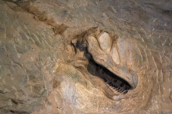
150 million years ago, dinosaurs roamed here. Their fossils are still embedded in the rocks. Today, mountains, desert, and rivers flowing in canyons support a variety of life. Petroglyphs reveal the l...
28 mi from route
~71 min detour
$25
near mile 330.9
Park data from the National Park Service API. Alerts update every 2 hours.
More Details
What kind of drive is this?
Expect a dynamic experience behind the wheel, as this route is categorized as a turn-heavy local drive rather than a monotonous interstate cruise. While you begin on major arteries like I-25, the journey quickly transitions into a more technical path. With a highway share of 0%, you should be ready for constant steering adjustments and varied road conditions rather than long, straight stretches of pavement. The character of the drive shifts as you move away from the urban start, requiring you to stay alert through every curve. This is not a route designed for cruise control, so settle in for a hands-on driving experience that tests your focus over the course of the 342.7-mile trek.
70% highway — fuel and pacing are the main things to plan.
20 navigation steps total — most of the decisions cluster near the start and finish.
Longest single stretch: 170.8 mi on I 70.
How Hard Is This Drive?
8/10
This is a straightforward highway drive that stays mostly on I 70 and Ronald Reagan Highway. This route has several spots where lane changes, forks, or exits need your full attention. The trickiest moment comes around 0.2 miles in near North Cascade Avenue.
Driving Effort8/10
Demanding - plan breaks and stay ahead of the key maneuvers
Balances navigation complexity with total wheel time.
This is a demanding drive. With 14 significant decision points across 342.7 miles, you will need to stay alert - especially through interchange areas and urban stretches. Consider splitting it into segments if you are not comfortable with fast highway navigation.
Where does it get tricky?
The main spots that need attention: at 0.2 miles (North Cascade Avenue): Navigation decision point; at 0.4 miles (West Bijou Street): Lane positioning matters here; at 67.6 miles: Exit ramp - move to the correct lane early. Lane positioning matters here.
Elevation Profile
Mountain driving with significant elevation changes
10,935 ft5,231 ft
Total Climb
8,405 ft
Total Descent
9,182 ft
Highest Point
10,935 ft
~122.4 mi in
Elevation Range
5,703 ft
Notable High Points
7,114 ft at ~24.5 miles+905 ft prominence
10,935 ft at ~122.4 miles+549 ft prominence
7,317 ft at ~269.3 miles+1,267 ft prominence
Towns Mentioned on Route Signs
Based on OSRM destination-sign hints, not a full list of every settlement the road passes.
Between Colorado Springs, CO and Rangely, CO, road signs point toward Lakewood and Meeker.
Colorado Springs is a city of about 490,000 in the western U.S. state of Colorado. The seat of El Paso County, the city lies 63 miles (101 km) south of Denver at the foot of Pikes Peak in South Central Colorado.
Top landmarks
•United States Air Force Academy Cadet Chapel — chapel in Colorado, USA
•Will Rogers Shrine of the Sun — commemorative tower and chapel in Colorado Springs, Colorado
•St. Mary's Cathedral — cathedral in Colorado Springs, United States of America
Doable as a same-day drive at 7h 14m. Total distance: 342.7 miles.
Family Friendly
Moderate complexity with 2 natural rest stops along the way.
Solo Traveler
7h 14m drive, plan rest stops for pacing.
Frequently Asked Questions
The longest stretch is about 170.8 miles on I 70. The full list of main roads is in the Roads section above.
Yes — we found about 9 rest areas or service plazas within a short detour of the route (from OpenStreetMap). See the Rest Stops tab under Nearby Places for locations and mile markers. Plan to stretch, use the bathroom, and top off fluids every 2–3 hours on longer drives.
It helps. This route has a higher-than-average number of complex decision points, which get harder in the dark. If the last hour of the trip is on surface roads or mountain grades, aim to arrive at Rangely, CO before sunset when you can. Check the Trip Plan for departure windows that land you in daylight.
Only with planning. This is a long drive for kids — consider splitting it into two days rather than pushing through. Plan at least 2 meaningful breaks. There are 9 rest areas along the route for bathroom stops.
The main spots that need attention: at 0.2 miles (North Cascade Avenue): Navigation decision point; at 0.4 miles (West Bijou Street): Lane positioning matters here; at 67.6 miles: Exit ramp - move to the correct lane early. Lane positioning matters here.
Yes — Florissant Fossil Beds National Monument and Dinosaur National Monument. See the National Parks section for detour distances and tips on detours.
Not recommended in a single day. At 7.2 hours each way, a round trip means 14.5 hours of driving — that is an unsafe level of fatigue for most drivers. Plan at least one night at Rangely, CO before the return drive.