Colorado Springs to Estes Park is 133.3 miles and takes about 2h 51m via Ronald Reagan Highway and Denver–Boulder Turnpike, with a fuel budget near $21 and enough daylight to finish in a day. This trip stays within Colorado, taking you from the Mountain West region to another part of the Mountain West. You'll encounter mostly surface roads, making it a good choice if you prefer to avoid extensive highway time. With a single recommended stop and a duration under three hours, this is a very manageable one-day drive.
Trip Pace
Same-day drive is realistic
A same-day return is realistic if you keep stops short.
Break Rhythm
1 planned break
A short stop every 2 to 3 hours is enough for this drive.
Midpoint
66.7 miles from Colorado Springs, CO
A natural place for your longest stop of the day
, about 1h 15m into the drive
.
Main Roads
Road
Distance
Duration
Ronald Reagan Highway
68.6 mi
1h 16m
Denver–Boulder Turnpike
19.8 mi
23m
28th Street
15.5 mi
22m
East Highway 36
12 mi
19m
North Saint Vrain Avenue
7.6 mi
13m
Monument Valley Freeway
5.7 mi
6m
Ute Highway
1 mi
1m
West Main Street
0.7 mi
1m
Longest stretch:
Ronald Reagan Highway
— 68.6 mi, about 1h 16m
Traffic on I-25
Hour-of-day weekday pattern from 16 FHWA count stations on your route.
Peak
4 PM
~5,006 veh/hr typical
Quietest
2 AM
~373 veh/hr
Peak-to-quiet ratio
13.4×
busier at peak than in the quiet hours
12a6anoon6p11p
Averaged across 52 weeks of 2023 FHWA Travel Monitoring Analysis System data. Weekday hours only (Mon–Fri).
Turn-by-Turn Driving Directions
Step-by-step road directions between Colorado Springs, CO and Estes Park, CO.
1
Start on East Pikes Peak Avenue
0.2 mi·47 sec·East Pikes Peak Avenue
2
Turn right onto North Cascade Avenue
0.2 mi·42 sec·North Cascade Avenue
3
Turn left onto West Bijou Street
0.2 mi·26 sec·West Bijou Street
Use the left lane.
4
Take the ramp
0.4 mi·51 sec
Toward I 25
5
Merge onto I 25
5.7 mi·6 min·Monument Valley Freeway
Use the straight / slight right lanes.
6
Continue on I 25
69 mi·1 hr 16 min·Ronald Reagan Highway
Use the straight / slight right lanes.
7
Take the exit
0.6 mi·51 sec
Exit 217AToward US 36 West: Westminster, BoulderUse the slight left lane.
8
Merge onto US 36
2.1 mi·2 min·Denver–Boulder Turnpike
9
Keep slight right at fork onto US 36
1.7 mi·1 min·Denver–Boulder Turnpike
10
Keep slight right at fork onto US 36
2.3 mi·2 min·Denver–Boulder Turnpike
11
Keep slight right at fork onto US 36
1.9 mi·2 min·Denver–Boulder Turnpike
Use the straight / slight right lanes.
12
Keep slight right at fork onto US 36
2.1 mi·2 min·Denver–Boulder Turnpike
Use the straight / slight right lanes.
13
Keep slight right at fork onto US 36
2.9 mi·3 min·Denver–Boulder Turnpike
Use the straight / slight right lanes.
14
Keep slight right at fork onto US 36
2.4 mi·2 min·Denver–Boulder Turnpike
Use the straight / slight right lanes.
15
Keep slight right at fork onto US 36
2.2 mi·2 min·Denver–Boulder Turnpike
16
Keep slight left at fork onto US 36
2.3 mi·2 min·Denver–Boulder Turnpike
Use the straight lane.
17
Continue on US 36
16 mi·22 min·28th Street
Use the left / straight lanes.
18
Turn left onto US 36
1.0 mi·1 min·Ute Highway
Use the left / straight lanes.
19
Continue on US 36
0.5 mi·1 min·Main Street
Use the straight lane.
20
Continue on US 36
0.7 mi·1 min·West Main Street
Use the slight right lane.
21
Continue on US 36
6.1 mi·10 min·North Saint Vrain Avenue
Use the straight lane.
22
Continue on US 36
12 mi·19 min·East Highway 36
Use the straight lane.
23
Continue on US 36
0.5 mi·51 sec·North Saint Vrain Avenue
Use the straight lane.
24
Enter roundabout onto US 36
56 ft·0 sec·North Saint Vrain Avenue
25
Continue on US 36
0.9 mi·1 min·North Saint Vrain Avenue
Use the left / straight lanes.
26
Turn left onto US 36; US 34 BUS
0.3 mi·53 sec·East Elkhorn Avenue
27
Turn right onto Virginia Drive
219 ft·7 sec·Virginia Drive
Use the straight / right lanes.
28
Arrive at destination
Park Lane
Trip Plan
Given the relatively short duration of 2 hours and 51 minutes, you can easily complete this trip in one day. Aim to leave Colorado Springs in the morning to maximize your daylight hours in Estes Park. The recommended single stop is ample for a break, but you have flexibility to add more if needed. Keep an eye on your fuel gauge, as the estimated cost is $21, and it's always wise to top off before heading into less populated areas. Be aware that the transition from highway to surface roads means you'll encounter more local traffic and traffic controls.
Morning Departure
Leave by 9 AM and you'll arrive before lunch.
Evening Departure
Even a 4 PM departure gets you there before dark in summer.
You can normally do this drive in one day.
Plan roughly 1 meaningful break for fuel, food, and rest.
The halfway point lands around 66.7 miles from Colorado Springs, CO, or about 1h 15m into the drive.
The longest continuous stretch on this route runs about 68.6 miles.
This is a comfortable same-day trip.
Departure
Before you leave
Start with fuel, water, and navigation already sorted so the first hour feels easy.
First stop
Around 29 miles or 34m in
Use this first pause for coffee, a restroom break, and a quick traffic check ahead.
Halfway reset
Around 66.7 miles or 1h 15m in
This is the best place for your longest stop, a real meal, and a full fuel check.
Final approach
Final hour starts around 2h 9m
Traffic, exits, and arrival timing usually matter more near Estes Park, CO than in the middle of the route.
Before You Leave
+
Open the route before leaving Colorado Springs, CO so your first major turns are already loaded.
+
Leave with enough water and a charging cable within reach, not packed away.
+
Check your fuel range against the first long segment, especially if you are starting outside city service areas.
Day 1
Settle into the route from Colorado Springs, CO
This is one driving day of about 133.3 miles and 2h 51m.
Your first comfortable stop window is around 29 miles from Colorado Springs, CO.
This route can stay practical as a one-day drive if traffic stays reasonable.
Plan about 1 real break rather than only quick fuel stops.
The longest stretch is on Ronald Reagan Highway for about 68.6 miles.
Where to Stop
Rest stops, refuel points, and overnight suggestions along this route.
Place data sourced from public business listings. Hours and availability may vary.
Heads-up: tricky spots
5 of 19
5 decision points cluster between mile 0.4 and 133.3 — GPS handles the exact turns, but know they're coming. Your lane choice matters more than the turn itself.
6
0.4 mi into trip|~1m in|West Bijou Street
Turn left onto West Bijou Street
Lane positioning matters here
Use the left lane.
8
75.3 mi into trip|~1h 25m in
Take the exit toward US 36 West: Westminster, Boulder
Exit ramp - move to the correct lane early. Lane positioning matters here. Multiple destination signs - pick the right one
Use the slight left lane.
Exit 217A
Toward US 36 West: Westminster, Boulder
6
81.9 mi into trip|~1h 33m in|US 36 / Denver–Boulder Turnpike
Keep slight right at fork onto US 36 / Denver–Boulder Turnpike
Highway fork - watch signs carefully. Lane positioning matters here
Use the straight / slight right lanes.
6
83.8 mi into trip|~1h 35m in|US 36 / Denver–Boulder Turnpike
Keep slight right at fork onto US 36 / Denver–Boulder Turnpike
Highway fork - watch signs carefully. Lane positioning matters here
Use the straight / slight right lanes.
7
133.3 mi into trip|~2h 50m in|Virginia Drive
Turn right onto Virginia Drive
Lane positioning matters here
Use the straight / right lanes.
Fuel & Cost
Regular Gas
$20.33 one way
$40.65 round trip
$3.87/gal25.4 MPG avg47 kg CO2
Fuel Type
$/gal
One Way
Round Trip
midgrade
$4.12
$21.61
$43.21
premium
$4.45
$23.37
$46.74
diesel
$4.80
$25.17
$50.34
Estimated Tolls: $1.38
Denver–Boulder Turnpike
(19.8 mi)$1.38
Toll estimates based on average 2024-2025 rates. EZ-Pass/SunPass discounts may lower the actual cost.
Estimated Trip Cost (one way, 1 person)
Fuel
$20
Tolls
$1
Meals
$25–$50
Total
$47–$72
Rough estimate based on US averages. Hotel $80–$140/night, meals $25–$50/day.
Estimated CO2 emission: 46.6 kg one way.
Prices: EIA weekly data, 2026-07-13.
EV Charging Along Route
3 DC fast chargers
· Coverage: good
ChargePoint Charging Station
Estes Park, Colorado
ChargePoint
1 DCFC
Tesla Supercharger
Estes Park, Colorado
Tesla
1 DCFC
ChargePoint Charging Station
Estes Park, Colorado
ChargePoint
1 DCFC
ChargePoint: 2
Tesla: 1
Station data from NREL Alternative Fuel Stations database.
Driving Electric?
About $14 in charging
· 0 stops
· 66% less CO2
Vehicle Type
kWh
Stops
DC Fast
Home Charge
Average EV
40
0
$14.00
$6.40
Efficient EV
33.3
0
$11.66
$5.33
EV Truck/SUV
53.3
0
$18.66
$8.53
Gas CO2
47 kg
EV CO2
16 kg (66% less)
This trip is well within single-charge range for most EVs. No charging stops needed if you start fully charged.
DC fast charging avg $0.35/kWh. Home charging avg $0.16/kWh. US grid CO2: 0.39 kg/kWh.
Travel Intel
Current conditions at both ends of the drive.
Forecast as of Jul 19, 2026
Origin
Colorado Springs, CO
Late night
in Colorado Springs on Sunday
Local time
2:23 AM
MDT
Current temp
61°F
Mostly Clear
SSE 0 to 5 mph2% chanceLive forecast
Heat Advisory
Heat Advisory issued July 18 at 4:46AM MDT until July 20 at 9:00PM MDT by NWS Denver CO
Destination
Estes Park, CO
Late night
in Estes Park on Sunday
Local time
2:23 AM
MDT
Current temp
52°F
Mostly Clear
SW 3 mph0% chanceLive forecast
Heat Advisory
Heat Advisory issued July 18 at 4:46AM MDT until July 20 at 9:00PM MDT by NWS Denver CO
Seasonal Notes
Summer travel usually means heavier construction, hotter rest stops, and busier weekend traffic around major cities.
Winter travel shortens daylight, so a route that looks manageable on paper can feel much longer after dark.
Holiday weekends tend to make both departure and arrival windows slower than the raw route time suggests.
Time zone
Same local time
Origin and destination are on the same clock, so arrival timing is easier to judge at a glance.
Temperature spread
9 degrees cooler at arrival
A meaningful temperature swing is a good cue to rethink layers, water, and how soon you want to arrive.
Road read
2h 51m on the road
The weather snapshot is not static. If you are leaving later, give both cities one more quick forecast check before departure.
Weather data from the National Weather Service. Conditions may change; check closer to your travel date.
National Parks Near This Route
Worth a detour if your schedule allows.
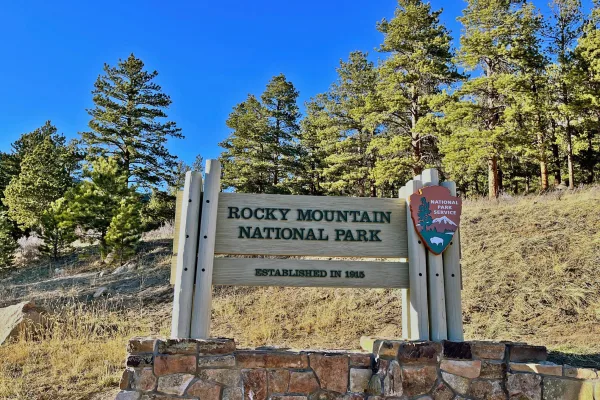
Rocky Mountain National Park
National Park
Rocky Mountain National Park's 415 square miles (265,807 acres) encompasses a spectacular range of mountain environments. From meadows found in the montane life zone to glistening alpine lakes and up...
9 mi from route
~23 min detour
$30
near mile 133.3
Beneath a grassy mountain valley in central Colorado lies one of the richest and most diverse fossil deposits in the world. Petrified redwood stumps up to 14 feet wide and thousands of detailed fossil...
Park data from the National Park Service API. Alerts update every 2 hours.
More Details
What kind of drive is this?
This route is primarily surface roads, with only 28% of the drive on highways. You'll experience a 68.6-mile stretch on Ronald Reagan Highway before transitioning. Expect more frequent traffic lights and intersections as you move off the main highway segments. The overall feel is less about high-speed cruising and more about navigating through populated areas.
Only 28% highway — the rest is turn-by-turn surface driving.
28 navigation steps total — most of the decisions cluster near the start and finish.
Longest single stretch: 68.6 mi on Ronald Reagan Highway.
How Hard Is This Drive?
9/10
Expect a hands-on drive with frequent turns and local roads rather than long highway stretches. This route has several spots where lane changes, forks, or exits need your full attention. The trickiest moment comes around 0.4 miles in near West Bijou Street.
Driving Effort9/10
High effort - long or complex enough to need steady focus all day
Balances navigation complexity with total wheel time.
This is a demanding drive. With 19 significant decision points across 133.3 miles, you will need to stay alert - especially through interchange areas and urban stretches. Consider splitting it into segments if you are not comfortable with fast highway navigation.
Where does it get tricky?
The main spots that need attention: at 0.4 miles (West Bijou Street): Lane positioning matters here; at 75.3 miles: Exit ramp - move to the correct lane early. Lane positioning matters here. Multiple destination signs - pick the right one; at 81.9 miles (US 36 / Denver–Boulder Turnpike): Highway fork - watch signs carefully. Lane positioning matters here.
Elevation Profile
High-altitude sections with notable climbs
7,529 ft5,194 ft
Total Climb
3,587 ft
Total Descent
2,067 ft
Highest Point
7,529 ft
~133.3 mi in
Elevation Range
2,335 ft
Notable High Points
6,995 ft at ~19 miles+203 ft prominence
6,403 ft at ~47.6 miles+69 ft prominence
5,426 ft at ~85.7 miles+70 ft prominence
5,595 ft at ~104.8 miles+127 ft prominence
Towns Mentioned on Route Signs
Based on OSRM destination-sign hints, not a full list of every settlement the road passes.
On the drive from Colorado Springs, CO to Estes Park, CO, road signs begin pointing toward Boulder along the way.
Boulder
75.3 mi in|~1h 25m
Detours Along the Way
Tagged by where each one fits in your drive — first break, midpoint, final stretch.
Colorado Springs is a city of about 490,000 in the western U.S. state of Colorado. The seat of El Paso County, the city lies 63 miles (101 km) south of Denver at the foot of Pikes Peak in South Central Colorado.
Top landmarks
•United States Air Force Academy Cadet Chapel — chapel in Colorado, USA
•Will Rogers Shrine of the Sun — commemorative tower and chapel in Colorado Springs, Colorado
•St. Mary's Cathedral — cathedral in Colorado Springs, United States of America
Estes Park is a town in the Front Range region of the state of Colorado in America. It is located 90 miles northwest of Denver, on the eastern slope of the Front Range in north central Colorado. Estes Park sits at the east entrance to Rocky Mountain National Park.
Top landmarks
•The Stanley Hotel — historic hotel in Estes Park, Colorado
•Park Theatre — movie theater in Estes Park, Colorado, United States
Doable as a same-day drive at 2h 51m. Total distance: 133.3 miles.
Family Friendly
Moderate complexity with 1 natural rest stops along the way.
Solo Traveler
2h 51m drive, comfortable solo distance.
Scenic Drive
Mostly surface roads route profile with national parks nearby.
Frequently Asked Questions
The longest stretch is about 68.6 miles on Ronald Reagan Highway. The full list of main roads is in the Roads section above.
Expect about $1.38 in tolls one way, starting with Denver–Boulder Turnpike. Most Northeast and Midwest toll agencies accept E-ZPass; in the West and Texas, transponders like TxTag or FasTrak apply. If you do not have a transponder, cashless tolling plates will mail a bill to the vehicle's registered address — usually with a surcharge, so a rental-car toll pass is often cheaper than paying by mail.
It helps. This route has a higher-than-average number of complex decision points, which get harder in the dark. If the last hour of the trip is on surface roads or mountain grades, aim to arrive at Estes Park, CO before sunset when you can. Check the Trip Plan for departure windows that land you in daylight.
Only with planning. This is a long drive for kids — consider splitting it into two days rather than pushing through. Plan at least 1 meaningful breaks. Dedicated rest areas are limited, so plan gas or food stops as your bathroom breaks.
The main spots that need attention: at 0.4 miles (West Bijou Street): Lane positioning matters here; at 75.3 miles: Exit ramp - move to the correct lane early. Lane positioning matters here. Multiple destination signs - pick the right one; at 81.9 miles (US 36 / Denver–Boulder Turnpike): Highway fork - watch signs carefully. Lane positioning matters here.
Yes — Rocky Mountain National Park and Florissant Fossil Beds National Monument. See the National Parks section for detour distances and tips on detours.
Yes. A round trip is manageable in a single day if you plan a break at Estes Park, CO before heading back.