Traveling from Clarksdale to Oxford covers 235.8 miles and typically takes about 5 hours and 26 minutes behind the wheel. This route is designed as a straightforward, highway-focused drive that is best suited for a single-day journey. You should budget roughly $36 for fuel to complete the trip comfortably. Navigating through the Southeast, you will spend the vast majority of your time on major thoroughfares like US 61, MS 28, and US 84. Since the entire drive stays within Mississippi, you will experience a consistent regional atmosphere throughout the transit. Whether you are looking for a focused commute or a quick weekend transition, this trek is efficient enough to manage without an overnight stay.
Trip Pace
Same-day drive is realistic
A same-day return is possible, but it will make for a full day on the road.
Break Rhythm
1 planned break
Plan on a short reset every 3 to 4 hours to stay fresh behind the wheel.
Midpoint
117.9 miles from Clarksdale, MS
A natural place for your longest stop of the day
, about 2h 34m into the drive
.
Main Roads
Road
Distance
Duration
US 61
190 mi
4h
MS 28
13.8 mi
24m
US 84
11.1 mi
12m
Gloster Road
9.8 mi
23m
Oxford-Meadville Road
6.3 mi
15m
South State Street
2.1 mi
3m
MS 184
1 mi
1m
Walnut Street
0.8 mi
1m
Longest stretch:
US 61
— 190 mi, about 4h
Turn-by-Turn Driving Directions
Step-by-step road directions between Clarksdale, MS and Oxford, MS.
1
Start on this road
158 ft·17 sec·this road
2
Turn left onto Issaquena Avenue
436 ft·21 sec·Issaquena Avenue
3
Turn right onto 4th Street
0.3 mi·56 sec·4th Street
4
At end of road, turn left onto Riverside Avenue
198 ft·5 sec·Riverside Avenue
5
Continue on Madison Avenue
0.4 mi·1 min·Madison Avenue
6
Turn right onto MS 161; MS 322
2.1 mi·3 min·South State Street
7
Turn right onto US 61; US 278
91 mi·1 hr 56 min·US 61; US 278
Use the straight lane.
8
Continue on US 61; MS 14
48 mi·1 hr 5 min·US 61; MS 14
9
Keep slight right at fork onto US 61
4.2 mi·5 min·US 61
10
Keep slight left at fork onto US 61
46 mi·52 min·US 61
Toward US 61 South: NatchezUse the slight left / straight lanes.
11
Turn left onto MS 28; MS 33
14 mi·24 min·MS 28; MS 33
12
Turn left onto US 84
11 mi·12 min·US 84
13
Turn left onto MS 184
1.0 mi·1 min·MS 184
14
Turn right onto Walnut Street
0.8 mi·1 min·Walnut Street
15
Continue on Gloster Road
3.3 mi·7 min·Gloster Road
16
At end of road, turn right onto Gloster Road
3.8 mi·9 min·Gloster Road
17
At end of road, turn right onto Gloster Road
2.8 mi·6 min·Gloster Road
18
Continue on Oxford-Meadville Road
6.3 mi·15 min·Oxford-Meadville Road
19
Arrive at destination
Oxford-Meadville Road
Trip Plan
To keep your energy levels steady, plan for at least one substantial stop to break up the 5.5-hour duration. Because the journey relies heavily on US 61, check local traffic reports before departing to ensure your longest 190-mile stretch remains clear. Aim to leave early in the morning to maximize daylight hours, especially if you want to avoid peak congestion during your transit. Since you are budgeting $36 for fuel, it is wise to top off your tank before leaving Clarksdale to avoid searching for stations during the longer highway stretches. Flexibility is your biggest advantage here, so feel free to adjust your single stop based on your personal comfort levels along the way.
Morning Departure
An early start around 7-8 AM gets you there with plenty of daylight left.
Evening Departure
A late afternoon start means arriving after dark. Morning is better.
You can normally do this drive in one day.
Plan roughly 1 meaningful break for fuel, food, and rest.
The halfway point lands around 117.9 miles from Clarksdale, MS, or about 2h 34m into the drive.
The longest continuous stretch on this route runs about 190 miles.
This is a comfortable same-day trip.
Departure
Before you leave
Start with fuel, water, and navigation already sorted so the first hour feels easy.
First stop
Around 52 miles or 1h 8m in
Use this first pause for coffee, a restroom break, and a quick traffic check ahead.
Halfway reset
Around 117.9 miles or 2h 34m in
This is the best place for your longest stop, a real meal, and a full fuel check.
Final approach
Final hour starts around 4h 7m
Traffic, exits, and arrival timing usually matter more near Oxford, MS than in the middle of the route.
Before You Leave
+
Open the route before leaving Clarksdale, MS so your first major turns are already loaded.
+
Leave with enough water and a charging cable within reach, not packed away.
+
Check your fuel range against the first long segment, especially if you are starting outside city service areas.
Day 1
Settle into the route from Clarksdale, MS
This is one driving day of about 235.8 miles and 5h 26m.
Your first comfortable stop window is around 52 miles from Clarksdale, MS.
This route can stay practical as a one-day drive if traffic stays reasonable.
Plan about 1 real break rather than only quick fuel stops.
The longest stretch is on US 61 for about 190 miles.
Where to Stop
Rest stops, refuel points, and overnight suggestions along this route.
Place data sourced from public business listings. Hours and availability may vary.
Heads-up: tricky spots
5 of 13
5 decision points cluster between mile 0 and 146.6 — GPS handles the exact turns, but know they're coming. Your lane choice matters more than the turn itself.
5
0 mi into trip|~0m in|Issaquena Avenue
Turn left onto Issaquena Avenue
Navigation decision point
4
0.1 mi into trip|~0m in|4th Street
Turn right onto 4th Street
Navigation decision point
4
0.5 mi into trip|~1m in|Riverside Avenue
At end of road, turn left onto Riverside Avenue
Navigation decision point
6
3 mi into trip|~6m in|US 61; US 278
Turn right onto US 61; US 278
Lane positioning matters here
Use the straight lane.
7
146.6 mi into trip|~3h 13m in|US 61
Keep slight left at fork onto US 61 toward US 61 South: Natchez
Highway fork - watch signs carefully. Lane positioning matters here
Use the slight left / straight lanes.
Toward US 61 South: Natchez
Fuel & Cost
Regular Gas
$32.73 one way
$65.47 round trip
$3.53/gal25.4 MPG avg83 kg CO2
Fuel Type
$/gal
One Way
Round Trip
midgrade
$3.95
$36.62
$73.25
premium
$4.29
$39.82
$79.63
diesel
$4.80
$44.52
$89.05
No toll roads detected on this route.
Estimated Trip Cost (one way, 1 person)
Fuel
$33
Meals
$25–$50
Total
$58–$83
Rough estimate based on US averages. Hotel $80–$140/night, meals $25–$50/day.
Estimated CO2 emission: 82.5 kg one way.
Prices: EIA weekly data, 2026-07-13.
Driving Electric?
About $25 in charging
· 0 stops
· 66% less CO2
Vehicle Type
kWh
Stops
DC Fast
Home Charge
Average EV
70.7
0
$24.76
$11.32
Efficient EV
59
0
$20.63
$9.43
EV Truck/SUV
94.3
1
$33.01
$15.09
Gas CO2
83 kg
EV CO2
28 kg (66% less)
Plan for 0 charging stops, roughly every 270 miles. Allow 25-40 minutes per stop at a DC fast charger.
DC fast charging avg $0.35/kWh. Home charging avg $0.16/kWh. US grid CO2: 0.39 kg/kWh.
Travel Intel
Current conditions at both ends of the drive.
Forecast as of Jul 18, 2026
Origin
Clarksdale, MS
Afternoon
in Clarksdale on Sunday
Local time
3:08 PM
CDT
Current temp
95°F
Sunny
WNW 0 to 5 mph2% chanceLive forecast
Heat Advisory
Heat Advisory issued July 18 at 10:12AM CDT until July 20 at 7:00PM CDT by NWS Jackson MS
Heat Advisory
Heat Advisory issued July 18 at 10:11AM CDT until July 18 at 6:00PM CDT by NWS New Orleans LA
Destination
Oxford, MS
Afternoon
in Oxford on Sunday
Local time
3:08 PM
CDT
Current temp
95°F
Sunny
NW 5 mph3% chanceLive forecast
Heat Advisory
Heat Advisory issued July 18 at 10:12AM CDT until July 20 at 7:00PM CDT by NWS Jackson MS
Heat Advisory
Heat Advisory issued July 18 at 10:11AM CDT until July 18 at 6:00PM CDT by NWS New Orleans LA
Seasonal Notes
Summer travel usually means heavier construction, hotter rest stops, and busier weekend traffic around major cities.
Winter travel shortens daylight, so a route that looks manageable on paper can feel much longer after dark.
Holiday weekends tend to make both departure and arrival windows slower than the raw route time suggests.
Time zone
Same local time
Origin and destination are on the same clock, so arrival timing is easier to judge at a glance.
Temperature spread
Very similar conditions
Both ends of the route are sitting at about the same temperature right now.
Road read
5h 26m on the road
An early start around 7-8 AM gets you there with plenty of daylight left.
Weather data from the National Weather Service. Conditions may change; check closer to your travel date.
National Parks Near This Route
Worth a detour if your schedule allows.
Natchez National Historical Park
National Historical Park
Discover the history of all the peoples of Natchez, Mississippi, from European settlement, African enslavement, the American cotton economy, to the Civil Rights struggle on the lower Mississippi River...
19 mi from route
~47 min detour
Free
near mile 203.3
Emmett Till and Mamie Till-Mobley National Monument
National Monument
In 1955, 14-year-old Emmett Till traveled to Money, Mississippi, to visit relatives. He was kidnapped, tortured, and murdered after reportedly whistling at a white woman. His mother, Mamie Till-Mobley...
Park data from the National Park Service API. Alerts update every 2 hours.
More Details
What kind of drive is this?
Expect a high-speed experience, as 92% of this route consists of highway driving. You will spend a significant portion of your time on US 61, which features a long, uninterrupted 190-mile stretch that demands steady focus. The road personality is primarily defined by these fast, open highway segments rather than winding local backroads. As you transition between the designated main roads, you will find a consistent, utilitarian pace that favors efficiency over technical maneuvering. It is a no-nonsense drive that rewards drivers who appreciate the rhythm of long-distance highway travel.
92% highway — fuel and pacing are the main things to plan.
19 navigation steps total — most of the decisions cluster near the start and finish.
Longest single stretch: 190 mi on US 61.
How Hard Is This Drive?
4/10
This is a straightforward highway drive that stays mostly on US 61 and MS 28. There are only a few real navigation decisions along the way. The trickiest moment comes early in the drive near Issaquena Avenue.
Driving Effort4/10
Easy - simple navigation with a manageable amount of wheel time
Balances navigation complexity with total wheel time.
This is a straightforward 5h 26m drive. You will face about 13 decision points, but nothing that requires special attention if you follow navigation.
Where does it get tricky?
The main spots that need attention: near the start (Issaquena Avenue): Navigation decision point; at 0.1 miles (4th Street): Navigation decision point; at 0.5 miles (Riverside Avenue): Navigation decision point.
Clarksdale is a town of 15,000 people (2020) in the Mississippi Delta. About an hour south of Memphis, this little podunk town draws visitors from all over the world for its blues clubs and blues history.
Oxford is a historic, picturesque town in North Central Mississippi. With its scenic town square, acclaimed restaurants, unique boutiques, oak-shaded neighborhoods, and friendly people, Oxford is the model Southern town. Named after Oxford, England, in hopes of attracting a university, the town was selected as the home of the University of Mississippi in 1848, which dominates life here today.
Top landmarks
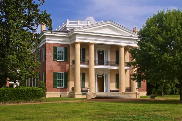
•Rowan Oak — William Faulkner's former home in Oxford, Mississippi
•Barnard Observatory — observatory at the University of Mississippi, USA
•Lyceum-The Circle Historic District — collection of historic buildings at the University of Mississippi in Oxford (USA...
The longest stretch is about 190 miles on US 61. The full list of main roads is in the Roads section above.
Yes — we found about 1 rest area or service plaza within a short detour of the route (from OpenStreetMap). See the Rest Stops tab under Nearby Places for locations and mile markers. Plan to stretch, use the bathroom, and top off fluids every 2–3 hours on longer drives.
Only with planning. This is a long drive for kids — consider splitting it into two days rather than pushing through. Plan at least 1 meaningful breaks. There are 1 rest area along the route for bathroom stops.
The main spots that need attention: near the start (Issaquena Avenue): Navigation decision point; at 0.1 miles (4th Street): Navigation decision point; at 0.5 miles (Riverside Avenue): Navigation decision point.
Yes — Natchez National Historical Park and Emmett Till and Mamie Till-Mobley National Monument. See the National Parks section for detour distances and tips on detours.
Not recommended in a single day. At 5.4 hours each way, a round trip means 10.9 hours of driving — that is an unsafe level of fatigue for most drivers. Plan at least one night at Oxford, MS before the return drive.