Oxford, MS to Pontotoc, MS is 288.9 miles and takes about 5h 46m via I 55 and MS 7, with a fuel budget near $44 and enough daylight to finish in a day. This trip stays within Mississippi, connecting two points in the Southeast region. Expect a drive that's predominantly on major highways, making for a straightforward transit. It's a route best suited for those looking to cover ground efficiently, without the need for an overnight stop. Consider this if your priority is reaching your destination with minimal fuss.
Trip Pace
Same-day drive is realistic
A same-day return is possible, but it will make for a full day on the road.
Break Rhythm
1 planned break
Plan on a short reset every 3 to 4 hours to stay fresh behind the wheel.
Midpoint
144.5 miles from Oxford, MS
A natural place for your longest stop of the day
, about 3h into the drive
.
Main Roads
Road
Distance
Duration
I 55
172.3 mi
3h 7m
MS 7
42.7 mi
50m
US 84
22.9 mi
26m
MS 6
21.2 mi
24m
US 278
6.8 mi
8m
Gloster Road
6.5 mi
15m
Oxford-Meadville Road
6.3 mi
15m
Yap 3 Road
2.6 mi
6m
Longest stretch:
I 55
— 172.3 mi, about 3h 7m
Traffic on I-55
Hour-of-day weekday pattern from 59 FHWA count stations on your route.
Peak
4 PM
~2,530 veh/hr typical
Quietest
2 AM
~145 veh/hr
Peak-to-quiet ratio
17.4×
busier at peak than in the quiet hours
12a6anoon6p11p
Averaged across 52 weeks of 2023 FHWA Travel Monitoring Analysis System data. Weekday hours only (Mon–Fri).
Turn-by-Turn Driving Directions
Step-by-step road directions between Oxford, MS and Pontotoc, MS.
1
Start on Oxford-Meadville Road
6.3 mi·15 min·Oxford-Meadville Road
2
Continue on Gloster Road
2.8 mi·6 min·Gloster Road
3
At end of road, turn left onto Gloster Road
3.8 mi·9 min·Gloster Road
4
Continue on Yap 3 Road
2.6 mi·6 min·Yap 3 Road
5
Turn left onto US 98
1.8 mi·2 min·United States Highway 98
6
Turn right onto MS 184
1.4 mi·2 min·Old US Hwy 84
7
Turn right onto US 84
23 mi·26 min·US 84
8
Take the exit
0.2 mi·27 sec
9
Merge onto I 55
53 mi·57 min·I 55
10
Keep slight right at fork onto I 55
2.1 mi·2 min·I 55
11
Keep slight left at fork onto I 55
117 mi·2 hr 7 min·I 55
Toward Grenada, Memphis
12
Take the exit onto MS 7
36 mi·41 min·MS 7
Toward MS 7 North: Coffeeville
13
Enter roundabout onto MS 7
171 ft·2 sec·MS 7
Toward MS 7 North: Oxford
14
Continue on MS 7
6.2 mi·8 min·MS 7
Toward MS 7 North: Oxford
15
Take the exit
0.3 mi·42 sec
16
Merge onto US 278; MS 6
1.0 mi·1 min·US 278; MS 6
17
Continue on MS 6; US 278
21 mi·24 min·MS 6; US 278
18
Continue on US 278; MS 6
5.8 mi·6 min·US 278; MS 6
19
Take the exit
0.3 mi·41 sec
Toward MS 15: Pontotoc, New Albany
20
Turn right onto MS 15
2.1 mi·3 min·MS 15
21
Turn left onto MS 336
0.4 mi·43 sec·Turnpike Road
22
Turn left onto MS 9
0.7 mi·1 min·West Oxford Street
23
Turn right onto MS 41
0.4 mi·42 sec·North Main Street
24
Turn left onto East Marion Street
54 ft·2 sec·East Marion Street
25
Arrive at destination
East Marion Street
Trip Plan
Given the 5h 46m duration, leaving Oxford, MS in the morning should get you to Pontotoc, MS with plenty of daylight to spare. The route is mostly highway, so plan your fuel stops accordingly, especially before heading onto the longer 172.3-mile stretch on I 55. While there's only one suggested stop, you have flexibility to add more if needed on this single-day trip. Keep an eye on the transition from I 55 to MS 7; this is where the driving experience will change most significantly.
Morning Departure
An early start around 7-8 AM gets you there with plenty of daylight left.
Evening Departure
A late afternoon start means arriving after dark. Morning is better.
You can normally do this drive in one day.
Plan roughly 1 meaningful break for fuel, food, and rest.
The halfway point lands around 144.5 miles from Oxford, MS, or about 3h into the drive.
The longest continuous stretch on this route runs about 172.3 miles.
This is a comfortable same-day trip.
Departure
Before you leave
Start with fuel, water, and navigation already sorted so the first hour feels easy.
First stop
Around 64 miles or 1h 32m in
Use this first pause for coffee, a restroom break, and a quick traffic check ahead.
Halfway reset
Around 144.5 miles or 3h in
This is the best place for your longest stop, a real meal, and a full fuel check.
Final approach
Final hour starts around 4h 42m
Traffic, exits, and arrival timing usually matter more near Pontotoc, MS than in the middle of the route.
Before You Leave
+
Open the route before leaving Oxford, MS so your first major turns are already loaded.
+
Leave with enough water and a charging cable within reach, not packed away.
+
Check your fuel range against the first long segment, especially if you are starting outside city service areas.
Day 1
Settle into the route from Oxford, MS
This is one driving day of about 288.9 miles and 5h 46m.
Your first comfortable stop window is around 64 miles from Oxford, MS.
This route can stay practical as a one-day drive if traffic stays reasonable.
Plan about 1 real break rather than only quick fuel stops.
The longest stretch is on I 55 for about 172.3 miles.
Where to Stop
Rest stops, refuel points, and overnight suggestions along this route.
Place data sourced from public business listings. Hours and availability may vary.
Heads-up: tricky spots
5 of 17
5 decision points cluster between mile 9.1 and 285.1 — GPS handles the exact turns, but know they're coming. Your lane choice matters more than the turn itself.
4
9.1 mi into trip|~21m in|Gloster Road
At end of road, turn left onto Gloster Road
Navigation decision point
4
95 mi into trip|~2h 6m in|I 55
Keep slight right at fork onto I 55
Highway fork - watch signs carefully
6
97.1 mi into trip|~2h 8m in|I 55
Keep slight left at fork onto I 55 toward Grenada, Memphis
Highway fork - watch signs carefully. Multiple destination signs - pick the right one
Toward Grenada, Memphis
5
250.5 mi into trip|~4h 57m in|MS 7
Enter roundabout onto MS 7 toward MS 7 North: Oxford
Roundabout - know your exit number before entering
Toward MS 7 North: Oxford
5
285.1 mi into trip|~5h 39m in
Take the exit toward MS 15: Pontotoc, New Albany
Exit ramp - move to the correct lane early. Multiple destination signs - pick the right one
Toward MS 15: Pontotoc, New Albany
Fuel & Cost
Regular Gas
$40.10 one way
$80.21 round trip
$3.53/gal25.4 MPG avg101 kg CO2
Fuel Type
$/gal
One Way
Round Trip
midgrade
$3.95
$44.87
$89.74
premium
$4.29
$48.78
$97.57
diesel
$4.80
$54.55
$109.10
No toll roads detected on this route.
Estimated Trip Cost (one way, 1 person)
Fuel
$40
Meals
$25–$50
Total
$65–$90
Rough estimate based on US averages. Hotel $80–$140/night, meals $25–$50/day.
Estimated CO2 emission: 101.1 kg one way.
Prices: EIA weekly data, 2026-07-13.
Driving Electric?
About $30 in charging
· 1 stop
· 66% less CO2
Vehicle Type
kWh
Stops
DC Fast
Home Charge
Average EV
86.7
1
$30.33
$13.87
Efficient EV
72.2
0
$25.28
$11.56
EV Truck/SUV
115.6
1
$40.45
$18.49
Gas CO2
101 kg
EV CO2
34 kg (66% less)
Plan for 1 charging stop. A 30-minute DC fast charge mid-route should be enough to complete the trip comfortably.
DC fast charging avg $0.35/kWh. Home charging avg $0.16/kWh. US grid CO2: 0.39 kg/kWh.
Travel Intel
Current conditions at both ends of the drive.
Forecast as of Jul 18, 2026
Origin
Oxford, MS
Morning
in Oxford on Sunday
Local time
10:30 AM
CDT
Current temp
75°F
Partly Cloudy
W 0 to 5 mph2% chanceLive forecast
Destination
Pontotoc, MS
Morning
in Pontotoc on Sunday
Local time
10:30 AM
CDT
Current temp
73°F
Mostly Clear
W 0 to 5 mph5% chanceLive forecast
93°F
Madison, MS
144 mi in
Seasonal Notes
Summer travel usually means heavier construction, hotter rest stops, and busier weekend traffic around major cities.
Winter travel shortens daylight, so a route that looks manageable on paper can feel much longer after dark.
Holiday weekends tend to make both departure and arrival windows slower than the raw route time suggests.
Time zone
Same local time
Origin and destination are on the same clock, so arrival timing is easier to judge at a glance.
Temperature spread
2 degrees cooler at arrival
A meaningful temperature swing is a good cue to rethink layers, water, and how soon you want to arrive.
Road read
5h 46m on the road
An early start around 7-8 AM gets you there with plenty of daylight left.
Weather data from the National Weather Service. Conditions may change; check closer to your travel date.
National Parks Near This Route
Worth a detour if your schedule allows.
Medgar and Myrlie Evers Home National Monument
National Monument
Medgar and Myrlie Evers were partners in the civil rights struggle. The assassination of Medgar Evers in the carport of their home on June 12, 1963, was the first murder of a nationally significant le...
In July, 1864, federal forces, including men from the United States Colored Troops, marched into Tupelo, Mississippi. Disorganized Confederate soldiers fought fiercely but could not overpower the fede...
15 mi from route
~37 min detour
Free
near mile 288.9
The Natchez Trace National Scenic Trail is five sections of hiking trail running roughly parallel to the 444-mile long Natchez Trace Parkway scenic motor road. The foot trails total more than 60 miles...
17 mi from route
~44 min detour
Free
near mile 288.9
Discover the history of all the peoples of Natchez, Mississippi, from European settlement, African enslavement, the American cotton economy, to the Civil Rights struggle on the lower Mississippi River...
Park data from the National Park Service API. Alerts update every 2 hours.
More Details
What kind of drive is this?
You'll spend about 94% of your time on highways, meaning most of this 288.9-mile drive will be on faster roads. The longest continuous stretch on a single highway is 172.3 miles, which occurs on I 55. Expect a fairly uninterrupted cruise for a significant portion of the trip. The transition to surface roads, like MS 7 and US 84, will likely involve a noticeable change in pace and exit frequency.
94% highway — fuel and pacing are the main things to plan.
25 navigation steps total — most of the decisions cluster near the start and finish.
Longest single stretch: 172.3 mi on I 55.
How Hard Is This Drive?
6/10
This is a straightforward highway drive that stays mostly on I 55 and MS 7. You will hit about 17 points where you need to pay attention to lane position or signs. The trickiest moment comes around 9.1 miles in near Gloster Road.
Driving Effort6/10
Moderate - straightforward overall, but long enough or busy enough to require pacing
Balances navigation complexity with total wheel time.
This drive requires moderate attention. Across 288.9 miles you will encounter 17 spots where lane choice or exit timing matters. Not difficult for experienced highway drivers, but worth previewing the tricky sections before you go.
Where does it get tricky?
The main spots that need attention: at 9.1 miles (Gloster Road): Navigation decision point; at 95 miles (I 55): Highway fork - watch signs carefully; at 97.1 miles (I 55): Highway fork - watch signs carefully. Multiple destination signs - pick the right one.
Elevation Profile
Mostly flat terrain
496 ft230 ft
Total Climb
587 ft
Total Descent
520 ft
Highest Point
496 ft
~288.9 mi in
Elevation Range
266 ft
Towns Mentioned on Route Signs
Based on OSRM destination-sign hints, not a full list of every settlement the road passes.
Between Oxford, MS and Pontotoc, MS, road signs point toward Grenada and Memphis.
Oxford is a historic, picturesque town in North Central Mississippi. With its scenic town square, acclaimed restaurants, unique boutiques, oak-shaded neighborhoods, and friendly people, Oxford is the model Southern town. Named after Oxford, England, in hopes of attracting a university, the town was selected as the home of the University of Mississippi in 1848, which dominates life here today.
Top landmarks
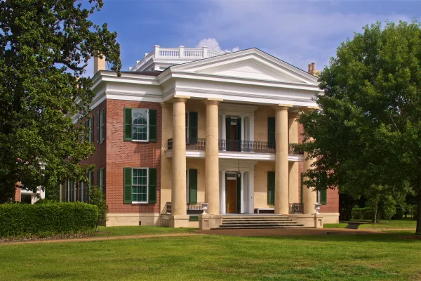
•Rowan Oak — William Faulkner's former home in Oxford, Mississippi
•Barnard Observatory — observatory at the University of Mississippi, USA
•Lyceum-The Circle Historic District — collection of historic buildings at the University of Mississippi in Oxford (USA...
Doable as a same-day drive at 5h 46m. Total distance: 288.9 miles.
Family Friendly
Moderate complexity with 1 natural rest stops along the way.
Solo Traveler
5h 46m drive, comfortable solo distance.
First-Time Driver
Mostly highway driving (94%). Some complex stretches to watch for.
Frequently Asked Questions
The longest stretch is about 172.3 miles on I 55. The full list of main roads is in the Roads section above.
Yes — we found about 12 rest areas or service plazas within a short detour of the route (from OpenStreetMap). See the Rest Stops tab under Nearby Places for locations and mile markers. Plan to stretch, use the bathroom, and top off fluids every 2–3 hours on longer drives.
It helps. This route has a higher-than-average number of complex decision points, which get harder in the dark. If the last hour of the trip is on surface roads or mountain grades, aim to arrive at Pontotoc, MS before sunset when you can. Check the Trip Plan for departure windows that land you in daylight.
Only with planning. This is a long drive for kids — consider splitting it into two days rather than pushing through. Plan at least 1 meaningful breaks. There are 12 rest areas along the route for bathroom stops.
The main spots that need attention: at 9.1 miles (Gloster Road): Navigation decision point; at 95 miles (I 55): Highway fork - watch signs carefully; at 97.1 miles (I 55): Highway fork - watch signs carefully. Multiple destination signs - pick the right one.
Yes — Medgar and Myrlie Evers Home National Monument, Tupelo National Battlefield and Natchez Trace National Scenic Trail (4 total within detour distance). See the National Parks section for detour distances and tips on detours.
Not recommended in a single day. At 5.8 hours each way, a round trip means 11.5 hours of driving — that is an unsafe level of fatigue for most drivers. Plan at least one night at Pontotoc, MS before the return drive.