Chandler, AZ to East Sahuarita, AZ is 118.7 miles and takes about 2h 17m via Casa Grande-Tucson Highway, with a fuel budget near $24 and enough daylight to finish in a day. This trip stays within the Desert Southwest, connecting two points in Arizona. You'll primarily be on surface roads, with a relatively small portion on highways, making for a more relaxed pace. With only one day recommended, this is a straightforward drive suitable for a quick transit or a relaxed exploration of the immediate areas.
Trip Pace
Same-day drive is realistic
A same-day return is realistic if you keep stops short.
Midpoint
59.3 miles from Chandler, AZ
A natural place for your longest stop of the day
, about 1h 8m into the drive
.
Main Roads
Road
Distance
Duration
Casa Grande-Tucson Highway
54.6 mi
55m
Phoenix-Casa Grande Highway
23.5 mi
23m
Nogales–Tucson Highway
16 mi
19m
North Arizona Avenue
6.9 mi
11m
AZ 587
6.1 mi
9m
North Freeway
5.4 mi
6m
West Sahuarita Road
3.5 mi
6m
South Country Club Road
1 mi
1m
Longest stretch:
Casa Grande-Tucson Highway
— 54.6 mi, about 55m
Turn-by-Turn Driving Directions
Step-by-step road directions between Chandler, AZ and East Sahuarita, AZ.
1
Start on East Chandler Boulevard
357 ft·9 sec·East Chandler Boulevard
2
Turn right onto North Washington Street
0.1 mi·21 sec·North Washington Street
Use the right lane.
3
Turn right onto East Buffalo Street
393 ft·15 sec·East Buffalo Street
4
Turn left onto AZ 87
6.9 mi·11 min·North Arizona Avenue
Use the left lane.
5
Continue on AZ 587
6.1 mi·9 min·AZ 587
6
Take the ramp
0.3 mi·36 sec
Toward I 10 East: Tucson
7
Merge onto I 10
24 mi·23 min·Phoenix-Casa Grande Highway
Use the straight / slight right lanes.
8
Continue on I 10
55 mi·55 min·Casa Grande-Tucson Highway
Use the straight / slight right lanes.
9
Continue on I 10
5.4 mi·6 min·North Freeway
Use the straight / slight right lanes.
10
Take the exit
0.5 mi·37 sec
Exit 260Toward I 19 South: NogalesUse the straight / slight right lanes.
11
Continue on I 19
16 mi·19 min·Nogales–Tucson Highway
Use the straight / slight right lanes.
12
Take the exit
0.4 mi·58 sec
Exit 75Toward Sahuarita RoadUse the straight / slight right lanes.
13
Turn left onto West Sahuarita Road
3.5 mi·6 min·West Sahuarita Road
14
Turn right onto South Country Club Road
1.0 mi·1 min·South Country Club Road
15
At end of road, turn left onto East El Toro Road
316 ft·8 sec·East El Toro Road
16
Arrive at destination
East El Toro Road
Trip Plan
Since this is a single-day drive, you have flexibility with your departure time. Aiming for a mid-morning start would allow you to avoid the earliest rush hour and still arrive with plenty of daylight. Plan for your fuel needs, as the estimated cost is around $24. While there are no specific stops noted, keep an eye on your fuel gauge, especially before the longest stretch of 54.6 miles on the Casa Grande-Tucson Highway, to ensure you have enough to reach East Sahuarita comfortably.
Morning Departure
Leave by 9 AM and you'll arrive before lunch.
Evening Departure
Even a 4 PM departure gets you there before dark in summer.
You can normally do this drive in one day.
You may only need one short stretch break if traffic stays light.
The halfway point lands around 59.3 miles from Chandler, AZ, or about 1h 8m into the drive.
The longest continuous stretch on this route runs about 54.6 miles.
This is a comfortable same-day trip.
Departure
Before you leave
Start with fuel, water, and navigation already sorted so the first hour feels easy.
First stop
Around 26 miles or 34m in
Use this first pause for coffee, a restroom break, and a quick traffic check ahead.
Halfway reset
Around 59.3 miles or 1h 8m in
This is the best place for your longest stop, a real meal, and a full fuel check.
Final approach
Final hour starts around 1h 48m
Traffic, exits, and arrival timing usually matter more near East Sahuarita, AZ than in the middle of the route.
Before You Leave
+
Open the route before leaving Chandler, AZ so your first major turns are already loaded.
+
Leave with enough water and a charging cable within reach, not packed away.
+
Check your fuel range against the first long segment, especially if you are starting outside city service areas.
Day 1
Settle into the route from Chandler, AZ
This is one driving day of about 118.7 miles and 2h 17m.
Your first comfortable stop window is around 26 miles from Chandler, AZ.
This route can stay practical as a one-day drive if traffic stays reasonable.
The longest stretch is on Casa Grande-Tucson Highway for about 54.6 miles.
Where to Stop
Rest stops, refuel points, and overnight suggestions along this route.
Place data sourced from public business listings. Hours and availability may vary.
Heads-up: tricky spots
5 of 10
5 decision points cluster between mile 0.1 and 113.7 — GPS handles the exact turns, but know they're coming. Your lane choice matters more than the turn itself.
7
0.1 mi into trip|~0m in|North Washington Street
Turn right onto North Washington Street
Lane positioning matters here
Use the right lane.
4
0.2 mi into trip|~0m in|East Buffalo Street
Turn right onto East Buffalo Street
Navigation decision point
5
13.6 mi into trip|~22m in|I 10 / Phoenix-Casa Grande Highway
Merge onto I 10 / Phoenix-Casa Grande Highway
Merge point - match speed before joining. Lane positioning matters here
Use the straight / slight right lanes.
7
97.2 mi into trip|~1h 47m in
Take the exit toward I 19 South: Nogales
Exit ramp - move to the correct lane early. Lane positioning matters here
Use the straight / slight right lanes.
Exit 260
Toward I 19 South: Nogales
7
113.7 mi into trip|~2h 7m in
Take the exit toward Sahuarita Road
Exit ramp - move to the correct lane early. Lane positioning matters here
Use the straight / slight right lanes.
Exit 75
Toward Sahuarita Road
Fuel & Cost
Regular Gas
$23.65 one way
$47.29 round trip
$5.06/gal25.4 MPG avg42 kg CO2
Fuel Type
$/gal
One Way
Round Trip
midgrade
$5.36
$25.03
$50.05
premium
$5.59
$26.13
$52.26
diesel
$5.61
$26.21
$52.41
No toll roads detected on this route.
Estimated Trip Cost (one way, 1 person)
Fuel
$24
Meals
$25–$50
Total
$49–$74
Rough estimate based on US averages. Hotel $80–$140/night, meals $25–$50/day.
Estimated CO2 emission: 41.5 kg one way.
Prices: EIA weekly data, 2026-04-13.
Driving Electric?
About $12 in charging
· 0 stops
· 67% less CO2
Vehicle Type
kWh
Stops
DC Fast
Home Charge
Average EV
35.6
0
$12.46
$5.70
Efficient EV
29.7
0
$10.39
$4.75
EV Truck/SUV
47.5
0
$16.62
$7.60
Gas CO2
42 kg
EV CO2
14 kg (67% less)
This trip is well within single-charge range for most EVs. No charging stops needed if you start fully charged.
DC fast charging avg $0.35/kWh. Home charging avg $0.16/kWh. US grid CO2: 0.39 kg/kWh.
Travel Intel
Current conditions at both ends of the drive.
Forecast as of Apr 18, 2026
Origin
Chandler, AZ
Late night
in Chandler on Sunday
Local time
5:05 AM
MST
Current temp
92°F
Sunny
SW 5 mph0% chanceLive forecast
Wind Advisory
Wind Advisory issued April 18 at 12:22PM MST until April 19 at 1:00PM MST by NWS Tucson AZ
Wind Advisory
Wind Advisory issued April 18 at 12:22PM MST until April 19 at 1:00PM MST by NWS Tucson AZ
Destination
East Sahuarita, AZ
Late night
in East Sahuarita on Sunday
Local time
5:05 AM
MST
Current temp
88°F
Sunny
ENE 6 mph0% chanceLive forecast
Wind Advisory
Wind Advisory issued April 18 at 12:22PM MST until April 19 at 1:00PM MST by NWS Tucson AZ
Wind Advisory
Wind Advisory issued April 18 at 12:22PM MST until April 19 at 1:00PM MST by NWS Tucson AZ
Seasonal Notes
Summer travel usually means heavier construction, hotter rest stops, and busier weekend traffic around major cities.
Winter travel shortens daylight, so a route that looks manageable on paper can feel much longer after dark.
Holiday weekends tend to make both departure and arrival windows slower than the raw route time suggests.
Time zone
Same local time
Origin and destination are on the same clock, so arrival timing is easier to judge at a glance.
Temperature spread
4 degrees cooler at arrival
A meaningful temperature swing is a good cue to rethink layers, water, and how soon you want to arrive.
Road read
2h 17m on the road
The weather snapshot is not static. If you are leaving later, give both cities one more quick forecast check before departure.
Weather data from the National Weather Service. Conditions may change; check closer to your travel date.
National Parks Near This Route
Worth a detour if your schedule allows.
Casa Grande Ruins National Monument
National Monument
An Ancestral Sonoran Desert People's farming community and "Great House" are preserved at Casa Grande Ruins. Whether a gathering place for people or simply a waypoint marker in an extensive system of...
10 mi from route
~26 min detour
Free
near mile 28.6
Tucson, Arizona is home to the nation's largest cacti. The giant saguaro is the universal symbol of the American west. These majestic plants, found only in a small portion of the United States, are pr...
13 mi from route
~33 min detour
$25
near mile 98.2
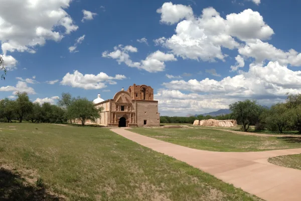
Tumacácori sits at a cultural crossroads in the Santa Cruz River valley. Here O’odham, Yaqui, and Apache people met and mingled with European Jesuit and Franciscan missionaries, settlers, and soldiers...
27 mi from route
~67 min detour
$10
near mile 118.7
Park data from the National Park Service API. Alerts update every 2 hours.
More Details
What kind of drive is this?
You'll spend most of your time on surface roads, as the highway share is only 10%. Expect a longest stretch of 54.6 miles on the Casa Grande-Tucson Highway before transitioning to other surface roads. This suggests a drive with frequent intersections and varying speed limits rather than continuous highway cruising. You'll notice the shift from faster-paced highway driving to more local road conditions as you progress.
Only 10% highway — the rest is turn-by-turn surface driving.
16 navigation steps total — most of the decisions cluster near the start and finish.
Longest single stretch: 54.6 mi on Casa Grande-Tucson Highway.
How Hard Is This Drive?
4/10
Expect a hands-on drive with frequent turns and local roads rather than long highway stretches. There are only a few real navigation decisions along the way. The trickiest moment comes around 0.1 miles in near North Washington Street.
Driving Effort4/10
Easy - simple navigation with a manageable amount of wheel time
Balances navigation complexity with total wheel time.
This is a straightforward 2h 17m drive. You will face about 10 decision points, but nothing that requires special attention if you follow navigation.
Where does it get tricky?
The main spots that need attention: at 0.1 miles (North Washington Street): Lane positioning matters here; at 0.2 miles (East Buffalo Street): Navigation decision point; at 13.6 miles (I 10 / Phoenix-Casa Grande Highway): Merge point - match speed before joining. Lane positioning matters here.
Mostly surface roads route profile with national parks nearby.
Frequently Asked Questions
The longest stretch is about 54.6 miles on Casa Grande-Tucson Highway. The full list of main roads is in the Roads section above.
Yes, with realistic expectations. Build in a stop roughly every 2 hours, have snacks and activities ready, and check the Nearby Places tabs for kid-friendly stops along the way.
The main spots that need attention: at 0.1 miles (North Washington Street): Lane positioning matters here; at 0.2 miles (East Buffalo Street): Navigation decision point; at 13.6 miles (I 10 / Phoenix-Casa Grande Highway): Merge point - match speed before joining. Lane positioning matters here.
Yes — Casa Grande Ruins National Monument, Saguaro National Park and Tumacácori National Historical Park. See the National Parks section for detour distances and tips on detours.
Yes. A round trip is manageable in a single day if you plan a break at East Sahuarita, AZ before heading back.