Spanning 79.6 miles, this drive from Canaan to Keene, New Hampshire, is a straightforward journey through the Northeast that typically takes about 1 hour and 44 minutes. Because of the manageable distance, this route is perfectly suited for a single-day excursion, allowing you to reach your destination without needing an overnight stop. You can expect to spend approximately $13 on fuel, making it a budget-friendly option for a regional trip. The path relies heavily on major thoroughfares, ensuring a consistent pace throughout your travels. Whether you are heading south for business or leisure, the direct nature of this connection simplifies your planning significantly.
Trip Pace
Same-day drive is realistic
A same-day return is realistic if you keep stops short.
Midpoint
39.8 miles from Canaan, NH
A natural place for your longest stop of the day
, about 55m into the drive
.
Main Roads
Road
Distance
Duration
I 91
41.2 mi
47m
Bellows Falls Road
16 mi
18m
U.S. Route 4
8.2 mi
16m
I 89
7.2 mi
8m
Dartmouth College Highway
2.9 mi
5m
West Street
1 mi
2m
Westminster Street
0.8 mi
<1m
U.S. Route 5
0.7 mi
<1m
Longest stretch:
I 91
— 41.2 mi, about 47m
Turn-by-Turn Driving Directions
Step-by-step road directions between Canaan, NH and Keene, NH.
1
Start on Canaan Street
52 ft·4 sec·Canaan Street
2
Turn right onto School Street
0.2 mi·32 sec·School Street
3
Continue on US 4
8.2 mi·16 min·U.S. Route 4
Use the straight lane.
4
Continue on US 4
2.9 mi·5 min·Dartmouth College Highway
5
Take the ramp
0.3 mi·41 sec
6
Merge onto I 89; NH 10
7.2 mi·8 min·I 89; NH 10
7
Take the exit
0.2 mi·26 sec
Toward I 91 South
8
Merge onto I 91
41 mi·47 min·I 91
9
Take the exit
0.2 mi·28 sec
Exit 5Toward Westminster, Walpole New Hampshire
10
Turn left onto Westminster Street
0.8 mi·55 sec·Westminster Street
11
At end of road, turn right onto US 5
0.7 mi·46 sec·U.S. Route 5
12
Turn straight onto VT 123
362 ft·10 sec·Vermont Route 123
13
Continue on VT 123
0.3 mi·17 sec·Vermont Route 123
14
Continue on NH 123
0.1 mi·11 sec·NH 123
15
Continue on NH 12
16 mi·18 min·Bellows Falls Road
16
Take the exit
0.2 mi·37 sec
Toward West St, Downtown
17
Turn left onto West Street
1.0 mi·2 min·West Street
Use the straight lane.
18
Arrive at destination
Roxbury Street
Trip Plan
Since this is a relatively short trip, you have plenty of flexibility regarding your departure time, though planning for a mid-morning start can help you avoid any localized congestion. Given the $13 fuel estimate, it is wise to fill your tank before leaving Canaan to ensure you don't need to hunt for gas stations during the 41.2-mile interstate segment. Because there are no mandatory stops scheduled, you have the freedom to pace the drive exactly how you prefer. Keep a close eye on your GPS when switching from U.S. Route 4 to the Bellows Falls Road transition, as these junctions require a bit more attention than the open highway. Remember that since the entire route is a 1-day commitment, you can easily adjust your arrival time to suit your personal schedule.
Morning Departure
Leave by 9 AM and you'll arrive before lunch.
Evening Departure
Even a 4 PM departure gets you there before dark in summer.
You can normally do this drive in one day.
You may only need one short stretch break if traffic stays light.
The halfway point lands around 39.8 miles from Canaan, NH, or about 55m into the drive.
The longest continuous stretch on this route runs about 41.2 miles.
This is a comfortable same-day trip.
Departure
Before you leave
Start with fuel, water, and navigation already sorted so the first hour feels easy.
First stop
Around 18 miles or 30m in
Use this first pause for coffee, a restroom break, and a quick traffic check ahead.
Halfway reset
Around 39.8 miles or 55m in
This is the best place for your longest stop, a real meal, and a full fuel check.
Final approach
Final hour starts around 1h 28m
Traffic, exits, and arrival timing usually matter more near Keene, NH than in the middle of the route.
Before You Leave
+
Open the route before leaving Canaan, NH so your first major turns are already loaded.
Day 1
Settle into the route from Canaan, NH
This is one driving day of about 79.6 miles and 1h 44m.
Your first comfortable stop window is around 18 miles from Canaan, NH.
This route can stay practical as a one-day drive if traffic stays reasonable.
The longest stretch is on I 91 for about 41.2 miles.
Where to Stop
Rest stops, refuel points, and overnight suggestions along this route.
Place data sourced from public business listings. Hours and availability may vary.
Heads-up: tricky spots
5 of 10
5 decision points cluster between mile 0 and 78.3 — GPS handles the exact turns, but know they're coming. Your lane choice matters more than the turn itself.
5
0 mi into trip|~0m in|School Street
Turn right onto School Street
Navigation decision point
4
18.8 mi into trip|~31m in
Take the exit toward I 91 South
Exit ramp - move to the correct lane early
Toward I 91 South
6
60.2 mi into trip|~1h 19m in
Take the exit toward Westminster, Walpole New Hampshire
Exit ramp - move to the correct lane early. Multiple destination signs - pick the right one
Exit 5
Toward Westminster, Walpole New Hampshire
4
60.4 mi into trip|~1h 19m in|Westminster Street
Turn left onto Westminster Street
Navigation decision point
5
78.3 mi into trip|~1h 40m in
Take the exit toward West St, Downtown
Exit ramp - move to the correct lane early. Multiple destination signs - pick the right one
Toward West St, Downtown
Fuel & Cost
Regular Gas
$12.81 one way
$25.63 round trip
$4.09/gal25.4 MPG avg28 kg CO2
Fuel Type
$/gal
One Way
Round Trip
midgrade
$4.50
$14.10
$28.20
premium
$4.86
$15.24
$30.49
diesel
$5.61
$17.57
$35.15
No toll roads detected on this route.
Estimated Trip Cost (one way, 1 person)
Fuel
$13
Meals
$25–$50
Total
$38–$63
Rough estimate based on US averages. Hotel $80–$140/night, meals $25–$50/day.
Estimated CO2 emission: 27.9 kg one way.
Prices: EIA weekly data, 2026-04-13.
Driving Electric?
About $8 in charging
· 0 stops
· 68% less CO2
Vehicle Type
kWh
Stops
DC Fast
Home Charge
Average EV
23.9
0
$8.36
$3.82
Efficient EV
19.9
0
$6.96
$3.18
EV Truck/SUV
31.8
0
$11.14
$5.09
Gas CO2
28 kg
EV CO2
9 kg (68% less)
This trip is well within single-charge range for most EVs. No charging stops needed if you start fully charged.
DC fast charging avg $0.35/kWh. Home charging avg $0.16/kWh. US grid CO2: 0.39 kg/kWh.
Travel Intel
Current conditions at both ends of the drive.
Forecast as of Apr 15, 2026
Origin
Canaan, NH
Night
in Canaan on Saturday
Local time
10:49 PM
EDT
Current temp
34°F
Unavailable
Live forecast
Destination
Keene, NH
Night
in Keene on Saturday
Local time
10:49 PM
EDT
Current temp
52°F
Unavailable
Live forecast
36°F
Springfield, VT
40 mi in
Seasonal Notes
Summer travel usually means heavier construction, hotter rest stops, and busier weekend traffic around major cities.
Winter travel shortens daylight, so a route that looks manageable on paper can feel much longer after dark.
Holiday weekends tend to make both departure and arrival windows slower than the raw route time suggests.
Time zone
Same local time
Origin and destination are on the same clock, so arrival timing is easier to judge at a glance.
Temperature spread
18 degrees warmer at arrival
A meaningful temperature swing is a good cue to rethink layers, water, and how soon you want to arrive.
Road read
1h 44m on the road
Use the two city cards together: check the sky where you start, then compare it with the local time and temperature at arrival.
Weather data from the National Weather Service. Conditions may change; check closer to your travel date.
National Parks Near This Route
Worth a detour if your schedule allows.
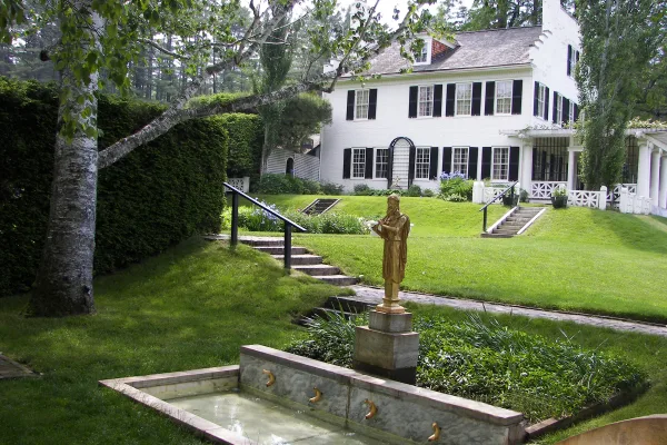
Saint-Gaudens National Historical Park
National Historical Park
Your National Park for the Arts preserves the home and studio of sculptor Augustus Saint-Gaudens (1848-1907). Here stories flow through a landscape of inspiration. Discover the history behind the capt...
Park data from the National Park Service API. Alerts update every 2 hours.
More Details
What kind of drive is this?
This trip is heavily highway-focused, with 73% of your travel time spent on faster, high-capacity roads. You will navigate via a combination of U.S. Route 4, Bellows Falls Road, and I-91, which serves as the backbone of your journey. The most significant portion of your time behind the wheel involves a 41.2-mile stretch on I-91, providing a long, uninterrupted segment to cover ground efficiently. As you transition between these roads, the character of the drive shifts from local connectivity to the steady, rhythmic pace of the interstate. It is a functional and efficient route designed to get you between these two New Hampshire towns with minimal navigation stress.
73% highway — fuel and pacing are the main things to plan.
18 navigation steps total — most of the decisions cluster near the start and finish.
Longest single stretch: 41.2 mi on I 91.
How Hard Is This Drive?
5/10
This is a straightforward highway drive that stays mostly on I 91 and Bellows Falls Road. You will hit about 10 points where you need to pay attention to lane position or signs. The trickiest moment comes early in the drive near School Street.
Driving Effort5/10
Moderate - straightforward overall, but long enough or busy enough to require pacing
Balances navigation complexity with total wheel time.
This drive requires moderate attention. Across 79.6 miles you will encounter 10 spots where lane choice or exit timing matters. Not difficult for experienced highway drivers, but worth previewing the tricky sections before you go.
Where does it get tricky?
The main spots that need attention: near the start (School Street): Navigation decision point; at 18.8 miles: Exit ramp - move to the correct lane early; at 60.2 miles: Exit ramp - move to the correct lane early. Multiple destination signs - pick the right one.
Elevation Profile
Gently rolling terrain
953 ft293 ft
Total Climb
1,075 ft
Total Descent
1,545 ft
Highest Point
953 ft
Elevation Range
660 ft
Towns Mentioned on Route Signs
Based on OSRM destination-sign hints, not a full list of every settlement the road passes.
Between Canaan, NH and Keene, NH, road signs point toward Westminster and Walpole New Hampshire.
Westminster
60.2 mi in|~1h 19m
Walpole New Hampshire
60.2 mi in|~1h 19m
Who Is This Route For?
Weekend Trip
Doable as a same-day drive at 1h 44m. Total distance: 79.6 miles.
Family Friendly
Moderate complexity with 0 natural rest stops along the way.
Solo Traveler
1h 44m drive, comfortable solo distance.
First-Time Driver
Mostly highway driving (73%). Some complex stretches to watch for.
Frequently Asked Questions
The longest stretch is about 41.2 miles on I 91. The full list of main roads is in the Roads section above.
Yes. At under 2 hours behind the wheel, this works well for families — plan one quick stop if you have younger kids.
Mostly yes along the main roads, but rural stretches through NH can have sparse or no coverage. Before you leave, download offline Google Maps or Apple Maps for the route, and consider downloading music or podcasts instead of streaming. If you depend on data for navigation, keep a paper backup of the turn-by-turn directions.
The main spots that need attention: near the start (School Street): Navigation decision point; at 18.8 miles: Exit ramp - move to the correct lane early; at 60.2 miles: Exit ramp - move to the correct lane early. Multiple destination signs - pick the right one.
Yes — Saint-Gaudens National Historical Park. See the National Parks section for detour distances and tips on detours.
Yes. A round trip is manageable in a single day if you plan a break at Keene, NH before heading back.