Embarking from Brooksville, Mississippi, to Olive Branch, Mississippi, this 160-mile journey is comfortably manageable as a single-day trip, estimated to take just over 3 hours. With a fuel cost around $24, it's an economical option for exploring within the Southeast region. The route primarily utilizes I-22 and US Highway 45 Alternate, offering a straightforward drive. Given its relatively short duration and the highway-focused profile, this trip is well-suited for a day excursion, allowing you to reach your destination without needing an overnight stop.
Trip Pace
Same-day drive is realistic
A same-day return is realistic if you keep stops short.
Break Rhythm
1 planned break
A short stop every 2 to 3 hours is enough for this drive.
Midpoint
80 miles from Brooksville, MS
A natural place for your longest stop of the day
, about 1h 37m into the drive
.
Main Roads
Road
Distance
Duration
I 22
82.1 mi
1h 27m
US Highway 45 Alternate
52.4 mi
1h 3m
Martin Luther King Drive
18.1 mi
20m
Martin Luther King, Junior Drive
3.3 mi
4m
US 45
1.6 mi
2m
Cockrum Road
1 mi
1m
Deerbrook Road
0.5 mi
1m
Old US 45
0.3 mi
<1m
Longest stretch:
I 22
— 82.1 mi, about 1h 27m
Turn-by-Turn Driving Directions
Step-by-step road directions between Brooksville, MS and Olive Branch, MS.
1
Start on East Main Street
52 ft·3 sec·East Main Street
2
Turn right onto North Oliver Street
0.2 mi·36 sec·North Oliver Street
3
Turn right onto Deerbrook Road
0.5 mi·1 min·Deerbrook Road
4
Turn left onto Old US 45
0.3 mi·31 sec·Old US 45
5
Turn left onto US 45 ALT
52 mi·1 hr 3 min·US Highway 45 Alternate
Use the straight / slight left lanes.
6
Continue on US 45 ALT
18 mi·20 min·Martin Luther King Drive
7
Continue on US 45; MS 6
3.3 mi·4 min·Martin Luther King, Junior Drive
Use the straight / slight right lanes.
8
Keep slight right at fork onto US 45
1.6 mi·2 min·US 45
Use the straight / slight left lanes.
9
Take the exit
0.2 mi·29 sec
Toward US 78:west: Memphis
10
Merge onto I 22; US 78
82 mi·1 hr 27 min·I 22; US 78
Use the straight / slight right lanes.
11
Take the exit
0.2 mi·30 sec
12
Keep slight right at fork
274 ft·6 sec
13
Turn straight onto MS 305
1.0 mi·1 min·Cockrum Road
14
Turn right onto Goodman Road
260 ft·5 sec·Goodman Road
15
Arrive at destination
Goodman Road
Trip Plan
For this 3-hour drive, consider an early morning departure from Brooksville to maximize your day in Olive Branch. With only one recommended stop and a straightforward route, you have plenty of flexibility. The $24 fuel estimate is a good budget point, but always check your gauge, especially before heading onto the 82.1-mile stretch of I-22. While the route is largely highway, be aware of potential traffic or construction, particularly as you approach the Memphis metropolitan area around Olive Branch. Planning your fuel stops in advance will ensure a smooth and uninterrupted journey.
Morning Departure
An early start around 7-8 AM gets you there with plenty of daylight left.
Evening Departure
A late afternoon start means arriving after dark. Morning is better.
You can normally do this drive in one day.
Plan roughly 1 meaningful break for fuel, food, and rest.
The halfway point lands around 80 miles from Brooksville, MS, or about 1h 37m into the drive.
The longest continuous stretch on this route runs about 82.1 miles.
This is a comfortable same-day trip.
Departure
Before you leave
Start with fuel, water, and navigation already sorted so the first hour feels easy.
First stop
Around 35 miles or 43m in
Use this first pause for coffee, a restroom break, and a quick traffic check ahead.
Halfway reset
Around 80 miles or 1h 37m in
This is the best place for your longest stop, a real meal, and a full fuel check.
Final approach
Final hour starts around 2h 32m
Traffic, exits, and arrival timing usually matter more near Olive Branch, MS than in the middle of the route.
Before You Leave
+
Open the route before leaving Brooksville, MS so your first major turns are already loaded.
+
Leave with enough water and a charging cable within reach, not packed away.
+
Check your fuel range against the first long segment, especially if you are starting outside city service areas.
Day 1
Settle into the route from Brooksville, MS
This is one driving day of about 160 miles and 3h 3m.
Your first comfortable stop window is around 35 miles from Brooksville, MS.
This route can stay practical as a one-day drive if traffic stays reasonable.
Plan about 1 real break rather than only quick fuel stops.
The longest stretch is on I 22 for about 82.1 miles.
Where to Stop
Rest stops, refuel points, and overnight suggestions along this route.
Place data sourced from public business listings. Hours and availability may vary.
Heads-up: tricky spots
5 of 10
5 decision points cluster between mile 0 and 158.9 — GPS handles the exact turns, but know they're coming. Your lane choice matters more than the turn itself.
5
0 mi into trip|~0m in|North Oliver Street
Turn right onto North Oliver Street
Navigation decision point
4
1 mi into trip|~2m in|US 45 ALT / US Highway 45 Alternate
Turn left onto US 45 ALT / US Highway 45 Alternate
Lane positioning matters here
Use the straight / slight left lanes.
6
74.8 mi into trip|~1h 31m in|US 45
Keep slight right at fork onto US 45
Highway fork - watch signs carefully. Lane positioning matters here
Use the straight / slight left lanes.
5
76.6 mi into trip|~1h 33m in|I 22; US 78
Merge onto I 22; US 78
Merge point - match speed before joining. Lane positioning matters here
Use the straight / slight right lanes.
5
158.9 mi into trip|~3h 2m in
Keep slight right at fork
Highway fork - watch signs carefully
Fuel & Cost
Regular Gas
$24.16 one way
$48.33 round trip
$3.84/gal25.4 MPG avg56 kg CO2
Fuel Type
$/gal
One Way
Round Trip
midgrade
$4.21
$26.53
$53.05
premium
$4.56
$28.72
$57.44
diesel
$5.61
$35.33
$70.65
No toll roads detected on this route.
Estimated Trip Cost (one way, 1 person)
Fuel
$24
Meals
$25–$50
Total
$49–$74
Rough estimate based on US averages. Hotel $80–$140/night, meals $25–$50/day.
Estimated CO2 emission: 56 kg one way.
Prices: EIA weekly data, 2026-04-13.
Driving Electric?
About $17 in charging
· 0 stops
· 66% less CO2
Vehicle Type
kWh
Stops
DC Fast
Home Charge
Average EV
48
0
$16.80
$7.68
Efficient EV
40
0
$14.00
$6.40
EV Truck/SUV
64
0
$22.40
$10.24
Gas CO2
56 kg
EV CO2
19 kg (66% less)
This trip is well within single-charge range for most EVs. No charging stops needed if you start fully charged.
DC fast charging avg $0.35/kWh. Home charging avg $0.16/kWh. US grid CO2: 0.39 kg/kWh.
Travel Intel
Current conditions at both ends of the drive.
Forecast as of Apr 20, 2026
Origin
Brooksville, MS
Late night
in Brooksville on Tuesday
Local time
3:50 AM
CDT
Current temp
61°F
Unavailable
Live forecast
Destination
Olive Branch, MS
Late night
in Olive Branch on Tuesday
Local time
3:50 AM
CDT
Current temp
77°F
Unavailable
Live forecast
Seasonal Notes
Summer travel usually means heavier construction, hotter rest stops, and busier weekend traffic around major cities.
Winter travel shortens daylight, so a route that looks manageable on paper can feel much longer after dark.
Holiday weekends tend to make both departure and arrival windows slower than the raw route time suggests.
Time zone
Same local time
Origin and destination are on the same clock, so arrival timing is easier to judge at a glance.
Temperature spread
16 degrees warmer at arrival
A meaningful temperature swing is a good cue to rethink layers, water, and how soon you want to arrive.
Road read
3h 3m on the road
Use the two city cards together: check the sky where you start, then compare it with the local time and temperature at arrival.
Weather data from the National Weather Service. Conditions may change; check closer to your travel date.
National Parks Near This Route
Worth a detour if your schedule allows.
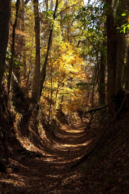
Natchez Trace National Scenic Trail
National Scenic Trail
The Natchez Trace National Scenic Trail is five sections of hiking trail running roughly parallel to the 444-mile long Natchez Trace Parkway scenic motor road. The foot trails total more than 60 miles...
2 mi from route
~6 min detour
Free
near mile 77.2
Park Closure: Partial Closure of Rocky Springs Trail
Park Closure: Temporary Blackland Prairie Trail Closure to Equestrians
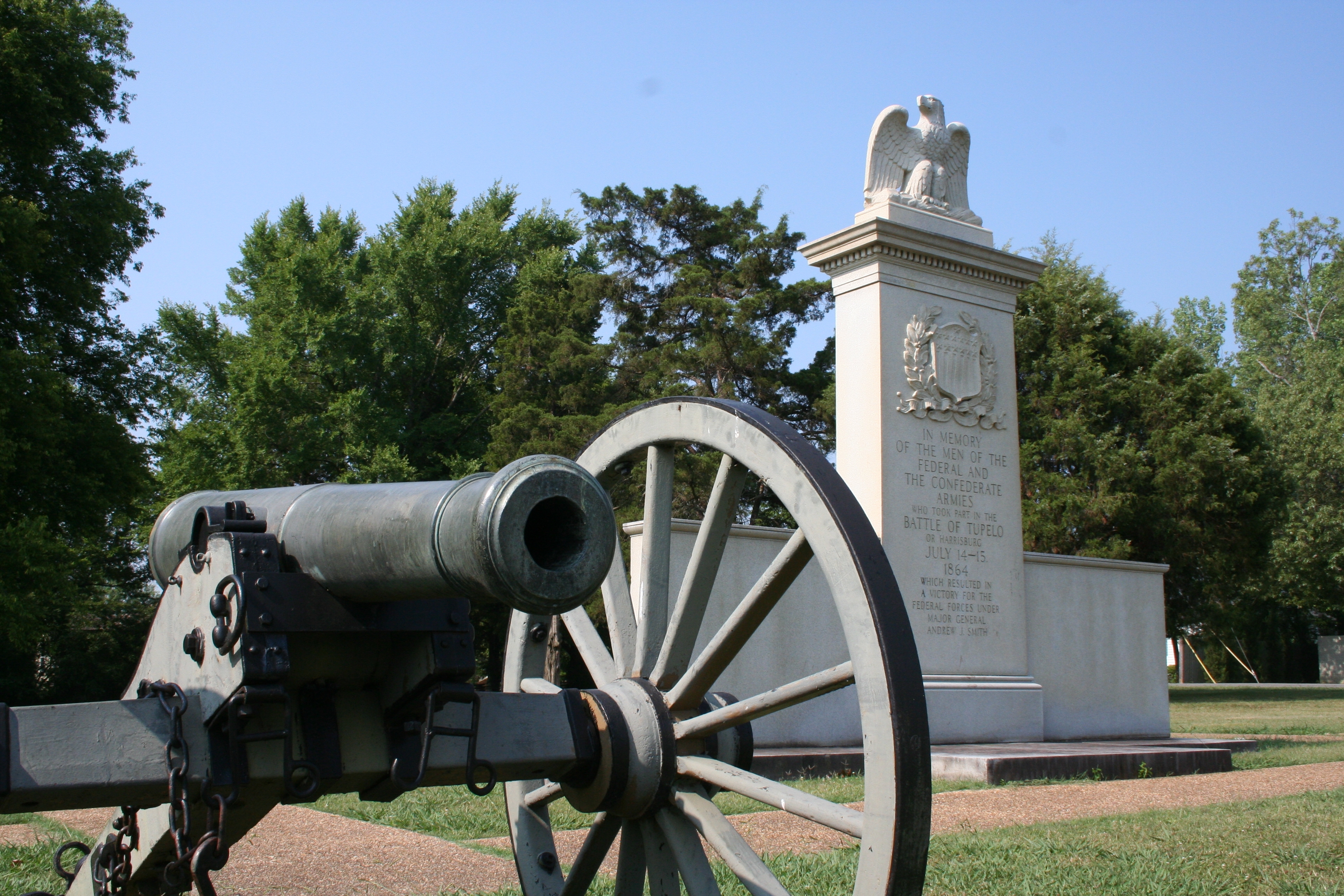
In July, 1864, federal forces, including men from the United States Colored Troops, marched into Tupelo, Mississippi. Disorganized Confederate soldiers fought fiercely but could not overpower the fede...
Park data from the National Park Service API. Alerts update every 2 hours.
More Details
What kind of drive is this?
This drive is predominantly a highway experience, with 85% of the route on major roads like I-22 and US Highway 45 Alternate. You'll encounter an 82.1-mile stretch on I-22, which forms the longest uninterrupted segment. While the profile is highway-focused, expect transitions as you navigate between these main arteries and potentially local roads like Martin Luther King Drive closer to your destination. The character is largely efficient, designed for covering distance rather than leisurely sightseeing.
85% highway — fuel and pacing are the main things to plan.
15 navigation steps total — most of the decisions cluster near the start and finish.
Longest single stretch: 82.1 mi on I 22.
How Hard Is This Drive?
5/10
This is a straightforward highway drive that stays mostly on I 22 and US Highway 45 Alternate. You will hit about 10 points where you need to pay attention to lane position or signs. The trickiest moment comes early in the drive near North Oliver Street.
Driving Effort5/10
Moderate - straightforward overall, but long enough or busy enough to require pacing
Balances navigation complexity with total wheel time.
This drive requires moderate attention. Across 160 miles you will encounter 10 spots where lane choice or exit timing matters. Not difficult for experienced highway drivers, but worth previewing the tricky sections before you go.
Where does it get tricky?
The main spots that need attention: near the start (North Oliver Street): Navigation decision point; at 1 miles (US 45 ALT / US Highway 45 Alternate): Lane positioning matters here; at 74.8 miles (US 45): Highway fork - watch signs carefully. Lane positioning matters here.
Who Is This Route For?
Weekend Trip
Doable as a same-day drive at 3h 3m. Total distance: 160 miles.
Family Friendly
Moderate complexity with 1 natural rest stops along the way.
Solo Traveler
3h 3m drive, comfortable solo distance.
First-Time Driver
Mostly highway driving (85%). Some complex stretches to watch for.
Frequently Asked Questions
The longest stretch is about 82.1 miles on I 22. The full list of main roads is in the Roads section above.
We did not find dedicated rest areas on this route. For a drive this long, plan bathroom and stretch breaks around gas stations, fast-food stops, or small-town downtowns — check the Nearby Places section for options.
Yes, with realistic expectations. Build in a stop roughly every 2 hours, have snacks and activities ready, and check the Nearby Places tabs for kid-friendly stops along the way.
The main spots that need attention: near the start (North Oliver Street): Navigation decision point; at 1 miles (US 45 ALT / US Highway 45 Alternate): Lane positioning matters here; at 74.8 miles (US 45): Highway fork - watch signs carefully. Lane positioning matters here.
Yes — Natchez Trace National Scenic Trail and Tupelo National Battlefield. See the National Parks section for detour distances and tips on detours.
Possible but tiring. At 3.1 hours each way, an in-and-out day trip would put you behind the wheel for 6.1 hours — manageable with a long break at Olive Branch, MS, but most travelers stay overnight.