If you are planning a trip from Brodhead to Hopkinsville, expect a straightforward journey covering 207.2 miles across Kentucky. With a drive time of approximately 3 hours and 58 minutes, this route is perfectly manageable as a one-day excursion. You will primarily utilize the Cumberland Parkway, US 68, and I-65 to navigate between the two locations. Budgeting around $31 for fuel should cover your needs for the trip. Since both cities are located within the Southeast region of the state, the drive maintains a consistent regional feel. Whether you are traveling for business or a quick visit, this highway-focused drive offers a reliable and efficient way to traverse the state.
Trip Pace
Same-day drive is realistic
A same-day return is realistic if you keep stops short.
Break Rhythm
1 planned break
A short stop every 2 to 3 hours is enough for this drive.
Midpoint
103.6 miles from Brodhead, KY
A natural place for your longest stop of the day
, about 1h 58m into the drive
.
Main Roads
Road
Distance
Duration
Cumberland Parkway
86.2 mi
1h 32m
US 68
26.4 mi
31m
I 65
21.4 mi
22m
Cumberland Lake Parkway
15.6 mi
18m
Bowling Green Road
12.4 mi
14m
Hal Rogers Parkway
10.9 mi
14m
Russellville Road
8.2 mi
9m
Hopkinsville Road
7.9 mi
9m
Longest stretch:
Cumberland Parkway
— 86.2 mi, about 1h 32m
Traffic on I-65
Hour-of-day weekday pattern from 24 FHWA count stations on your route.
Peak
3 PM
~2,316 veh/hr typical
· worst 2,886
Quietest
2 AM
~356 veh/hr
Peak-to-quiet ratio
6.5×
busier at peak than in the quiet hours
12a6anoon6p11p
Averaged across 52 weeks of 2023 FHWA Travel Monitoring Analysis System data. Weekday hours only (Mon–Fri).
Turn-by-Turn Driving Directions
Step-by-step road directions between Brodhead, KY and Hopkinsville, KY.
1
Start on Sycamore Street
0.1 mi·26 sec·Sycamore Street
2
At end of road, turn right onto KY 1505
0.1 mi·16 sec·Boone Way
3
Turn left onto KY 2250
1.0 mi·1 min·South Main Street
4
Turn left onto US 150
4.5 mi·5 min·US 150
5
Turn right onto KY 461
16 mi·18 min·Cumberland Lake Parkway
6
Merge onto KY 80
11 mi·14 min·Hal Rogers Parkway
Use the straight lane.
7
Turn right onto KY 914
0.4 mi·34 sec·KY 914
8
Keep slight left at fork
0.6 mi·1 min
Toward Bowling Green
9
Merge onto Cumberland Parkway
86 mi·1 hr 32 min·Cumberland Parkway
10
Continue on Cumberland Parkway
0.3 mi·19 sec·Cumberland Parkway
Exit 1BToward I 65 South: Bowling Green
11
Continue on Cumberland Expressway
0.7 mi·1 min·Cumberland Expressway
12
Merge onto I 65
21 mi·22 min·I 65
13
Take the exit
0.2 mi·21 sec
Exit 20A-BToward I 165, KY 9007: Owensboro, ScottsvilleUse the slight right lane.
14
Keep slight right at fork
0.6 mi·50 sec
Exit 20BToward I 165: Owensboro
15
Merge onto I 165
4.3 mi·4 min·I 165
16
Take the exit
0.3 mi·45 sec
Exit 5Toward US 68, KY 80: Russellville, Bowling Green
17
Turn left onto US 68; KY 80
8.2 mi·9 min·Russellville Road
Use the straight / right lanes.
18
Continue on US 68; KY 80
12 mi·13 min·Bowling Green Road
19
Continue on US 68; KY 80
3.2 mi·3 min·East Jefferson Davis Highway
20
Continue on US 68; KY 80
0.6 mi·51 sec·Bowling Green Road
21
Continue on US 68 Business
0.1 mi·12 sec·Franklin Street
22
Continue on US 68 Business
0.2 mi·19 sec·Franklin Road
23
Continue on US 68 Business
373 ft·6 sec·Franklin Street
24
Continue on US 68 Business
0.6 mi·54 sec·East 4th Street
25
Turn right onto US 68 Business; KY 3519
129 ft·5 sec·North Main Street
26
Turn left onto US 68 Business; KY 3519
227 ft·5 sec·West 4th Street
27
Continue on US 68 Business
0.3 mi·23 sec·West 4th Street
28
Continue on US 68 Business
7.9 mi·9 min·Hopkinsville Road
29
Continue on US 68; KY 80
26 mi·31 min·US 68; KY 80
30
Turn right onto US 41; KY 109
0.7 mi·1 min·East 9th Street
31
Turn left onto Bethel Street
301 ft·13 sec·Bethel Street
32
Arrive at destination
Bethel Street
Trip Plan
To keep your travel efficient, aim to complete the 207.2-mile journey in a single day, as the duration is well-suited for a standard itinerary. Since the route includes only one planned stop, ensure you time your break strategically to coincide with the longest 86.2-mile stretch on the Cumberland Parkway to stay refreshed. Monitoring your fuel levels is a good practice, especially given the estimated $31 cost for the trip. Because this drive is relatively short, you have the flexibility to depart whenever traffic patterns suit your schedule best. Keep an eye on your transition points between the Parkway, US 68, and I-65, as navigating these shifts is the key to maintaining your estimated four-hour travel time.
Morning Departure
An early start around 7-8 AM gets you there with plenty of daylight left.
Evening Departure
A late afternoon start means arriving after dark. Morning is better.
You can normally do this drive in one day.
Plan roughly 1 meaningful break for fuel, food, and rest.
The halfway point lands around 103.6 miles from Brodhead, KY, or about 1h 58m into the drive.
The longest continuous stretch on this route runs about 86.2 miles.
This is a comfortable same-day trip.
Departure
Before you leave
Start with fuel, water, and navigation already sorted so the first hour feels easy.
First stop
Around 46 miles or 56m in
Use this first pause for coffee, a restroom break, and a quick traffic check ahead.
Halfway reset
Around 103.6 miles or 1h 58m in
This is the best place for your longest stop, a real meal, and a full fuel check.
Final approach
Final hour starts around 3h 12m
Traffic, exits, and arrival timing usually matter more near Hopkinsville, KY than in the middle of the route.
Before You Leave
+
Open the route before leaving Brodhead, KY so your first major turns are already loaded.
+
Leave with enough water and a charging cable within reach, not packed away.
+
Check your fuel range against the first long segment, especially if you are starting outside city service areas.
Day 1
Settle into the route from Brodhead, KY
This is one driving day of about 207.2 miles and 3h 58m.
Your first comfortable stop window is around 46 miles from Brodhead, KY.
This route can stay practical as a one-day drive if traffic stays reasonable.
Plan about 1 real break rather than only quick fuel stops.
The longest stretch is on Cumberland Parkway for about 86.2 miles.
Where to Stop
Rest stops, refuel points, and overnight suggestions along this route.
Place data sourced from public business listings. Hours and availability may vary.
Heads-up: tricky spots
5 of 17
5 decision points cluster between mile 0.1 and 146.7 — GPS handles the exact turns, but know they're coming. Your lane choice matters more than the turn itself.
5
0.1 mi into trip|~0m in|KY 1505 / Boone Way
At end of road, turn right onto KY 1505 / Boone Way
Navigation decision point
5
21.3 mi into trip|~26m in|KY 80 / Hal Rogers Parkway
Merge onto KY 80 / Hal Rogers Parkway
Merge point - match speed before joining. Lane positioning matters here
Use the straight lane.
8
141.6 mi into trip|~2h 39m in
Take the exit toward I 165, KY 9007: Owensboro, Scottsville
Exit ramp - move to the correct lane early. Lane positioning matters here. Multiple destination signs - pick the right one
Use the slight right lane.
Exit 20A-B
Toward I 165, KY 9007: Owensboro, Scottsville
6
141.8 mi into trip|~2h 40m in
Keep slight right at fork toward I 165: Owensboro
Highway fork - watch signs carefully
Exit 20B
Toward I 165: Owensboro
6
146.7 mi into trip|~2h 45m in
Take the exit toward US 68, KY 80: Russellville, Bowling Green
Exit ramp - move to the correct lane early. Multiple destination signs - pick the right one
Exit 5
Toward US 68, KY 80: Russellville, Bowling Gree...
Fuel & Cost
Regular Gas
$30.60 one way
$61.20 round trip
$3.75/gal25.4 MPG avg73 kg CO2
Fuel Type
$/gal
One Way
Round Trip
midgrade
$4.14
$33.78
$67.56
premium
$4.72
$38.47
$76.94
diesel
$4.80
$39.12
$78.25
No toll roads detected on this route.
Estimated Trip Cost (one way, 1 person)
Fuel
$31
Meals
$25–$50
Total
$56–$81
Rough estimate based on US averages. Hotel $80–$140/night, meals $25–$50/day.
Estimated CO2 emission: 72.5 kg one way.
Prices: EIA weekly data, 2026-07-13.
Driving Electric?
About $22 in charging
· 0 stops
· 67% less CO2
Vehicle Type
kWh
Stops
DC Fast
Home Charge
Average EV
62.2
0
$21.76
$9.95
Efficient EV
51.8
0
$18.13
$8.29
EV Truck/SUV
82.9
1
$29.01
$13.26
Gas CO2
72 kg
EV CO2
24 kg (67% less)
This trip is well within single-charge range for most EVs. No charging stops needed if you start fully charged.
DC fast charging avg $0.35/kWh. Home charging avg $0.16/kWh. US grid CO2: 0.39 kg/kWh.
Travel Intel
Current conditions at both ends of the drive.
Forecast as of Jul 19, 2026
Origin
Brodhead, KY
Morning
in Brodhead on Monday
Local time
6:23 AM
EDT
Current temp
70°F
Chance Showers And Thunderstorms
WSW 5 mph61% chanceLive forecast
Heat Advisory
Heat Advisory issued July 18 at 10:43AM CDT until July 21 at 7:00PM CDT by NWS Paducah KY
Heat Advisory
Heat Advisory issued July 18 at 10:43AM CDT until July 21 at 7:00PM CDT by NWS Paducah KY
Destination
Hopkinsville, KY
Late night
in Hopkinsville on Monday
Local time
5:23 AM
CDT
Current temp
74°F
Chance Showers And Thunderstorms then Partly Cloudy
WSW 5 mph26% chanceLive forecast
Heat Advisory
Heat Advisory issued July 18 at 10:43AM CDT until July 21 at 7:00PM CDT by NWS Paducah KY
Heat Advisory
Heat Advisory issued July 18 at 10:43AM CDT until July 21 at 7:00PM CDT by NWS Paducah KY
67°F
Greensburg, KY
104 mi in
Seasonal Notes
Summer travel usually means heavier construction, hotter rest stops, and busier weekend traffic around major cities.
Winter travel shortens daylight, so a route that looks manageable on paper can feel much longer after dark.
Holiday weekends tend to make both departure and arrival windows slower than the raw route time suggests.
Time zone
1 hour earlier
The destination clock does not match departure time, so double-check hotel check-in windows and late arrival plans.
Temperature spread
4 degrees warmer at arrival
A meaningful temperature swing is a good cue to rethink layers, water, and how soon you want to arrive.
Road read
3h 58m on the road
The weather snapshot is not static. If you are leaving later, give both cities one more quick forecast check before departure.
Weather data from the National Weather Service. Conditions may change; check closer to your travel date.
National Parks Near This Route
Worth a detour if your schedule allows.
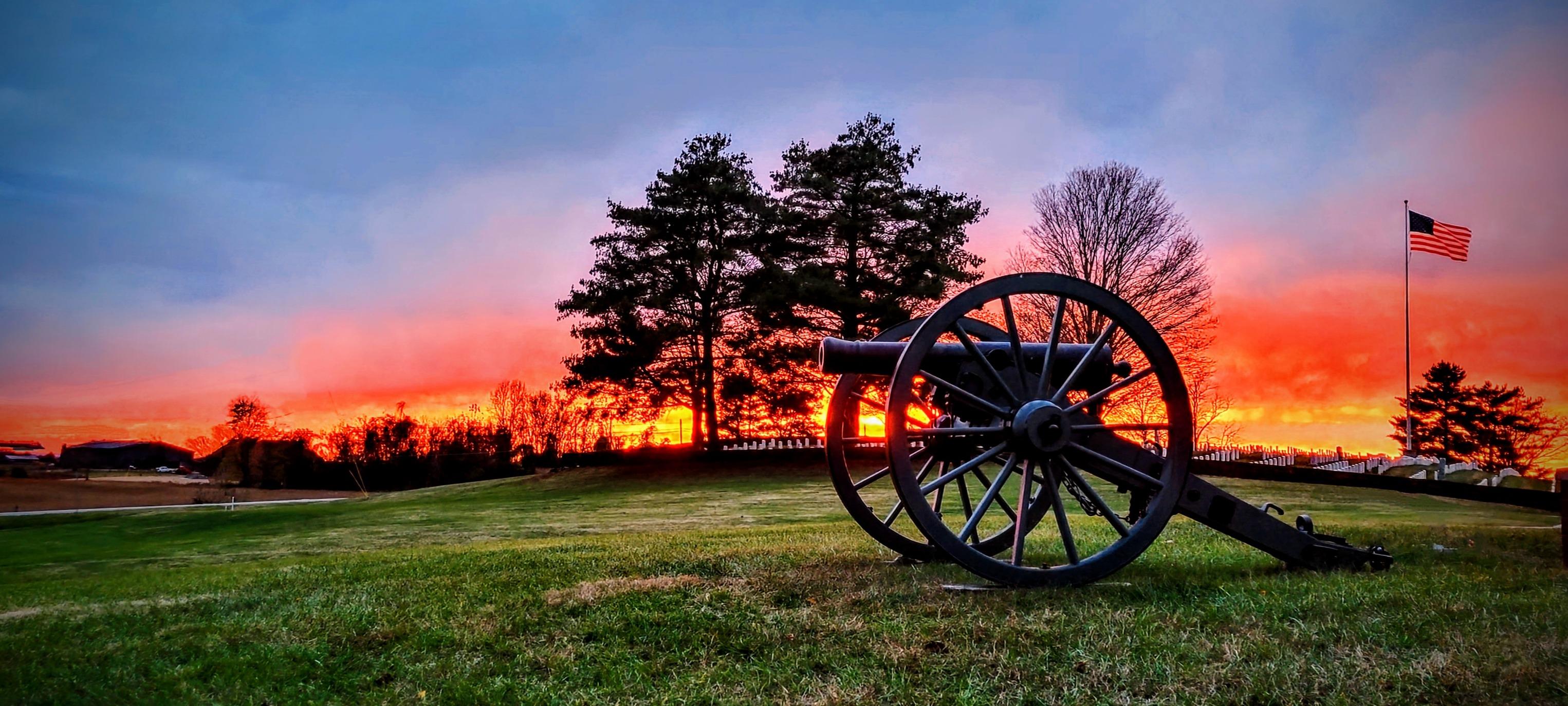
Mill Springs Battlefield National Monument
National Monument
The US won a significant victory early in the Civil War at the Battle of Mill Springs. Explore the rolling fields of Kentucky where the battle took place and learn about that state's strategic importa...
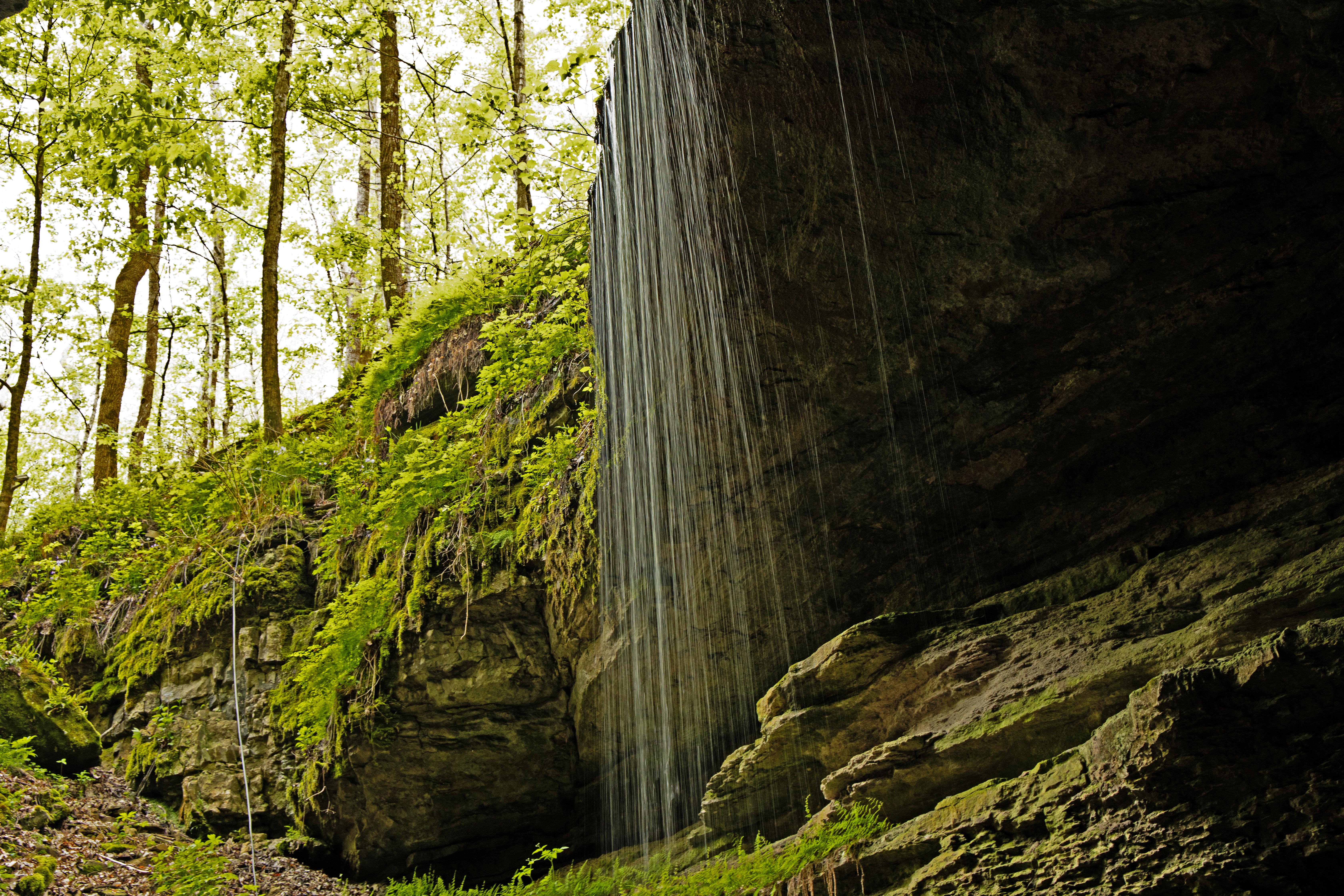
Rolling hills, deep river valleys, and the world's longest known cave system. Mammoth Cave National Park is home to thousands of years of human history and a rich diversity of plant and animal life, e...
10 mi from route
~25 min detour
Free
near mile 121.5
The US Army established Camp Nelson as a fortified supply depot in April 1863. Over the next 3 years, the site evolved into a massive recruitment and training center for United States Colored Troops a...
Park data from the National Park Service API. Alerts update every 2 hours.
More Details
What kind of drive is this?
This trip is defined by a heavy reliance on major thoroughfares, with 82% of your travel taking place on highways. You will spend a significant portion of your time on the Cumberland Parkway, which features the route's longest uninterrupted stretch of 86.2 miles. Because the path is highway-focused, you can expect a fairly consistent pace throughout the drive. The transition between these specific roads creates a balanced experience, moving you steadily from the Southeast region toward your destination. While the experience is functional rather than technical, the road surface and traffic patterns remain predictable for those looking for a direct transit.
82% highway — fuel and pacing are the main things to plan.
32 navigation steps total — most of the decisions cluster near the start and finish.
Longest single stretch: 86.2 mi on Cumberland Parkway.
How Hard Is This Drive?
7/10
This is a straightforward highway drive that stays mostly on Cumberland Parkway and US 68. This route has several spots where lane changes, forks, or exits need your full attention. The trickiest moment comes around 0.1 miles in near KY 1505 / Boone Way.
Driving Effort7/10
Demanding - plan breaks and stay ahead of the key maneuvers
Balances navigation complexity with total wheel time.
This is a demanding drive. With 17 significant decision points across 207.2 miles, you will need to stay alert - especially through interchange areas and urban stretches. Consider splitting it into segments if you are not comfortable with fast highway navigation.
Where does it get tricky?
The main spots that need attention: at 0.1 miles (KY 1505 / Boone Way): Navigation decision point; at 21.3 miles (KY 80 / Hal Rogers Parkway): Merge point - match speed before joining. Lane positioning matters here; at 141.6 miles: Exit ramp - move to the correct lane early. Lane positioning matters here. Multiple destination signs - pick the right one.
Elevation Profile
Mostly flat terrain
1,058 ft532 ft
Total Climb
489 ft
Total Descent
917 ft
Highest Point
1,058 ft
~44.4 mi in
Elevation Range
526 ft
Towns Mentioned on Route Signs
Based on OSRM destination-sign hints, not a full list of every settlement the road passes.
Between Brodhead, KY and Hopkinsville, KY, road signs point toward Bowling Green and Scottsville.
Doable as a same-day drive at 3h 58m. Total distance: 207.2 miles.
Family Friendly
Moderate complexity with 1 natural rest stops along the way.
Solo Traveler
3h 58m drive, comfortable solo distance.
First-Time Driver
Mostly highway driving (82%). Some complex stretches to watch for.
Frequently Asked Questions
The longest stretch is about 86.2 miles on Cumberland Parkway. The full list of main roads is in the Roads section above.
Yes — we found about 5 rest areas or service plazas within a short detour of the route (from OpenStreetMap). See the Rest Stops tab under Nearby Places for locations and mile markers. Plan to stretch, use the bathroom, and top off fluids every 2–3 hours on longer drives.
It helps. This route has a higher-than-average number of complex decision points, which get harder in the dark. If the last hour of the trip is on surface roads or mountain grades, aim to arrive at Hopkinsville, KY before sunset when you can. Check the Trip Plan for departure windows that land you in daylight.
Only with planning. This is a long drive for kids — consider splitting it into two days rather than pushing through. Plan at least 1 meaningful breaks. There are 5 rest areas along the route for bathroom stops.
The main spots that need attention: at 0.1 miles (KY 1505 / Boone Way): Navigation decision point; at 21.3 miles (KY 80 / Hal Rogers Parkway): Merge point - match speed before joining. Lane positioning matters here; at 141.6 miles: Exit ramp - move to the correct lane early. Lane positioning matters here. Multiple destination signs - pick the right one.
Yes — Mill Springs Battlefield National Monument, Mammoth Cave National Park and Camp Nelson National Monument. See the National Parks section for detour distances and tips on detours.
Possible but tiring. At 4.0 hours each way, an in-and-out day trip would put you behind the wheel for 7.9 hours — manageable with a long break at Hopkinsville, KY, but most travelers stay overnight.