If you are planning to travel from Barre to Lawrence, expect a straightforward 62.4-mile journey that typically takes about 1 hour and 32 minutes. Since this is a relatively short trip within Massachusetts, it is perfectly suited for a single-day excursion, meaning you won't need to worry about overnight lodging. You can anticipate spending roughly $8 on fuel for the trip, making it a very economical drive. The route connects two distinct parts of the Northeast, utilizing major arteries to bridge the distance efficiently. Because the duration is quite manageable, you have plenty of flexibility in your schedule to head out whenever it suits your plans best.
Trip Pace
Same-day drive is realistic
A same-day return is realistic if you keep stops short.
Midpoint
31.2 miles from Barre, MA
A natural place for your longest stop of the day
, about 52m into the drive
.
Main Roads
Road
Distance
Duration
I 495
21.5 mi
24m
Concord Turnpike
12.3 mi
16m
MA 2
8.9 mi
13m
South Street
3.6 mi
7m
Hubbardston Road
3.5 mi
6m
New Westminster Road
3.5 mi
6m
Barre Road
2.4 mi
4m
Brigham Street
1.2 mi
2m
Longest stretch:
I 495
— 21.5 mi, about 24m
Turn-by-Turn Driving Directions
Step-by-step road directions between Barre, MA and Lawrence, MA.
1
Start on MA 32; MA 122
171 ft·10 sec·Concert Mall
2
Turn sharp left onto South Street
168 ft·3 sec·South Street
3
Continue on MA 62
0.4 mi·47 sec·Mechanic Street
4
Continue on MA 62
3.5 mi·6 min·Hubbardston Road
5
Continue on MA 62
0.4 mi·44 sec·Old Boston Turnpike
6
Turn left onto Barre Road
2.4 mi·4 min·Barre Road
7
Continue on Elm Street
0.3 mi·30 sec·Elm Street
8
Continue on Brigham Street
1.2 mi·2 min·Brigham Street
9
Continue on New Westminster Road
3.5 mi·6 min·New Westminster Road
10
Continue on South Street
3.6 mi·7 min·South Street
11
At end of road, turn right onto MA 2A
0.7 mi·1 min·Main Street
12
Take the ramp
0.3 mi·46 sec
13
Merge onto MA 2
8.9 mi·13 min·MA 2
14
Keep slight left at fork onto MA 2
12 mi·16 min·Concord Turnpike
Use the straight / slight right lanes.
15
Take the exit
0.5 mi·59 sec
Exit 113BToward I 495 North: LowellUse the right lane.
16
Keep slight left at fork
0.2 mi·23 sec
Toward I 495 North: Lowell, Lawrence
17
Merge onto I 495
22 mi·24 min·I 495
Use the straight / slight right lanes.
18
Take the exit
0.3 mi·52 sec
Exit 99BToward MA 28 North: LawrenceUse the slight right lane.
19
Turn straight onto MA 28
0.2 mi·22 sec·Union Street
20
Keep slight right at fork onto South Union Street
0.7 mi·1 min·South Union Street
21
Turn left onto MA 114
0.3 mi·36 sec·Winthrop Avenue
22
Continue on MA 114
0.5 mi·55 sec·Parker Street
23
Continue on Amesbury Street
0.3 mi·40 sec·Amesbury Street
24
Turn right onto Canal Street
282 ft·6 sec·Canal Street
25
Turn left onto Lawrence Street
492 ft·18 sec·Lawrence Street
26
Turn left onto Essex Street
498 ft·11 sec·Essex Street
27
Arrive at destination
Essex Street
Trip Plan
Because this is a direct drive without scheduled stops, you have the advantage of total control over your departure time. Since the trip takes less than two hours, you can easily bypass the need for formal breaks if you prefer to reach your destination quickly. Keep in mind that traffic patterns on I-495 can be unpredictable, so checking local conditions before you pull out of Barre is a smart move. Given the modest $8 fuel estimate, topping off your tank before you leave ensures you won't have to hunt for a station along the way. Use the flexibility of this short duration to time your arrival in Lawrence for early morning or late afternoon to avoid the heaviest commute windows.
Morning Departure
Leave by 9 AM and you'll arrive before lunch.
Evening Departure
Even a 4 PM departure gets you there before dark in summer.
You can normally do this drive in one day.
You may only need one short stretch break if traffic stays light.
The halfway point lands around 31.2 miles from Barre, MA, or about 52m into the drive.
The longest continuous stretch on this route runs about 21.5 miles.
This is a comfortable same-day trip.
Departure
Before you leave
Start with fuel, water, and navigation already sorted so the first hour feels easy.
First stop
Around 14 miles or 25m in
Use this first pause for coffee, a restroom break, and a quick traffic check ahead.
Halfway reset
Around 31.2 miles or 52m in
This is the best place for your longest stop, a real meal, and a full fuel check.
Final approach
Final hour starts around 1h 19m
Traffic, exits, and arrival timing usually matter more near Lawrence, MA than in the middle of the route.
Before You Leave
+
Open the route before leaving Barre, MA so your first major turns are already loaded.
Day 1
Settle into the route from Barre, MA
This is one driving day of about 62.4 miles and 1h 32m.
Your first comfortable stop window is around 14 miles from Barre, MA.
This route can stay practical as a one-day drive if traffic stays reasonable.
The longest stretch is on I 495 for about 21.5 miles.
Where to Stop
Rest stops, refuel points, and overnight suggestions along this route.
Place data sourced from public business listings. Hours and availability may vary.
Heads-up: tricky spots
5 of 14
5 decision points cluster between mile 0 and 59.8 — GPS handles the exact turns, but know they're coming. Your lane choice matters more than the turn itself.
6
0 mi into trip|~0m in|South Street
Turn sharp left onto South Street
Sharp turn - reduce speed on approach
6
25.3 mi into trip|~44m in|MA 2 / Concord Turnpike
Keep slight left at fork onto MA 2 / Concord Turnpike
Highway fork - watch signs carefully. Lane positioning matters here
Use the straight / slight right lanes.
7
37.7 mi into trip|~1h 1m in
Take the exit toward I 495 North: Lowell
Exit ramp - move to the correct lane early. Lane positioning matters here
Use the right lane.
Exit 113B
Toward I 495 North: Lowell
6
38.1 mi into trip|~1h 2m in
Keep slight left at fork toward I 495 North: Lowell, Lawrence
Highway fork - watch signs carefully. Multiple destination signs - pick the right one
Toward I 495 North: Lowell, Lawrence
7
59.8 mi into trip|~1h 27m in
Take the exit toward MA 28 North: Lawrence
Exit ramp - move to the correct lane early. Lane positioning matters here
Use the slight right lane.
Exit 99B
Toward MA 28 North: Lawrence
Fuel & Cost
Regular Gas
$9.99 one way
$19.97 round trip
$4.07/gal25.4 MPG avg22 kg CO2
Fuel Type
$/gal
One Way
Round Trip
midgrade
$4.43
$10.89
$21.78
premium
$4.82
$11.85
$23.70
diesel
$5.61
$13.78
$27.55
Estimated Tolls: $0.86
Concord Turnpike
(12.3 mi)$0.86
Toll estimates based on average 2024-2025 rates. EZ-Pass/SunPass discounts may lower the actual cost.
Estimated Trip Cost (one way, 1 person)
Fuel
$10
Tolls
$1
Meals
$25–$50
Total
$36–$61
Rough estimate based on US averages. Hotel $80–$140/night, meals $25–$50/day.
Estimated CO2 emission: 21.8 kg one way.
Prices: EIA weekly data, 2026-04-13.
Driving Electric?
About $7 in charging
· 0 stops
· 68% less CO2
Vehicle Type
kWh
Stops
DC Fast
Home Charge
Average EV
18.7
0
$6.55
$3.00
Efficient EV
15.6
0
$5.46
$2.50
EV Truck/SUV
25
0
$8.74
$3.99
Gas CO2
22 kg
EV CO2
7 kg (68% less)
This trip is well within single-charge range for most EVs. No charging stops needed if you start fully charged.
DC fast charging avg $0.35/kWh. Home charging avg $0.16/kWh. US grid CO2: 0.39 kg/kWh.
Travel Intel
Current conditions at both ends of the drive.
Forecast as of Apr 21, 2026
Origin
Barre, MA
Late night
in Barre on Tuesday
Local time
4:07 AM
EDT
Current temp
61°F
Unavailable
Live forecast
Destination
Lawrence, MA
Late night
in Lawrence on Tuesday
Local time
4:07 AM
EDT
Current temp
60°F
Unavailable
Live forecast
Seasonal Notes
Summer travel usually means heavier construction, hotter rest stops, and busier weekend traffic around major cities.
Winter travel shortens daylight, so a route that looks manageable on paper can feel much longer after dark.
Holiday weekends tend to make both departure and arrival windows slower than the raw route time suggests.
Time zone
Same local time
Origin and destination are on the same clock, so arrival timing is easier to judge at a glance.
Temperature spread
1 degrees cooler at arrival
A meaningful temperature swing is a good cue to rethink layers, water, and how soon you want to arrive.
Road read
1h 32m on the road
Use the two city cards together: check the sky where you start, then compare it with the local time and temperature at arrival.
Weather data from the National Weather Service. Conditions may change; check closer to your travel date.
National Parks Near This Route
Worth a detour if your schedule allows.
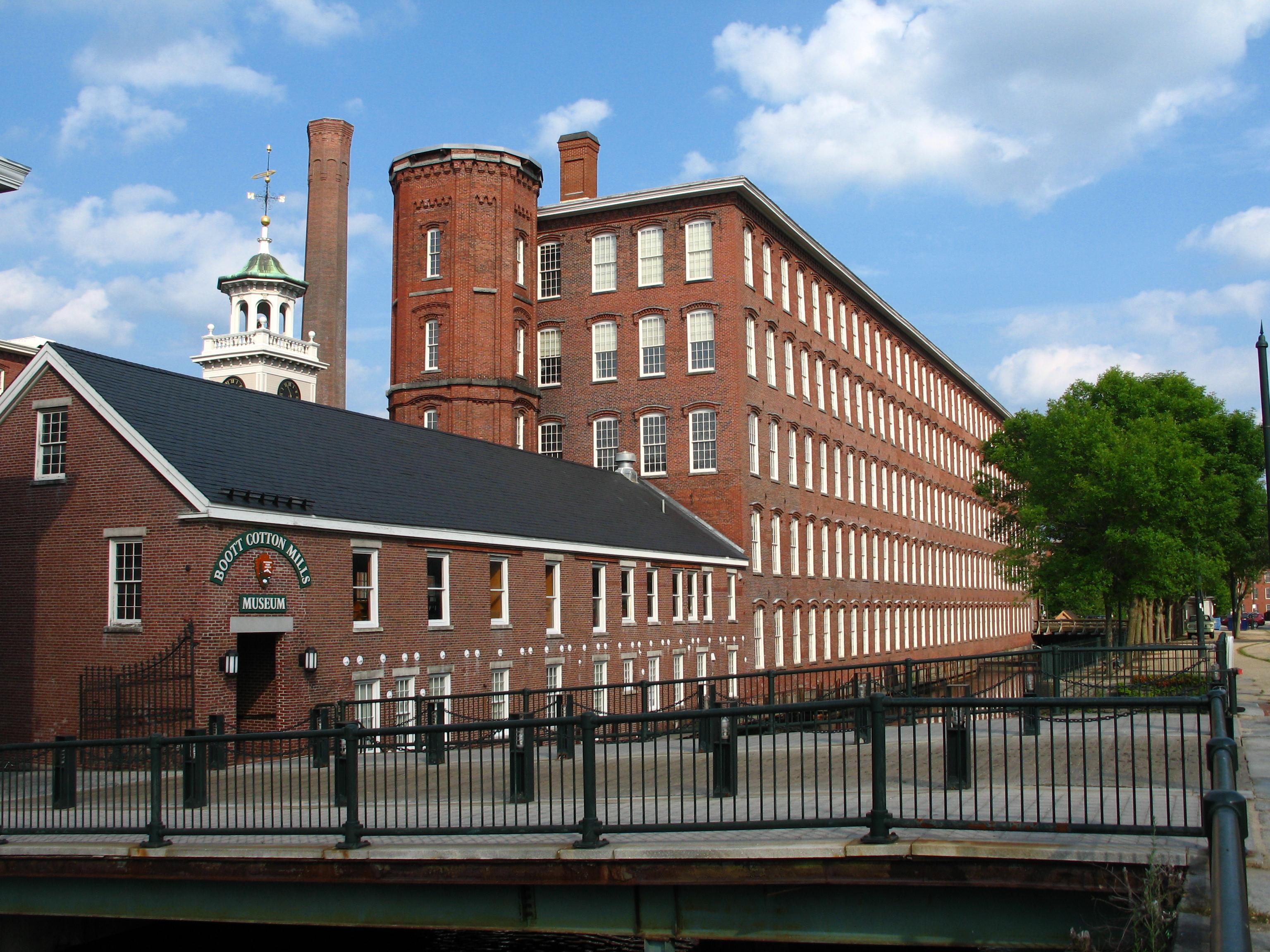
Lowell National Historical Park
National Historical Park
Lowell’s water-powered textile mills catapulted the nation – including immigrant families and early female factory workers – into an uncertain new industrial era. Nearly 200 years later, the changes t...
At Minute Man National Historical Park the opening battle of the Revolution is brought to life as visitors explore the battlefields and structures associated with April 19, 1775, and witness the Ameri...
Originally established in 1938 as the first National Historic Site in the United States, Salem Maritime National Historical Park consists of nine acres of land and twelve historic structures along the...
17 mi from route
~44 min detour
Free
near mile 60.2
Discover how one city could be the Cradle of Liberty, site of the first major battle of American Revolution, and home to many who espoused that freedom can be extended to all.
21 mi from route
~52 min detour
Free
near mile 53.8
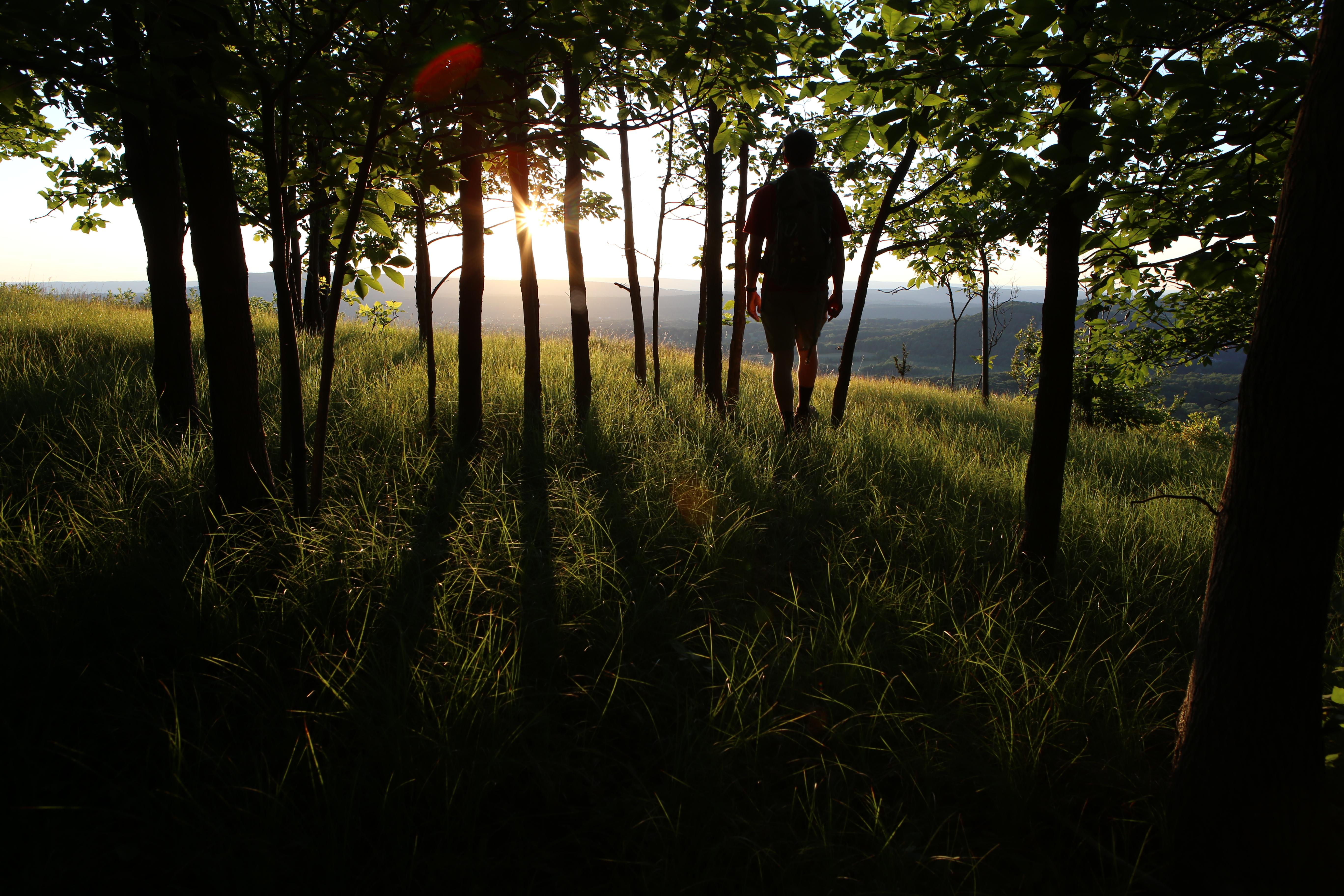
From the Sound to the summits: the New England Trail covers 235 miles from Long Island Sound across long ridges to scenic mountain summits in Connecticut and Massachusetts. The trail offers panoramic...
. . . where you can walk a Civil War-era fort, view historic lighthouses, explore tide pools, hike lush trails, camp under the stars, or relax while fishing, picnicking, or swimming—all within reach o...
27 mi from route
~68 min detour
Free
near mile 55.9
Park data from the National Park Service API. Alerts update every 2 hours.
More Details
What kind of drive is this?
This trip is predominantly a highway-focused drive, with 69% of your time spent on major roads like I-495, the Concord Turnpike, and MA-2. You will find yourself settling into a steady pace, particularly during the longest uninterrupted stretch of 21.5 miles on I-495. While the route offers a mix of different road types, the highway segments dictate the overall flow and speed of your travel. Expect a functional, efficient experience behind the wheel rather than a winding backroad adventure. Navigating these varied road types requires you to stay alert as you transition from local roadways onto the faster-moving interstate sections.
69% highway — fuel and pacing are the main things to plan.
27 navigation steps total — most of the decisions cluster near the start and finish.
Longest single stretch: 21.5 mi on I 495.
How Hard Is This Drive?
9/10
This is a straightforward highway drive that stays mostly on I 495 and Concord Turnpike. This route has several spots where lane changes, forks, or exits need your full attention. The trickiest moment comes early in the drive near South Street.
Driving Effort9/10
Demanding - stay alert through the decision-heavy sections
Balances navigation complexity with total wheel time.
This drive requires moderate attention. Across 62.4 miles you will encounter 14 spots where lane choice or exit timing matters. Not difficult for experienced highway drivers, but worth previewing the tricky sections before you go.
Where does it get tricky?
The main spots that need attention: near the start (South Street): Sharp turn - reduce speed on approach; at 25.3 miles (MA 2 / Concord Turnpike): Highway fork - watch signs carefully. Lane positioning matters here; at 37.7 miles: Exit ramp - move to the correct lane early. Lane positioning matters here.
Doable as a same-day drive at 1h 32m. Total distance: 62.4 miles.
Family Friendly
Moderate complexity with 0 natural rest stops along the way.
Solo Traveler
1h 32m drive, comfortable solo distance.
First-Time Driver
Mostly highway driving (69%). Some complex stretches to watch for.
Frequently Asked Questions
The longest stretch is about 21.5 miles on I 495. The full list of main roads is in the Roads section above.
Expect about $0.86 in tolls one way, starting with Concord Turnpike. Most Northeast and Midwest toll agencies accept E-ZPass; in the West and Texas, transponders like TxTag or FasTrak apply. If you do not have a transponder, cashless tolling plates will mail a bill to the vehicle's registered address — usually with a surcharge, so a rental-car toll pass is often cheaper than paying by mail.
It helps. This route has a higher-than-average number of complex decision points, which get harder in the dark. If the last hour of the trip is on surface roads or mountain grades, aim to arrive at Lawrence, MA before sunset when you can. Check the Trip Plan for departure windows that land you in daylight.
Yes. At under 2 hours behind the wheel, this works well for families — plan one quick stop if you have younger kids.
The main spots that need attention: near the start (South Street): Sharp turn - reduce speed on approach; at 25.3 miles (MA 2 / Concord Turnpike): Highway fork - watch signs carefully. Lane positioning matters here; at 37.7 miles: Exit ramp - move to the correct lane early. Lane positioning matters here.
Yes — Lowell National Historical Park, Minute Man National Historical Park and Salem Maritime National Historical Park (6 total within detour distance). See the National Parks section for detour distances and tips on detours.
Yes. A round trip is manageable in a single day if you plan a break at Lawrence, MA before heading back.